Wednesday, May 16, 2018

May. 15 18

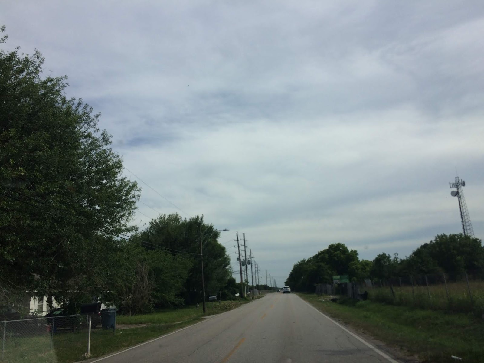
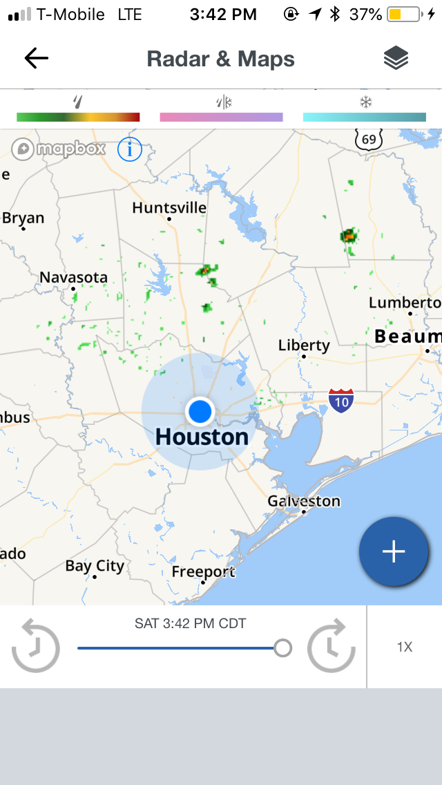
Northwest Houston, TX, during the late morning, on my way to pick up my friend from his house in northwest Houston.
Northwest Houston, TX. during the early afternoon, on my way back to my house in northwest Houston, TX, after dropping my friend off back at his house.
Northwest Houston, TX. during the mid-afternoon, on my way back to my house in northwest Houston, TX, after dropping my friend off back at his house.
Northwest Houston, TX, during the early evening, at my house.


Locations: Northwest Houston, TX.


Thoughts: The day was hot, sunny, and dry.


Area Forecast Discussion 
Issued by NWS Houston/Galveston, TX
Home | Current Version | Previous Version | Text Only | Print | Product List | Glossary Off
Versions: 1 2 3 4 5 6 7 8 9 10 11 12 13 14 15 16 17 18 19 20 21 22 23 24 25 26 27 28 29 30 31 32 33 34 35 36 37 38 3940 41 42 43 44 45 46 47 48 49 50
000
FXUS64 KHGX 152353
AFDHGX

Area Forecast Discussion
National Weather Service Houston/Galveston TX
653 PM CDT Tue May 15 2018

.AVIATION...
VFR. Thinning evening cirrus blow off from northwestern convection
over Central Texas with a light overnight southwesterly becoming
variable/calm (land?) breeze. More interior (western to far northern
terminal) around sunrise fog that may fall to IFR or below once
again at LBX....higher odds on the MVFR nature. Any fog will
quickly evaporate during the 14Z hour and give way to SKC or just
a few cirrus. A late day sea breeze may back winds more southerly
to southeasterly but expect sub-10 knot breezes to be out of the
west or southwest through the mid-afternoon hours. 31

&&

.PREV DISCUSSION... /ISSUED 356 PM CDT Tue May 15 2018/

DISCUSSION...
As of the 3PM obs, IAH is currently tied for the record high for
this date/site, and there is no reason to think we won`t be
setting a new record before all is said and done today. Also
during this short-term, we will also have to keep an eye to the
N/NW as the convection developing over North/North Central TX
continues to slowly build to the S/SE. Short-range progs are still
flirting with the idea that some of this activity could reach
Burleson/Brazos/Madison Counties maybe early this evening.
However, still think that the cap will hold for anything
developing south of these locales.

Otherwise, have trended Min Temps down a bit from guidance for
tonight as the drier air aloft continues to mix down (based on
the current dewpoint obs across SE TX). Fog could be an issue once
again overnight/early Weds morning for inland sites. Another hot/
dry day is expected tomorrow (and likely through the rest of the
week) as the upper ridge axis lingers just to our west. POPS are
going to remain very low/nil during this period...but shortwaves
trekking down this NW flow aloft could be worth watching, if not
for the strong/persistent cap here.

Some flattening of the upper ridge is possible by the weekend as
the upper low moves off to the NE. This along with the return of
more SE winds at the surface/low levels could help to "moderate"
daytime temps down a few degrees Sat/Sun. Somewhat related, very
low rain chances might also return with the seabreeze. So, until
then, hot and dry weather will prevail. 41

&&

CLIMATE...
Near to record high temperatures will be possible across
Southeast Texas over the next few days. A listing of these record
high temperatures for the Southeast Texas climate sites are
included below. Because of how early in the season this heat is
occurring, residents may be more prone to heat illness and are
encouraged to take proper precautions if spending extended time
outdoors this week.

MAY 15...
LOCATION         RECORD HIGH     YEAR
Houston IAH           92         2003
Houston HOU           94         1978
College Station       95         1925
Galveston             89         1875

MAY 16...
LOCATION         RECORD HIGH     YEAR
Houston IAH           93         2003
Houston HOU           93         1933
College Station       95         2003
Galveston             90         1875

MAY 17...
LOCATION         RECORD HIGH     YEAR
Houston IAH           95         1894
Houston HOU           94         1998
College Station       96         1925
Galveston             87         2017

Huffman

&&

MARINE...
Light winds and low seas will persist for the next several days.
Onshore winds will begin to increase on Friday as low pressure
develops over the Texas panhandle and deepens as it moves across the
southern plains. A moderate onshore flow will prevail through the
weekend.  47

&&

.PRELIMINARY POINT TEMPS/POPS...
College Station (CLL)      67  94  68  94  69 /  10   0   0  10   0
Houston (IAH)              66  94  67  94  69 /   0   0   0  10   0
Galveston (GLS)            73  88  75  87  74 /   0   0   0  10  10

&&

.HGX WATCHES/WARNINGS/ADVISORIES...
TX...NONE.
GM...NONE.
&&

$$

Discussion...42
Aviation/Marine...31

Air Quality Alert

TXZ213-237-238-313-337-338-437-438-170000-

AIR QUALITY ALERT MESSAGE
TEXAS COMMISSION ON ENVIRONMENTAL QUALITY
RELAYED BY NATIONAL WEATHER SERVICE HOUSTON/GALVESTON TX
219 PM CDT Tue May 15 2018

...OZONE ACTION DAY FOR WEDNESDAY...

THE TEXAS COMMISSION ON ENVIRONMENTAL QUALITY (TCEQ)...HAS ISSUED AN
OZONE ACTION DAY FOR THE HOUSTON...GALVESTON...AND BRAZORIA AREAS FOR
WEDNESDAY...MAY 16 2018.

ATMOSPHERIC CONDITIONS ARE EXPECTED TO BE FAVORABLE FOR PRODUCING
HIGH LEVELS OF OZONE POLLUTION IN THE HOUSTON...GALVESTON AND
SURROUNDING AREAS ON WEDNESDAY. YOU CAN HELP PREVENT OZONE POLLUTION BY
SHARING A RIDE...WALKING...RIDING A BICYCLE...TAKING YOUR LUNCH TO
WORK...AVOIDING DRIVE THROUGH LANES...CONSERVING ENERGY AND KEEPING YOUR
VEHICLE PROPERLY TUNED.

FOR MORE INFORMATION ON OZONE:

OZONE: THE FACTS (WWW.TCEQ.TEXAS.GOV/AIRQUALITY/MONOPS/OZONEFACTS.HTML)
EPA AIR NOW:
(WWW.AIRNOW.GOV/INDEX.CFM?ACTION=AIRNOW.LOCAL_CITY&CITYID=236)
TAKE CARE OF TEXAS: (WWW.TAKECAREOFTEXAS.ORG/AIR/AIRQUALITY)

$$

Hazardous Weather Outlook

Hazardous Weather Outlook
National Weather Service Houston/Galveston TX
412 AM CDT Tue May 15 2018

TXZ163-164-176>179-195>200-210>214-226-227-235>238-300-313-
335>338-436>438-160915-
Austin-Brazoria Islands-Brazos-Burleson-Chambers-Coastal Brazoria-
Coastal Galveston-Coastal Harris-Coastal Jackson-
Coastal Matagorda-Colorado-Fort Bend-
Galveston Island and Bolivar Peninsula-Grimes-Houston-
Inland Brazoria-Inland Galveston-Inland Harris-Inland Jackson-
Inland Matagorda-Madison-Matagorda Islands-Montgomery-
Northern Liberty-Polk-San Jacinto-Southern Liberty-Trinity-Walker-
Waller-Washington-Wharton-
412 AM CDT Tue May 15 2018

This hazardous weather outlook is for portions of Southeast Texas..

.DAY ONE...Today and Tonight

Locally dense fog will be possible this morning west and southwest
of the Houston metro.

Near to record high temperatures will be possible today. Because
of how early in the year this heat is occurring, residents are
urged to take precautions for heat illness. These include taking
frequent breaks if working outdoors, wearing lightweight and
loose-fitting clothing, and drinking plenty of water.

.DAYS TWO THROUGH SEVEN...Wednesday through Monday

Near to record high temperatures will be possible Wednesday and
Thursday. Because of how early in the year this heat is
occurring, residents are urged to take precautions for heat
illness. These include taking frequent breaks if working outdoors,
wearing lightweight and loose-fitting clothing, and drinking
plenty of water.

.SPOTTER INFORMATION STATEMENT...

Spotter activation will not be needed.

$$

Tuesday, May 15, 2018

May. 14 18

Southeast, or maybe southwest Houston, TX, during the mid-morning, driving down Beltway 8, on my way to the pet resort that I work for in southeast Houston, TX. from my house in northwest Houston, TX.
Southeast Houston, TX, during the early afternoon, at McDonald's getting lunch.
Southeast Houston, TX, during the late afternoon, on my way to my house in northwest Houston, TX.
Near the heights Houston, TX, I think, during the late afternoon, on my way home from the pet resort that I work at in southeast Houston, TX, to my house in northwest Houston, TX.
Near the heights Houston, TX, I think, during the early evening, on my way home from the pet resort that I work at in southeast Houston, TX, to my house in northwest Houston, TX.


Locations: Northwest, southwest, southeast, the heights, and downtown Houston, TX.


Thoughts: The day was very hot and sunny. I am eagerly awaiting some rain for Houston, TX. As of yet it doesn't look like Houston, TX will get any significant rainfall anytime soon.


Area Forecast Discussion 
Issued by NWS Houston/Galveston, TX

Home | Current Version | Previous Version | Text Only | Print | Product List | Glossary Off
Versions: 1 2 3 4 5 6 7 8 9 10 11 12 13 14 15 16 17 18 19 20 21 22 23 24 25 26 27 28 29 30 31 32 33 34 35 36 37 38 3940 41 42 43 44 45 46 47 48 49 50
000
FXUS64 KHGX 150240
AFDHGX

Area Forecast Discussion
National Weather Service Houston/Galveston TX
940 PM CDT Mon May 14 2018

.UPDATE...
No major changes.

11

&&

.PREV DISCUSSION... /ISSUED 620 PM CDT Mon May 14 2018/

AVIATION...
Generally VFR for SE TX TAFS the next day or so. Once again, could
see a brief period of MVFR CIGS and/or BR tomorrow morning (10-14Z)
and again on Wednesday morning at some sites (mainly north).  42

PREV DISCUSSION... /ISSUED 345 PM CDT Mon May 14 2018/

SHORT TERM/LONG TERM [Tonight Through Monday]...

Let`s review some Texas weather forecasting rules of thumb. First
all floods end in drought and all droughts end in floods. Second
when in drought, forecast more drought until it starts to rain -
when in flood, forecast more flood until it stops raining.
Drought monitor has some abnormal dryness and moderate drought to
the southwest of Houston. But Houston IAH is 2.55 inches below
normal rainfall since March 1 and 0.34 inches below for the year.
Houston HOU is down 3.65 inches below normal since March 1 and
3.49 inches below normal for the year. Given the current analysis
and forecast data going forward, there is little chance if any at
precipitation over the next 7 days.

Upper level analysis at the standard levels pretty much shows
upper level riding from 500mb up to 250mb over much of the Texas
Gulf Coast northeast to the Mid-South. Strong southwest jet stream
flow was noted from the southern Rockies across the Plains into
the Midwest which matches up pretty well with SPC`s day 1 slight
risk severe weather outlook. The area of no thunderstorms in the
outlook matches well with the location of the ridge. Surface
analysis shows weak high pressure over SW LA and SE Texas.

Looking at 500mb height analysis and forecasts from the
GFS/ECMWF/Canadian all pretty much show the same thing for the
next 7 days. Upper level ridging over the region remains in place
as a mean upper level trough sets up over the Great Basin through
the end of the week. This ridge may break down over the weekend
into early next week but the GFS/ECMWF hold onto higher heights
than the Canadian. The weak upper level trough over the eastern
Gulf takes its time meandering across that same region through the
end of the week. Models do takes this system inland over the
weekend and towards the Carolinas. Model run total precipitation
forecasts for each model range from 0 to 0.20 inches of rainfall
for the next 7 days across the area so think a dry forecast is
safe at this point. Temperatures are looking rather persistent
with high temperatures in the low 90s and low temperature sin the
low 70s maybe upper 60s in a few spots. High temperatures
Wednesday through Friday may reach the mid 90s as the upper ridge
builds more over the area.

We may need to really push heat safety this week. Heat index
values could reach the 96-100F range especially Thursday and
Friday this week. These are pretty typical numbers for later in
June but a bit high for mid May especially after a cool April.
People may not be quite acclimated to the heat and may overdo
outside activities leading to heat illnesses. The other factor to
consider will be the winds which with higher winds it will not
feel as hot. Winds will be around 5 mph for most of Thursday but
closer to 10 mph on Friday. This may make Thursday feel hotter
than Friday even though heat index values may be slightly higher
on Friday due to higher moisture.

Overpeck

MARINE...

Not a lot of changes expected with the upcoming marine forecast as
generally light onshore winds prevail through the short-term. This
pattern should shift a bit by mid-week as the surface high weakens
and a weak surface low develops near the FL panhandle. This should
result in a more W/SW low-level flow across the region during this
time frame. However, not expecting any issues with the system here
given the progged mid/upper pattern(s). Tides will continue to run
near normal. No Caution/Advisory flags through the week. 41

TROPICAL...

National Hurricane Center is tracking a non-tropical area of low
pressure over the eastern Gulf. Right now NHC has lowered the
probability of development down to 30 percent over the next 5
days. Biggest problem for any type of development will be drier
air on the west side of this area of low pressure seen on water
vapor imagery. This system should not affect the western Gulf at
this time and likely produce heavy rainfall/flooding over Florida
and the southeastern U.S.

Overpeck

&&

.PRELIMINARY POINT TEMPS/POPS...
College Station (CLL)      69  92  67  93  68 /   0   0   0   0   0
Houston (IAH)              70  94  70  94  71 /   0   0   0   0   0
Galveston (GLS)            75  84  74  88  75 /   0   0   0   0   0

&&

.HGX WATCHES/WARNINGS/ADVISORIES...
TX...NONE.
GM...NONE.
&&

$$

Discussion...11

Air Quality Alert

TXZ213-237-238-313-337-338-437-438-160000-

AIR QUALITY ALERT MESSAGE
TEXAS COMMISSION ON ENVIRONMENTAL QUALITY
RELAYED BY NATIONAL WEATHER SERVICE HOUSTON/GALVESTON TX
244 PM CDT Mon May 14 2018

...OZONE ACTION DAY FOR TUESDAY...

THE TEXAS COMMISSION ON ENVIRONMENTAL QUALITY (TCEQ)...HAS ISSUED AN
OZONE ACTION DAY FOR THE HOUSTON...GALVESTON...AND BRAZORIA AREAS FOR
TUESDAY... MAY 14 2018.

ATMOSPHERIC CONDITIONS ARE EXPECTED TO BE FAVORABLE FOR PRODUCING
HIGH LEVELS OF OZONE POLLUTION IN THE HOUSTON...GALVESTON AND
SURROUNDING AREAS ON TUESDAY. YOU CAN HELP PREVENT OZONE POLLUTION BY
SHARING A RIDE...WALKING...RIDING A BICYCLE...TAKING YOUR LUNCH TO
WORK...AVOIDING DRIVE THROUGH LANES...CONSERVING ENERGY AND KEEPING YOUR
VEHICLE PROPERLY TUNED.

FOR MORE INFORMATION ON OZONE:

OZONE: THE FACTS (WWW.TCEQ.TEXAS.GOV/AIRQUALITY/MONOPS/OZONEFACTS.HTML)
EPA AIR NOW:
(WWW.AIRNOW.GOV/INDEX.CFM?ACTION=AIRNOW.LOCAL_CITY&CITYID=236)
TAKE CARE OF TEXAS: (WWW.TAKECAREOFTEXAS.ORG/AIR/AIRQUALITY)

$$

Sunday, May 13, 2018

May. 12 18

Northwest Houston, TX, during the early morning.
The heights, Houston, TX, I think, during the mid-afternoon, on my way to the El Gato Cat Cafe in the heights, Houston, TX, coming from the pet resort that I work for in southeast Houston, TX.
Houston, TX radar, during the mid-afternoon.
The heights, Houston, TX, during the mid-afternoon, parked at the El Gato Cat Cafe.
The heights, Houston, TX, during the early evening, on my way to a Tuesday Morning in northwest Houston, TX, to find a gift for my mom for Mother's Day.
Northwest Houston, TX, during the early evening, arrived at a Tuesday Morning.
Northwest Houston, TX, during the late evening, on my way to a Walgreen's in northwest Houston, TX, to find some more things for my mom for Mother's Day.


Locations: Northwest, southwest, southeast, downtown, and the heights, Houston, TX.


Thoughts: The day was hot and sunny. The cumulus clouds made another appearance with some better rain chances, but only a few scattered light showers, with maybe some heavier, were seen on the Houston, TX radar, during different times of the day. I think I may have felt a few rain drops, but I am not sure.


Area Forecast Discussion 
Issued by NWS Houston/Galveston, TX
Home | Current Version | Previous Version | Text Only | Print | Product List | Glossary Off
Versions: 1 2 3 4 5 6 7 8 9 10 11 12 13 14 15 16 17 18 19 20 21 22 23 24 25 26 27 28 29 30 31 32 33 34 35 36 37 38 3940 41 42 43 44 45 46 47 48 49 50
000
FXUS64 KHGX 130226
AFDHGX

Area Forecast Discussion
National Weather Service Houston/Galveston TX
926 PM CDT Sat May 12 2018

.UPDATE...
Previous forecast appears to be on track. Only minor adjustments
were made for current obs.

11

&&

.PREV DISCUSSION... /ISSUED 621 PM CDT Sat May 12 2018/

AVIATION...

Not much of a change from the last forecast cycle. Given healthy
dewpoints and modestly higher precipitable water than surrounding
areas per GOES- East, went a touch more pessimistic on
ceilings/fog, with a mix of MVFR and VFR ceilings across the area.
If moisture quality is actually even better, may have to trend the
rest of the area downward as well, but will wait to see if that
shows its face in the obs in the coming hours before committing
fully.

Tomorrow should return to VFR throughout and be largely a repeat
of today, though a slightly weaker pressure gradient may keep
winds closer to 10 knots than 15. Also, another chance of a stray
shower or two, but not enough coverage expected to make it worth
adding to any specific TAFs at this point.

Luchs

PREV DISCUSSION... /ISSUED 311 PM CDT Sat May 12 2018/

DISCUSSION...
Isolated showers will continue this afternoon, but a strong
capping inversion will inhibit any thunderstorm development. Some
of this rainfall may be moderate at times, but with most of
Southeast Texas 1 to 2 inches below normal monthly rainfall, this
will be a welcome change of pace. The cap weakens slightly
tomorrow, but should still be strong enough to limit any thunder
potential. Expect highs again near 90 F and lows near 70 F
tomorrow, as there will be no change in airmass over the next
week.

A surface low will develop over the Eastern Gulf early in the
week, but will remain to the east and not likely affect SE TX.
Upper level ridging will continue to dominate our weather for at
least the next week. High pressure gradually builds in from the
east and surface winds will periodically shift from onshore to
westerly Tuesday and Wednesday. Temperatures will remain roughly 5
degrees above our normal high of 85 and low of 66 in Houston this
week. Slight chance to a chance for showers and isolated
thunderstorms will return for our extreme northeastern counties on
Wednesday. 22

MARINE...
Light to occasionally moderate onshore flow will persist for the
rest of the weekend and into the beginning of the upcoming week.
Winds across the northwest Gulf appear to become increasingly
variable to potentially offshore towards the middle of the
upcoming week as a weak surface low develops near the Florida
panhandle and lifts into the southeastern US. A strengthening
onshore flow can be expected by late week with wave heights
remaining in a 2 to 4 foot range. 42

&&

.PRELIMINARY POINT TEMPS/POPS...
College Station (CLL)      90  72  90  71  90 /  20   0   0  10  10
Houston (IAH)              89  73  89  71  91 /  20  10  20  10  10
Galveston (GLS)            84  77  82  76  84 /  10  10  10  10  10

&&

.HGX WATCHES/WARNINGS/ADVISORIES...
TX...NONE.
GM...NONE.
&&

$$

Discussion...11

Saturday, May 12, 2018

May. 11 18

Northwest Houston, TX, during the late morning, on my way to pick up my friend from his house in northwest Houston, TX.
Houston, TX radar, during the early afternoon.
Northwest Houston, TX, during the early evening, on my way back to my house in northwest Houston, TX, after dropping my friend off at his house in northwest Houston, TX.


Locations: Northwest Houston, TX.


Thoughts: More thick cumulus clouds, but still no rain, apart from a few brief light showers in and around the Houston, TX area. I didn't see, feel, or hear any rain drops. The day was hot and sunny.


Area Forecast Discussion 
Issued by NWS Houston/Galveston, TX
Home | Current Version | Previous Version | Text Only | Print | Product List | Glossary Off
Versions: 1 2 3 4 5 6 7 8 9 10 11 12 13 14 15 16 17 18 19 20 21 22 23 24 25 26 27 28 29 30 31 32 33 34 35 36 37 38 3940 41 42 43 44 45 46 47 48 49 50
000
FXUS64 KHGX 120452
AFDHGX

Area Forecast Discussion
National Weather Service Houston/Galveston TX
1152 PM CDT Fri May 11 2018

.AVIATION...
A mix of VFR and MVFR conditions are expected overnight, with
sites further south and west having a better shot at MVFR
ceilings. Everywhere should improve to VFR Saturday morning. A
stray shower or two may be possible, but coverage and confidence
are too low to include in the tafs.  11

&&

.PRELIMINARY POINT TEMPS/POPS...
College Station (CLL)      89  69  90  71  90 /  10  10  10   0  10
Houston (IAH)              89  71  90  72  90 /  10  10  10   0  10
Galveston (GLS)            84  76  85  76  85 /  10  10  10  10  10

&&

.HGX WATCHES/WARNINGS/ADVISORIES...
TX...NONE.
GM...SMALL CRAFT SHOULD EXERCISE CAUTION until 6 AM CDT Saturday for
     the following zones: Coastal waters from Freeport to
     Matagorda Ship Channel TX out 20 NM...Coastal waters from
     High Island to Freeport TX out 20 NM...Galveston Bay...
     Matagorda Bay...Waters from Freeport to Matagorda Ship
     Channel TX from 20 to 60 NM...Waters from High Island to
     Freeport TX from 20 to 60 NM.

&&

$$

Discussion...31
Aviation/Marine...11

Friday, May 11, 2018

May. 10 18

Northwest Houston, TX, I think, during the early morning, on my way to work at a pet resort in southeast Houston, TX.
Southeast Houston, TX, I think, during the early morning, I think near the pet resort that I currently work for. There was some very dense rolling ground fog.
Southeast Houston, TX, during the late morning, at the pet resort that I currently work for.
Southeast Houston, TX, during the early afternoon, at the pet resort that I currently work for.
Northwest Houston, TX, during the late evening, at Home Depot trying to find some better piping for a pet bath tub that I had just bought.


Locations: Northwest, southwest, southeast, the heights, and downtown Houston, TX.


Thoughts: There was a slight maybe 10 percent chance for rain for the Houston, TX area. Some thick cumulus clouds formed during the late morning and stayed through the late afternoon, maybe early evening. But no rain came. Maybe just a few very light sprinkles in some parts of Houston,TX.


Area Forecast Discussion 
Issued by NWS Houston/Galveston, TX
Home | Current Version | Previous Version | Text Only | Print | Product List | Glossary Off
Versions: 1 2 3 4 5 6 7 8 9 10 11 12 13 14 15 16 17 18 19 20 21 22 23 24 25 26 27 28 29 30 31 32 33 34 35 36 37 38 3940 41 42 43 44 45 46 47 48
000
FXUS64 KHGX 110144
AFDHGX

Area Forecast Discussion
National Weather Service Houston/Galveston TX
844 PM CDT Thu May 10 2018

.UPDATE...

Surface analysis has low pressure over eastern Colorado which is
supporting southerly winds over the region this evening. Winds
should decrease tonight like the last couple of nights and allow
for low temperatures to drop into the upper 60s. Surface dewpoints
should recover and there is increased low level moisture since
dewpoints this evening are slightly higher than yesterday. Should
winds decouple enough, there could be some patchy fog again with
maybe an isolated shower. There may be enough moisture advection
in the morning for a weak shower, but probabilities are low.
Otherwise the forecast looks on track and only adjustments were in
the near term for ongoing trends.

Overpeck


&&

.PREV DISCUSSION... /ISSUED 707 PM CDT Thu May 10 2018/

AVIATION...
VFR through the early morning hours. Clear skies will once again
introduce the probs for more rural radiational fog development.
Slightly higher southerly winds may keep any shallow fog in MVFR
territory. Slight chances for a short lived near (or shortly
after) dawn shower at KGLS. Moderate chance for periods of
northern county mid to late morning MVFR ceilings...areawide
scattering out to VFR decks around noon. Decent inland warming
tomorrow morning will push a sea breeze inland through mid-
afternoon and aid in clearing out air fields (or just few cu) from
HOU southward. 31

&&

.PRELIMINARY POINT TEMPS/POPS...
College Station (CLL)      68  89  70  90  71 /  10  10  10  10  10
Houston (IAH)              70  88  71  90  72 /  10  10  10  10  10
Galveston (GLS)            75  84  76  86  76 /  10  10  10  10  10

&&

.HGX WATCHES/WARNINGS/ADVISORIES...
TX...NONE.
GM...NONE.
&&

$$

Discussion...39