Friday, May 25, 2018

May. 24 18

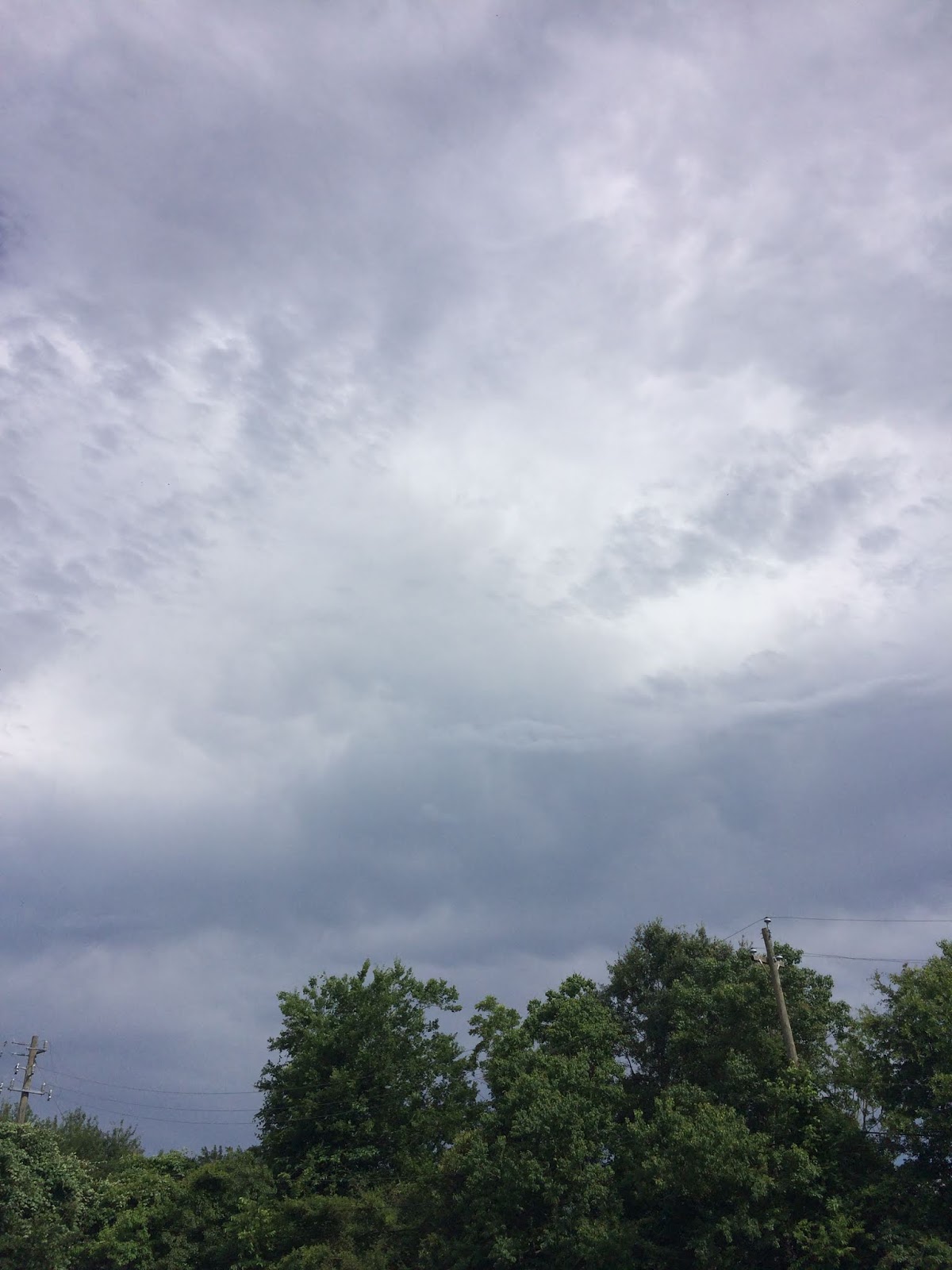
Northwest Houston, TX, I think, during the early morning, on my way to the pet resort that I work for, from my house in northwest Houston, TX.
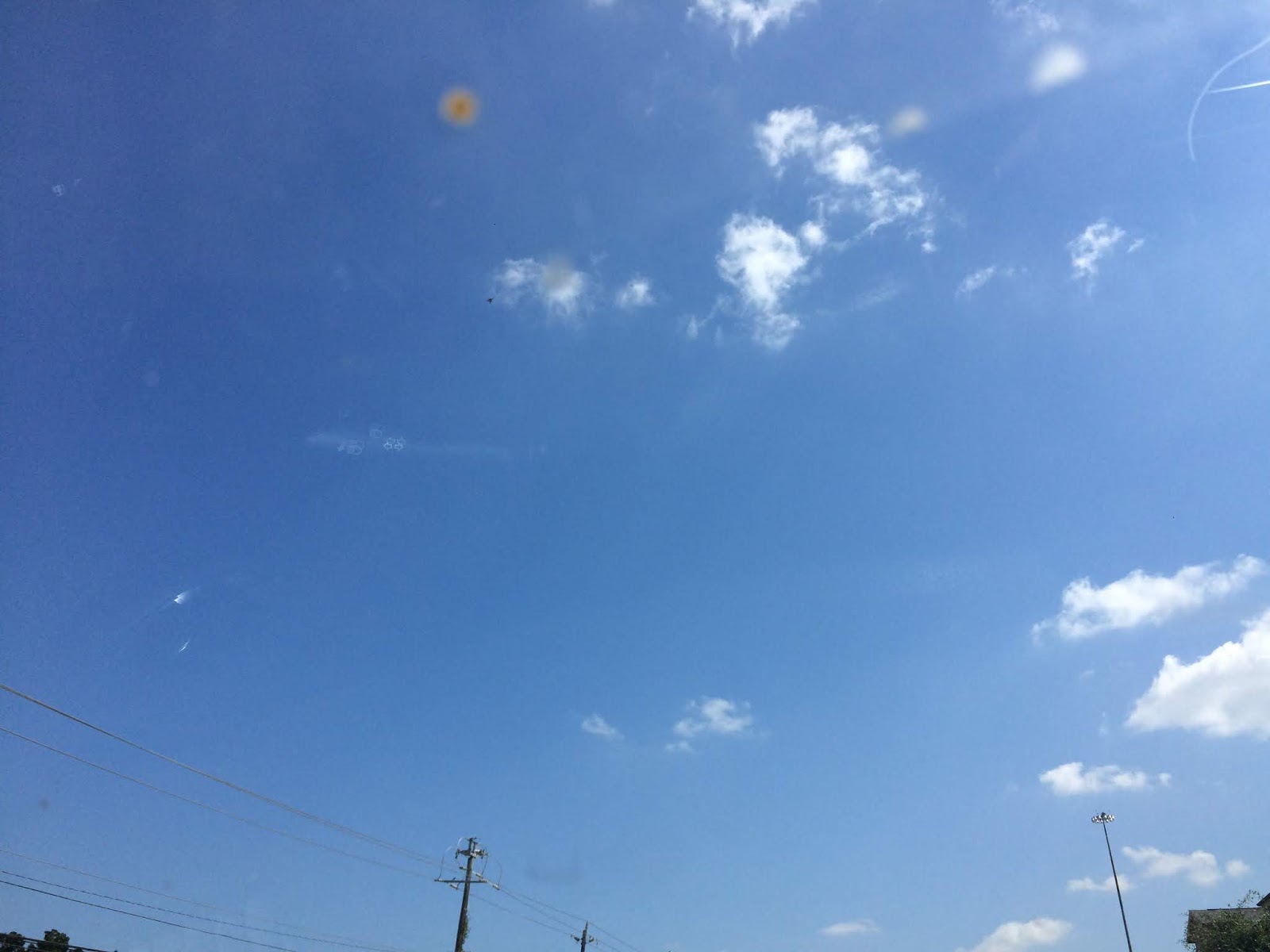
Southeast Houston, TX, during the early morning, on my way to the pet resort that I work for, from my house in northwest Houston, TX.
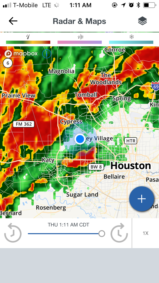
Houston, TX radar, during the early afternoon.
Houston, TX radar, during the mid-afternoon.
Houston, TX radar, during the late afternoon.
Southeast Houston, TX, during the late afternoon, at the pet resort that I work for.
Near the heights of Houston, TX, during the early evening, on my way to my friends house in northwest Houston, TX.
Northwest Houston, TX, during the early evening, on my way to my friends house.
Houston, TX radar, during the early night.


Hazardous Weather Outlook

Hazardous Weather Outlook
National Weather Service Houston/Galveston TX
440 AM CDT Thu May 24 2018

TXZ163-164-176>179-195>200-210>214-226-227-235>238-300-313-
335>338-436>438-250945-
Austin-Brazoria Islands-Brazos-Burleson-Chambers-Coastal Brazoria-
Coastal Galveston-Coastal Harris-Coastal Jackson-
Coastal Matagorda-Colorado-Fort Bend-
Galveston Island and Bolivar Peninsula-Grimes-Houston-
Inland Brazoria-Inland Galveston-Inland Harris-Inland Jackson-
Inland Matagorda-Madison-Matagorda Islands-Montgomery-
Northern Liberty-Polk-San Jacinto-Southern Liberty-Trinity-Walker-
Waller-Washington-Wharton-
440 AM CDT Thu May 24 2018

This hazardous weather outlook is for portions of Southeast Texas..

.DAY ONE...Today and Tonight

Scattered showers and thunderstorms are expected today. Brief,
but locally heavy rain and gusty winds will be possible with the
stronger storms. The storms are expected to end during the early
evening.

.DAYS TWO THROUGH SEVEN...Friday through Wednesday

Warmer than normal afternoon temperatures are expected continue
through the next week. Near-record heat is expected early next
week with heat index values in the low to mid 100s. Because of how
early in the year this heat is occurring, residents are urged to
take precautions for heat illness. These include taking frequent
breaks if working outdoors, wearing lightweight and loose-fitting
clothing and drinking plenty of water. In addition, please
remember to check the backseat for children and pets.

.SPOTTER INFORMATION STATEMENT...

Spotter activation will not be needed.

$$


Locations: Northwest, southwest, southeast, the heights, and downtown Houston, TX.


Thoughts: The day was very warm, there were some scattered showers and thunderstorms in and around the Houston, TX area, during the morning, afternoon, and evening. A light to maybe moderate shower looked to have maybe passed over the pet resort that I work for, sometime during the afternoon. I think I may have passed through some sprinkles, while driving my car, sometime during the day, but I don't remember.

Wednesday, May 23, 2018

May. 22 18

Houston, TX radar, during the early morning.
Houston, TX radar, during the mid-morning.
Houston, TX radar, during the late morning.
Houston, TX radar, during the early afternoon.
Cypress, TX, I think, during the early afternoon, at a community center/police station to vote.
Northwest Houston, TX, during the early afternoon, driving down highway 6 to the place where I need to vote in west Houston, TX, since the place I went to before in mostly likely Cypress, TX, was the wrong place to vote.
West Houston, TX, during the early afternoon, at the place where I am actually supposed to vote.
Houston, TX radar, during the mid-afternoon.
West Houston, TX, during the mid-afternoon, driving down Tully, on my way to pick up my friend from his house in northwest Houston, TX.
Northwest Houston, TX, during the mid-afternoon, driving down Hempstead highway, on my way to pick up my friend from his house.
Houston, TX radar, during the late afternoon.
Northwest, or maybe west Houston, TX, during the late afternoon, at a Kroger's that my friend wanted to go to.
Northwest Houston, TX, during the late afternoon, on my way to my house with my friend.

Houston, TX radar, during the early evening.
Northwest Houston, TX, during the late evening, almost early night, driving on 290 towards my house, after dropping my friend off at his house and getting flea shampoo for cats at a Petco.


Area Forecast Discussion 
Issued by NWS Houston/Galveston, TX
Home | Current Version | Previous Version | Text Only | Print | Product List | Glossary Off
Versions: 1 2 3 4 5 6 7 8 9 10 11 12 13 14 15 16 17 18 19 20 21 22 23 24 25 26 27 28 29 30 31 32 33 34 35 36 37 38 3940 41 42 43 44 45 46 47 48 49 50
000
FXUS64 KHGX 230047
AFDHGX

Area Forecast Discussion
National Weather Service Houston/Galveston TX
747 PM CDT Tue May 22 2018

.AVIATION...
Showers/thunderstorms earlier this afternoon have dissipated this
evening. Should be a quiet night with mostly VFR conditions, with
patchy fog possible for our usual sites (CXO/LBX) by sunrise. Not
too many changes from previous as the onshore flow persists and a
slightly deeper moisture from the Gulf persists across the region.
Daytime heating along with the seabreeze should help produce more
scattered storms tomorrow afternoon. Will keep with the VCSH/VCTS
wording for now. 41

&&

.PREV DISCUSSION... /ISSUED 402 PM CDT Tue May 22 2018/

Afternoon showers and storms today, but today mainly limited to
the seabreeze and near an outflow boundary from yesterday`s action
at the northern edge of our area. Some patchy fog in rural areas
should crop up again tonight, with another day of isolated to
scattered convection tomorrow near the seabreeze. Expect a warming
trend into the weekend, which - depending on how things play out
with the area of disturbed weather moving from the Caribbean into
the Gulf - could continue straight on into early next week.

NEAR TERM [Through Tonight]...

Showers and storms again today - but are more subdued than the
past two days. Most activity is happening near the seabreeze, and
what looks to be an outflow boundary from yesterday`s storms at
the far northern edge of our area of responsibility. Cores have
been getting to 1-2 inches per hour of instantaneous rain rate,
and though they aren`t moving quickly, they`re dragging just
enough to keep totals from getting excessive. The heaviest rain
today has been in a very rural corner of Matagorda County.
Fortunately, the portions of Harris and Montgomery counties that
got slammed the last two days, have largely been getting a break
today. Though some urban spots show very small flares in the MRMS
unit streamflow product, the area looks pretty well behaved today.

Look for the scattered activity to begin winding down with the
loss of heating as the sun sets, coming fully to an end later in
the evening. With plenty of moisture in place, look for tonight to
be another warm one.

SHORT TERM [Wednesday Through Thursday Night]...

Scattered convection and warm temps can be expected the next two
days as well, and again the seabreeze should be most active. For
now, think that southwest of Houston may be a bit favored
Wednesday afternoon, and as an upper low drifts a little bit
eastward, will shift up towards Galveston Bay Thursday. However,
that`s fairly tentative given the relatively small and slow
motions we`re talking about here.

LONG TERM [Friday Through Tuesday]...

The extended forecast will be very strongly influenced by the
interplay of the aforementioned upper low as well as the area of
disturbed weather being tracked by NHC and given a medium chance
for development. As the upper low drifts eastward into the
weekend, heights should rise a bit, and with it highs into the
lower to mid 90s. From there...there is spread in the guidance as
to the upper low`s path. It could drift back our way, and allow
for higher rain chances. This may also allow the surface feature
to make its way further west, though at this time, even the left
edge of the guidance envelope keeps any direct impact east of
Texas. However, if it doesn`t retrograde quite as much, heights
may stay higher, and with subsidence on the edge of
the...whatever...that comes out, we could get quite hot next week.
Since the trend in the guidance has been to tighten some more on
the north central Gulf coast, the forecast leans a little more in
that direction. If this does indeed occur, we could see our first
triple digit heat indices of the year sometime next week.

&&

.PRELIMINARY POINT TEMPS/POPS...
College Station (CLL)      69  90  69  90  71 /  10  10  10  20  10
Houston (IAH)              72  90  71  90  73 /  10  20  10  30  10
Galveston (GLS)            78  84  77  85  77 /  10  20  10  20  20

&&

.HGX WATCHES/WARNINGS/ADVISORIES...
TX...NONE.
GM...NONE.
&&

$$

Hazardous Weather Outlook

Hazardous Weather Outlook
National Weather Service Houston/Galveston TX
440 AM CDT Tue May 22 2018

TXZ163-164-176>179-195>200-210>214-226-227-235>238-300-313-
335>338-436>438-230945-
Austin-Brazoria Islands-Brazos-Burleson-Chambers-Coastal Brazoria-
Coastal Galveston-Coastal Harris-Coastal Jackson-
Coastal Matagorda-Colorado-Fort Bend-
Galveston Island and Bolivar Peninsula-Grimes-Houston-
Inland Brazoria-Inland Galveston-Inland Harris-Inland Jackson-
Inland Matagorda-Madison-Matagorda Islands-Montgomery-
Northern Liberty-Polk-San Jacinto-Southern Liberty-Trinity-Walker-
Waller-Washington-Wharton-
440 AM CDT Tue May 22 2018

This hazardous weather outlook is for portions of Southeast Texas..

.DAY ONE...Today and Tonight

Scattered showers and thunderstorms are expected today. Brief,
but locally heavy rain will be possible with a few of the stronger
storms. The storms are expected to end during the early evening.

.DAYS TWO THROUGH SEVEN...Wednesday through Monday

The warmer than normal afternoon temperatures are expected
continue through the upcoming week. Heat index values could reach
100 degrees by the end of the week. Because of how early in the
year this heat is occurring, residents are urged to take
precautions for heat illness. These include taking frequent breaks
if working outdoors, wearing lightweight and loose-fitting
clothing and drinking plenty of water.

.SPOTTER INFORMATION STATEMENT...

Spotter activation will not be needed.

$$


Locations: Northwest and west Houston, TX, and maybe Cypress, TX.


Thoughts: I really enjoyed driving through the scattered showers and 
thunderstorms!

Saturday, May 19, 2018

Mar. 30 18

River flood warnings for the Houston, TX area, during the early morning.
Southeast Houston, TX, during the early morning, at the pet resort that I work for.
Southeast Houston, TX, during the early afternoon, at the pet resort that I work for.
Near the heights of Houston, TX, I think, during the early afternoon, on my way to my house in northwest Houston, TX.
West Houston, TX, during the early afternoon, on my way to my house in northwest Houston, TX.
Northwest Houston, TX, during the mid-afternoon, I think, at my house.
Northwest Houston, TX, I think, during the late afternoon.


Locations: Northwest, southwest, southeast, and west Houston, TX, and the heights of Houston, TX, and downtown Houston, TX.


Thoughts: I don't remember it was a long time ago.

May. 18 18

Northwest Houston, TX, during the mid-afternoon, on my way to a Edwards's theater in west Houston, TX, to watch Deadpool 2 with a friend.
West Houston, TX, I think, during the mid-afternoon,  on my way to a Edwards's theater in west Houston, TX, to watch Deadpool 2 with a friend.
West Houston, TX, during the early evening, at a Edwards theater.
Northwest Houston, TX, during the late evening, at my house.


Locations: Northwest and west Houston, TX.


Thoughts: The day was very hot, sunny, and dry.

Friday, May 18, 2018

Mar. 29 18


Houston, TX radar, during the early morning.
Watches, warnings, and weather statements for the Houston, TX area, during the early morning
Southeast Houston, TX, during the early afternoon, at the parking lot of the pet resort that I work for, about to leave, on my way home to my house in northwest Houston, TX.
Southeast Houston, TX, during the mid-afternoon, on my way to my house in northwest Houston, TX.
Southeast, or maybe southwest Houston, TX during the mid-afternoon, on my way to my house in northwest Houston, TX.
Southwest Houston, TX, I think, during the late afternoon, on my way to my house in northwest Houston, TX.
Northwest Houston, TX, during the early evening, on my way to my house in northwest Houston, TX.
Northwest Houston, TX, I think, during the late evening.


Locations: Northwest, southwest, southeast, the heights, and downtown Houston, TX. And maybe west Houston, TX.


Thoughts: The day was hot, or maybe very warm, dry, and sunny.

May. 17 18

Northwest Houston, TX, during the early morning, on my way to work at a pet resort in southeast Houston, TX.
Southeast Houston, TX, during the late morning, on my lunch break at the pet resort that I work for.
Southeast Houston, TX, during the early afternoon, on my way to my house in northwest Houston, TX, from the pet resort that I work for in southeast Houston, TX.
Northwest Houston, TX, during the mid-afternoon, checking my car for damage from a possible accident on the freeway.
Northwest Houston, TX, during the late evening, on my way to my house in northwest Houston, TX, after dropping my friend off at his house in northwest Houston, TX.


Locations: Northwest, southwest, southeast, the heights, and downtown Houston, TX.


Thoughts: Another hot and dry day for Houston, TX.


Area Forecast Discussion 
Issued by NWS Houston/Galveston, TX

Home | Current Version | Previous Version | Text Only | Print | Product List | Glossary Off
Versions: 1 2 3 4 5 6 7 8 9 10 11 12 13 14 15 16 17 18 19 20 21 22 23 24 25 26 27 28 29 30 31 32 33 34 35 36 37 38 3940 41 42 43 44 45 46 47 48 49 50
000
FXUS64 KHGX 180206
AFDHGX

Area Forecast Discussion
National Weather Service Houston/Galveston TX
906 PM CDT Thu May 17 2018

.DISCUSSION...
Seeing no reason to make any major changes to the forecast this evening.
Lots of cirrus is streaming across the area from the west and northwest
storm activity, but do not expect any if this precip to make it into
our area overnight.

We might get close to record highs again tomorrow. Houston Intercontinental
Airport has tied or set record high temperatures in each of the last
four days.

The record highs for Friday (May 18th) are...
College Station - 96 set in 1925
Houston Intercontinental - 95 set in 1890
Houston Hobby - 93 set in 2003 and 1998
Galveston - 89 set in 1875

42
&&

.PREV DISCUSSION... /ISSUED 700 PM CDT Thu May 17 2018/

AVIATION...
VFR. Take today`s flying conditions and that is likely what you
will experience tomorrow...barring a rogue cumulus cloud or two.
31

PREV DISCUSSION... /ISSUED 419 PM CDT Thu May 17 2018/

DISCUSSION...
Another hot/dry day across SE TX today with some records highs
prepared to fall (or very near) this afternoon (Galveston/IAH).
Patchy fog possible again tonight across areas W/SW of Houston
likely lingering through mid Fri morning. The return of south-
east winds tomorrow could bring an end to the streak of record
setting days as the onshore flow helps to modify things.

As the upper ridge breaks down over the weekend (likely as the
response to a series of shortwaves rotating around the base of
elongated trof axis along the west coast), we should be seeing
slightly better rain chances over the weekend as the seabreeze
tries to get things going. However, the better chances to hold
until the start of next week (when weak disturbances come into
play with the seabreeze). Additionally models are hinting that
increased PWs (1.6-1.8") are possible during that time period.
Drying pattern could be returning by the end of next week. 41

MARINE...
Light s/sw winds today will strengthen tonight and become more
southerly on Friday as low pressure develops over the Texas
panhandle. Increasing winds and seas Friday night into Sunday will
probably require a combination of caution/advisory flags. Winds/seas
will weaken a touch going into early next week, but anticipate
onshore winds to continue.  47

&&

.PRELIMINARY POINT TEMPS/POPS...
College Station (CLL)      69  95  70  92  73 /  10  10  10   0  10
Houston (IAH)              72  95  73  91  73 /  10  10   0   0  10
Galveston (GLS)            76  87  77  87  77 /  10  10   0  10  10

&&

.HGX WATCHES/WARNINGS/ADVISORIES...
TX...NONE.
GM...NONE.
&&

$$

Hazardous Weather Outlook

Hazardous Weather Outlook
National Weather Service Houston/Galveston TX
258 AM CDT Thu May 17 2018

TXZ163-164-176>179-195>200-210>214-226-227-235>238-300-313-
335>338-436>438-180800-
Austin-Brazoria Islands-Brazos-Burleson-Chambers-Coastal Brazoria-
Coastal Galveston-Coastal Harris-Coastal Jackson-
Coastal Matagorda-Colorado-Fort Bend-
Galveston Island and Bolivar Peninsula-Grimes-Houston-
Inland Brazoria-Inland Galveston-Inland Harris-Inland Jackson-
Inland Matagorda-Madison-Matagorda Islands-Montgomery-
Northern Liberty-Polk-San Jacinto-Southern Liberty-Trinity-Walker-
Waller-Washington-Wharton-
258 AM CDT Thu May 17 2018

This hazardous weather outlook is for portions of Southeast Texas..

.DAY ONE...Today and Tonight

Near to record high temperatures will be possible today. Because
of how early in the year this heat is occurring, residents are
urged to take precautions for heat illness. These include taking
frequent breaks if working outdoors, wearing lightweight and
loose-fitting clothing, and drinking plenty of water.

.DAYS TWO THROUGH SEVEN...Friday through Wednesday

Near to record high temperatures will be possible Friday and
Saturday. Because of how early in the year this heat is
occurring, residents are urged to take precautions for heat
illness. These include taking frequent breaks if working outdoors,
wearing lightweight and loose-fitting clothing, and drinking
plenty of water.

.SPOTTER INFORMATION STATEMENT...

Spotter activation will not be needed.

$$