Sunday, December 24, 2017

Dec. 23 17

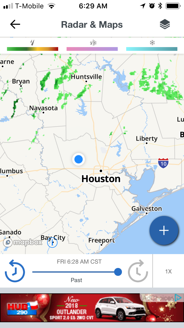
Houston, TX radar, during the early afternoon.


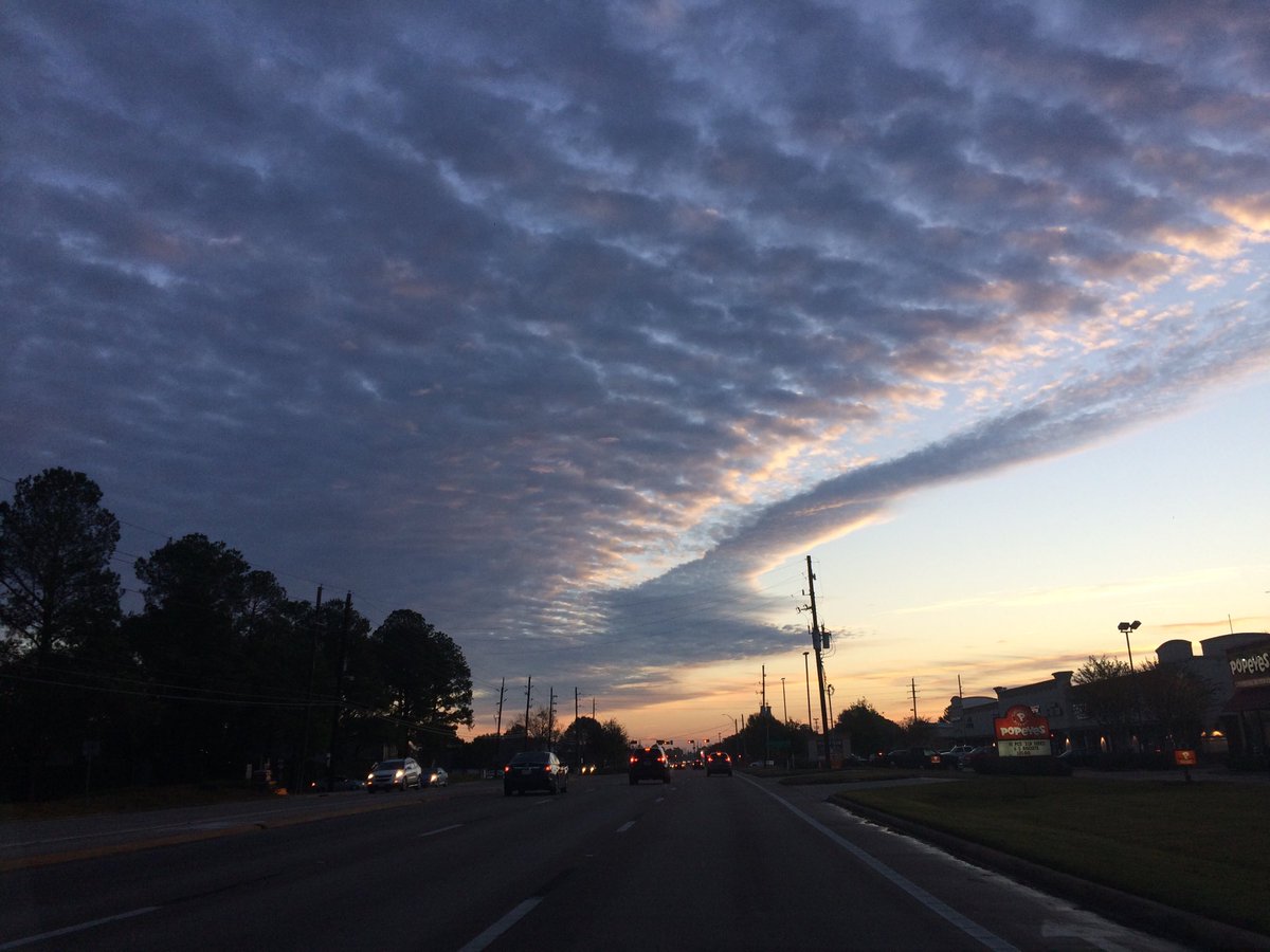
Summary: The day was cool, sunny, and dry. Maybe some rain for some locations in the Houston, TX area. I saw some isolated light showers on the Houston, TX radar, when I looked at it, during the early and mid-afternoon. Wavy alto stratus with some stratus clouds looked to be scattered to widely scattered across the sky, during the morning, afternoon, evening, and maybe night. The wind speeds looked to be calm with gentle to moderate gusts and maybe some moderately strong gusts. It felt very cold, during the early and mid-morning and night. It felt very cool, during the late morning and evening. It felt cool, during the afternoon. There were no watches, warnings, alerts, advisories, or weather statements/outlooks issued for the Houston, TX area, that I know of.


Houston, TX Storm Summary: Maybe some rain for some locations in the Houston, TX area. I saw some isolated light showers on the Houston, TX radar, when I looked at it, during the early and mid-afternoon. I didn't see, or hear about any flooding, or storm damage caused by the weather in any of the locations in the Houston, TX area, during anytime of the day.


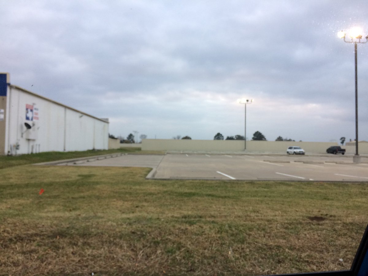
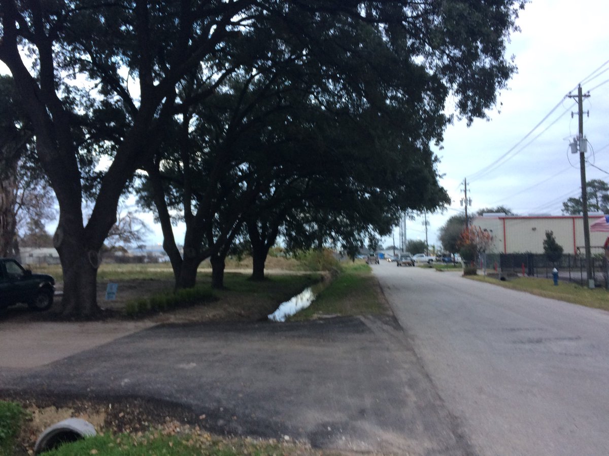
My Storm Summary: There looked to be some possible precip producing clouds, in my neighborhood, in northwest Houston, TX, where I was, during the morning, afternoon, and maybe evening. I didn't see any wet roads, puddles, or wet ground. I didn't see any flooding, or damage caused by the weather, during anytime of the day. I didn't see any flashes of lightning, or hear any rumbles of thunder.


Locations: Northwest Houston, TX.


Thoughts: The sky looked nice in the Houston, TX area, after the cloudy day that the Houston, TX area had the day before.

Saturday, December 23, 2017

Dec. 22 17

Houston, TX radar, during the early morning.
Northwest Houston, TX, during the early morning.
Houston, TX radar, during the early afternoon.
Northwest Houston, TX, during the early afternoon.
Houston, TX radar, during the early evening.
West Houston, TX, during the early evening.


Summary: The day was mostly warm, mostly cloudy, and a little wet. Isolated light to moderate rain showers and drizzle with maybe some moderately heavy showers and drizzle were scattered in and around the Houston, TX area, during the morning, afternoon, evening, and night. I saw and felt a few rain drops/drizzle, where I was in northwest Houston, TX, during the morning and early and mid-afternoon. More widespread light to moderate drizzle and a few occasional moderately heavy showers and drizzle began falling, where I was in northwest Houston, TX, during the late afternoon, and continued off and on through the late night. I think I saw some light to moderate drizzle, when I went to pick up my mom from my dad's store in west Houston, TX, during the early evening. Big, thick stratus clouds looked to cover the whole sky and sometimes only most of the sky, during the morning, afternoon, evening, and night. The wind speeds were gentle with moderate to moderately strong gusts, during the morning and afternoon, with some really strong 20 to 25 and maybe even 30+ mph gusts, during the evening and night. It felt warm during the morning and afternoon. It started to feel cool, during the early evening. It started to feel very cool, during the late evening. It started to feel very cold, during the early night. It felt very cold, during the late night. There were no watches, warnings, alerts, advisories, or weather statements/outlooks issued for the Houston, TX area, that I know of. The low temperatures looked to be in the mid to low 40's and the high temperatures looked to be in the mid to high 70's with maybe some low 80's, for the Houston, TX area.


Houston, TX Storm Summary: Isolated light to moderate rain showers and drizzle with maybe some moderately heavy showers and drizzle were scattered in and around the Houston, TX area, during the morning, afternoon, evening, and night. I didn't see, or hear about any reports of flooding, or damage caused by the weather, in any of the locations in the Houston, TX area, during anytime of the day.


My Storm Summary: I saw and felt a few rain drops/drizzle, where I was in northwest Houston, TX, during the morning and early and mid-afternoon. More widespread light to moderate drizzle and a few occasional moderately heavy showers and drizzle began falling, where I was in northwest Houston, TX, during the late afternoon, and continued off and on through the late night. I think I saw some light to moderate drizzle, when I went to pick up my mom from my dad's store in west Houston, TX, during the early evening. I saw lots of leaves and twigs with some big sticks, that had fallen from trees, as the cold front was pushing through my neighborhood, during the night. I just saw some partly wet roads and ground, but no puddles. I didn't see any flashes of lightning, or hear any rumbles of thunder. I didn't see any flooding, or damage caused by the weather.


Locations: Northwest and west Houston, TX.


Thoughts: I was really enjoying the warm weather, but it looks like it is going to be cold for a lirrle while. That's ok!


Area Forecast Discussion 
Issued by NWS Houston/Galveston, TX
Home | Current Version | Previous Version | Text Only | Print | Product List | Glossary Off
Versions: 1 2 3 4 5 6 7 8 9 10 11 12 13 14 15 16 17 18 19 20 21 22 23 24 25 26 27 28 29 30 31 32 33 34 35 36 37 38 3940 41 42 43 44 45 46 47 48 49 50
000
FXUS64 KHGX 230528
AFDHGX

Area Forecast Discussion
National Weather Service Houston/Galveston TX
1128 PM CST Fri Dec 22 2017

.AVIATION...
The cold front has cleared KGLS leaving scattered showers and low
ceilings in its wake. Ceilings will continue to gradually improve
from NW to SE throughout the night, with KCLL already back up to
VFR. All sites should be VFR by around mid-morning. Breezy NW
winds are expected in the wake of the front, with the gustiness
hanging around about as long as the low ceilings. NW winds are
expected to continue through most of the taf period before
gradually turning around to onshore again overnight Saturday
night. 11

&&

.PREV DISCUSSION... /ISSUED 633 PM CST Fri Dec 22 2017/

UPDATE...
Cold front is sweeping through Southeast Texas, with a temperature
gradient of up to 30 degrees across the front. This has required a
little retooling of the temperature grids to better match with
obs. The big picture forecast is on track, so there`s little to
do beyond capturing the temperature gradient more accurately and
tweaking PoPs slightly as well.


PREV DISCUSSION... /ISSUED 249 PM CST Fri Dec 22 2017/

DISCUSSION...
A cold front as of 2 pm was through College Station and Crockett.
On north side of front temperatures were in the 40s and
50s...south of the front 70s to near 80. This front is progged to
push from NW to SE this afternoon and evening reaching the coast
between 9 and 10 pm tonight. Observed and model soundings show
significant cap limited precipitation to shallow convection,
showers from instability beneath the cap. There have been a few
lightning strikes this afternoon north of the front from elevated
convection. Can rule out an isolated rumble of thunder near and
behind the front but in general expect just rain showers with this
system. Will also see that 20 to 25 degree drop in temperatures as
well. There will be a small window for sea fog ahead of the front
as winds speeds decrease and winds become more southwesterly but
not confident of this. Have kept that possibility in between 6 and
9 pm or 00 to 03 UTC.

For Saturday through Monday...Christmas Day...expect cool...dry
conditions with abundant sunshine with high pressure building in
at the surface and zonal flow aloft. Coldest night would seem to
be Christmas Eve when could see a light freeze across northern
sections but nothing too extreme.

For Tuesday through Thursday of next week rain chances increase
again with more of an easterly wind at low levels...and hint of a
coastal trough and lift from right rear quadrant of intensifying
upper level jet. Not expecting anything heavy but more of a band
of relatively light stratiform rain as air mass still cool and
stable.

18

MARINE...
A cold front will cross the coast tonight. Ahead of the front, a brief
period of sea fog will be possible this evening. The threat for fog
will end once the front moves through the coastal waters sometime
between 03z and 06z. Winds will increase quickly behind the front
and an SCA will be required for the offshore waters. Slightly
lighter winds expected over the bays and near shore waters and will
issue a SCEC for those areas. The moderate to strong offshore flow
will push water out of the bays and some brief/minor low water
conditions could be possible early Saturday. Conditions are expected
to improve by late Saturday as surface high pressure slides into
Southeast Texas. Offshore flow will gradually veer to the east by
Christmas with the departure of the surface high, with winds
flirting with caution flag criteria at times as this happens. A
persistent E-NE wind will develop mid week and tide levels will
increase in response to the prolonged E-NE fetch. 43

&&

.PRELIMINARY POINT TEMPS/POPS...
College Station (CLL)      38  55  38  59  35 /  40   0   0   0   0
Houston (IAH)              44  57  40  63  39 /  60  10   0   0   0
Galveston (GLS)            49  56  49  61  46 /  60  10   0   0   0

&&

.HGX WATCHES/WARNINGS/ADVISORIES...
TX...NONE.
GM...Small Craft Advisory until 6 AM CST Saturday for the following
     zones: Coastal waters from Freeport to the Matagorda Ship
     Channel out 20 NM...Coastal waters from High Island to
     Freeport out 20 NM...Galveston Bay...Matagorda Bay...Waters
     from Freeport to the Matagorda Ship Channel from 20 to 60
     NM...Waters from High Island to Freeport from 20 to 60 NM.

&&

$$

Discussion...25
Aviation/Marine...11

Friday, December 22, 2017

Dec. 21 17

Northwest Houston, TX, during the early morning.
Northwest Houston, TX, during the early evening.


Locations: Northwest Houston, TX.


Thoughts: I am trying, but I cannot write a good enough report and sleep at the same time. I guess I am going to have to go to bed earlier.


Area Forecast Discussion 
Issued by NWS Houston/Galveston, TX
Home | Current Version | Previous Version | Text Only | Print | Product List | Glossary Off
Versions: 1 2 3 4 5 6 7 8 9 10 11 12 13 14 15 16 17 18 19 20 21 22 23 24 25 26 27 28 29 30 31 32 33 34 35 36 37 38 3940 41 42 43 44 45 46 47 48 49 50
000
FXUS64 KHGX 220248
AFDHGX

Area Forecast Discussion
National Weather Service Houston/Galveston TX
848 PM CST Thu Dec 21 2017

.NEAR TERM [Through Tonight]...
IR satellite imagery shows low clouds across much of the area.
Surface analysis shows southerly winds over the area with a cold
front pushing through Oklahoma and Texas Panhandle. VAD wind
profile from KHGX WSR 88D shows 30-35kts about 1000-2000 feet AGL
so there should be enough mixing to keep winds going overnight.
This will do a couple of things. First the mixing will allow for
some light surface winds. This will keep temperatures from
dropping. Southerly wind are also advecting moisture into the
region as dewpoints increase from the 60s into the low 70s. Again
this will keep temperatures from falling much. Moisture will also
support low stratus and maybe a few showers. Again keeping
temperatures from falling much. So min temperatures in the upper
60s in the forecast may be even a bit of a stretch. Some people
will be waking up to temperatures in the low 70s which is yuck for
December. The good news in all of this is that there should not
be any stupid radiation fog. Fog if any will be limited to the
coastal areas and area observations/webcams do not show much fog
through Galveston Bay or off the coast. There is still plenty of
time for advection fog to form so will keep the dense fog advisory
going for the marine areas.

SPC has a day 2 severe weather risk of marginal for SE Texas. One
look at the 00Z CRP sounding and I think I have good confidence
in the fact that the severe weather threat will be more limited
tomorrow. Sounding shows 850mb temperature of 22C with a nice
elevated mixed layer. Winds through the boundary layer veer to the
SW so very likely that the EML will advect over much of SE Texas.
This means a rather strong cap will be in place for much of the
day. Model soundings also show the EML over SE Texas but as most
models, they show the cap eroding with time. Looking at WRF
reflectivity output, this also seems to confirm that surface based
convection will be limited. Above the cap there will be some
instability so I can understand the marginal threat, but that only
depends upon convective initiation in the warm sector breaking
the cap. The other issue is large scale ascent out of phase with
low level forcing. With the best PVA back over the Big Country of
Texas along with strong upper level divergence, frontal forcing
will have to be the main driver for initiation. Cap may be too
strong for weak lift along the front to overcome. It still looks
like there may be some post frontal precipitation due to elevated
convection, but it does not appear to be that strong. Much like we
saw Tuesday night, thinking there will be a squeegee line of
storms to push through the area with some post frontal showers.
There will of course be the chance for brief heavy rain, gusty
winds and lightning, but storms should be below severe levels.

Only changes to the forecast tonight were to keep up with ongoing
trends and to better define the timing of the front. Rest of the
forecast looks on track even with the high uncertainty in the
forecast beyond Christmas. Model differences are huge.

Overpeck


&&

.PREV DISCUSSION /Issued 613 PM CST Thu Dec 21 2017/...

.AVIATION...
VFR becoming MVFR over the next few hours across all TAF
sites. Some drizzle will also be possible in the early morning
hours, associated with possible streamer showers developing below
the cap out ahead of our next cold front. Lower visibilities to
around 5SM will be possible overnight with MVFR/IFR ceilings
expected in the northern terminals. Metro terminals such as IAH,
HOU, and SGR will see visibilities likely lower to MVFR criteria.
Ceilings will continue to drop to IFR/MVFR criteria, as the cloud
deck continues to lower in height with the help of radiational
cooling from the surface, allowing the temperature and dew point
spread to decrease. Along the coast, LBX and GLS will deal with
the influence of sea fog, resulting in both visibilities and
ceilings lowering to IFR/LIFR status. Lowered visibilities and
ceilings will continue to be possible until the passing of our
next frontal passage, expected to reach the area late Friday into
early Saturday morning.

The cold front should reach the coast between 06Z to 10Z Saturday
morning. A line of showers with potential isolated thunderstorms
will be embedded with this front. Winds behind the boundary will
turn out of the NW and eventually become northerly, and wind
speeds will pick up to around 15 knots. Winds could become gusty
at times behind this feature.

Hathaway

.PREV DISCUSSION... /ISSUED 303 PM CST Thu Dec 21 2017/

DISCUSSION...
Warm and humid for this first day of winter for SE TX. However,
changes are on the way tomorrow with a cold front to move across
late Friday afternoon and evening. Prior to the front, expect
areas of dense fog near the coast as well as showers and
thunderstorms tomorrow along and ahead of the boundary.

Model guidance is in good agreement with the timing of the front
on Friday, reaching CLL mid afternoon, IAH early evening, and off
the coast late evening. It will be warm ahead of the front with
central portions of the area likely approaching 80 degrees again.
Some differences are showing up in the models concerning the
degree of capping over the area as the front moves through. I
think W/NW areas of SE TX have a chance of seeing a few strong
storms mid/late aft tomorrow; however, by early eve, with the loss
of heating, not sure this threat will extend SE into central
areas. Will carry likely pops areawide ahead of and along the
front and should be free of inland rain by Saturday morning.

In the wake of the front, expect dry and cool conditions through
Christmas. The only areas that may see a freeze on Christmas
morning appears to be the far northern areas. By Tuesday we will
see slightly warmer temps and a return of moisture. The GFS and
ECMWF are not in agreement after Tuesday with significant
differences in the mid/upper level pattern upstream of Texas. For
sensible weather across the area this results in the GFS being
much warmer than the ECMWF Wed and Thu. The ECMWF brings a cold
front through the area Tue night and Wed morning, and the GFS does
not. Leaning toward no front, but not forecasting temps to be as
warm as the GFS for now. Not a lot of confidence in temps and
rain chcs for next Wed and Thu. 33

MARINE...
Sea fog has been affecting parts of the marine area today and
conditions remain favorable for more fog overnight lingering through
Friday night. Warm air will continue to flow over cooler shelf waters
resulting in periods of dense sea fog. Sfc winds are S-SE and this
trajectory will bring slightly warmer water toward the coast
reducing the water temp/air temp difference. In addition, slightly
stronger winds will aid in mixing slightly drier air aloft to the
surface. The stronger winds tonight may reach caution levels for the
20-60 NM waters. All that said, the potential for sea fog will
remain high until a cold front moves through the coastal waters
sometime early Saturday morning between midnight and 6 AM.

A strong offshore flow will develop in the wake of the front on
Saturday and a Small Craft Advisory may briefly be required for the
offshore waters early Saturday. Winds will diminish Saturday night
into Sunday as winds veer to the NE. Winds will veer to the east on
Monday and remain generally easterly through Wednesday afternoon.
Some increase in tide levels can be expected toward the middle of
next week. 43

&&

.PRELIMINARY POINT TEMPS/POPS...

College Station (CLL)  66  71  42  56  39 /  40  80  60  10  10
Houston (IAH)          68  79  48  58  42 /  20  30  70  10  10
Galveston (GLS)        68  75  52  59  49 /  10  20  60  10  10

&&

.HGX WATCHES/WARNINGS/ADVISORIES...

TX...None.
GM...Dense Fog Advisory until 4 AM CST Friday for the following
     zones: Coastal waters from Freeport to the Matagorda Ship
     Channel out 20 NM...Coastal waters from High Island to
     Freeport out 20 NM...Galveston Bay...Matagorda Bay.

     SMALL CRAFT SHOULD EXERCISE CAUTION until 4 AM CST Friday for
     the following zones: Waters from Freeport to the Matagorda
     Ship Channel from 20 to 60 NM...Waters from High Island to
     Freeport from 20 to 60 NM.


&&

$$

NEAR TERM...Overpeck

Thursday, December 21, 2017

Dec. 20 17


Northwest Houston, TX, during the early morning.
West Houston, TX, during the early evening.


Locations: Northwest and west Houston, TX.


Thoughts: I forgot what happened weather wise, so I am going to have to forget the weather report of this day also.


Area Forecast Discussion 
Issued by NWS Houston/Galveston, TX

Home | Current Version | Previous Version | Text Only | Print | Product List | Glossary Off
Versions: 1 2 3 4 5 6 7 8 9 10 11 12 13 14 15 16 17 18 19 20 21 22 23 24 25 26 27 28 29 30 31 32 33 34 35 36 37 38 3940 41 42 43 44 45 46 47 48 49 50
000
FXUS64 KHGX 202331
AFDHGX

Area Forecast Discussion
National Weather Service Houston/Galveston TX
531 PM CST Wed Dec 20 2017

.AVIATION...
Two main issues in this evening`s forecast are trends in winds,
and visibility. Pretty high confidence that southwesterly/westerly
winds from this afternoon will become light and variable
overnight. When they reestablish in the morning, look for
southerly winds.

Visibility and ceilings are a trickier bit. There had been strong
HRRR consensus for dense fog for the entire area from IAH
coastward towards dawn. Given that dewpoints in the area are still
only in the mid to upper 40s, without a real strong onshore
component to boost them quickly, was unsure of how that would play
out. Fortunately, the latest HRRR seems more in line with
observations. In short, towards dawn, have MVFR visibility from
CXO to SGR/HOU. Do go to high IFR at LBX and GLS, nearer the
coast. Finally, bring in some low MVFR ceilings all the way to UTS
(but leave out CLL) tomorrow afternoon as onshore flow and
moisture return kick in more strongly.

Luchs

&&

.PREV DISCUSSION... /ISSUED 319 PM CST Wed Dec 20 2017/

DISCUSSION...
Clear skies overnight with light and variable winds, should help
prime conditions for the potential development of radiational fog.
Patchy fog should develop where the best moisture will be
available, essentially from I-10 southward, as well as in our
western counties. The onset of development would begin around 09Z
Thursday and could carry through late morning. Short term guidance
such as the SREF and HRRR also indicates the potential for
lowered visibilities starting along the coast and slowly spreading
inland and westward.

Surface winds though light overnight, will begin to turn more
southerly early Thursday allowing a warm air advection pattern to
set up. This will help to push warm moist air back over the
region. As this airmass advects over the cooler shelf waters, the
chance for sea fog will return Thursday morning along the coastal
counties. Patchy to thicker areas of fog could linger through
much of Thursday afternoon. Cloud cover will also thicken as a
stratus deck develops early Thursday, and should keep temperatures
a touch cooler. High temperatures for Thursday are still above
normal for this time of year, in the mid to upper 70s. The chance
for sea fog will again be a factor early Friday morning out ahead
of our next cold front.

The global models have come into better agreement with the timing of
the next cold front, which should reach our coastal waters
between 06Z-12Z Saturday. Showers and isolated thunderstorms will
be possible with this frontal passage, with precip starting as
early as late Thursday and carrying through the early afternoon
hours Saturday. Showers can be expected out ahead of the front
late Thursday, with the bulk of the precip associated with the
frontal boundary occuring late Friday into early Saturday. Behind
the front, showers again will fill in, lingering into the early
afternoon hours on Saturday. Temperatures will not be as cool
behind this first front, as previous runs of the GFS and ECMWF
anticipated. As a result, high temperatures Friday compared to
Saturday will drop anywhere from 10 to 15 degrees, leaving high
temperatures Saturday in the upper 50s to lower 60s. A cooler
drier airmass will arrive late Sunday into Monday, which will
bring the secondary push of cooler air. This airmass will lower
temperatures a little further bringing Monday`s high temperatures
into the 50s. Therefore, slightly below normal temperatures are
in store for your holiday weekend.

The warming trend should continue through mid week, bringing
temperatures back into the upper 50s to mid 60s. Onshore flow
should return by Monday evening. Lastly, another cold front, is
expected to arrive towards the end of next week. This will result
in another round of precip beginning early Wednesday, with a front
potential sliding off the coast next Thursday.

Hathaway

MARINE...
Light onshore winds will develop tonight as surface high pressure moves
east of the region. A warm front and associated return flow will bring
deeper moisture back into the area and surface dew points will increase
to near 70 by Thursday afternoon. Water temperatures are in the lower
60s at the current time so would expect sea fog to begin to develop
perhaps as early as Thursday morning. Visibility will probably fall
to below a mile at times and a Marine Dense Fog Advisory may be needed at
times. One small concern regarding the potential for sea fog is that
surface winds will be S-SE and this will bring slightly warmer waters
toward the coast so the difference between the water temp and dew pt
will lessen and this could reduce the potential for sea fog. SREF ensembles
keep the best potential for sea fog from about Galveston Bay, eastward
along the Louisiana coast. The onshore flow will also strengthen Thursday
into Friday and a SCEC may be required for the 20-60 NM waters.

A cold front will cross the coast between 09-12z Saturday and usher in
an offshore flow and end the fog threat. Borderline SCA conditions expected
in the wake of the front. A secondary surge of colder air will enter the
area on Sunday and the gradient over the water will tighten with SCA conditions
expected over the Gulf waters on Sunday night into Monday. Onshore winds will
return by Monday evening and persist through next Wednesday. 43

&&

.PRELIMINARY POINT TEMPS/POPS...
College Station (CLL)      51  77  64  70  44 /   0  10  40  60  70
Houston (IAH)              53  77  67  76  52 /   0  20  30  40  70
Galveston (GLS)            60  74  65  74  56 /  10  20  20  30  70

&&

.HGX WATCHES/WARNINGS/ADVISORIES...
TX...NONE.
GM...NONE.
&&

$$

Discussion...39
Aviation/Marine...25

Wednesday, December 20, 2017

Dec. 19 17

Northwest Houston, TX, during the early morning.

Northwest Houston, TX, during the early afternoon.
Northwest Houston, TX, during the late afternoon.

Houston, TX radar, during the early night.

Houston, TX radar, during the late night.


Locations: Northwest and west Houston, TX.


Thoughts: I enjoyed the line of thunderstorms that passed through.


Area Forecast Discussion 
Issued by NWS Houston/Galveston, TX

Home | Current Version | Previous Version | Text Only | Print | Product List | Glossary Off
Versions: 1 2 3 4 5 6 7 8 9 10 11 12 13 14 15 16 17 18 19 20 21 22 23 24 25 26 27 28 29 30 31 32 33 34 35 36 37 38 3940 41 42 43 44 45 46 47 48 49 50
259
FXUS64 KHGX 200232
AFDHGX

Area Forecast Discussion
National Weather Service Houston/Galveston TX
832 PM CST Tue Dec 19 2017

.NEAR TERM [Through Tonight]...

Radar shows line of storms from Madisonville to Columbus moving
east this evening. Based on current trends and latest short term
model guidance, storms should reach Houston area around 11PM and
then along the coast around 3AM Wednesday. Main changes to the
forecast were to update T/Td trends with ongoing conditions and to
better time the line of storms moving through the area. Overall
environment supports thunderstorm activity but the combinations of
instability, lift and shear are not supportive of severe weather.
Storms may get strong enough for some 30 knot winds as they push
through with frequent lightning. There may be some brief heavy
rainfall but rainfall amounts are expected to remain under a half
inch. Sea fog has developed in the bays and coastal waters but
should erode during the morning as the front pushes off the coast
behind the line of storms. West winds tomorrow should allow for
drier conditions and for high temperatures to reach the upper 70s.
Some areas could reach the low 80s like a few spots did today.

Overpeck

&&


.PREV DISCUSSION /Issued 542 PM CST Tue Dec 19 2017/...

Breaks in the clouds have provided enough insolation for isolated
to scattered showers and even a few thunderstorms to develop this
afternoon. So far activity has been well-behaved, but with the
region located south of a warm front (roughly stretching from New
Braunfels to Jarrell to Palestine) and SPC mesoanalysis showing
25-30 knots of 0-1 km bulk shear would not be surprised to hear of
some transient rotation or funnel clouds from any discrete cells
that develop in the vicinity or south of the warm front through
sunset. A secondary line of showers and thunderstorms is expected
to develop west of the region late this afternoon along the
western extent of the warm front (New Braunfels to Jarrell) as it
pushes back east as a "cold" front. Already starting to see some
development along this feature and expect this line to sweep
across the region during the evening and early morning hours,
clearing sometime closer to 3-4 AM. Increasing forcing for ascent
as a compact upper low reaches North Texas combined with 0-6 km
bulk shear approaching 50 knots may allow for a few of the
thunderstorms that develop to become strong north of a Columbus to
Cleveland line. The main threat is expected to be gusty winds as
a some of the energy from a developing 40 knot low level jet is
transported to the surface by stronger downdrafts, but brief heavy
rain will also be possible with precipitable water values between
1.6-1.8 inches. No flooding issues are expected but localized
visibility restrictions will be possible from the heavy rain.

After the front clears the region, drier air will not only scour
out the sea fog along the coast but allow for the region to warm
into the mid to upper 70s on Wednesday under sunny skies. Return
flow quickly becomes established by Thursday as a lee surface low
develops over the Central Plains, ushering the clouds back in and
chances for warm air advection showers with highs again in the 70s.
Returning moisture will also mean the sea fog threat returns and
persists into Friday ahead of a cold front crossing the region.
Scattered showers and thunderstorms will be possible with the
front with rain clearing the region by Saturday morning as the
front pushes into the Gulf. Highs on Saturday look to be about 20
degrees cooler than Friday with a reinforcing cold front on Sunday
further dropping highs into the 40s.

Medium range guidance continues to trend drier with the late
weekend cold front and expect the beginning of Christmas week to
be cold and dry. Will have to keep an eye on the potential for
widespread freezing conditions Monday/Tuesday morning as a
1028-1030 mb surface high slides across the region.

Huffman

.AVIATION.../00Z TAF/
For the most part, the previous cycle of TAFs is on track.
Developing line of thunderstorms northwest of CLL is a bit slow,
and though it didn`t force a change there, that slight delay will
grow such that most sites downstream needed the arrival of these
storms to be nudged back 1-3 hours. Still anticipating this line
of convection to be thin and broken, so it should move through
relatively quickly and is not guaranteed to impact the sites.
However, if they do, stronger cells are certainly capable of
producing wind gusts in excess of 30 knots.

Meanwhile, at the coast, GLS is back into the marine fog, and is
fairly dense. Webcams in the area are pretty socked in with obs
down to 1/2 mile. This will persist until the front comes to clear
everything out. Did not include LBX at this time, but if fog makes
a greater intrusion inland, that may be cause for an amendment
later tonight.

Luchs


&&

.PRELIMINARY POINT TEMPS/POPS...

College Station (CLL)  54  73  51  76  61 /  80   0   0  10  30
Houston (IAH)          60  78  52  76  65 /  50   0   0  20  30
Galveston (GLS)        62  74  59  73  64 /  40  10   0  20  20

&&

.HGX WATCHES/WARNINGS/ADVISORIES...

TX...None.
GM...Dense Fog Advisory until 6 AM CST Wednesday for the following
     zones: Coastal waters from Freeport to the Matagorda Ship
     Channel out 20 NM...Coastal waters from High Island to
     Freeport out 20 NM...Galveston Bay...Matagorda Bay.


&&

$$

UPDATE...Overpeck
NEAR TERM...Overpeck
SHORT TERM...25

Hazardous Weather Outlook

Hazardous Weather Outlook
National Weather Service Houston/Galveston TX
317 PM CST Tue Dec 19 2017

TXZ213-214-235>238-202130-
Brazoria-Chambers-Galveston-Harris-Jackson-Matagorda-
317 PM CST Tue Dec 19 2017

This hazardous weather outlook is for portions of Southeast Texas..

.DAY ONE...This Afternoon and Tonight

Areas of sea fog will impact the coastal areas this afternoon and
tonight, reducing visibilities to 1 statute mile or less at
times.

.DAYS TWO THROUGH SEVEN...Wednesday through Monday

Fog may return to coastal areas Thursday and Friday.

.SPOTTER INFORMATION STATEMENT...

Spotter activation is not anticipated at this time.

$$