Northwest Houston, TX, during the early morning.
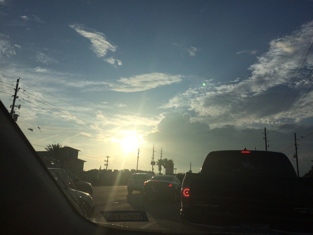
Northwest Houston, TX, during the early afternoon.
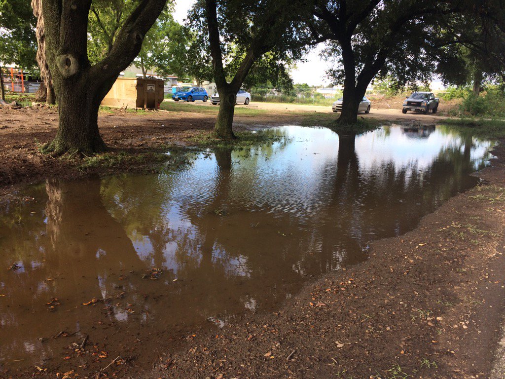
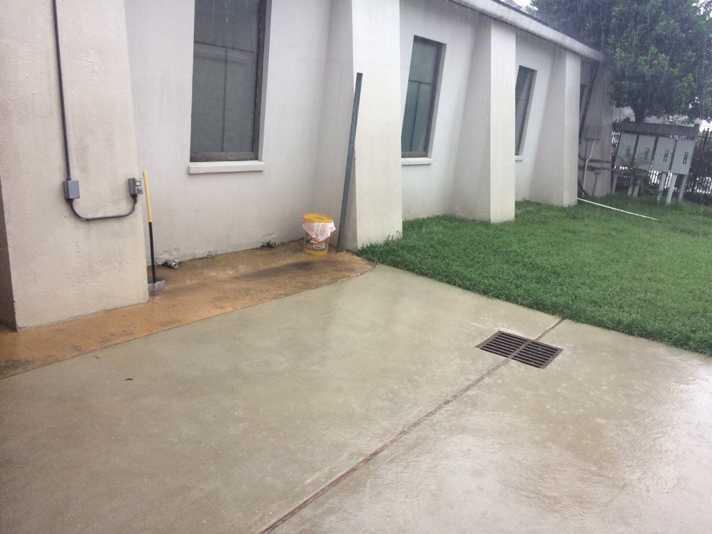
Northwest Houston, TX, during the early evening.
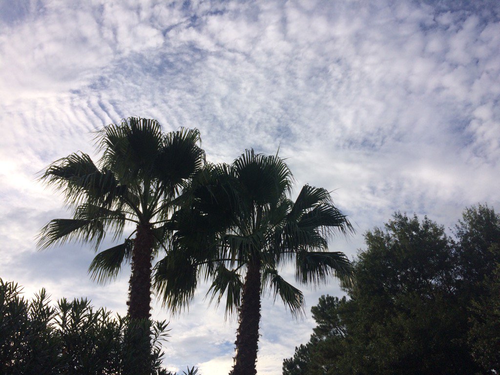
Northwest Houston, TX, during the late evening.
Summary: The day was mostly cloudy, wet, and warm. Light to really heavy showers and thunderstorms were scattered to isolated across the Houston, TX area, during the morning, afternoon, evening, and night. Moderate to really heavy showers and thunderstorms passed over where I work in northwest Houston, TX, during the early and mid-afternoon. I didn't see anymore rain after, or before that. Alto stratus and stratus clouds with maybe some nimbus clouds looked to cover most of the sky during the early and mid-morning, and evening. Stratus, stratocumulus and nimbus clouds looked to cover most of the sky, during the late morning and afternoon. There looked to be only some alto stratus, or alto stratocumulus clouds in the sky, during the night. The wind speeds looked to be calm with some gentle and moderate gusts. It felt warm during the morning, afternoon, evening, and night. There was a hazardous weather outlook issued for the Houston, TX area, by NOAA and there was also a tropical funnel weather statement issued with maybe some flood advisories and watches, for the Houston, TX area. The low temps looked to be in the 70's and the high temps looked to be in the 80's with maybe some 90's, for the Houston, TX area.
Storm Summary: There were a lot of reports of flash flooding in and around the Houston, TX area, during the early and mid-afternoon. The animal hospital that I work at in northwest Houston, TX got some flash flooding and the power went out for a few seconds, after a lightning strike. I didn't hear about, or see any storm damage, or funnel clouds.
Locations: Northwest Houston, TX.
Thoughts: I got to see some interesting weather events today. It was really fun to see the really heavy rain. My car almost got flooded, but thankfully mine and other employees cars didn't get flooded. There is still more rain on the way! I am interested to see what happens next. After that it is going to get really hot. Typical Houston, TX summer weather.
Hazardous Weather Outlook
Hazardous Weather Outlook
National Weather Service Houston/Galveston TX
1240 PM CDT Tue Jun 27 2017

TXZ163-164-176>179-195>200-210>214-226-227-235>238-281745-
Austin-Brazoria-Brazos-Burleson-Chambers-Colorado-Fort Bend-
Galveston-Grimes-Harris-Houston-Jackson-Liberty-Madison-Matagorda-
Montgomery-Polk-San Jacinto-Trinity-Walker-Waller-Washington-
Wharton-
1240 PM CDT Tue Jun 27 2017

This hazardous weather outlook is for portions of Southeast Texas..

.DAY ONE...This Afternoon and Tonight

Scattered to occasionally numerous showers and thunderstorms are
expected today. Very localized heavy rainfall and 20 to 40 mph
wind gusts will be a possibility in the strongest cells. Several
inches of rain could fall in a short time period...quickly running
off to produce street and small stream flooding.

Tropical funnel clouds will also be possible across parts of the
region. Most are expected to be short-lived and not reach the
ground.

.DAYS TWO THROUGH SEVEN...Wednesday through Monday

Periods of showers and thunderstorms should persist into the
middle to late parts of the work week. With a similar weather
pattern remaining in place, we will continue to monitor the
possibility for some localized heavy rainfall.

.SPOTTER INFORMATION STATEMENT...

Spotter activation is not anticipated at this time.

$$
No comments:
Post a Comment