Friday, September 30, 2016

Sep. 30 16

Early morning, near Memorial and Kirkwood, Houston, TX.
Late evening, my house in west Houston, TX.
Late night, my house in west Houston, TX.


Notes: The day was sunny with a mostly clear sky. There were also some high stratus clouds here and there from time to time. The wind speeds were mostly calm with maybe some moderate gusts. The morning and night were cool. I needed a jacket to wear when I was walking to my car during the late night. The mid to late morning, afternoon, and evening where warm and dry.

Thursday, September 29, 2016

Sep. 29 16

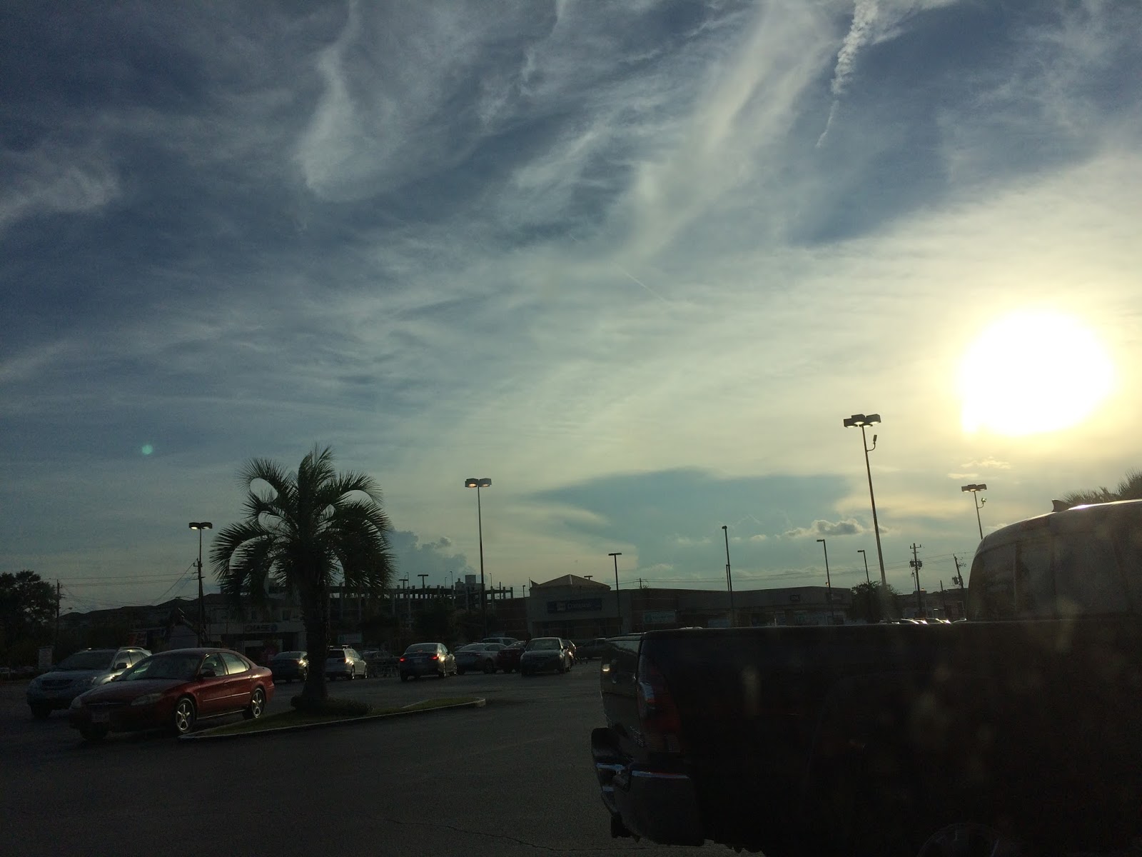
My house in west Houston, TX, during the early morning.
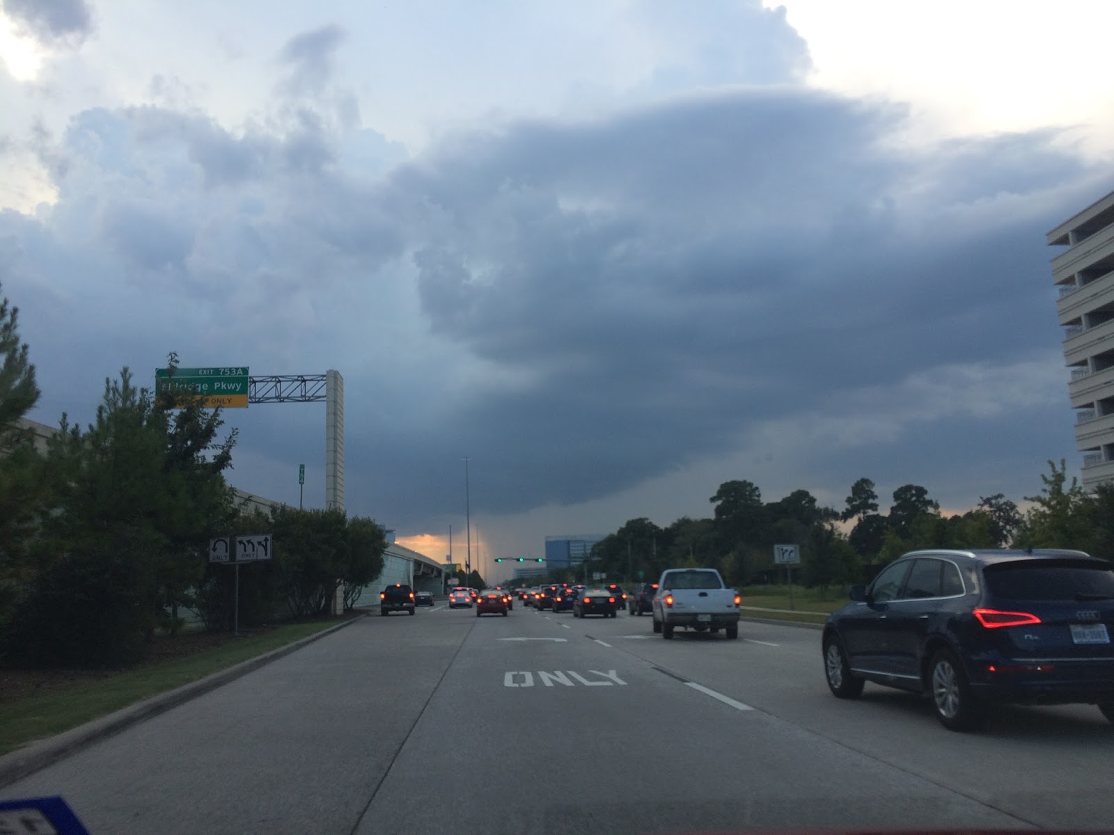
My house in west Houston, TX, during the early evening.


Notes: The day was slightly cool during the early morning, late evening, and night, The rest of the day was warm and dry. The sky was mostly clear with some isolated wavy startus clouds from time to time during the day. 


Area Forecast Discussion 
Issued by NWS Houston/Galveston, TX

Home | Current Version | Previous Version | Text Only | Print | Product List | Glossary Off
Versions: 1 2 3 4 5 6 7 8 9 10 11 12 13 14 15 16 17 18 19 20 21 22 23 24 25 26 27 28 29 30 31 32 33 34 35 36 37 38 39 40 41 42 43 44 45 46 47 48 49 50

000
FXUS64 KHGX 292348
AFDHGX

Area Forecast Discussion
National Weather Service Houston/Galveston TX
648 PM CDT Thu Sep 29 2016

.AVIATION...
VFR through the period. Resident dry air with a moderate offshore
pressure gradient producing a light north-northeast breeze. 31

&&

.PREV DISCUSSION...

SHORT TERM...
A cold front has pushed through the area allowing for a nice northerly
breeze and drier airmass over SE Texas. Dew point temperatures
have dropped into the 50s to low 60s and with temperatures in the
mid/upper 80s, relative humidity levels are down to 35 to 40
percent. With clear skies and light/calm winds tonight, minimum
temperatures should drop into the 50s most areas with 60s along
the coast.

Current upper level pattern has not changed much with a closed upper
low over the Ohio river valley and a ridge over the Rio Grande Valley.
A similar pattern is expected tomorrow with good agreement of the
synoptic models. Upper level trough upstream over the Pacific will
begin to change the pattern over the weekend. As such another dry
day will be expected tomorrow with high temperatures in the low
80s. It should be a nice way to end the month. 39

&&

LONG TERM...
Ridging will remain over the area through most of the long term period,
allowing temperatures to slowly rebound back into the upper 80s to
low 90s by Tue/Wed of next week. Pleasant weather will continue
across SE Texas until an upper level trough and associated cold
front approaches from the NW during the second half of the week
next week. Current thinking is that showers and thunderstorms will
reenter the forecast next Wednesday/Thursday with the actual cold
front arriving sometime in the Thursday/Thursday night time frame.
11

&&

TROPICAL WEATHER...
Matthew has become a category 1 hurricane despite a hostile environment
with wind shear across the eastern Caribbean Sea. Matthew will
continue moving west before turning to the NW and N over the
weekend. An upper level trough is still expected to develop over
the Gulf for the weekend and help move Matthew northward into the
western Atlantic. No impacts are expected for SE Texas. 39

&&

MARINE...
A cold front passed through SE Texas today and will cause gusty
winds of 15 to 20 knots and seas of 3 to 4 feet overnight tonight.
Small craft should exercise caution. High pressure will build into
Texas tomorrow and winds will begin to relax as the gradient weakens.
The high will shift to the east on Sunday night and onshore winds
will return to the coastal waters Sunday night. Onshore winds will
strengthen and likely persist for the first half of next week.
Another cold front will cross the coastal waters next Thursday or
Thursday night. 11

PREV DISCUSSION...

AVIATION.../18Z TAF/
Surface analysis has cold front off the coast with northerly winds
behind it. Expect VFR CIGS next 24-30hrs with winds decoupling
overnight and remaining light on Friday. 39

&&

.PRELIMINARY POINT TEMPS/POPS...
College Station (CLL)      57  81  60  83  61 /   0   0   0   0   0
Houston (IAH)              58  82  62  85  64 /   0   0   0   0   0
Galveston (GLS)            69  80  71  82  73 /   0   0   0   0   0

&&

.HGX WATCHES/WARNINGS/ADVISORIES...
TX...NONE.
GM...SMALL CRAFT SHOULD EXERCISE CAUTION until 6 AM CDT Friday FOR
     THE FOLLOWING ZONES: Coastal waters from Freeport to the
     Matagorda Ship Channel out 20 NM...Coastal waters from High
     Island to Freeport out 20 NM...Galveston Bay...Matagorda
     Bay...Waters from Freeport to the Matagorda Ship Channel
     from 20 to 60 NM...Waters from High Island to Freeport from
     20 to 60 NM.

&&

$$

Discussion...42
Aviation/Marine...31

Wednesday, September 28, 2016

Sep. 28 16

Late evening, my house, West Houston, TX.


Notes: The day was mostly clear with maybe a few stratus clouds during the morning. The wind speeds were relatively calm with maybe some moderate gusts. The day was slightly cool during the early and mid-morning. Then warm and dry during the late morning, afternoon, evening, and maybe night.

Tuesday, September 27, 2016

Sep. 27 16

Brittmoore, near I-10, Houston, TX, early afternoon.
Brittmoore, near I-10, Houston, TX, late afternoon.
Memorial and Dairy Ashford, Houston, TX, late evening.


Notes:  The day was warm with cool winds in the morning. The air also felt dry. The sky was cloudy to mostly cloudy during the morning, afternoon, evening, and night. There were a few isolated showers and maybe thunderstorms in and near Houston, TX, during the morning, afternoon, evening, and maybe night hours. As I saw on the radar. I didn't hear about any flood, or damage reports from them. It was the first day of the fall season that I thought about wearing a sweater. I didn't, but I might start leaving some extra jackets and sweaters in my car just in case.


000
FXUS64 KHGX 280241
AFDHGX

Area Forecast Discussion
National Weather Service Houston/Galveston TX
941 PM CDT Tue Sep 27 2016

.DISCUSSION...
We are right on track for our first cool night of the fall season with
overnight low temperatures falling into the 60s at almost all inland
locations (sorry beaches, you`ll probably be staying in the 70s). These
cool nights (and less humid days) look to last through the end of the
week and on through the upcoming weekend. Enjoy!  42
&&

.PREV DISCUSSION... /ISSUED /

AVIATION...
VFR. High pressure nudging its way into the region from the west,
with drier air advecting in from the north, will aid in clearing
out skies over the next several hours. A light northerly breeze
that will oscillate from NE to NW through Wednesday. 31

PREV DISCUSSION...

DISCUSSION...
May see an isolated, short lived, cell or two pop up south of I-10
in the late aftn or early evening hours. Otherwise look for a dry
night, a mix of cloudiness and overnight lows in the 60s for good
portion of the area.

Frontal zone & coastal trof should remain well off the coast
tomorrow. Expect a bit more sun to emerge so afternoon readings
should be a touch higher than todays.

A reinforcing surge of dry air will push thru SE Tx and off the coast
on Thurs. This will lead to a stretch of several pleasant early
fall-like days...lasting thru the weekend into early next week
as low/mid level ridging remains in control.

A slow modifying/moistening trend resumes early & middle parts of
next week as onshore winds resume and slowly transport Gulf
moisture back into the region. 47

MARINE...
The frontal boundary was located about 20 nm off the coast at 2:30
PM. Showers and isolated thunderstorms will continue to be possible
along and south of the dissipating frontal zone through Wednesday.
Behind the front surface high pressure will build over the land
areas tonight and Wednesday. The light wind regime and afternoon
heating should help a seabreeze to develop and move inland on
Wednesday. A reinforcing front is then expected to move off the
coast during the morning on Thursday.  40

FIRE WEATHER...
A drier airmass will filter across Southeast Texas on Wednesday. A
seabreeze is expected to develop and affect the coastal counties
during Wednesday afternoon. Minimum relative humidity values could
fall to between 30 and 35 percent Wednesday afternoon along and
north of a line from Groveton to Huntsville to Bellville. A second
cold front will help reinforce the dry airmass on Thursday. Some
modification of the airmass is then expected to start on Friday as
the surface winds become more easterly.  40

&&

.PRELIMINARY POINT TEMPS/POPS...
College Station (CLL)      64  87  64  83  59 /   0   0   0   0   0
Houston (IAH)              67  87  66  87  61 /   0   0   0   0   0
Galveston (GLS)            75  86  76  87  72 /  10   0   0   0   0

&&

.HGX WATCHES/WARNINGS/ADVISORIES...
TX...NONE.
GM...NONE.
&&

$$

Monday, September 26, 2016

Sep. 26 16

Early morning, Memorial and Kirkwood, Houston, TX
Beltway 8 and I-10, Houston, TX, late afternoon.
My house, west Houston, TX, early evening.
My house, west Houston, TX, late evening.
My house, west Houston, TX, early night.


Notes: Showers and thunderstorms swirled around Houston, TX during the morning, afternoon, evening, and night. A small shower passed near my house during the early night. The wind speeds were mostly calm. The day was very warm and humid. No storm damage, or flooding seemed to be reported.

Sunday, September 25, 2016

Sep. 25 16

My house, west Houston, TX, early morning.
My house, west Houston, TX, mid-morning.
My house, west Houston, TX, late morning.

Near Westgreen, Katy, TX, early afternoon.


Highway 6 N, Houston, TX, early afternoon.

Highway 6 N, Houston, TX, mid-afternoon.
Highway 6 N, Houston, TX, late afternoon.
I-10 and Tully, Houston, TX, late afternoon.


Notes: Scattered showers and thundestorms started to swirl around Houston, TX at around 4 am. A small heavy shower passed over my house at around 4 am. The showers and thunderstorms started to dissipate during the evening hours and were only swirling around certain areas of Houston, TX by the night time hours. Their was no flooding, or any other damage reported that I know of from any of these showers and thunderstorms. The wind speeds were relatively quiet, except for before and after a shower, or thunderstorm. The day was warm and humid.

Thursday, September 22, 2016

Sep. 22 16

Brittmoore, Houston, TX, early afternoon.

Memorial and Dairy Ashford, Houston, TX, early evening.


Notes: A very warm and maybe sometimes hot and humid day with mostly calm wind speeds. There were scattered showers and maybe thunderstorms in and around the Houston, TX area during the morning, afternoon, evening, and maybe night hours. An isolated shower, or maybe thunderstorm passed near where I work on Brittmoore, during the mid-morning.


Area Forecast Discussion 
Issued by NWS Houston/Galveston, TX
Home | Current Version | Previous Version | Text Only | Print | Product List | Glossary Off
Versions: 1 2 3 4 5 6 7 8 9 10 11 12 13 14 15 16 17 18 19 20 21 22 23 24 25 26 27 28 29 30 31 32 33 34 35 36 37 3839 40 41 42 43 44 45 46 47 48 49 50
662
FXUS64 KHGX 230301
AFDHGX

Area Forecast Discussion
National Weather Service Houston/Galveston TX
1001 PM CDT Thu Sep 22 2016

.DISCUSSION...
Showers finally dissipated this evening but not before dumping a
good 1-2 inches of rain from near Hempstead to south of College
Station. Deeper moisture has returned with the 00z LCH sounding
showing 1.7 inches of precipitable water and CRP showing 2 inches.
Water vapor imagery shows deepening upper level low over the Great
Basin. Upper level ridge remains over much of Texas but has not
done much to suppress convection much.

After looking at 12z/18z model guidance, here is what we think we
know and what we think we don`t know. Models are in pretty good
agreement through about 3 days which really isn`t much. Upper low
organizes over the Rockies and swings east towards the N Plains by
Sunday. Models are good with breaking off a piece of vorticity
which drops south into the S Rockies by Sunday. At the surface, a
cold front pushes into the plains as the surface low organizes
over the N plains. The front then makes slow progress south into
Texas on Sunday. Friday through Sunday the boundary layer flow
increases off the Gulf of Mexico and moisture continues to
increase. Precipitable water values reach 2-2.2 inches Saturday
into Sunday. So looks like a good chance of rain Saturday through
much of the weekend and early next week. Rainfall amounts will
probably be around 1-3 inches areawide for the next 5 days.

Considering there are large variability`s between model solutions
after Saturday, there are certain details that we don`t know. It
is unclear how the upper trough and possible cut off low
development evolves. GFS and ECMWF are quite different. This is
key because this evolution also determines when the cold front
pushes through the area or as the case is with the ECMWF...not
push through till much later next week. The front may also be
weaker. The other challenge is figuring out the details of
where/when any locally heavy rainfall will occur. There are bound
to be isolated areas of higher rainfall amounts given storms that
could produce high rain rates and strong moisture advection off
the Gulf with decent upper level support. But right now it looks
like the main axis of heavy rainfall will be more through C TX
into OK and E KS. This axis could shift depending on how the
trough and upper low evolve. The main point being that it looks
like a wet weekend and still have time to monitor forecast data.
With the weekend coming up, it would not hurt to prepare and have
back up plans in case of heavy rainfall.

Overpeck


&&


AVIATION...00Z TAF
Still a few pesky showers around north and west, as well as some
winds up around 10 kts to start off the forecast period, but both
should wrap up pretty early in the evening. After that, clearish
skies and lighter winds should prevail for much of the night.
Towards morning, sites north look to see light fog and/or some
lower clouds. For now, chose to go with some MVFR visibilities,
and some clouds, but no ceilings at MVFR levels. Closer to the
coast, nocturnal marine showers should push onshore and gradually
stream inland into the afternoon. Angled towards VCSH, and kept
VFR conditions at SGR and LBX, but there are some second thoughts
about that with some potential for similar fog/low clouds.
Generally soft-pedaling the guidance here, and banking on a
transition from last night being largely VFR through the night
towards better potential this weekend.

Luchs

PREV DISCUSSION... /ISSUED 342 PM CDT Thu Sep 22 2016/

DISCUSSION...
Scattered precip will taper off by early evening with the loss of
heating. Expect it to regenerate off/near the coast during the
late night and morning hours Fri...then expand inland during the
day. Similar diurnal scenario will persist Saturday and probably
again Sunday...albeit with probably slightly more coverage each
consecutive day as moisture levels increase.

Forecast from Sunday night into the middle of next week becomes
more problematic in regards to the overall pattern which would
impact local frontal timing (if any), temps & precip. Not going
dive into the specifics regarding different model
solutions/scenarios that far out as they`ll change again in the
next set of runs.

In general, rain chances will increase late in the weekend into
early next week as an upper trof & surface front nudge closer to
the region. When and where best coverage (and potentially heavier
amounts) occur will be dependent on positioning of the trigger and
focusing mechanisms described above.

Overall forecast confidence is low beyond Sunday. Grids mainly
consist of a blend weighted with a higher dose of the slower &
warmer ECMWF soln. 47

MARINE...
Lee cyclogenesis will allow SE winds to persist through Friday. The
low pressure system over Colorado will then move N-NE and drag a
cold front into North Texas on Sunday night. There is still some
uncertainty with regard to the frontal position on Monday. With the
upper flow parallel to the surface front, prefer to follow the lead
of the previous fcstr and lean toward a slower fropa for early next
week. A weak surface low is expected to develop over the SW Gulf and
surface winds will probably become E-NE in response to these
systems. Tide levels will probably become slightly elevated early
next week in response to the E-NE winds. Deeper moisture over the
Gulf and disturbances rotating around abroad upper low over western
Mexico will keep showers and thunderstorms in the forecast through
early next week.

FWIW, both the GFS and the GEM bring the front through on Monday. 43

&&

.PRELIMINARY POINT TEMPS/POPS...
College Station (CLL)      75  93  76  91  75 /  30  40  10  40  20
Houston (IAH)              76  91  77  90  76 /  10  40  10  40  30
Galveston (GLS)            81  90  82  88  81 /  40  40  30  40  40

&&

.HGX WATCHES/WARNINGS/ADVISORIES...
TX...NONE.
GM...NONE.
&&

$$

Discussion...39

Wednesday, September 21, 2016

Sep. 21 16

Some light fog near Memorial and WIlcrest, Houston, TX, early morning.
Beltway 8 and I-10, Houston, TX, early evening.


Notes: The day was generally very hot and humid. It felt better during the morning and evening hours. There were a few scattered isolated showers and maybe thundershowers, or maybe storms on the east and south east side of Houston, TX, during the evening and maybe afternoon and morning hours. I didn't see any rain, lightning, or hear any thunder. The wind speeds were relatively calm with maybe some moderately strong gusts.

Tuesday, September 20, 2016

Sep. 20 16

Brittmoore road, Houston, TX, during the early afternoon.

I-10 West, Houston, TX, during the late evening.


Notes: The day was very hot. There were some storms and showers in and around the Houston area during the afternoon and evening hours, but I did not see any rain.


Sunday, September 18, 2016

Saturday, September 17, 2016

Sep. 17 16

Downtown Houston, TX Mid-morning.
Downtown Houston, TX, late morning.
West Houston, TX, frontage road I-10 West, early afternoon.
Late evening, Houston, TX, near Memorial Park.


Late evening, Westheimer, near Weslayen, Houston, TX.