Northwest Houston, TX, during the early morning.
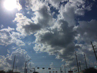
Northwest Houston, TX, during the early afternoon.
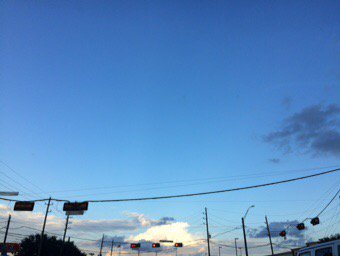
West Houston, TX, during the early evening.
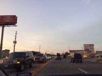
Northwest Houston, TX, during the early evening.
Northwest Houston, TX, during the late evening.
Summary: The day was mostly cloudy, mostly wet, and warm. Isolated to scattered moderately heavy to really heavy showers and thunderstorms passed over the Houston, TX area, during the late morning, afternoon, evening, and maybe night. A moderately heavy to heavy thunderstorm passed over where I work, in northwest Houston, TX, during the early afternoon. Alto stratus, stratus and stratocumulus clouds looked to cover most of the sky, during the morning, afternoon, evening, and maybe night. The wind speeds looked to be calm with gentle to moderate gusts with some moderately strong gusts, and maybe some occasional really strong (20 mph) gusts. It felt warm, during the early morning, afternoon, evening, and night. It felt very warm, during the mid-morning. It felt hot, during the late morning. There was a Flash Flood Warning and Advisory issued, along with probably many other advisories, warnings, and watches, for the Houston, TX area. There was also a Hazardous Weather Outlook issued for the Houston, TX area, by NOAA. The low temps looked to be in the 70's and the high temps looked to be in the 80's with maybe some 90's, for the Houston, TX area.
Houston, TX Storm Summary: Isolated to scattered showers and thunderstorms passed through the Houston, TX area, bringing moderately heavy to really heavy rain to some areas of Houston, TX, during the late morning, afternoon, evening, and maybe night. Flash flooding did occur in some areas of Houston, TX. I didn't hear about any storm damages.
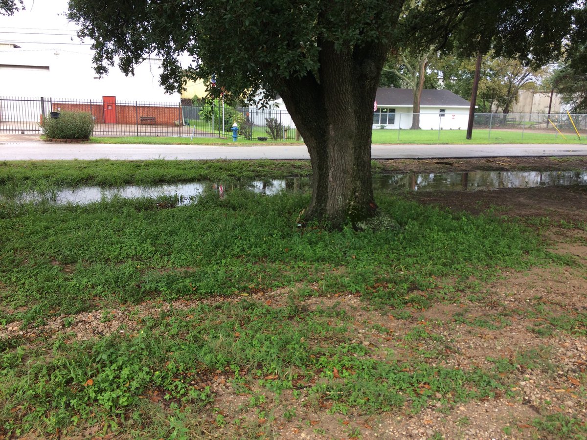
My Storm Summary: A moderately heavy to heavy thunderstorm passed over where I work, in northwest Houston, TX, during the early afternoon. I saw a few big puddles, but no flooding. I didn't see any storm damages. I saw a few lightning strikes. I may even have saw some cloud-to-ground lightning strikes, that may have caused a few car alarms to go off. Near where I work, in northwest Houston, TX. I heard a few loud and deep rumbles of thunder, during the early and maybe mid-afternoon.
Locations: Northwest and west Houston, TX.
Thoughts: More rain for the Houston, TX area. I didn't see as much rain, as some Houstonians saw today.
Area Forecast Discussion
Issued by NWS Houston/Galveston, TX
Home | Current Version | Previous Version | Text Only | Print | Product List | Glossary Off
Versions: 1 2 3 4 5 6 7 8 9 10 11 12 13 14 15 16 17 18 19 20 21 22 23 24 25 26 27 28 29 30 31 32 33 34 35 36 37 38 39 40 41 42 43 44 45 46 47 48 49 50
000
FXUS64 KHGX 212351
AFDHGX
Area Forecast Discussion
National Weather Service Houston/Galveston TX
651 PM CDT Thu Sep 21 2017
.AVIATION...
Some changes with the 00Z TAFS - lowered CIGS/VIS a bit for to-
night/early Fri morning for some sites and added the mention of
VCSH for most sites tomorrow afternoon. Widespread showers this
afternoon should give way to clearing skies,light winds and wet
grounds across the area tonight. These conditions will be favo-
rable for the development of some patchy fog/low clouds tonight
through sunrise tomorrow morning...in particular locations just
north of IAH. While most models are drying things out tomorrow,
still not confident enough to not mention at least VCSH for the
afternoon hours tomorrow. Of note, NAM is the lone outlier, and
has a slug of 2" PWs moving in from the west tomorrow afternoon.
41
&&
.PREV DISCUSSION... /ISSUED 332 PM CDT Thu Sep 21 2017/
Scattered to numerous slow moving showers and thunderstorms
continue across Southeast Texas this afternoon as a disturbance
moves eastward across the area. The slow moving activity and
precipitable water values above 2 inches have brought locally
heavy rainfall to the area resulting in several
advisories/warnings. At one point, a Harris County Flood Warning
System rain gage (Cypress Creek at Huffmeister) had rainfall rates
of 0.48 inches in 5 minutes and 0.80 inches in 10 minutes. Expect
decreasing coverage/intensity late this afternoon through early
this evening. The area remains on the southern fringes of ridging
both at the surface and aloft, and enough heating should allow for
some mainly daytime shower and thunderstorm development over the
next several days. But compared to today, expect to see much less
coverage for the end of the week and over the weekend with lower
precipitable water values. Still looking at an eventual increase
in rain chances next week as mid/upper level ridging edges
eastward and a western U.S. trough gradually works its way toward
the east. Will be carrying higher rain chances as we head on into
the middle to end of the week when the trough and associated slow
moving cold front begin to work their way toward our area. Will
need to keep a close eye on model trends over the next several
days as some have precipitable water values approaching a very
high 2.50 inches under the persistent onshore flow ahead of the
slow moving boundary. This potential heavy rain event is still
many days away, and a lot can change with the models. Obviously,
our area does not need to see another significant rainfall event
as the Harvey recovery continues. 42
&&
.PRELIMINARY POINT TEMPS/POPS...
College Station (CLL) 73 91 72 92 72 / 30 20 10 20 10
Houston (IAH) 73 91 72 90 73 / 30 20 10 20 10
Galveston (GLS) 80 89 78 89 80 / 30 20 10 20 10
&&
.HGX WATCHES/WARNINGS/ADVISORIES...
TX...NONE.
GM...NONE.
&&
$$
Hazardous Weather Outlook
Hazardous Weather Outlook
National Weather Service Houston/Galveston TX
341 AM CDT Thu Sep 21 2017

TXZ163-164-176>179-195>200-210>214-226-227-235>238-221300-
Austin-Brazoria-Brazos-Burleson-Chambers-Colorado-Fort Bend-
Galveston-Grimes-Harris-Houston-Jackson-Liberty-Madison-Matagorda-
Montgomery-Polk-San Jacinto-Trinity-Walker-Waller-Washington-
Wharton-
341 AM CDT Thu Sep 21 2017

This hazardous weather outlook is for portions of Southeast Texas..

.DAY ONE...Today and Tonight

Showers and thunderstorms are expected to become more widespread
throughout this morning and afternoon. There is a chance for
isolated strong storms to produce locally heavy rainfall that may
lead to localized minor flooding.

.DAYS TWO THROUGH SEVEN...Friday through Wednesday

No hazardous weather is expected at this time.

.SPOTTER INFORMATION STATEMENT...

Spotter activation may be needed today and early this evening.

$$