Northwest Houston, TX, during the early morning, on my way to the pet resort that I work for in southeast Houston, TX, from where I live in northwest Houston, TX.
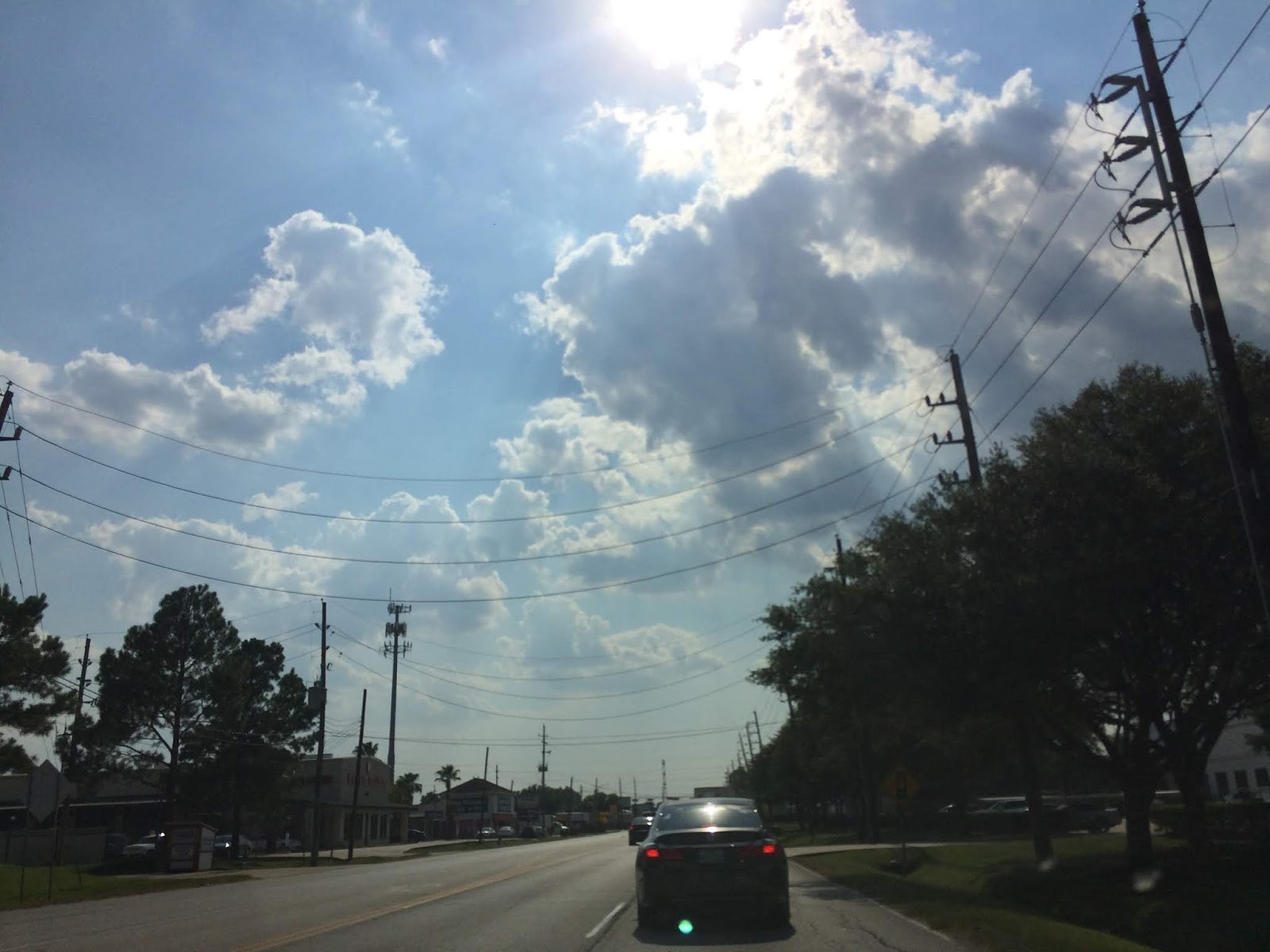
Driving north up 288, near southeast Houston, TX, during the late afternoon, going to where I live in northwest Houston, TX, from the pet resort that I work for in southeast Houston, TX.
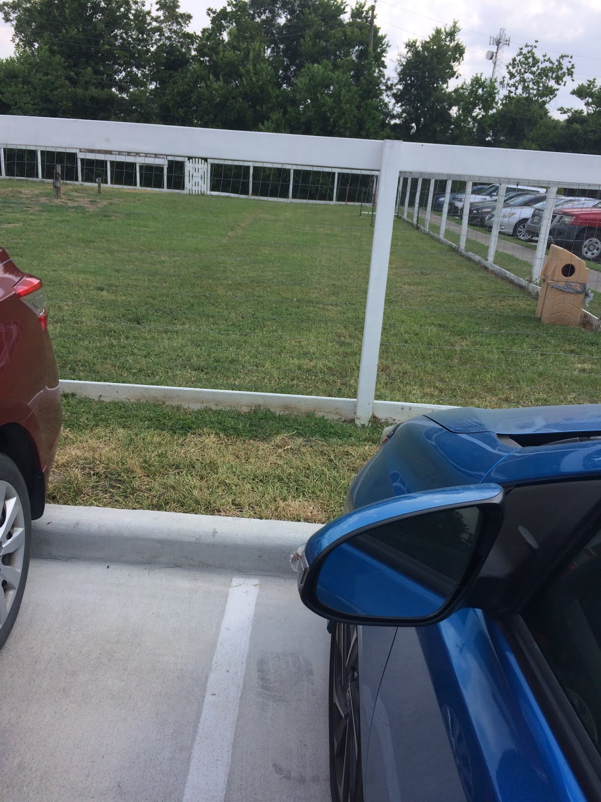
Still driving north up 288, near southeast Houston, TX, during the early evening, going to where I live in northwest Houston, TX, from the pet resort that I work for in southeast Houston, TX.
Northwest Houston, TX, at a Half Price Books looking for a dog grooming book, during the early evening.
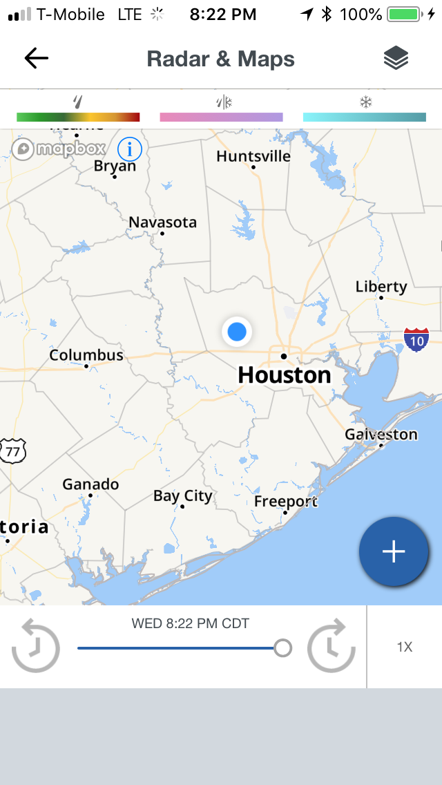
Houston, TX radar, during the early night.
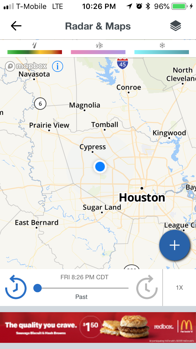
Houston, TX radar, during the late night.
A Heat Advisory and an Air Quality Alert were issued when I checked the weather, during the late night.
Area Forecast Discussion
Issued by NWS Houston/Galveston, TX
000
FXUS64 KHGX 210255
AFDHGX

Area Forecast Discussion
National Weather Service Houston/Galveston TX
955 PM CDT Fri Jul 20 2018

.UPDATE...
Previous forecast appears to be on track. No major changes were
made.  11

&&

.PREV DISCUSSION... /ISSUED 701 PM CDT Fri Jul 20 2018/

AVIATION...
VFR. Brief periods of MVFR or IFR over northern, primarily non-
metro, terminals shortly after sunrise Saturday. There is a low
probability that a few metro hubs could go down to below VFR for
about an hour during the 7 to 9 AM LT period. Mainly a southwest
breeze that will back a bit more southerly late in the afternoon.
Late afternoon inland movement of the sea breeze boundary will
strengthen island`s SW-S winds going into the early evening hours.
31

PREV DISCUSSION... /ISSUED 250 PM CDT Fri Jul 20 2018/

DISCUSSION...
Hot and dry conditions for the next few days as a sprawling upper
level ridge expands eastward with heights building to 597 dm over
North Texas in the next couple of days. Cloud cover mixed out
during the mid to late morning leaving clear, sunny skies behind
it this afternoon. PWs have slightly increased throughout the day,
though subsidence from the ridge will continue to inhibit
convection as we head into the weekend.

Weekend high temperatures are expected to gradually increase
through Monday. A Heat Advisory has been issued for Saturday and
will likely be extended into Sunday with Monday expected to be
the hottest day. Bringing 850 mb temperatures down dry adiabatically
on Sunday and Monday supports temperatures between 106 and 109
degrees. If these temperatures verify, an Excessive Heat Warning
may be required for parts of the area. The GFS and ECMWF suggest
the ridge may begin to retreat beginning Monday. The NAM appears
to agree, though heights remain higher than both the ECMWF and
GFS. As heights lower with the retreating ridge, we can expect
slightly cooler temperatures at the surface heading into next
week, though there is low confidence in forecast high temperatures
due to a fairly large spread between models.

Rain chances for next week appear to be fairly low. The GFS
suggests a much wetter situation with the upper low moving
westward and sitting over the S/SE TX and LA region late next
week and into next weekend. We`re keeping precipitation chances at
a minimum leaning toward the drier and more consistent ECMWF,
though we do have a few low PoPs mainly for our SE and coastal
zones for Tuesday night through Friday Night. Randall/43

MARINE...
Light to occasionally moderate south to southwest winds are expected
to persist throughout the weekend and into the beginning of the
upcoming week. At times during the overnight hours, nocturnal
cooling inland may produce enough of a thermal gradient along the
coast to result in winds nearing caution levels. Seas are expected
to remain in a 1 to 3 foot range. 42

FIRE...
Even though temperatures will be hot over the weekend, elevated
fire weather conditions are not anticipated due to light winds.
However, no rain chances and very low afternoon humidities may
make conditions favorable for isolated fire starts, especially
across portions of the Brazos Valley or Piney Woods regions.
Residents should make sure to not idle or drive vehicles in tall
grasses and secure or remove loose chains on vehicles and farm
equipment. 42

&&

.PRELIMINARY POINT TEMPS/POPS...
College Station (CLL)      77 103  77 104  77 /   0   0   0   0   0
Houston (IAH)              79 101  78 101  78 /   0   0   0   0   0
Galveston (GLS)            82  92  82  92  82 /   0   0   0   0   0

&&

.HGX WATCHES/WARNINGS/ADVISORIES...
TX...Heat Advisory from noon to 8 PM CDT Saturday for the following
     zones: Austin...Brazoria Islands...Brazos...Burleson...
     Chambers...Coastal Brazoria...Coastal Galveston...Coastal
     Harris...Coastal Jackson...Coastal Matagorda...Colorado...
     Fort Bend...Galveston Island and Bolivar Peninsula...
     Grimes...Houston...Inland Brazoria...Inland Galveston...
     Inland Harris...Inland Jackson...Inland Matagorda...
     Madison...Matagorda Islands...Montgomery...Northern
     Liberty...Polk...San Jacinto...Southern Liberty...Trinity...
     Walker...Waller...Washington...Wharton.

GM...NONE.
&&

$$

Discussion...11
Heat Advisory
URGENT - WEATHER MESSAGE
National Weather Service Houston/Galveston TX
309 PM CDT Fri Jul 20 2018

...HEAT ADVISORY IN EFFECT THROUGH 8 PM CDT THIS EVENING FOR
               MUCH OF SOUTHEAST TEXAS...

...HEAT ADVISORY IN EFFECT FOR ALL OF SOUTHEAST TEXAS ON
                       SATURDAY...

.Upper level ridging will bring hot temperatures to Southeast
Texas this weekend. High temperatures will warm between 98 and 104
degrees inland and into the lower 90`s along the immediate coast.
Heat index values will range from 102 to 111 degrees.

TXZ163-164-176>179-195>200-211>214-227-237-238-300-313-337-338-
437-438-212015-
/O.NEW.KHGX.HT.Y.0003.180721T1700Z-180722T0100Z/
/O.CON.KHGX.HT.Y.0002.000000T0000Z-180721T0100Z/
Austin-Brazoria Islands-Brazos-Burleson-Chambers-Coastal Brazoria-
Coastal Galveston-Coastal Harris-Fort Bend-
Galveston Island and Bolivar Peninsula-Grimes-Houston-
Inland Brazoria-Inland Galveston-Inland Harris-Madison-Montgomery-
Northern Liberty-Polk-San Jacinto-Southern Liberty-Trinity-Walker-
Waller-Washington-
Including the cities of Alvin, Anahuac, Angleton, Baytown,
Bellville, Brenham, Brookshire, Bryan, Caldwell, Cleveland,
Clute, Coldspring, College Station, Conroe, Corrigan, Crockett,
Dayton, Devers, Dickinson, First Colony, Freeport, Friendswood,
Galveston, Groveton, Hempstead, Houston, Huntsville, La Marque,
Lake Jackson, League City, Liberty, Livingston, Madisonville,
Mission Bend, Missouri City, Mont Belvieu, Navasota,
Old River-Winfree, Pasadena, Pearland, Pecan Grove, Prairie View,
Rosenberg, Sealy, Shepherd, Somerville, Stowell, Sugar Land,
Surfside Beach, Texas City, The Woodlands, Trinity, Waller,
and Winnie
309 PM CDT Fri Jul 20 2018

...HEAT ADVISORY REMAINS IN EFFECT UNTIL 8 PM CDT THIS EVENING...

...HEAT ADVISORY IN EFFECT FROM NOON TO 8 PM CDT SATURDAY...

The National Weather Service in Houston/Galveston has issued a
Heat Advisory, which is in effect from noon to 8 PM CDT Saturday.

* EVENT...High temperatures between 99 to 104 degrees and Heat
  Index values between 102 to 111.

* TIMING...Through 8 pm, and again Saturday between noon and 8 PM.

* IMPACT...Dangerous heat conditions.

PRECAUTIONARY/PREPAREDNESS ACTIONS...

Take extra precautions if you work or spend time outside. When
possible...reschedule strenuous activities to early morning or
evening. Know the signs and symptoms of heat exhaustion and heat
stroke. Wear light weight and loose fitting clothing when
possible and drink plenty of water.

To reduce risk during outdoor work...the occupational safety and
health administration recommends scheduling frequent rest breaks
in shaded or air conditioned environments. Anyone overcome by
heat should be moved to a cool and shaded location. Heat stroke
is an emergency - call 911.

Each year...a number of fatalities occur nationwide due to
children accidentally being left in vehicles during the summer
months. In the past dozen years...500 children have died due to
hyperthermia after being left in or gaining access to cars. Never
leave children or pets unattended in a vehicle not even for a
minute. Remember...beat the heat...check the backseat.

&&

$$
Hazardous Weather Outlook
Hazardous Weather Outlook
National Weather Service Houston/Galveston TX
319 PM CDT Fri Jul 20 2018

TXZ163-164-176>179-195>200-210>214-226-227-235>238-300-313-
335>338-436>438-212030-
Austin-Brazoria Islands-Brazos-Burleson-Chambers-Coastal Brazoria-
Coastal Galveston-Coastal Harris-Coastal Jackson-
Coastal Matagorda-Colorado-Fort Bend-
Galveston Island and Bolivar Peninsula-Grimes-Houston-
Inland Brazoria-Inland Galveston-Inland Harris-Inland Jackson-
Inland Matagorda-Madison-Matagorda Islands-Montgomery-
Northern Liberty-Polk-San Jacinto-Southern Liberty-Trinity-Walker-
Waller-Washington-Wharton-
319 PM CDT Fri Jul 20 2018

This hazardous weather outlook is for portions of Southeast Texas..

.DAY ONE...This Afternoon and Tonight

Hot temperatures will prevail through the evening. High
temperatures today will approach or exceed 100 degrees inland with
heat index values exceeding 108 degrees at times. A Heat Advisory
is in effect for much of Southeast Texas through 8 PM.

.DAYS TWO THROUGH SEVEN...Saturday through Thursday

Hot temperatures will persist through Monday. A Heat Advisory has
been issued for all of Southeast Texas for Saturday and will
likely be extended through Monday. Although there are varying
model solutions regarding high temperatures on Sunday and Monday,
there is a growing consensus that high temperatures could exceed
105 degrees north of a Brenham to Crockett line. If this occurs,
an Excessive Heat Warning will be required. A weak cold front on
Tuesday could bring slightly cooler temperatures and slightly
drier air to the region but heat will return Wednesday and linger
into next weekend.

.SPOTTER INFORMATION STATEMENT...

Spotter activation will not be needed.

$$
Air Quality Alert
TXZ213-237-238-313-337-338-437-438-220000-

AIR QUALITY ALERT MESSAGE
TEXAS COMMISSION ON ENVIRONMENTAL QUALITY
RELAYED BY NATIONAL WEATHER SERVICE HOUSTON/GALVESTON TX
228 PM CDT Fri Jul 20 2018

...OZONE ACTION DAY FOR SATURDAY...

THE TEXAS COMMISSION ON ENVIRONMENTAL QUALITY (TCEQ)...HAS ISSUED AN
OZONE ACTION DAY FOR THE HOUSTON...GALVESTON...AND BRAZORIA AREAS FOR
SATURDAY... JULY 21 2018.

ATMOSPHERIC CONDITIONS ARE EXPECTED TO BE FAVORABLE FOR PRODUCING
HIGH LEVELS OF OZONE POLLUTION IN THE HOUSTON...GALVESTON AND
SURROUNDING AREAS ON SATURDAY. YOU CAN HELP PREVENT OZONE POLLUTION BY
SHARING A RIDE...WALKING...RIDING A BICYCLE...TAKING YOUR LUNCH TO
WORK...AVOIDING DRIVE THROUGH LANES...CONSERVING ENERGY AND KEEPING YOUR
VEHICLE PROPERLY TUNED.

FOR MORE INFORMATION ON OZONE:

OZONE: THE FACTS (WWW.TCEQ.TEXAS.GOV/AIRQUALITY/MONOPS/OZONEFACTS.HTML)
EPA AIR NOW:
(WWW.AIRNOW.GOV/INDEX.CFM?ACTION=AIRNOW.LOCAL_CITY&CITYID=236)
TAKE CARE OF TEXAS: (WWW.TAKECAREOFTEXAS.ORG/AIR/AIRQUALITY)

$$
Locations: Northwest, southwest, southeast, the heights, and downtown Houston, TX.
Thoughts: The days are just getting hotter and hotter. The radar did show a band of scattered light showers near southeast Houston, TX, but I don't know if those were actually showers, or radar error. I would like to see some rain for the Houston, TX area soon. Until then I am going to keep upping on my water intake. I was starting to get a dry throat.