Wednesday, November 30, 2016

Nov. 30 16

Notes: No pictures today. I forgot to take them... Big to small, bright white, light to dark grey, blueish grey, and purplish grey, thick, flat, puffy high stratus clouds looked to cover most of the sky in northwest and west Houston, TX during the early morning. The sky became clear in west Houston, TX, sometime during the mid, or maybe late morning. The sky looked to be clear in west Houston, TX during the afternoon. I saw a huge deck of clustered up high bright white stratus clouds in the sky in west Houston, TX, during the early evening. The sky looked to be clear in west Houston, TX, during the late evening. I think the sky looked to be clear in northwest and west Houston, TX during the early night. The wind speeds looked to be calm with some moderate gusts in northwest and west Houston, TX during the early morning. The wind speeds looked to be calm with some moderate gusts in west Houston, TX during the mid and late morning, afternoon, and evening. The wind speeds looked to be calm with some moderate gusts in northwest and west Houston, TX during the early night. It felt very cool in northwest and west Houston, TX during the early morning. It still felt very cool when I was west Houston, TX during the mid-morning. It started feel a little cool in west Houston, TX during the late morning. It felt warm, maybe still a little cool in west Houston, TX during the afternoon. It felt cool in west Houston, TX during the evening. It felt cool in west Houston, TX during the early night. It started to feel cold when I came home in northwest Houston, TX during the early night. I didn't see, hear, or feel any rain drops anywhere in, or near Houston, TX, during the morning, afternoon, evening, or night.


Thoughts: It is cold.....


Disclaimer: This was my observation of the weather that occurred in northwest and west Houston, TX, where I was during the day.

Tuesday, November 29, 2016

Nov. 29 16

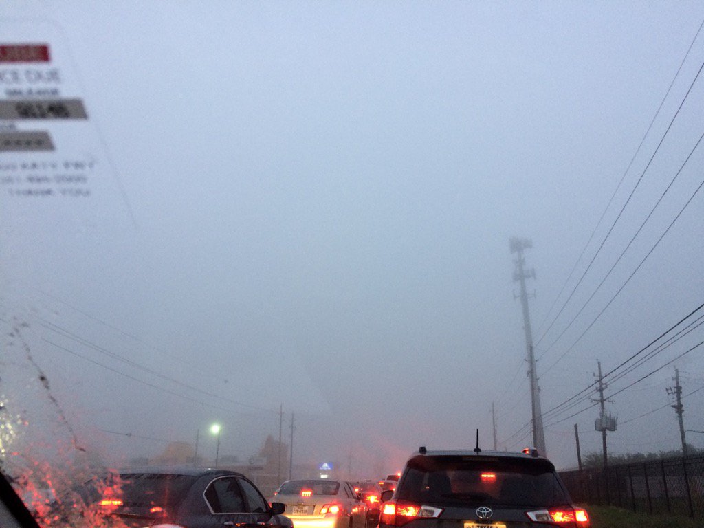
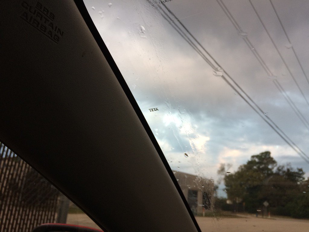
Northwest Houston, TX during the early morning
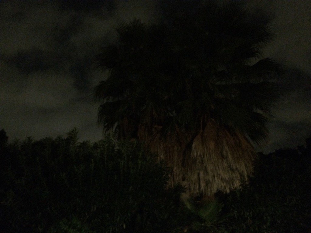
Northwest Houston, TX during the early night.


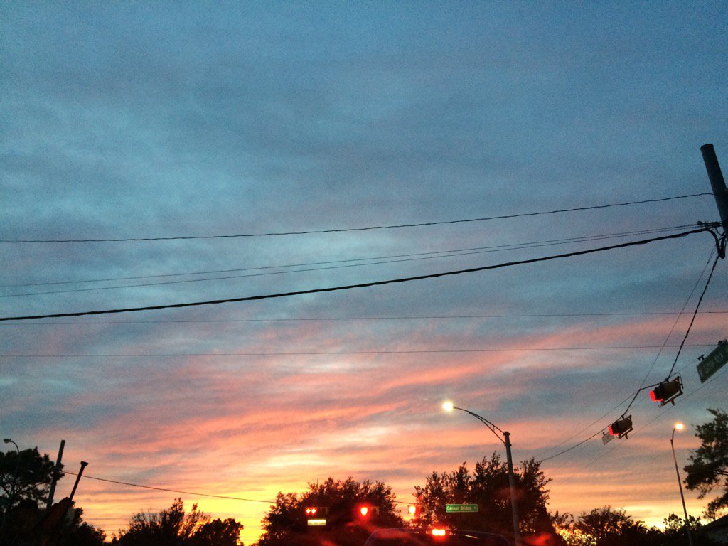
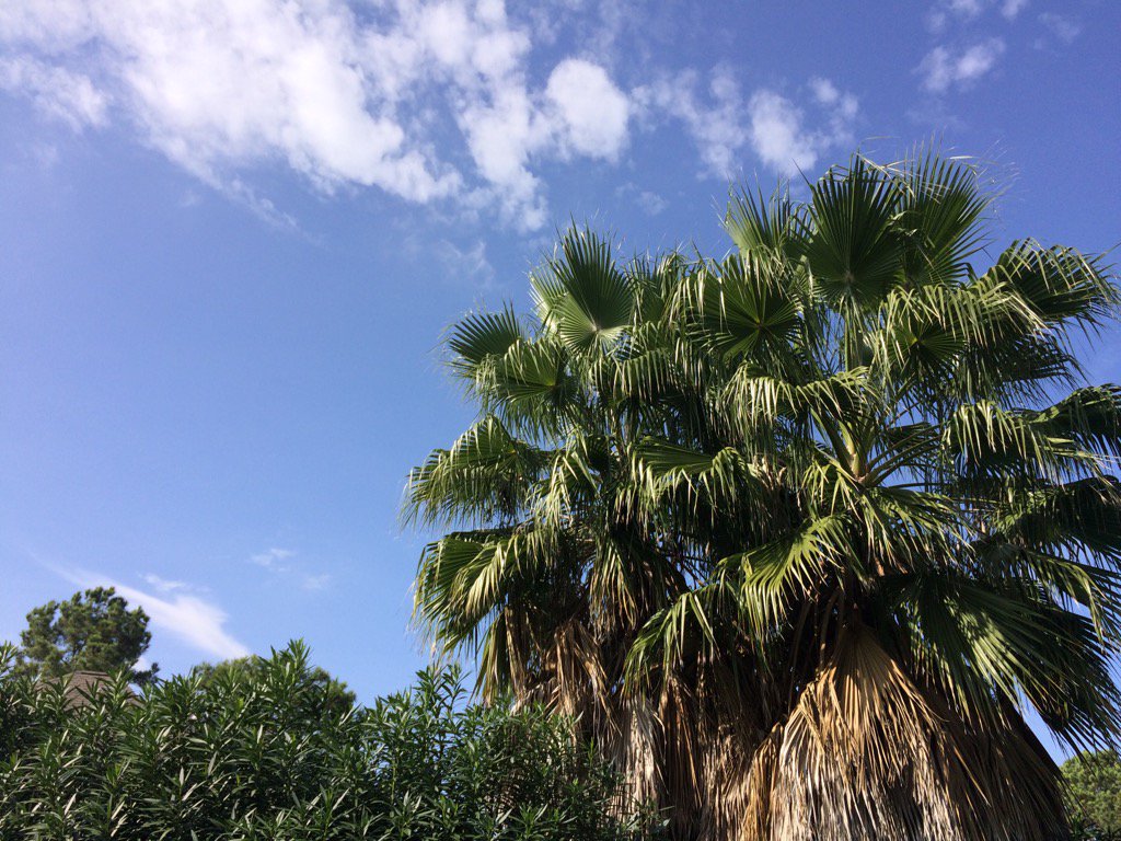
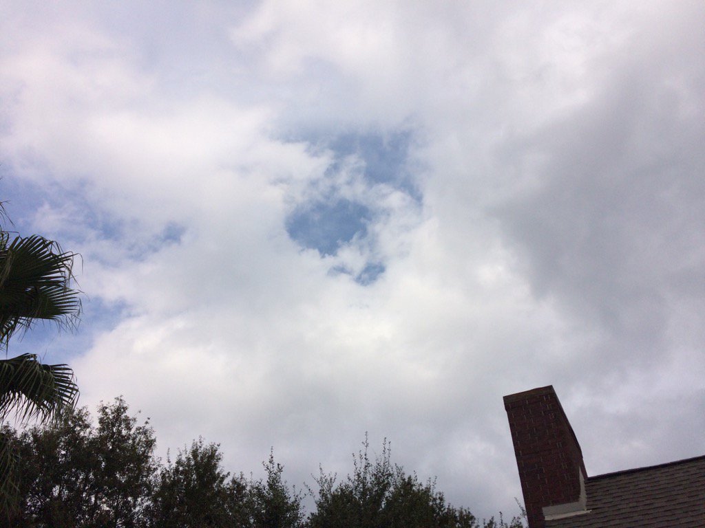
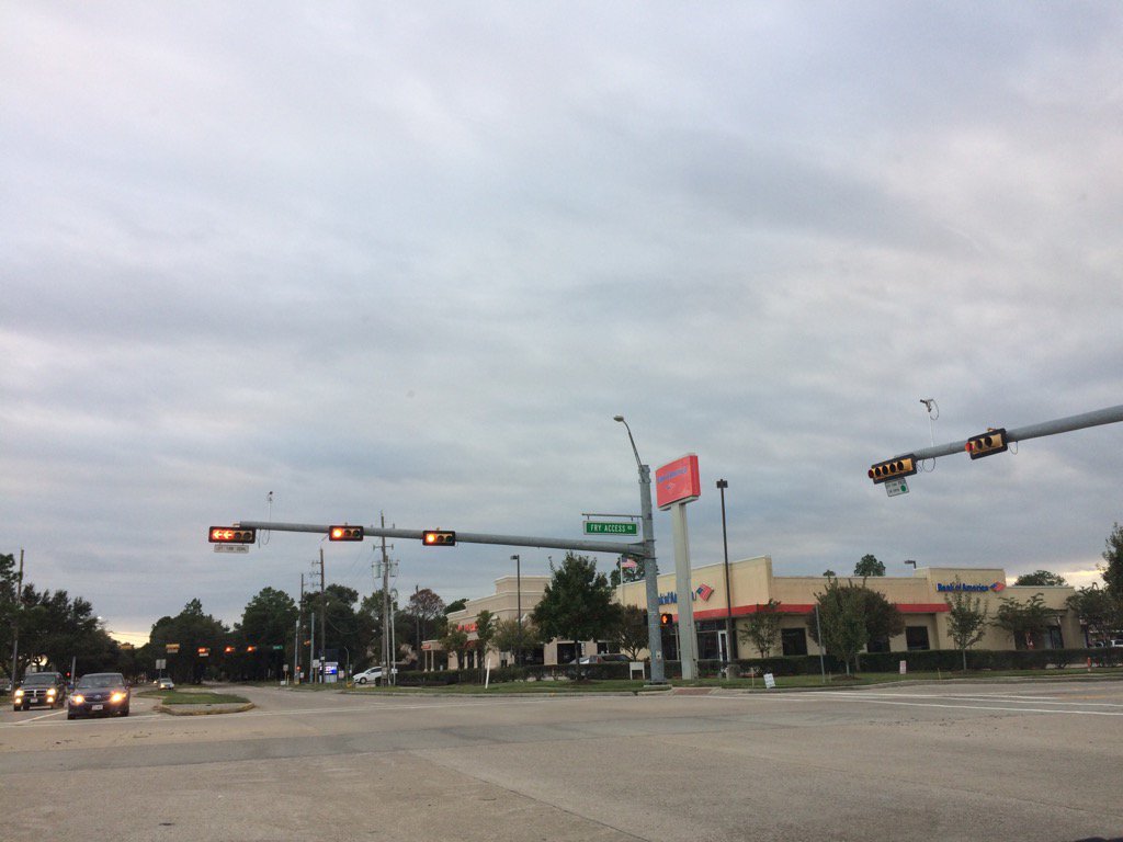
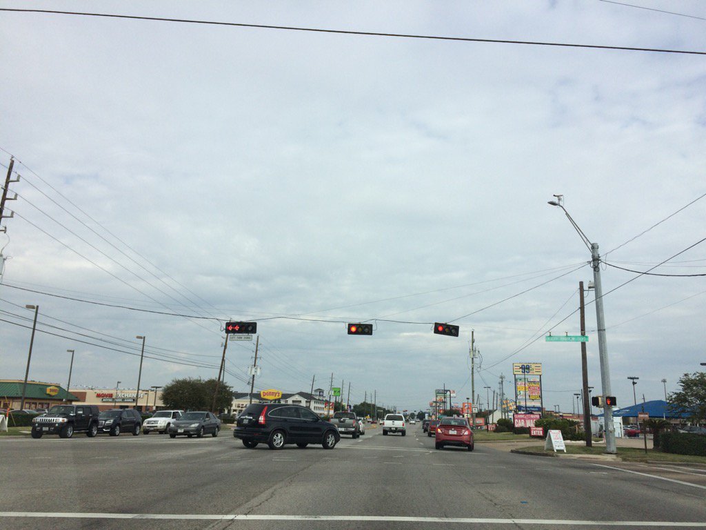
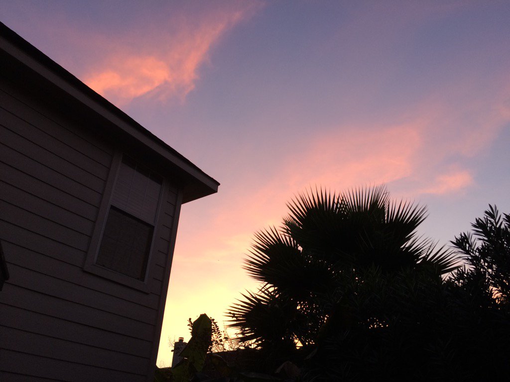
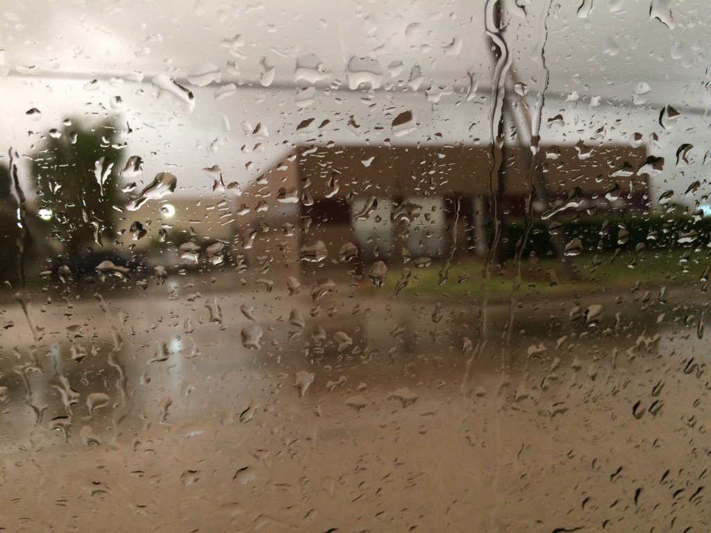
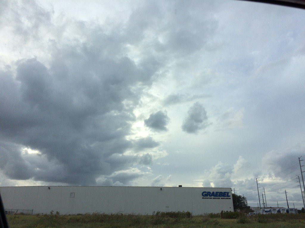
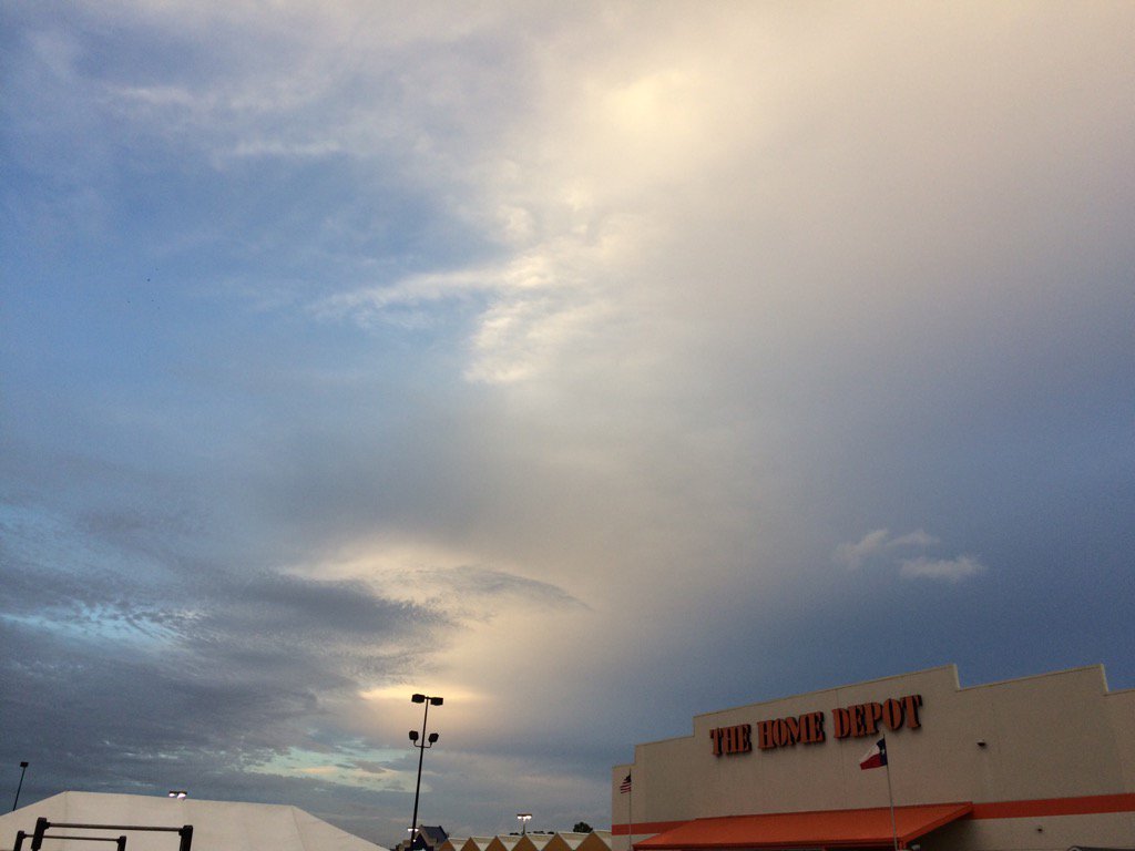
Notes: Very dense fog in northwest Houston, TX turned into moderate dense fog in west Houston, TX during the early morning. The fog looked to have left west Houston, TX and turned into bright white to light grey, puffy, low stratus clouds in west Houston, TX during the mid-morning. The stratus clouds looked to cover most of the sky in west Houston, TX, during the late morning, afternoon, and early evening. Bright white, maybe light grey, puffy, low stratus clouds looked to cover most of the sky in northwest Houston, TX during the late evening. Bright white, puffy, high stratus clouds looked to be widely scattered across the sky in northwest Houston, TX during the early night. The wind speeds were calm in northwest and west Houston, TX, during the early morning. The wind speeds looked to be mostly calm with maybe some moderate gusts in west Houston, TX, during the mid and late morning, afternoon, and early evening.  The wind speeds looked to be mostly calm with maybe some moderate gusts in northwest Houston, TX during the late evening and early night. It felt warm and humid in northwest and west Houston, TX during the morning, afternoon, evening, and night. There looked to be a few isolated showers and thunderstorms on the radar, near and maybe in the Houston, TX area during the morning, afternoon, evening, and maybe night.

Thoughts: There wasn't as much rain in the Houston, TX area as foretasted from the passing cold front, for both Monday and Tuesday. I was really hoping to see some thunderstorms, or heavy rain with the passing cold front, but that's ok, maybe next time. Houston, TX did get some decent showers. It looks like we might get some heavy rain this weekend, and cooler temps too! I was surprised to see, as you'll see in NOAA's forecast discussion that there were some record highs broken in the Houston, TX area. I knew it was abnormally hot today, but I didn't know it was hot enough to break a record.

Disclaimer: This was my observation of the weather that occurred in northwest and west Houston, TX, where I was during the day.


Hazardous Weather Outlook

HAZARDOUS WEATHER OUTLOOK
NATIONAL WEATHER SERVICE HOUSTON/GALVESTON TX
412 PM CST TUE NOV 29 2016

TXZ213-214-226-227-235>237-010730-
BRAZORIA-CHAMBERS-FORT BEND-HARRIS-JACKSON-MATAGORDA-WHARTON-
412 PM CST TUE NOV 29 2016

THIS HAZARDOUS WEATHER OUTLOOK IS FOR PORTIONS OF SOUTHEAST TEXAS.

.DAY ONE...THIS AFTERNOON AND TONIGHT

NO HAZARDOUS WEATHER WILL OCCUR.

.DAYS TWO THROUGH SEVEN...WEDNESDAY THROUGH MONDAY

AN UPPER LEVEL LOW OVER THE BAJA GULF OF CALIFORNIA REGION...IN
TANDEM WITH A DEVELOPING NEAR COASTAL SURFACE TROUGH...WILL PRODUCE
A FRIDAY INTO THE WEEKEND PERIOD OF MODERATE LOW TO LOCALLY HEAVY
PRECIPITATION. HIGHER MOISTURE CLOSER TO THE COAST WILL HAVE
HIGHER PROBABILITIES OF EXCESSIVE RAINFALL LEADING TO FLOODING
CONCERNS FOCUSED OVER COASTAL COUNTIES. COASTAL RUNUP MAY
BE AN ISSUE THIS WEEKEND.

.SPOTTER INFORMATION STATEMENT...

HEIGHTENED SPOTTER AWARENESS FRIDAY THROUGH SUNDAY.


$$


Area Forecast Discussion 
Issued by NWS Houston/Galveston, TX

Home | Current Version | Previous Version | Text Only | Print | Product List | Glossary Off
Versions: 1 2 3 4 5 6 7 8 9 10 11 12 13 14 15 16 17 18 19 20 21 22 23 24 25 26 27 28 29 30 31 32 33 34 35 36 37 3839 40 41 42 43 44 45 46 47 48 49 50
000
FXUS64 KHGX 300307
AFDHGX

Area Forecast Discussion
National Weather Service Houston/Galveston TX
907 PM CST Tue Nov 29 2016

.DISCUSSION...
Based on radar fine lines, the cold front was located from near
KJAS in east TX to KLVJ (Pearland) and then SW to KBYY (Bay City).
The front appears to be moving fairly slowly, maybe 5 mph. Latest
HRRR model trends have the front pushing off the coast after
06z/midnight and then accelerating south. Radar still shows a few
lines of showers/storms in the Gulf but remain rather weak due to
capping aloft evident by ACARS soundings as well as the 00Z CRP
sounding. CRP sounding had temps of 10C at 700mb, 20C at 850mb.
Surface obs also showed a few isolate areas of fog developing
south of the front. Mainly visibility has dropped to around 3 to
5 miles along the coast and just off shore. The front should erode
the fog the next couple of hours. We are certainly not expecting
dense fog to quickly form like last night.

Main changes to the forecast were to just update for on going
trends with the front pushing south. Minimum temps may not be
quite as cool along the coast since it will take some time for
cold air advection to take place.

As for this coming weekend, I think the previous discussion covers
the potential rain event. Despite some model differences, I`ll
sum up by saying "It gonna rain".

Overpeck

&&

.PREV DISCUSSION... /ISSUED 535 PM CST Tue Nov 29 2016/

AVIATION...
For most sites, dry air on northwest flow should keep fog from
being an issue tonight. However, with a boundary stalled just
inland of the Gulf shore, this seems unlikely at GLS, which
should see some fog develop before gusty northwest winds on a cold
front blast dry air in. Went with MVFR conditions now, on chance
that stalled boundary drifts southward this evening, but potential
for IFR definitely exists and may be cause for later amendments.

Other challenge will be how and when winds get gusty as cold front
works through. In collaboration with the CWSU, agree on bringing
in gustier winds a little after winds just off the surface
increase. Along with that, the narrow band of clouds near the
coast should also depart the area.

PREV DISCUSSION... /ISSUED 408 PM CST Tue Nov 29 2016/

DISCUSSION...
The frontal boundary responsible for thunderstorms across parts
of the Brazos Valley and Piney Woods earlier this morning as it
lifted north is now sagging south across the region this
afternoon. Surface analysis shows this boundary snaked from Edna
to Katy to Dayton, with satellite imagery showing enhanced cumulus
developing along the boundary. Despite this, convection this
afternoon has been largely limited as warm air advection at 850
and 700 MB has resulted in a strengthening cap across the Houston
metro. Low level warm air advection today has also resulted in a
few locations reaching or setting record high temperatures, with
Houston Intercontinental having reached at least 84 degrees as of
4 PM (which would exceed the record of 83 set in 2006).

Cannot rule out a few showers developing underneath this cap as
the boundary slowly sags towards the coast this afternoon, with
scattered showers and thunderstorms blossoming over the coastal
waters and extreme southeastern counties this evening as a
secondary cold front across North and Central Texas sweeps off the
coast this evening and tonight. May see a few of the storms across
the coastal waters become strong to marginally severe, but this
activity will continue to move into the northern Gulf and away
from the Upper Texas coast with the associated front. Until the
cold front moves off the coast tonight and ushers in drier air,
may see some patchy fog across the bays and nearshore waters with
warm, moist air pooled right along the coast. Otherwise, expect
overnight lows in the low 40s to mid 50s.

Surface high pressure building into the region in the wake of
tonight`s front will result in dry, cooler weather for the region
on Wednesday and Thursday. Elevated north winds (15-20 MPH) and
relative humidity values falling to near 25 percent during the
afternoon tomorrow will result in elevated fire weather conditions
for most inland areas tomorrow afternoon, but decreasing winds on
Thursday will help limit overall fire weather concerns. Expect
highs Wednesday and Thursday to be in the 60s with lows ranging
from the upper 30s across the extreme northern counties to mid 50s
along the coast.

Attention then turns to the upcoming weekend as energy from an
upper trough approaching from the west cuts off over northern
Mexico. Surface high pressure shifting into the southeastern US on
Friday will allow moisture to begin surging into the region, aided
by the development of a coastal trough along the Middle Texas
coast. Southwest flow aloft combined with enhanced low level
convergence from the coastal trough will result in periods of
showers and thunderstorms across Southeast Texas in the Saturday
through Monday timeframe. With precipitable water values climbing
to near 1.7 inches along the coast, have increasing concerns for
heavy rain to impact parts of the Upper Texas coast. Medium range
guidance has come into better agreement on the overall upper
pattern evolution, but still offers different timing on when the
upper low will lift across Texas and placements on the coastal
trough that develops (which would affect which areas see the
heaviest rain). Regardless, this weekend looks cool, wet, and one
to watch for heavy rain impacting parts of the Upper Texas coast.

Huffman


&&

.PRELIMINARY POINT TEMPS/POPS...
College Station (CLL)      46  65  40  66  45 /   0   0   0   0   0
Houston (IAH)              54  67  42  67  46 /  10   0   0   0   0
Galveston (GLS)            61  68  54  65  58 /  20   0   0   0   0

&&

.HGX WATCHES/WARNINGS/ADVISORIES...
TX...NONE.
GM...SMALL CRAFT SHOULD EXERCISE CAUTION from 6 AM CST Wednesday
     through Wednesday morning for the following zones: Coastal
     waters from Freeport to the Matagorda Ship Channel out 20
     NM...Coastal waters from High Island to Freeport out 20
     NM...Matagorda Bay.

     Small Craft Advisory from 6 AM to noon CST Wednesday for the
     following zones: Waters from Freeport to the Matagorda Ship
     Channel from 20 to 60 NM...Waters from High Island to
     Freeport from 20 to 60 NM.

&&

$$

Discussion...39

Monday, November 28, 2016

Nov. 28 16

Northwest Houston, TX during the late evening.


Notes: Big to small, bright white, light, medium, and dark grey, some light to medium blueish grey, thick, puffy low stratus clouds looked to cover most of the sky in northwest and west Houston, TX during the morning and afternoon. The stratus clouds looked to be leaving the sky in northwest and west Houston, TX, during the evening. The stratus clouds looked to cover only some of the sky in northwest Houston, TX during the early night. The wind speeds were relatively calm with moderate to strong and some very strong gusts in northwest and west Houston, TX, during the early morning. The wind speeds were relatively calm with moderate to strong and some very strong gusts in west Houston, TX during the mid and late morning, early afternoon, and maybe mid-afternoon.The wind speeds were mostly calm with some moderate gusts in west Houston, TX during the late afternoon. The wind speeds were mostly calm with some moderate gusts in west Houston, TX during the early evening. The wind speeds were mostly calm with some moderate gusts in northwest Houston, TX during the late evening and early night. It felt a little cool in northwest and west Houston, TX, during the early morning. It felt a little cool in west Houston, TX, during the mid and late morning. It started to feel warm in west Houston, TX during the early afternoon, It felt warm in west Houston, TX, during the mid and late afternoon and early evening. It felt a little cool in northwest Houston, TX, during the late evening and early night. Light to moderate, a few heavy and maybe a few thunderstorms were scattered across the Houston, TX area from the early morning through the late afternoon, or maybe evening. Light to moderate rain and drizzle passed over my house in northwest Houston, TX and was pouring when I was on my way to work in west Houston, TX, during the early morning. I saw some more light rain in west Houston, TX, sometime during the mid, or late morning and afternoon. I didn't see any lightning, or hear any thunder. I thought I may have heard some distant rumbles of thunder in west Houston, TX, sometime during the mid, or late morning, or maybe afternoon, but wasn't sure. I didn't hear about any flooding, or damages from the showers and maybe thunderstorms that passed over the Houston, TX area during the morning, afternoon, and maybe evening. Disclaimer: This was my observation of the weather that occurred in northwest and west Houston, TX, where I was during the day.


Hazardous Weather Outlook

HAZARDOUS WEATHER OUTLOOK
NATIONAL WEATHER SERVICE HOUSTON/GALVESTON TX
1210 PM CST MON NOV 28 2016

TXZ163-164-176>179-195>200-210>213-226-227-291815-
AUSTIN-BRAZOS-BURLESON-COLORADO-FORT BEND-GRIMES-HARRIS-HOUSTON-
LIBERTY-MADISON-MONTGOMERY-POLK-SAN JACINTO-TRINITY-WALKER-WALLER-
WASHINGTON-WHARTON-
1210 PM CST MON NOV 28 2016

THIS HAZARDOUS WEATHER OUTLOOK IS FOR PORTIONS OF SOUTHEAST TEXAS.

.DAY ONE...THIS AFTERNOON AND TONIGHT

A DRYLINE WILL MOVE INTO THE REGION TODAY AND TRIGGER SOME
SHOWERS AND THUNDERSTORMS. A FEW STORMS COULD BECOME SEVERE. THE
BEST CHANCES SHOULD GENERALLY BE SITUATED NORTH OF I-10 AND EAST
OF I-45 BETWEEN 7AM AND 2PM. THE PRIMARY WEATHER THREATS WILL BE
LOCALIZED WIND DAMAGE AND ISOLATED TORNADOES. A WIND ADVISORY IS
IN EFFECT THROUGH THIS AFTERNOON.

.DAYS TWO THROUGH SEVEN...TUESDAY THROUGH SUNDAY

HAZARDOUS WEATHER IS NOT EXPECTED.

.SPOTTER INFORMATION STATEMENT...

SPOTTER ACTIVATION MIGHT BE NEEDED TODAY.

$$

Sunday, November 27, 2016

Nov. 27 16

Northwest Houston, TX during the late morning.
Northwest Houston, TX during the early afternoon.
East Katy, TX during the late afternoon.


Big to small, bright white, thin, wavy cirrus with bright white to light grey and blue, thick, flat, puffy, low stratus clouds looked to cover most of the sky in northwest and west Houston, TX and east Katy, TX during the morning, afternoon, evening, and early night. Big to small, bright white and light grey, thick, flat low stratus clouds looked cover the whole sky in northwest Houston, TX during the early night. The wind speeds looked to be calm with some moderate gusts in northwest Houston, TX during the early and mid-morning. There looked to be moderate wind speeds with moderately strong to strong gusts in northwest Houston, TX, during the late morning and maybe early afternoon. The wind speeds looked to be calm with moderate and some strong gusts in northwest Houston, TX, during the mid-afternoon. The wind speeds looked to be calm with moderate and some strong gusts in northwest and west Houston, TX and east Katy, TX during the late afternoon, evening, and early night. It felt cool in northwest Houston, TX during the morning. It felt a little cool in northwest Houston, TX during the early and mid-afternoon. It felt a little cool in northwest and west Houston, TX and east Katy, TX during the late afternoon and evening. It felt cool, or maybe a little cool in northwest and west Houston, TX and east Katy, TX during the early night. There looked to be a few isolated showers near south, west, and north Houston, TX when I looked at the radar during the early night. I didn't feel, see, or hear about any rain reaching Houston, TX anytime during the day. Disclaimer: This is my observation of the weather that occurred in northwest, west, and east Katy, TX, where I was during the day.

Nov. 26 16

Northwest Houston, TX during the late morning.
Northwest Houston, TX during the late evening.


Notes: The sky looked to be clear, or maybe mostly clear in northwest Houston, TX, during the early morning and night. Big to small, bright white, light grey, light to medium blueish grey, thick, flat low stratus clouds looked to cover most of the sky in northwest Houston, TX during the mid and late morning and afternoon. Big to small, thin and thick, wavy, high stratus clouds looked to be widely scattered across the sky in northwest Houston, TX during the evening. The wind speeds looked to be calm with some moderate gusts in northwest Houston, TX during the morning, afternoon, evening, and maybe night. It felt cool in northwest Houston, TX during the morning, afternoon, and evening. It felt cool, almost cold in northwest Houston, TX during the night. I didn't hear about, see, or feel any rain drops anywhere in, or near the Houston, TX area during the morning, afternoon, evening, or night. Disclaimer: This was my observation of the weather that occurred in northwest Houston, TX, where I was during the day.

Friday, November 25, 2016

Nov. 25 16

West Houston, TX during the early morning.


Notes: Big to small bright white, light to medium grey, and light to medium blueish grey thick flat and puffy stratus clouds looked to cover most of the sky in northwest and west Houston, TX, during the early morning. Big to small bright white, light to medium grey, and light to medium blueish grey thick flat and puffy stratus clouds looked to cover most of the sky in west Houston, TX during the mid and late morning and early and mid-afternoon. There looked to be numerous bright white thin, wavy cirrus clouds with only a few high stratus clouds in the sky in west Houston, TX and east Katy, TX during the late afternoon.  There looked to be numerous bright white thin, wavy cirrus clouds with only a few high stratus clouds in the sky in northwest Houston, TX during the evening. The sky looked to have become clear, or maybe mostly cleared of the stratus and cirrus clouds in northwest Houston, TX during the night. The wind speeds looked to be calm with maybe some moderate gusts in northwest and west Houston, TX,during the early morning.  The wind speeds looked to be calm with maybe some moderate gusts in west Houston, TX during the mid and late morning and early and mid-afternoon. The wind speeds looked to be calm with maybe some moderate gusts in west Houston, TX and east Katy, TX during the late afternoon. The wind speeds looked to be calm with maybe some moderate gusts in northwest Houston, TX during the evening and night. It felt cool almost cold in northwest and west Houston, TX during the early morning. It felt cool in west Houston, TX during the mid-morning. It started to feel a little cool in west Houston, TX during the late morning. It felt a little cool, almost warm in west Houston, TX during the early and mid-afternoon. It felt a little cool, almost warm in west Houston, TX and east Katy, TX during the late afternoon. It felt a little cool in northwest Houston, TX during the evening. It felt cool in northwest Houston, TX during the night. Light to moderate rain was scattered across the Houston, TX area during the morning, afternoon, and maybe evening and night. I saw a few sprinkles and light rain in west Houston, TX during the early and mid-morning. I didn't hear about any flooding, or damages from the showers. Disclaimer: This was my observation of the weather that occurred in northwest, west, and east Katy, TX, where I was during the day.

Thursday, November 24, 2016

Nov. 24 16

Notes: I forgot to take pictures. Happy Thanksgiving! There looked to be a medium to small, thin, flat, high stratus clouds in the sky in northwest Houston, TX, during the morning, afternoon, evening, and night. There looked to be a few medium to small, thin, flat, high stratus clouds in the sky when I was west Houston, TX during the early afternoon. The wind speeds looked to relatively calm with maybe some moderate gusts in northwest Houston, TX during the morning, afternoon, and evening. The wind speeds looked to relatively calm with maybe some moderate gusts in west Houston, TX, during the early afternoon. The wind speeds looked to be calm in northwest Houston, TX, during the night. It felt cold in northwest Houston, TX, during the early morning. It started to feel cool in northwest Houston, TX, during the mid-morning. It felt cool in northwest Houston, TX, during the late morning. It felt warm in west Houston, TX, during the early afternoon. It felt warm in northwest Houston, TX, during the mid and late afternoon. It felt a little cool, almost cool in northwest Houston, TX, during the evening. It felt a little cool in northwest Houston, TX, during the night. I didn't see, or feel any rain drops. I did hear about their being a few chances for showers in and around the Houston, TX area during the night, but I didn't hear about any of the areas in and around the Houston, TX area receiving any rainfall. Disclaimer: This was my observation of the weather that occurred in northwest and west Houston, TX, where I was during the day.

Nov. 23 16

Northwest Houston, TX, during the early morning.


Notes: Big to small bright white to dark grey, thick, puffy low stratus clouds covered the whole sky in northwest and west Houston, TX, during the early morning. The stratus clouds started to break apart in west Houston, TX sometime during the mid-morning, I think. The sky became clear in west Houston, TX during the early morning. The sky looked to be clear in west Houston, TX, during the mid-afternoon. The sky looked to be clear in northwest and west Houston, TX, during the late after noon. The sky looked to be clear in northwest Houston, TX during the evening and night. The wind speeds looked to be moderate with moderately strong to strong gusts in northwest and west Houston, TX, during the early morning. The wind speeds looked to have become calm, or maybe relatively calm in west Houston, TX sometime during the mid, or maybe late morning. The wind speeds looked to be calm, or maybe relatively calm in west Houston, TX, during the early and mid-afternoon. The wind speeds looked to be calm, or maybe  relatively calm in northwest and west Houston, TX, during the late afternoon. The wind speeds looked to be calm, or maybe relatively calm in northwest Houston, TX during the evening and night. It felt warm and humid in northwest and west Houston, TX, during the early morning. It felt cool in west Houston, TX, during the mid and late morning. It felt a little cool, almost warm in west Houston, TX during the early and mid-afternoon. It felt a little cool in northwest and west Houston, TX, during the late afternoon. It started to feel cool in northwest Houston, TX during the evening. It started to feel cold in northwest Houston, TX during the early night. It felt cold in northwest Houston, TX, during the late night. A huge line of light to heavy showers and thunderstorms passed over most if not all of the Houston, TX area during the morning. There were some reports of flash flooding, but no reports of any damages. I saw some huge puddles on the road in west Houston, TX during early morning. Disclaimer:  This was my observation the weather that occurred in northwest and west Houston, TX, where I was during the day.


Hazardous Weather Outlook

HAZARDOUS WEATHER OUTLOOK
NATIONAL WEATHER SERVICE HOUSTON/GALVESTON TX
637 AM CST WED NOV 23 2016

TXZ163-164-176>179-195>200-210>214-226-227-235>238-241200-
AUSTIN-BRAZORIA-BRAZOS-BURLESON-CHAMBERS-COLORADO-FORT BEND-
GALVESTON-GRIMES-HARRIS-HOUSTON-JACKSON-LIBERTY-MADISON-MATAGORDA-
MONTGOMERY-POLK-SAN JACINTO-TRINITY-WALKER-WALLER-WASHINGTON-
WHARTON-
637 AM CST WED NOV 23 2016

THIS HAZARDOUS WEATHER OUTLOOK IS FOR PORTIONS OF SOUTHEAST TEXAS.

.DAY ONE...TODAY AND TONIGHT

A LINE OF THUNDERSTORMS AHEAD OF AN APPROACHING COLD FRONT WILL
PASS ACROSS THE SOUTHERN FORECAST AREA THROUGH 11 AM. SOME OF
THESE STORMS WILL PRODUCE WIND GUSTS TO 40 MPH AND SMALL HAIL.
THIS LINE OF CONVECTION WILL BE OFF THE COAST BY NOON. HIGH
PRESSURE BUILDING IN BEHIND THE COLD FRONT WILL END ANY
THUNDERSTORM THREAT THIS AFTERNOON.

.DAYS TWO THROUGH SEVEN...THURSDAY THROUGH TUESDAY

NO HAZARDOUS WEATHER IS ANTICIPATED.

.SPOTTER INFORMATION STATEMENT...
HEIGHTENED SPOTTER AWARENESS THIS MORNING, ESPECIALLY OVER MORE
SOUTHERN NEAR COASTAL COUNTIES.

$$

Tuesday, November 22, 2016

Nov. 22 16

Late afternoon, west Houston, TX.
Early evening, northwest Houston, TX.

Notes: I found a way to get pictures uploaded again! Big to small, bright white with light grey and blueish grey, thick, puffy, low stratus clouds looked to cover most of the sky in northwest and west Houston, TX, during the early morning, late morning, and afternoon. Big to small, bright white, thin, wavy cirrus clouds looked to be widely scattered across the sky in west Houston, TX, during the mid-morning, or maybe early morning after sunrise. Big to small, bright white grey, and blueish grey, flat, puffy, thick, low stratus clouds looked to cover most of the sky in northwest Houston, TX, during the evening. Big to small, bright white, and light to medium grey stratus clouds looked to be scattered across the sky in northwest Houston, TX, I think, during the early night. I think the wind speeds looked to be calm in northwest and west Houston, TX, during the early morning. The wind speeds became moderate with moderately strong to strong gusts in west Houston, TX, sometime during the morning, or maybe early afternoon. I think the wind speeds still looked to be moderate with moderately strong to strong gusts when I left work in west Houston, during the late afternoon. The wind speeds looked to be moderate with moderately strong to strong gusts when I was in northwest Houston, TX during the evening. The wind speeds looked to be relatively calm with some moderate gusts in northwest Houston, TX, during the early night. It felt warm in northwest and west Houston, TX, during the morning, afternoon, evening, and night. It may have felt cool, or maybe a little cool in northwest and west Houston, TX during the early and mid-morning. There looked to be a band of light showers to the west Houston, TX, when I looked at the radar throughout the day. I didn't hear about, see, or feel any rain drops anywhere in the Houston, TX area, during the morning, afternoon, and evening. There looked to be a band of light to heavy showers to the north of Houston, TX, that may have reached parts of north and maybe northwest Houston, TX, during the night. Disclaimer: This was my observation of the weather that occurred in northwest and west Houston, TX, where I was during the day.


Hazardous Weather Outlook

HAZARDOUS WEATHER OUTLOOK
NATIONAL WEATHER SERVICE HOUSTON/GALVESTON TX
646 AM CST TUE NOV 22 2016

TXZ163-164-176>179-195>200-210>214-226-227-235>238-231300-
AUSTIN-BRAZORIA-BRAZOS-BURLESON-CHAMBERS-COLORADO-FORT BEND-
GALVESTON-GRIMES-HARRIS-HOUSTON-JACKSON-LIBERTY-MADISON-MATAGORDA-
MONTGOMERY-POLK-SAN JACINTO-TRINITY-WALKER-WALLER-WASHINGTON-
WHARTON-
646 AM CST TUE NOV 22 2016

THIS HAZARDOUS WEATHER OUTLOOK IS FOR PORTIONS OF SOUTHEAST TEXAS.

.DAY ONE...TODAY AND TONIGHT

AS A COLD FRONT APPROACHES AND PASSES ACROSS SOUTHEASTERN TEXAS
LATE TONIGHT THROUGH WEDNESDAY MORNING THERE IS A POSSIBILITY FOR
THE DEVELOPMENT OF STRONG TO SEVERE THUNDERSTORMS. DAMAGING
DOWNBURST WINDS AND ISOLATED TORNADOES WILL BE THE PRIMARY SEVERE
WEATHER THREATS. RAIN WILL END FROM NORTHWEST TO SOUTHEAST THROUGH
THE DAY WEDNESDAY. DRY CONDITIONS ARE EXPECTED ON THANKSGIVING.

.DAYS TWO THROUGH SEVEN...WEDNESDAY THROUGH MONDAY

HAZARDOUS WEATHER IS NOT ANTICIPATED.

.SPOTTER INFORMATION STATEMENT...

HEIGHTENED SPOTTER AWARENESS FROM TONIGHT THROUGH EARLY WEDNESDAY
AFTERNOON.

$$

Monday, November 21, 2016

Nov. 21 16

Notes: The sky looked to be clear in northwest and west Houston, TX, during the morning and afternoon. I saw some medium and small, bright white, thin and thick, flat high stratus clouds in the sky in northwest and west Houston, TX, during the evening. The sky looked to be clear in northwest Houston, TX, during the early night. The wind speeds looked to be calm in northwest and west Houston, TX, during the early morning. The wind speeds looked to have become relatively calm with some moderate gusts in west Houston, TX, sometime during the mid, or late morning, or maybe afternoon. The wind speeds looked to be relatively calm with some moderate gusts in northwest and west Houston, TX, during the evening. The wind speeds looked to be relatively calm with some moderate gusts during the early night. It felt cold in northwest and west Houston, TX, during the early morning. It felt cool in west Houston, TX, during the mid-morning. It started to feel warm in west Houston, TX, during the late morning, It felt warm in northwest and west Houston, TX, during the afternoon and early evening. I think it started to feel a little cool in northwest Houston, TX, during the late evening. It felt a little cool in northwest Houston, TX, during the early night. I didn't see, feel, or hear about any rain drops anywhere in, or near Houston, TX at anytime during the day. I did see some ground fog, or radiation fog when I was driving in west Houston, TX, on my way to work, during the early morning after sunrise. This was my observation of the weather that occurred in northwest and west Houston, TX, where I was during the day.

Sunday, November 20, 2016

Nov. 20 16

Notes: The looked to be clear in northwest Houston, TX, during the morning, afternoon, evening, and night. The wind speeds looked to be relatively calm with moderate and maybe some strong gusts in northwest Houston, TX, during the morning, afternoon, evening, and night. It felt cold in northwest Houston, TX, during the early and mid-morning. It felt cool in northwest Houston, TX, during the late morning, afternoon, and evening. It felt cold in northwest Houston, TX, during the night. I didn't see, feel, or hear about any rain drops anywhere in, or near Houston, TX, during the morning, afternoon, evening, or night. This was my observation of the weather that occurred in northwest Houston, TX, where I was, during the day.

Saturday, November 19, 2016

Nov. 19 16

Notes: The sky was clear in northwest and west Houston, TX, during the morning, afternoon, evening, and night. The wind speeds looked to be relatively calm with moderate and maybe some strong gusts (especially during the early morning, before sunrise) in northwest and west Houston, TX, during the morning and early afternoon. The wind speeds looked to be relatively calm with moderate and maybe some strong gusts in northwest Houston, TX, during the mid and late afternoon, and evening. The wind speeds looked to be mostly calm with maybe some moderate gusts in northwest Houston, TX, during the night. It felt very cold when I left my house in northwest Houston, TX, on my way to work in west Houston, TX, during the early morning. It still felt cold in west Houston, TX, during the mid-morning. It felt cool in northwest and west Houston, TX, during the late morning and early evening. It felt cool in northwest Houston, TX during the mid and late afternoon and evening. It felt cold in northwest Houston, TX, during the night. I didn't see, feel, or hear about any rain drops anywhere in, or near Houston, TX, during the morning, afternoon, evening, or night. This was my observation of the weather that occurred in northwest and west Houston, TX, where I was, during the day.


Hazardous Weather Outlook

HAZARDOUS WEATHER OUTLOOK
NATIONAL WEATHER SERVICE HOUSTON/GALVESTON TX
1007 PM CST SAT NOV 19 2016

TXZ163-164-176>179-195>200-210>214-226-227-235>238-210415-
AUSTIN-BRAZORIA-BRAZOS-BURLESON-CHAMBERS-COLORADO-FORT BEND-
GALVESTON-GRIMES-HARRIS-HOUSTON-JACKSON-LIBERTY-MADISON-MATAGORDA-
MONTGOMERY-POLK-SAN JACINTO-TRINITY-WALKER-WALLER-WASHINGTON-
WHARTON-
1007 PM CST SAT NOV 19 2016

THIS HAZARDOUS WEATHER OUTLOOK IS FOR PORTIONS OF SOUTHEAST TEXAS.

.DAY ONE...TONIGHT

COLDER TEMPERATURES ARE EXPECTED TONIGHT WITH INLAND LOWS FALLING
INTO THE 30S. FREEZING TEMPERATURES ARE EXPECTED ACROSS PORTIONS
OF HOUSTON... TRINITY... AND MADISON COUNTIES AND A FREEZE WARNING
IS IN EFFECT.

.DAYS TWO THROUGH SEVEN...SUNDAY THROUGH FRIDAY

AFTER SUNDAY MORNING`S COLD TEMPERATURES...A GRADUAL WARMING
TREND CAN BE EXPECTED SUNDAY AFTERNOON THROUGH MIDWEEK. RAIN COMES
BACK INTO THE FORECAST MAINLY TUESDAY THROUGH WEDNESDAY MORNING IN
ASSOCIATION WITH THE NEXT COLD FRONT. THANKSGIVING DAY IS LOOKING
DRY.

.SPOTTER INFORMATION STATEMENT...
SPOTTER ACTIVATION WILL NOT BE NEEDED.

$$

Friday, November 18, 2016

Nov. 18 16

Notes: Big to small, bright white, some with light to medium grey and some with light to medium blueish grey, thick, flat, puffy stratus clouds looked to cover most of the sky in northwest and west Houston, TX, during the early and mid-morning. Big to small, bright white with light to medium grey clouds started to cover the whole sky in west Houston, TX, sometime during the early afternoon, or maybe late morning. Big to small, bright white with light and medium grey, thick, flat, puffy, low stratus clouds still covered the whole sky in west Houston, TX, during the evening. Big to small, bright white, some with bright white and light to medium grey stratus clouds looked to cover most of the sky when I arrived home in northwest Houston, TX, during the early night. The wind speeds looked to be relatively calm with moderate to strong gusts in northwest and west Houston, TX, during the morning, afternoon, evening, and night. The wind speeds might have been calm with maybe some moderate gusts in northwest and west Houston, TX, during the morning hours, but i'm not sure, I don't remember that well. Light to moderate drizzle looked to be off and on in northwest and west Houston, TX, during the morning, afternoon, evening, and early night. A cluster of heavy rain and few rumbles of thunder passed through where I was in west Houston, TX, sometime during 2 pm. I still heard some distant rumbles of thunder where I was in west Houston, TX, during 3 pm. It felt warm and humid in northwest and west Houston, TX, during the morning and afternoon. It felt a little cool in west Houston, TX, during the evening. It started to feel cool in northwest and west Houston, TX, during the early night. This was my observation of the weather that occurred in northwest and west Houston, TX, where I was during the day.


Wind Advisory

URGENT - WEATHER MESSAGE
NATIONAL WEATHER SERVICE HOUSTON/GALVESTON TX
302 PM CST FRI NOV 18 2016

...WIND ADVISORY IN EFFECT...

.STRONG NORTH WIND EXPECTED BEHIND PASSING COLD FRONT.

TXZ213-235-190515-
/O.NEW.KHGX.WI.Y.0010.161119T0000Z-161119T0900Z/
HARRIS-JACKSON-
INCLUDING THE CITIES OF...EDNA...HOUSTON...HUMBLE...KATY...
PASADENA...TOMBALL
302 PM CST FRI NOV 18 2016

...WIND ADVISORY IN EFFECT FROM 6 PM THIS EVENING TO 3 AM CST
SATURDAY...

THE NATIONAL WEATHER SERVICE IN HOUSTON/GALVESTON HAS ISSUED A
WIND ADVISORY...WHICH IS IN EFFECT FROM 6 PM THIS EVENING TO 3 AM
CST SATURDAY.

* EVENT...NORTH WIND 20 TO 30 MPH AND GUSTY NEAR THE BAYS

* TIMING...UNTIL 6AM

* IMPACT...COULD MAKE FOR HAZARDOUS DRIVING CONDITIONS

PRECAUTIONARY/PREPAREDNESS ACTIONS...

DRIVERS OF VANS...CAMPERS...TRAILERS...AND OTHER HIGH-PROFILE
VEHICLES SHOULD BE ALERT TO THE DANGER OF THESE WINDS...
ESPECIALLY WHEN DRIVING ALONG EAST TO WEST ORIENTED ROADS

&&

$$


Hazardous Weather Outlook

HAZARDOUS WEATHER OUTLOOK
NATIONAL WEATHER SERVICE HOUSTON/GALVESTON TX
417 AM CST FRI NOV 18 2016

TXZ163-164-176>179-195>200-210>214-226-227-235>238-191300-
AUSTIN-BRAZORIA-BRAZOS-BURLESON-CHAMBERS-COLORADO-FORT BEND-
GALVESTON-GRIMES-HARRIS-HOUSTON-JACKSON-LIBERTY-MADISON-MATAGORDA-
MONTGOMERY-POLK-SAN JACINTO-TRINITY-WALKER-WALLER-WASHINGTON-
WHARTON-
417 AM CST FRI NOV 18 2016

THIS HAZARDOUS WEATHER OUTLOOK IS FOR PORTIONS OF SOUTHEAST TEXAS.

.DAY ONE...TODAY AND TONIGHT

A STRONG COLD FRONT WILL MOVE THROUGH SOUTHEAST TEXAS TODAY. LOOK FOR
SHOWERS AND THUNDERSTORMS TO DEVELOP ALONG AND AHEAD OF THE FRONT.
BEHIND THE FRONT...WIND ADVISORIES MIGHT BE NEEDED.

.DAYS TWO THROUGH SEVEN...SATURDAY THROUGH THURSDAY

SIGNIFICANTLY COOLER TEMPERATURES CAN BE EXPECTED ON SATURDAY AND
SUNDAY. COLDEST OVERNIGHT LOWS ARE EXPECTED SUNDAY MORNING WITH INLAND
READINGS IN THE MID 30S TO LOWER 40S. NO FREEZE IS ANTICIPATED.

.SPOTTER INFORMATION STATEMENT...

SPOTTER ACTIVATION WILL NOT BE NEEDED.

$$

Thursday, November 17, 2016

Nov. 17 16

Notes: The sky looked to be clear in northwest Houston, TX, during the early morning. Big to small, bright white, thick, puffy, low stratus clouds started to appear in the sky in northwest Houston, TX, sometime during the mid, or maybe late morning. Big to small, bright white with light grey, thick, flat, puffy low stratus clouds were widely scattered across the sky in northwest, west, and central Houston, TX, during the afternoon, evening, and night. The wind speeds were calm to moderate with strong gusts (20 to maybe 30 mph) in northwest, west, and central Houston, TX, during the morning, afternoon, evening, and night. I think it felt a little cool in northwest Houston, TX, during the early and mid-morning. It felt warm in northwest Houston, TX, during the late morning. It felt very warm in northwest, west, and central Houston, TX, during the afternoon. It felt warm in northwest and west Houston, TX, during the evening. It felt warm in northwest Houston, TX, during the night. There was no rain that I know of anywhere in, or near Houston, TX. There were reports of dense fog near and maybe in the Houston, TX area during the early and mid-morning. I didn't see any fog in northwest Houston, TX, where I was, during the early and mid-morning. This was my observation of the weather that occurred in northwest, west, and central Houston, TX, where I was during the day.

Wednesday, November 16, 2016

Nov. 16 16

Notes: The wind speeds felt to be calm with maybe some moderate to strong gusts in northwest and west Houston, TX, during the early and mid-morning. The wind speeds looked to have become relatively calm with moderate to strong gusts in west Houston, TX, sometime during the late morning, or maybe early afternoon. The wind speeds looked to be relatively calm with moderate to strong gusts in northwest and west Houston, TX, during the mid and late afternoon, evening, and maybe night. There looked to be a few big to small, bright white, thick to thin, puffy, maybe some wavy high stratus clouds in the sky in northwest and west Houston, TX, during the early morning. The looked to have become clear in west Houston, TX sometime during the mid, or maybe late morning. The sky looked to be clear in northwest and west Houston, TX, during the afternoon, evening, and night. It felt cool in northwest and west Houston, TX, during the early and mid-morning. It felt a little cool in west Houston, TX, during the late morning. It felt warm in northwest and west Houston, TX, during the afternoon and evening. It felt a little cool, maybe cool in northwest Houston, TX, during the night. I didn't see, or hear about any rain anywhere in, or near the Houston, TX area, during the day. But I did see some frost and more ground fog in northwest and maybe in west Houston, TX, during the early morning on my way to work. This was my observation of the weather in northwest and west Houston, TX where I was, during the day.

Tuesday, November 15, 2016

Nov. 15 16

Notes: Big to small, bright white, thick and thin, flat, some puffy high stratus clouds looked to be scattered across the sky in northwest and west Houston, TX, during the early and mid-morning. The sky became clear in west Houston, TX, sometime during the late morning. The sky was still in clear with maybe some small and medium, bright white, thick and thin, puffy high stratus clouds in northwest and west Houston, TX, during the evening and night. The wind speeds were calm with moderate to strong gusts in northwest and west Houston, TX, during the morning, afternoon, evening, and night. I think it felt cool in northwest and west Houston, TX, during the early morning. I think it felt a little cool in west Houston, TX, during the mid-morning. It felt warm in northwest and west Houston, TX, during the late morning, afternoon, and evening. It started to feel cool in northwest Houston, TX, during the early night. There was no rain anywhere in, or near Houston, TX that I know, during the day. There was a moderate dense ground fog in northwest and west Houston, TX, during the early morning, after sunrise. I saw some rain drops on my wind shield and the ground looked to be wet in some spots. I don't know if the rain drops, or wet ground was from the fog, or not,but I think so. This was my observation of the weather that occurred in northwest and west Houston, TX, where I was, during the day.

Monday, November 14, 2016

Nov. 14 16

Notes: The wind speeds felt to be relatively calm in northwest and west Houston, TX, during the morning, mid and late afternoon, evening, and night. The wind speeds felt to be relatively calm with moderate and strong gusts in northwest and west Houston, TX, during the early afternoon. Big to small, bright white, thick and thin, flat, some puffy high stratus clouds looked to be widely scattered across the sky in northwest and west Houston, TX, during the morning and afternoon. The sky looked to have become clear in northwest and west Houston, TX, sometime during the evening. The sky looked to be clear in northwest Houston, TX, during the night. It felt cool in northwest and west Houston, TX, during the early and mid-morning. It started to feel warm in west Houston, TX, during the late morning. It felt warm in northwest and west Houston, TX, during the afternoon and early evening. It started to feel cool in northwest Houston, TX, during the late evening. It felt cool in northwest Houston, TX, during the night. I saw some light dense fog in west Houston, TX, on my way to work during the early morning, after sunrise. I didn't see, or hear about any rain anywhere in, or near Houston, TX, anytime during the day. This was my observation of the weather that occurred in northwest and west Houston, TX, where I was, during the day.

Sunday, November 13, 2016

Nov. 13 16

Notes: The wind speeds felt to be calm with maybe some moderate gusts in northwest and west Houston, TX and east Katy, TX, during the morning, afternoon, evening, and night. Big to small, mostly bright white, some light grey and blue thick, puffy, low stratus clouds looked to cover the whole sky in northwest Houston, TX, during the early, mid, and maybe late morning. The sun started to break through the clouds in northwest Houston, TX sometime during the late morning, or early afternoon. The sky looked to have become clear in northwest Houston, TX and maybe west Houston, TX, and east Katy, TX, during the early night. It felt cool in northwest and west Houston, TX, and Katy, TX, during the morning, afternoon, and evening. It felt a little cool in northwest and west Houston, TX and east Katy, TX, during the early night. A group of light to moderate showers looked to have passed through parts of southwest, west, and northwest Houston, TX, sometime during the mid, or maybe late morning. The ground looked to be wet when I was outside of my house in northwest Houston, TX, during the late morning. I didn't hear about any flooding, or damages from the showers. This was my observation of the weather that occurred in northwest and west Houston, TX, and east Katy, TX, where I was during the day.

Nov. 12 16

Notes: Big to small, bright white, sometimes light to medium grey and blueish grey, thick, flat, high stratus clouds looked to be scattered to widely scattered across the sky in northwest Houston, TX, during the morning, afternoon, evening, and night. The wind speeds felt to be calm with some moderate and maybe some strong gusts in northwest Houston, TX, during the morning, afternoon, evening, and night. It felt cool in northwest Houston, TX during the early and mid-morning. It felt a little cool in northwest Houston, TX during the late morning, evening, and early night. It felt warm in northwest Houston, TX, during the afternoon. There may have been some light showers somewhere in, or near Houston, TX, during the day. I didn't see any, but heard about it from NOAA's weather forecast discussion. I did't hear, or see any flooding, or damages anywhere in, or near Houston, TX. This was my observation of the weather that occurred in northwest Houston, TX, where I was during the day.

Friday, November 11, 2016

Nov. 11 16

Notes: Big, puffy low stratus clouds looked to cover the whole, or maybe most of the sky in northwest and west Houston, TX, during the early morning. The sun started to peak through the clouds in west Houston, TX, sometime during the mid to late morning. Big, wide, bright white high stratus clouds with little bright white, high puffy stratus clouds looked to cover most of the sky in northwest and west Houston, TX during the afternoon, evening, and night. The wind speeds were relatively calm with moderate and maybe some strong gusts in northwest and west Houston, TX, during the morning, afternoon, evening, and night. It felt cold in northwest and west Houston, TX, during the early morning. It felt cool in west Houston, TX, during the mid-morning. It felt a little cool, almost warm in northwest and west Houston, TX, during the afternoon and evening. It felt cool in northwest Houston, TX, during the night. The ground looked to be a little wet and their were some spots on my car in northwest Houston,TX, during the early morning. I saw some more drops fall on my window when I approached west Houston, TX, during the early morning. That was the only rain that I saw. I saw some isolated light to moderate showers pop up on the radar in and around Houston, TX, during the morning, afternoon, evening, and maybe night. I didn't hear about, or see any flooding, or damages from the showers. This was my observation of the weather that occurred in northwest and west Houston, TX, where I was, during the day.

Thursday, November 10, 2016

Nov. 10 16

Notes: Big to small, bright white and light grey, thick and think flat high to low stratus clouds looked to be widely scattered across the sky during the mid and late morning, afternoon, evening, and maybe night in west, central, and northwest Houston. TX. Big to small, bright white and light grey, thick, flat stratus clouds looked to cover the whole sky during the early morning in northwest Houston, TX. The wind speeds felt to be calm with some moderate gusts during the morning, afternoon, evening, and night in west, central, and northwest Houston, TX. It felt cool, almost cold during the early morning in northwest Houston, TX. It felt cool during the mid-morning in northwest and west Houston, TX. It felt a little cool during the late morning, afternoon, and evening in west, central and northwest Houston, TX. It felt cool in west and northwest Houston, TX, during the night. There looked to be a small band of light to moderately heavy showers during the early night, or maybe evening, or late afternoon on the radar in central, near east Houston, TX. I didn't hear about any flooding, or damages from the showers. This was my observation of the weather that occurred in west, central, and northwest Houston, TX, where I was during the day.

Wednesday, November 9, 2016

Nov. 9 16

Notes: Big to small, bright white, light to dark grey and maybe some blueish grey, thick, low puffy stratus clouds looked to cover the whole sky in northwest and west Houston, TX, during the early and mid-morning. The sun started to peak through the sky sometime during the early morning, or early afternoon. The wind speeds were calm with moderate to strong cool gusts in northwest and west Houston, TX during the morning, afternoon, evening, and night. It felt a little cool with cool gusts of wind in northwest and west Houston, TX, during the morning, afternoon, evening, and night. Light drizzle was falling in west Houston, TX, during the early, or maybe mid-morning. A light shower passed over where I was in west Houston, TX, during the early afternoon. There were a few light to moderate showers scattered around Houston, TX, during the morning, afternoon, evening, and night. I didn't hear about, or see any flooding, or damages from the showers. This was my observation of the weather that occurred in west and northwest Houston, TX, where I was during the day.

Tuesday, November 8, 2016

Nov. 8 16

Notes: Big to small, bright white, light to dark grey and blueish grey low stratus clouds looked to cover the whole sky, maybe breaking up a bit at times in west and northwest Houston, TX, during the morning, afternoon, evening, and night. The wind speeds felt to be calm with maybe some moderate to strong gusts in west and northwest Houston, TX. It felt very cool in west and northwest Houston, TX, during the early morning. It felt cool, almost warm, in west and northwest Houston, TX, during the late morning, afternoon, evening, and night.  There looked to be a light, or maybe moderate dense fog with some light drizzle when I was driving into work in west Houston, TX, during the early morning at around 7 am. I didn't see, or feel any rain drops after that. There looked to be a couple of clusters of light to moderate showers on the radar near Houston, TX, when I looked sometime during the early night. I didn't hear about any flooding, or damages from the showers. This was my observation of the weather that occurred in west and northwest Houston, TX, where I was during the day.

Monday, November 7, 2016

Nov. 7 16

Notes: The wind speeds were calm with maybe some moderate and strong gusts in northwest and west Houston, TX, during the morning, afternoon, evening, and night. It felt cool during the early and mid-morning in northwest and west Houston, TX. It felt a little cool in west and northwest Houston, TX, during the late morning, afternoon, and evening. Big to small, bright white, light and dark grey low stratus clouds covered most of the sky in northwest and west Houston, TX, during the morning, afternoon, and maybe evening, and night. The sun started to peak through the clouds at around 3 pm, I think and lasted until sunset. A line of showers and thunderstorms was still moving through the Houston, TX area from the day before, during the early morning. The line of showers and thunderstorms finally left the Houston, TX area sometime during the early morning after sunrise. My house in northwest Houston, TX as well as many other areas in and around Houston, TX received some rain. I saw some big puddles on my way to work, in west Houston, TX. I didn't see any flooding, or damages other than a few twigs and leaves. This was my observation of the weather that occurred in west and northwest Houston, TX, where I was during the day.

Sunday, November 6, 2016

Nov. 6 16

Notes: The wind speeds were mostly calm with some moderate gusts in northwest and west Houston, TX, during the morning and early and mid-afternoon. The wind speeds were relatively calm with moderate and maybe some strong gusts in west and northwest Houston, TX and east Katy, TX, during the late afternoon and evening. The wind speeds were relatively calm with moderate and some strong gusts during the early night. Big to small, bright white, light and dark grey with maybe some bluish grey low stratus clouds covered most of the sky in northwest and west Houston, TX, during the morning and early and mid-afternoon. Big to small, bright white, light and dark grey with maybe some blueish grey low stratus clouds covered the whole sky in west and northwest Houston, TX and east Katy, TX, during the late afternoon and evening. Big to small, bright white and dark grey low stratus clouds covered the whole sky during the night. It felt warm and humid in northwest and west Houston, TX, during the morning and early and mid-afternoon. It felt a little cool in west and northwest Houston, TX and east Katy, TX, during the late afternoon, evening, and night. Showers and thunderstorms were scattered in and near the Houston, TX area during the morning, afternoon, evening, and night. Light rain was falling when I was driving through west Houston, TX on my way to east Katy, TX, during the late afternoon. I saw some possible drizzle in west and maybe northwest Houston, TX during the evening. A moderate shower passed over my house in northwest Houston, TX, at around 7 pm. A heavy thunderstorm was approaching my house in northwest Houston, TX with thunder and lightning during 8 pm. Heavy rain with thunder and lightning started to pass over my house in northwest Houston, TX at around 9 pm. The heavy rain and thunder and lightning stopped at around 9 pm. I saw some twigs on the ground along with big puddles in west and east Katy, TX, during the late afternoon and evening. A flood advisory was issued along with a special weather statement for the west, northwest, and east Katy, TX area during the early night. This was my observation of the weather that occurred in west and northwest Houston, TX and east Katy, TX, where I was during the day.


Hazardous Weather Outlook
HAZARDOUS WEATHER OUTLOOK
NATIONAL WEATHER SERVICE HOUSTON/GALVESTON TX
409 AM CST SUN NOV 6 2016

TXZ163-164-176>179-195>200-210>214-226-227-235>238-071015-
AUSTIN-BRAZORIA-BRAZOS-BURLESON-CHAMBERS-COLORADO-FORT BEND-
GALVESTON-GRIMES-HARRIS-HOUSTON-JACKSON-LIBERTY-MADISON-MATAGORDA-
MONTGOMERY-POLK-SAN JACINTO-TRINITY-WALKER-WALLER-WASHINGTON-
WHARTON-
409 AM CST SUN NOV 6 2016

THIS HAZARDOUS WEATHER OUTLOOK IS FOR PORTIONS OF SOUTHEAST TEXAS.

.DAY ONE...TODAY AND TONIGHT

AN UPPER LEVEL DISTURBANCE WILL TRIGGER SHOWERS AND THUNDERSTORMS
TODAY. THE SHOWERS WILL DEVELOP SOUTHWEST OF A COLUMBUS TO
FREEPORT LINE THIS MORNING AND INCREASE IN COVERAGE AND INTENSITY
AS THE SYSTEM MOVES NORTHEAST LATER TODAY. RAINFALL AMOUNTS BY
MONDAY MORNING WILL AVERAGE BETWEEN 1 AND 2 INCHES SOUTHWEST OF A
BRYAN TO WHARTON LINE AND BETWEEN 0.50 TO 1.00 INCHES TO THE EAST
OF THIS LINE.

.DAYS TWO THROUGH SEVEN...MONDAY THROUGH SATURDAY

ANOTHER UPPER LEVEL DISTURBANCE WILL BRING ADDITIONAL SHOWERS AND
THUNDERSTORMS TO SOUTHEAST TEXAS ON MONDAY. ADDITIONAL RAINFALL
WILL AVERAGE BETWEEN 0.50 AND 1.00 INCHES WITH THE HEAVIER AMOUNTS
GENERALLY SOUTHWEST OF A BRYAN TO HOUSTON TO GALVESTON LINE.

.SPOTTER INFORMATION STATEMENT...

SPOTTER ACTIVATION WILL NOT BE NEEDED.

$$


Special Weather Statement
SPECIAL WEATHER STATEMENT
NATIONAL WEATHER SERVICE HOUSTON/GALVESTON TX
902 PM CST SUN NOV 6 2016

TXZ199-213-070345-
HARRIS TX-MONTGOMERY TX-
902 PM CST SUN NOV 6 2016

...STRONG THUNDERSTORMS ACROSS SOUTHWESTERN MONTGOMERY AND CENTRAL
HARRIS COUNTIES THROUGH 945 PM CST...

AT 900 PM CST...DOPPLER RADAR WAS TRACKING STRONG THUNDERSTORMS NEAR
KATY...MOVING NORTHEAST AT 20 MPH.

WINDS IN EXCESS OF 30 MPH WILL BE POSSIBLE WITH THESE STORMS. HOURLY
RAINFALL RATES ARE BETWEEN 1 AND 2 INCHES.

LOCATIONS IMPACTED INCLUDE...
BELLAIRE...HUMBLE...WEST UNIVERSITY PLACE...TOMBALL...JERSEY
VILLAGE...HUNTERS CREEK VILLAGE...BUNKER HILL VILLAGE...PINEY POINT
VILLAGE...PINEHURST...ASTRODOME AREA...SPRING VALLEY...GREATER FIFTH
WARD...SPRING BRANCH WEST...NEARTOWN / MONTROSE...SECOND WARD...NEAR
NORTHSIDE HOUSTON...GREENWAY / UPPER KIRBY AREA...SPRING...UNIVERSITY
PLACE AND AFTON OAKS / RIVER OAKS AREA.

PRECAUTIONARY/PREPAREDNESS ACTIONS...

FREQUENT CLOUD TO GROUND LIGHTNING IS OCCURRING WITH THIS STORM.
LIGHTNING CAN STRIKE 10 MILES AWAY FROM A THUNDERSTORM. SEEK A SAFE
SHELTER INSIDE A BUILDING OR VEHICLE.

&&

LAT...LON 2977 9573 3001 9584 3015 9577 3016 9534
      2987 9521 2962 9542
TIME...MOT...LOC 0300Z 234DEG 7KT 2988 9575

$$


Flood Advisory
FLOOD ADVISORY
NATIONAL WEATHER SERVICE HOUSTON/GALVESTON TX
858 PM CST SUN NOV 6 2016

TXC201-070400-
/O.NEW.KHGX.FA.Y.0216.161107T0258Z-161107T0400Z/
/00000.N.ER.000000T0000Z.000000T0000Z.000000T0000Z.OO/
HARRIS TX-
858 PM CST SUN NOV 6 2016

THE NATIONAL WEATHER SERVICE IN LEAGUE CITY HAS ISSUED A

* FLOOD ADVISORY FOR...
  NORTHWESTERN HARRIS COUNTY IN SOUTHEASTERN TEXAS...

* UNTIL 1000 PM CST.

* AT 857 PM CST...DOPPLER RADAR INDICATED SLOW MOVING HEAVY RAINFALL
  IN THE AREA. RADAR ESTIMATES 1 TO 3 INCHES OF RAIN HAS ALREADY FALLEN
  IN PARTS OF THE AREA. SOME CELLS ARE PRODUCING RATES BETWEEN 2 AND
  2.5 INCHES PER HOUR. ADDITIONAL HEAVY RAIN WILL CAUSE MINOR FLOODING
  IN THE ADVISORY AREA.

* SOME LOCATIONS THAT WILL EXPERIENCE FLOODING INCLUDE...
  KATY...JERSEY VILLAGE...SPRING BRANCH NORTH...ADDICKS PARK TEN...
  SPRING BRANCH WEST...HOCKLEY...WALLER...CYPRESS...WESTBRANCH AND
  CARVERDALE.

LAT...LON 3008 9563 2979 9553 2979 9582 2992 9586
      3006 9591

$$

Nov. 5 16

Notes: The wind speeds felt to be calm with maybe some moderate gusts in west and northwest Houston, TX, during the day. Big to small, bright white and some bluish grey and light grey low stratus clouds covered most of the sky in west and northwest Houston, TX during morning, afternoon, and  maybe early evening. High with some small thin and some puffy stratus clouds looked to cover most of the sky during the late evening and night. It felt warm in west and northwest Houston, TX, during the day. There was a slight chance for rain, but I didn't see any where I was. There looked to be isolated light showers scattered around Houston, TX, on the radar, during the morning, afternoon, and night. I didn't hear about any flooding, or damages from the showers. This was my observation of the weather that occurred in west and northwest Houston, TX, where I was, during the day.

Saturday, November 5, 2016

Nov. 4 16

Notes: Big, white, light/grey/blueish grey low stratus clouds covered most of the sky during the day in west and northwest Houston, TX. The wind speeds felt to be relatively calm with moderate and maybe some strong gusts in west and northwest Houston, TX. It felt warm and humid in west and northwest Houston, TX, during the day. Light to moderately heavy, maybe some heavy showers and maybe a few thunderstorms were scattered around the Houston, TX, area during the morning, afternoon, evening, and night. Most of the showers and maybe thunderstorms were off to the west and north of Houston, TX. I didn't feel any rain drops, but I did see some rain drops on my car during the mid-morning in northwest Houston, TX. I think the rain drops were from a dense fog, or maybe isolated light shower that occurred sometime during the early morning. I didn't hear about any damages, or flooding from the showers and maybe thunderstorms. This was my observation of the weather that occurred in west and northwest Houston, TX, where I was during the day.

Thursday, November 3, 2016

Nov. 3 16

Notes: The wind speeds felt to be relatively calm with moderate and some strong gusts in west and northwest Houston, TX, during the morning, afternoon, evening, and maybe night. Big, high, thin stratus clouds looked to cover the whole sky during the early morning in west and northwest Houston, TX. I think only a few medium to small high stratus clouds looked to be in the sky in west Houston, TX, during the mid and late morning. Big to small, broth to light/dark grey and bluish grey clouds looked to be scattered across the sky during the afternoon and evening. Stratus clouds covered the whole sky during the night. It felt a little cool during the early morning. It felt a little cool during the early morning in northwest and west Houston, TX. It felt warm during the mid and late morning, evening, and night in west and northwest Houston, TX. It felt really warm, maybe hot during the afternoon. Showers and maybe thunderstorms became scattered across Houston, TX (mostly in the west areas) during the afternoon through the late night. A light, maybe moderate, or moderately heavy shower passed over west Houston, TX, where I was during the early afternoon. A moderate, maybe moderately heavy at times shower passed over west Houston, TX, where I was during the late and maybe mid-afternoon. I didn't see, or feel any rain drops after that. I didn't see, or hear about any flooding, or damages from the showers and maybe thunderstorms. This was my observation of the weather that occurred in west and northwest Houston, TX, where I was during the day.


Area Forecast Discussion
Issued by NWS Houston/Galveston, TX

Home | Current Version | Previous Version | Text Only | Print | Product List | Glossary Off
Versions: 1 2 3 4 5 6 7 8 9 10 11 12 13 14 15 16 17 18 19 20 21 22 23 24 25 26 27 28 29 30 31 32 33 34 35 36 37 38 39 40 41 42 43 44 45 46 47 48 49 50

000
FXUS64 KHGX 040247
AFDHGX

Area Forecast Discussion
National Weather Service Houston/Galveston TX
947 PM CDT Thu Nov 3 2016

.DISCUSSION...
Areas of showers and thunderstorms persist across parts of our western
and southwestern counties. Some locations in and around the stronger
activity earlier this evening have received a radar estimated 3 to 5
inches of rain, generally in and around a Columbus to New Ulm area.
Models show slow weakening over the next several hours as activity
drifts generally to the south. Have updated the evening forecast to
cover rain chances for the rest of the evening in the areas currently
experiencing the storms, and to also cover possible development during
the overnight hours due to left over boundaries and a weak front moving
across the area. 42
&&

.CLIMATE...
Today`s high temperature record was set at Houston Intercontinental
Airport (88 degrees broke the old record of 87 degrees set back in
1992).  42
&&

.PREV DISCUSSION... /ISSUED 734 PM CDT Thu Nov 3 2016/

AVIATION...
Convection still festering across the western forecast area has
VCSH in place over for the next few hours. Expecting the majority
of this vicinity activity to weaken going into the 03Z-04Z hours
..late evening into early Friday morning VFR. An approaching
weak cold frontal boundary will add an element of uncertainty to
the occurrence and extent of 09-14Z fog and Friday daytime showers
/storms. This package has the boundary slowing entering the
region through the pre-dawn through noon hours...with periods of
early morning MVFR decks and fog. Models are not aggressive with
Friday precipitation but...with the mid-lower level focus provided
by this weakly southern-sagging front within a fairly moist environment
..feel at least VCSH are warranted (amend along the way if needed).
31

PREV DISCUSSION... /ISSUED 339 PM CDT Thu Nov 3 2016/

DISCUSSION...
Once again warm and humid conditions are observed for the start
of November. Area radar show a few showers across SE Texas with
more organized thunderstorm activity over C Texas and the Hill
Country. Surface analysis shows a frontal boundary from the
boot heal of Missouri SW through N Texas into west central Texas.
Convection has formed ahead of this boundary which has driven rain
cooled air towards the Brazos Valley.

Water vapor imagery shows upper level ridging over much of Texas
with an upper level low over the Desert SW/Baja Mexico. This
system will remain quasi-stationary tonight but then begin to move
NE into the Rockies as it weakens on Saturday.

Overall for the short term portion of the forecast convection over
C Texas may push some east towards College Station to Columbus,
but likely weaken as it does so. Forecast will keep 20/30 PoPs as
a result. Friday the frontal boundary should remain stalled to the
north of the area allowing for the possibility of more diurnally
driven thunderstorm activity mainly along the coast. Saturday may
be both drier as far as rain chances are concerned but also with
the airmass. The frontal boundary eventually pushes through into
SE Texas more as a front between moist/dry air. There may still be
some slight rain chances to the SW of Houston depending upon how
far to the SW drier air advects.

Sunday into Monday will be a transition from somewhat drier air
from Saturday to having Gulf moisture re-establishing over the
area. Precipitable water values increase back to 1.5 to 1.8 inches
on Monday. GFS/ECMWF do have some consistency with enhanced W/SW
flow in the jet as a jet streak moves into S Texas from Mexico.
This places the left entrance region of the jet for divergence
over much of SE Texas. Warm advection pattern continues within the
boundary layer which will maintain a moist airmass. Right now
think higher rain chances are needed so increased to 40/50 percent
for Monday. This is looking like a decent event for rainfall as
much of the area could get near a half inch to an inch of
rainfall. This probably will not be a drought buster at all but
certainly could help ease dry conditions across the area.

Beyond Tuesday the extended range progs get messy. Wednesday into
Thursday the GFS develops a weak cut-off low back over the Desert
SW while also maintaining a closed low over the plains. ECMWF has
a broader cut off low in a similar position but has ridging
through the plains. The forecast will keep some low end PoPs of
20/30 percent for the middle of next week but think the forecast
may be headed more towards lower rain chances. The closed low the
GFS develops mid week is more progressive in the ECMWF with an
east coast trough. This may be more likely scenario but looks like
GFS ensembles are somewhat split over the pattern evolution.

Overpeck

MARINE...
Elevated seas will gradually slacken as winds continue to weaken
into this evening and overnight. A cold front will push off the
coast tomorrow, but pressure rises behind the front are not expected
to be very impressive. Winds will pick up on Saturday as low
pressure deepening over the Central Plains causes the gradient to
tighten a bit. Scattered showers and thunderstorms and moderate
onshore winds are expected early next week as a coastal trough
develops and hangs out across the Upper Texas Coast. Tides remain
around 1.0-1.4 feet above normal and may approach 3 feet during high
tide again tonight. 11

&&

.PRELIMINARY POINT TEMPS/POPS...
College Station (CLL)      67  82  62  77  58 /  40  20  10  10  10
Houston (IAH)              69  84  63  79  59 /  20  30  10  10  10
Galveston (GLS)            73  81  70  78  70 /  20  20  10  10  10

&&

.HGX WATCHES/WARNINGS/ADVISORIES...
TX...NONE.
GM...NONE.
&&

$$

Discussion...42
Aviation/Marine...31


Wednesday, November 2, 2016

Nov. 2 16

The wind speeds felt to be relatively calm during the early morning. The wind speeds felt to be relatively calm with moderate to strong gusts during the mid and late morning, afternoon, evening, and night. There looked to be a few medium to small, puffy stratus clouds in the sky during the morning. Big, medium, and small, light grey to medium/bluish grey stratus clouds looked to cover most of the sky during the afternoon and early evening. The sky looked to have become mostly clear during the late evening. The sky looked to be mostly clear during the night. Light to heavy showers and maybe thunderstorms became scattered across Houston, TX, sometime during the late morning, or early afternoon and stayed until the late evening. The showers and maybe thunderstorms were mostly scattered across the west areas of Houston, TX. A moderately heavy shower passed over where I was in west Houston, TX at around 4 pm. I felt some drizzle sometime during the late afternoon in west Houston, TX. I saw some water droplets fall on my cars window when I left work in west Houston, TX, during the late evening. I saw some big puddles on my way to northwest Houston, TX, during the late evening. I didn't hear about any damages from the showers and maybe thunderstorms. It felt warm and humid during the morning. It felt hot and humid during the early and mid-afternoon. It felt warm and humid during the late afternoon, evening, and night. This was my observation of the weather that occurred in west and northwest Houston, TX, where I was during the day.

Tuesday, November 1, 2016

Nov. 1 16

Notes: I think there looked to be a light fog with big high stratus clouds in the sky, during the early morning in northwest and west Houston, TX. Big, medium, and small, grey to bluish grey clouds covered most of the sky during the mid and late morning, afternoon, and maybe early evening in northwest and west Houston, TX. There looked to be only a few high stratus clouds in the sky during the late evening and night in northwest Houston, TX. It felt warm during the morning, afternoon, evening, and night in northwest and west Houston, TX. The wind speeds felt to be relatively calm with moderate to strong gusts during the morning, afternoon, evening, and early night in northwest and west Houston, TX. Light to moderate and heavy showers and maybe a few thunderstorms looked to be scattered across the southwest, west and northwest areas of Houston, TX, during the  morning and afternoon. A moderately, or maybe heavy shower passed over where I was in west Houston, TX, during the early afternoon. A few light showers passed over where I was in west Houston, TX after the moderately, or maybe heavy shower, during the early afternoon. Another moderate shower passed over where I was in west Houston, TX, during the mid-afternoon. I didn't see, or feel any rain drops after that. I didn't see, or hear about any flooding, or damages from the showers and maybe thunderstorms that passed over southwest, west, and northwest Houston, TX. I think I may have heard some distant thunder and seen some flashes of lightning, but wasn't too sure. There may have also been some showers and thunderstorms in other areas of Houston, TX, but I don't remember seeing any on the radar. This was my observation of the weather that occurred in west and norhtwest Houston, TX, where I was, during the day.