Houston, TX radar, during the early morning.

Gulf of Mexico radar, showing sub-tropical storm Alberto, during the early morning.

Northwest Houston, TX, during the early morning, on my way to pet resort that I work for in southeast Houston, TX, from my house in northwest Houston, TX.

Southeast Houston, TX, during the early morning, near the pet resort that I work for in southeast Houston, TX.

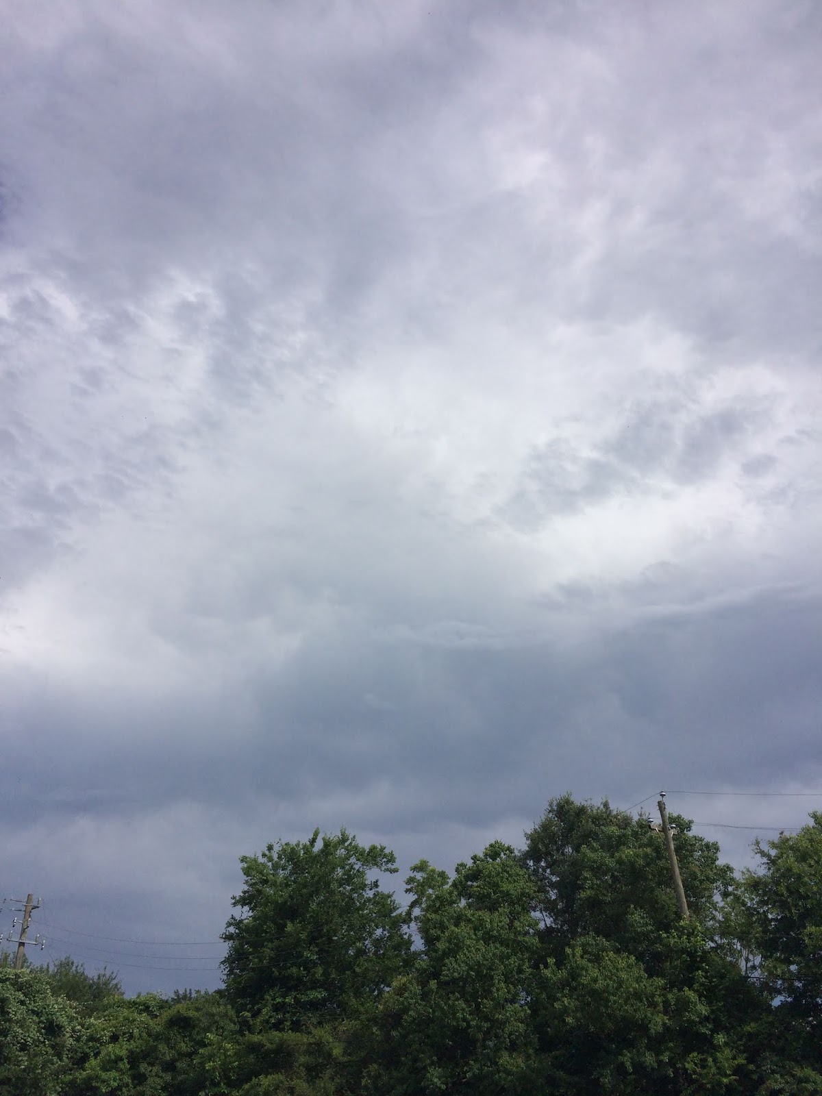
Southeast Houston, TX, during the late morning, at the pet resort that I work for.


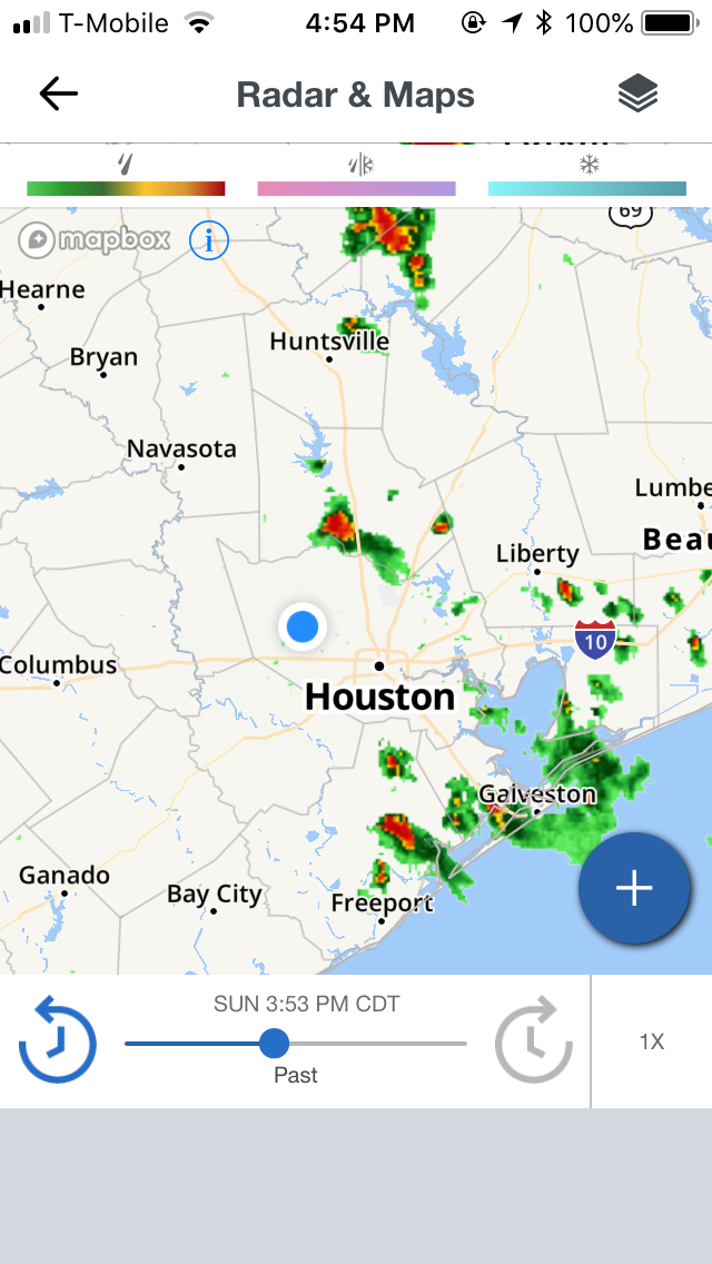
Houston, TX radar, during the early afternoon.

Gulf of Mexico radar, showing sub-tropical storm Alberto, during the early afternoon.
Houston, TX radar, during the mid-afternoon.

Air Quality Alert issued for the Houston, TX area. Picture taken during the late afternoon.

Houston, TX radar, during the late afternoon.

Northwest Houston, TX, on my way to drop off my friend at his house in northwest Houston, TX, from my house in northwest Houston, TX.

Northwest Houston, TX, on my way to my house in northwest Houston, TX, from dropping off my friend at his house in northwest Houston, TX.

Houston, TX radar, during the early night.

The Gulf of Mexico radar, showing sub-tropical storm Alberto, during the early night.
Area Forecast Discussion
Issued by NWS Houston/Galveston, TX
Issued by NWS Houston/Galveston, TX
Versions: 1 2 3 4 5 6 7 8 9 10 11 12 13 14 15 16 17 18 19 20 21 22 23 24 25 26 27 28 29 30 31 32 33 34 35 36 37 38 3940 41 42 43 44 45 46 47 48 49 50
000
FXUS64 KHGX 280239
AFDHGX

Area Forecast Discussion
National Weather Service Houston/Galveston TX
939 PM CDT Sun May 27 2018

.UPDATE...
Based on radar trends and loss of daytime heating have taken
precipitation out for the night. Have left patchy fog mention in
for west central zones...consistent with short range ensemble
forecasts showing potential for lower visibilities there. No
changes to temperature or sky forecast for the overnight.

&&

.AVIATION [00Z TAF Issuance]...

So far, much quieter weather across SE TX this evening. The loss
of daytime heating helping things to settle down. Drier air will
continue filter down into the region from the north/west through
the next few days so, will be keeping with the mostly VFR trends.
41

&&

.PRELIMINARY POINT TEMPS/POPS...

College Station (CLL)  73  95  73  95  74 /  10  10  10  10  10
Houston (IAH)          75  94  75  95  76 /  10  10  10  10  10
Galveston (GLS)        79  90  79  90  80 /  10  10  10  10  10

&&

.HGX WATCHES/WARNINGS/ADVISORIES...

TX...None.
GM...None.

&&

$$

UPDATE...18
Hazardous Weather Outlook
Hazardous Weather Outlook National Weather Service Houston/Galveston TX 424 AM CDT Sun May 27 2018 TXZ163-164-176>179-195>200-210>214-226-227-235>238-300-313- 335>338-436>438-280930- Austin-Brazoria Islands-Brazos-Burleson-Chambers-Coastal Brazoria- Coastal Galveston-Coastal Harris-Coastal Jackson- Coastal Matagorda-Colorado-Fort Bend- Galveston Island and Bolivar Peninsula-Grimes-Houston- Inland Brazoria-Inland Galveston-Inland Harris-Inland Jackson- Inland Matagorda-Madison-Matagorda Islands-Montgomery- Northern Liberty-Polk-San Jacinto-Southern Liberty-Trinity-Walker- Waller-Washington-Wharton- 424 AM CDT Sun May 27 2018 This hazardous weather outlook is for portions of Southeast Texas.. .DAY ONE...Today and Tonight Isolated thunderstorms will be possible today mainly east of a Madisonville to Wharton line. Some of the storms could become strong to severe with damaging straight line winds and hail. .DAYS TWO THROUGH SEVEN...Monday through Saturday Heat index values will increase above 100 degrees this week values will slowly increase through the week with the hottest conditions expected by the end of the week. Heat related illnesses will be an issue and people need to be careful engaging in outdoor activities. If outside people need to stay hydrated and take frequent breaks to avoid heat exhaustion or heat stroke. A heat advisory may be needed later this week. .SPOTTER INFORMATION STATEMENT... Spotter activation may be needed this afternoon. $$Air Quality Alert
TXZ213-237-238-313-337-338-437-438-290000- AIR QUALITY ALERT MESSAGE TEXAS COMMISSION ON ENVIRONMENTAL QUALITY RELAYED BY NATIONAL WEATHER SERVICE HOUSTON/GALVESTON TX 142 PM CDT Sun May 27 2018 ...OZONE ACTION DAY FOR MONDAY... THE TEXAS COMMISSION ON ENVIRONMENTAL QUALITY (TCEQ)...HAS ISSUED AN OZONE ACTION DAY FOR THE HOUSTON...GALVESTON...AND BRAZORIA AREAS FOR MONDAY...MAY 28. ATMOSPHERIC CONDITIONS ARE EXPECTED TO BE FAVORABLE FOR PRODUCING HIGH LEVELS OF OZONE POLLUTION IN THE HOUSTON...GALVESTON AND SURROUNDING AREAS ON MONDAY. YOU CAN HELP PREVENT OZONE POLLUTION BY SHARING A RIDE...WALKING...RIDING A BICYCLE...TAKING YOUR LUNCH TO WORK...AVOIDING DRIVE THROUGH LANES...CONSERVING ENERGY...AND KEEPING YOUR VEHICLE PROPERLY TUNED. FOR MORE INFORMATION ON OZONE: OZONE: THE FACTS (WWW.TCEQ.TEXAS.GOV/AIRQUALITY/MONOPS/OZONEFACTS.HTML) EPA AIR NOW: (WWW.AIRNOW.GOV/INDEX.CFM?ACTION=AIRNOW.LOCAL_CITY&CITYID=236) TAKE CARE OF TEXAS: (WWW.TAKECAREOFTEXAS.ORG/AIR/AIRQUALITY) $$
Locations: Northwest, southwest, southeast, the heights, and downtown Houston, TX.
Thoughts: The day was mostly sunny, dry, and hot, except for the small amount of isolated rain showers and possible thunderstorms, or maybe thundershowers that passed through the Houston, TX area, during different times of the day. I enjoyed the moderately heavy shower that I drove through in northwest Houston, TX, on my way to drop off my friend at his house in northwest Houston