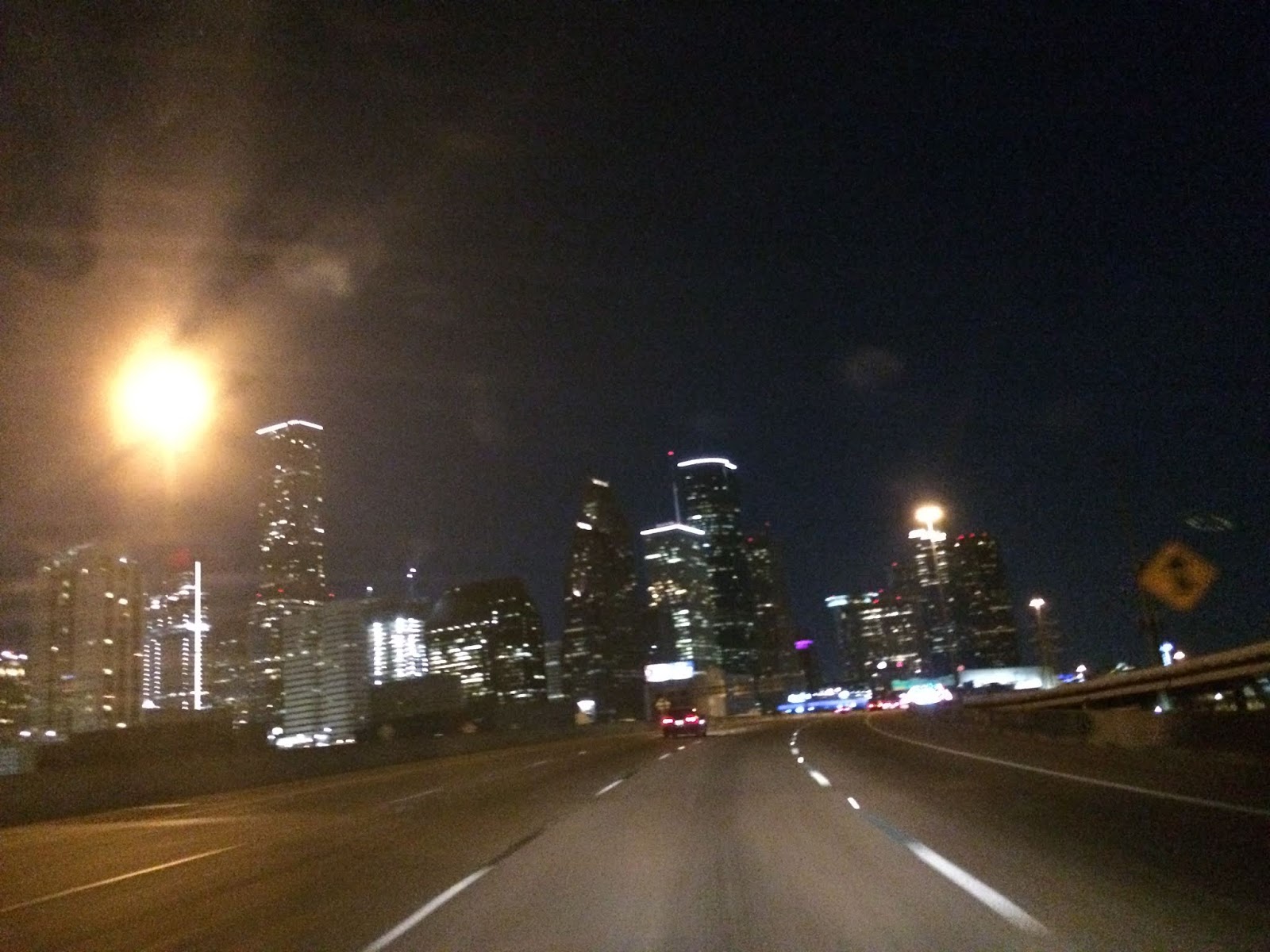
Friday, June 22, 2018

June. 21 18

River Flood Warning issued for a river in the Houston, TX area, during the early morning.
Houston, TX radar, during the early morning.
Northwest Houston, TX, during the early morning, on my way to the pet resort that I work for in southeast Houston, TX, from where I live in northwest Houston, TX.
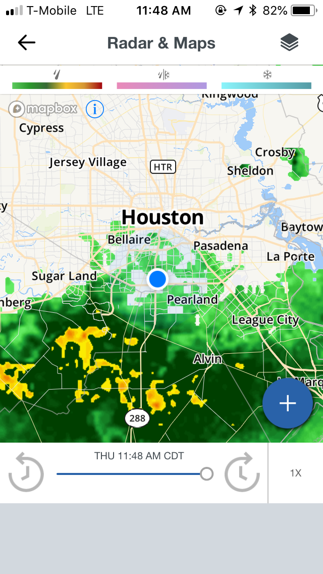
Houston, TX radar, during the late morning.
The heights area of Houston, TX, I think, during the late afternoon, on my way to where I live in northwest Houston, TX, from the pet resort that I work for in southeast Houston, TX.
Houston, TX radar, during the early evening.
At a Shell gas station on Hempstead, during the early evening, eating Wendy's for lunch.
Northwest Houston, TX, during the early evening, on my way to where I live in northwest Houston, TX.
Houston, TX radar, during the early night.


Locations: Northwest, southwest, southeast, the heights, and downtown Houston, TX.


Thoughts: The last remnants of moisture from the tropical wave that had been over the Houston, TX area the last couple of days brought another round of light to moderately heavy rain with some heavy rain, before leaving the Houston, TX area completely during the night. 


Area Forecast Discussion 
Issued by NWS Houston/Galveston, TX
Home | Current Version | Previous Version | Text Only | Print | Product List | Glossary Off
Versions: 1 2 3 4 5 6 7 8 9 10 11 12 13 14 15 16 17 18 19 20 21 22 23 24 25 26 27 28 29 30 31 32 33 34 35 36 37 38 3940 41 42 43 44 45 46 47 48 49 50
000
FXUS64 KHGX 220423
AFDHGX

Area Forecast Discussion
National Weather Service Houston/Galveston TX
1123 PM CDT Thu Jun 21 2018

.DISCUSSION...

06Z Aviation...Still seeing widespread cirrus clouds moving west
to east across SE TX. A few patches of low clouds near the coast,
but not any extending inland yet. Expect some areas of MVFR and
possibly IFR ceilings to form toward morning, but not as confident
as earlier on the extent of the coverage based on the latest
guidance. So I have opted for a TEMPO MVFR ceilings at many inland
TAF sites. Some patchy MVFR fog areas are possible as well toward
morning...but the thick cirrus should keep the fog patchy. 33

&&

.PREV DISCUSSION... /ISSUED 1014 PM CDT Thu Jun 21 2018/

DISCUSSION...
Made a few slight adjustments to grids with this update taking
precip chances out for the night based on radar trends and loss of
daytime heating. Remains extremely humid with dewpts in the mid
to upper 70s. Wouldnt be suprised some patchy fog in spots but
higher clouds an inhibiting factor. Models show ridging and drying
tomorrow so any shower and thunderstorm activity should be much
more limited. Kept 20 percent pops in for Friday afternoon with
max heating for possibility of isolated convection. 18

PREV DISCUSSION... /ISSUED 613 PM CDT Thu Jun 21 2018/

DISCUSSION...

00Z Aviation...A quiet radar this evening with just a couple
showers located south of CLL. The main concern for the next 24
hrs is the formation of low clouds in the MVFR/IFR range in the 8Z
to 14Z window. Have opted to include a ceiling of 1000 feet at
most inland TAF sites by 10Z based on model guidance and given the
abundant low-level moisture that is present. Could also see
patchy MVFR fog late tonight/early tomorrow as well. 33

&&

.PRELIMINARY POINT TEMPS/POPS...
College Station (CLL)      76  96  75  96  77 /  10  10  10  10  10
Houston (IAH)              77  95  77  94  79 /  20  20  10  10  10
Galveston (GLS)            81  88  81  89  82 /  10  10  10  10  10

&&

.HGX WATCHES/WARNINGS/ADVISORIES...
TX...NONE.
GM...NONE.
&&

$$

Discussion...33

Hazardous Weather Outlook

Hazardous Weather Outlook
National Weather Service Houston/Galveston TX
356 AM CDT Thu Jun 21 2018

TXZ163-164-176>179-195>200-210>214-226-227-235>238-300-313-
335>338-436>438-220900-
Austin-Brazoria Islands-Brazos-Burleson-Chambers-Coastal Brazoria-
Coastal Galveston-Coastal Harris-Coastal Jackson-
Coastal Matagorda-Colorado-Fort Bend-
Galveston Island and Bolivar Peninsula-Grimes-Houston-
Inland Brazoria-Inland Galveston-Inland Harris-Inland Jackson-
Inland Matagorda-Madison-Matagorda Islands-Montgomery-
Northern Liberty-Polk-San Jacinto-Southern Liberty-Trinity-Walker-
Waller-Washington-Wharton-
356 AM CDT Thu Jun 21 2018

This hazardous weather outlook is for portions of Southeast Texas..

.DAY ONE...Today and Tonight

Showers and thunderstorms today will be capable of producing
locally heavy rain across Southeast Texas. This threat is expected
to diminish by this evening.

.DAYS TWO THROUGH SEVEN...Friday through Wednesday

Heat index values may peak in the 102 to 108 degree range Friday,
Saturday, and Sunday across Southeast Texas. A Heat Advisory may
be needed at some point this weekend.

.SPOTTER INFORMATION STATEMENT...

Spotters are encouraged to report rain totals or any flooding
observed to the National Weather Service.

$$

Tuesday, June 12, 2018

Mar. 31 18

River Warnings issued for the Houston, TX area, from previous days rains, during the early morning.

Driving on 610, I think, near downtown Houston, TX, during the early morning, on my way to the pet resort that I work at in southeast Houston, TX, from where I live in northwest Houston, TX.
At the pet resort that I work at in southeast Houston, TX, during early morning.
At the pet resort that I work at in southeast Houston, TX, during the mid-morning.
West Houston, TX, near the Town and Country Center, I am pretty sure, during the mid-afternoon, getting Quizno's for lunch, I believe.
West Houston, TX, near the Town and Country Center, I am pretty sure, during the late afternoon.


Locations: Northwest, southwest, southeast, west, downtown, and maybe the heights area of Houston, TX.


Thoughts: Too long ago for me to remember. The day was sunny, dry, and very warm, maybe hot, I believe.

Jun. 11 18

Houston, TX radar, during the early morning.
Houston, TX radar, during the mid-morning.
Southeast Houston, TX, during the late afternoon, at the pet resort that I work for, I think.
West Park Tollway, I think, in , or maybe near west, or southwest Houston, TX, during the early evening, on my way to visit my friend at his house in Cypress, TX, from the pet resort that I work for in southeast Houston, TX.
Cypress, TX, I am pretty sure, during the early evening, still on my way to visit my friend at his house in Cypress, TX.
Houston, TX radar, during the early night.


Area Forecast Discussion 
Issued by NWS Houston/Galveston, TX
Home | Current Version | Previous Version | Text Only | Print | Product List | Glossary Off
Versions: 1 2 3 4 5 6 7 8 9 10 11 12 13 14 15 16 17 18 19 20 21 22 23 24 25 26 27 28 29 30 31 32 33 34 35 36 37 38 3940 41 42 43 44 45 46 47 48 49 50
540
FXUS64 KHGX 120244
AFDHGX

Area Forecast Discussion
National Weather Service Houston/Galveston TX
944 PM CDT Mon Jun 11 2018

.UPDATE...
Fairly quiet night is in store for the area. The previous forecast
appears to be on track, and only minor adjustments were made to
account for current observations.

11

&&

.PREV DISCUSSION... /ISSUED 643 PM CDT Mon Jun 11 2018/

AVIATION [00Z TAF Issuance]...

Storms over central Texas have dissipated so we will likely see
VFR conditions going into the overnight. Like last night there
will be a mix of MVFR/VFR decks beginning 07-09Z mainly for
KCLL/KUTS/KCXO and perhaps KIAH/KSGR. KLBX may also have some
higher MVFR ceilings but could be more transient. Upper level
short wave trough over the area now should weaken and combine with
a broader trough over the Gulf. Overall think this will limit the
chances for convection with large scale lift decreasing and
moisture looks to decrease as well with PWAT dropping to below 1.5
inches by tomorrow evening. There still may be some 20 knot wind
gusts tomorrow afternoon but likely just fair weather cumulus.

Overpeck

PREV DISCUSSION /Issued 340 PM CDT Mon Jun 11 2018/...

DISCUSSION...
Status quo through mid week with all eyes on the extended forecast
this weekend. Whatever evolves out of the Caribbean sea looks to
bring increased moisture and rain chances to the region into early
next week.

NEAR TERM [Through Tonight]...
Convection is struggling to maintain itself over the Piney Woods,
likely owing to the presence of a capping inversion located between
800-750 MB on aircraft soundings out of Houston. Afternoon visible
satellite does show some enhancement in altocumulus over Central
Texas, likely enhanced by a compact shortwave trough drifting
towards the ArkLaTex. Will need to keep an eye on this activity
heading into the evening hours as high resolution guidance is
attempting to bring at least decaying remnants of this activity
into the Brazos Valley as it appears to be forced at a level above
the capping inversion and should be unaffected by the cap. Cannot
rule out a quick shot of rain for a few lucky folks through early
evening as a result, but dry conditions will be the rule for most
this evening.

Isentropic upglide will again produce periods of low stratus
overnight across the region, helping to keep overnight lows in the
mid 70s to lower 80s. Despite lighter southerly surface winds
tonight, near surface winds in the 15-20 knot range should provide
enough mechanical mixing to mitigate against light fog outside of
sheltered or low-lying areas.

SHORT TERM [Tuesday Through Wednesday Night]...
More of the same Tuesday into Thursday with warm and humid
conditions holding each day, with a slight chance of afternoon
showers/thunderstorms Tuesday and Wednesday. Mostly sunny skies
will once again bring sufficient mixing to support generally 10-15
mph onshore winds which will help the afternoon heat somewhat.

LONG TERM [Thursday Through Monday]...
As a plume of tropical moisture overspreads the region, chances
for some much needed rain will increase late this week and
increase further into early next week. Much of this depends on
the evolution of tropical wave being monitored by NHC for possible
development over the next 5 days as it moves across the Caribbean
and into the southern Gulf of Mexico. Currently NHC has a low
probability (20% chance) of a distinct surface low
forming/closing-off, although models show more agreement in
influx of deep moisture and increasing rain chances over se TX,
specifically Sunday into Monday. Clouds and rain chances will
lower temps a bit in the extended at least.

MARINE...
Persistent onshore flow will support maintaining exercise caution
wording for offshore waters with slightly elevated winds/seas
through daybreak tomorrow. We should see onshore winds gradually
diminish into the mid-week. In the later periods, mostly Friday
through the weekend, we could see conditions gradually worsen with
increased long-swell and rain/tstm chances. Details of these
conditions will depend on how anything develops in the
southern/western Gulf this weekend.

TROPICAL...
Not a whole lot to add here, although all eyes are monitoring the
disturbed area moving across the Caribbean sea early this week, as
highlighted by latest 5 day graphical outlook from NHC (20%
probability of development in next 5 days). Considerable
uncertainty remains at this time with this `system` given lack of
any real consensus of a closed low forming in the operational
models. However, more there is a more consistent signal bringing
a fetch of deep moisture and increase in offshore winds across
the western Gulf this weekend. Therefore, rainfall chances are
increasing Sunday into Monday- some of which could be heavy. The
details are too murky to have any confidence in specifics given
the extended range of these possible impacts, however.

&&

.PRELIMINARY POINT TEMPS/POPS...
College Station (CLL)      77  96  73  94  73 /  20  10  10  20  10
Houston (IAH)              78  95  75  92  75 /  10  20   0  20  10
Galveston (GLS)            83  91  82  86  81 /  10  10  10  20  20

&&

.HGX WATCHES/WARNINGS/ADVISORIES...
TX...High Rip Current Risk until midnight CDT tonight for the
     following zones: Brazoria Islands...Galveston Island and
     Bolivar Peninsula...Matagorda Islands.

GM...SMALL CRAFT SHOULD EXERCISE CAUTION until 4 AM CDT Tuesday for
     the following zones: Coastal waters from Freeport to
     Matagorda Ship Channel TX out 20 NM...Coastal waters from
     High Island to Freeport TX out 20 NM...Waters from Freeport
     to Matagorda Ship Channel TX from 20 to 60 NM...Waters from
     High Island to Freeport TX from 20 to 60 NM.

&&

$$

Discussion...11


Locations: Northwest, southwest, southeast, and maybe west Houston, TX, Katy, TX, Fulshear, TX, and Cypress, TX.


Thoughts: The day was sunny, mostly cloudy, dry, and hot. There is some rain in the forecast for the Houston, TX area, late this week. I am hoping to see some more rain. Summer time rain is one of my favorite types of weather. Especially since it cools things down.

Sunday, June 10, 2018

Jun. 9 18

Houston, TX radar, during the early morning.
Houston, TX radar, during the late morning.

Houston, TX radar, during the early afternoon.
West Houston, TX, during the early afternoon, waiting for my mom to finish shopping with my older sister, at the Town and Country Center.
West Houston, TX, during the early afternoon, at my dad's store, waiting for the alterations store to let me in and alter my suit for my older sisters wedding.


Northwest Houston, TX, during the early afternoon, on my way back to my house with my mom, from my dad's store and the alterations store.

A severe thunderstorm warning and special weather statement issued for parts of the Houston, TX area, during the mid-afternoon.
Houston, TX radar, during the mid-afternoon.
Houston, TX radar, during the late afternoon.
Houston, TX radar, during the early evening.


Locations: Northwest and west Houston, TX.


Thoughts: I enjoyed the scattered showers and thunderstorms.

Saturday, June 9, 2018

Jun. 8 18

Northwest, maybe north Houston, TX, during the late morning.
Houston, TX radar, during the early afternoon.
North Houston, TX, during the early afternoon, at a Hyatt Regency hotel, about to leave, after volunteering to help The Houston Cat Club setup for a CFA cat show.
North, or maybe northwest Houston, TX, during the early afternoon, getting gas at a gas station.
Houston, TX radar, during the mid-afternoon.
Northwest, or maybe north Houston, TX, during the mid-afternoon.
Northwest Houston, TX, I think, during the mid-afternoon, at my house, I think.
Houston, TX radar, during the late afternoon.
Northwest Houston, TX, during the late afternoon, at my house.
Houston, TX radar, during the early evening.
Northwest Houston, TX, during the early evening, at my house.
Houston, TX radar, during the late evening.
Northwest Houston, TX, during the late evening, at my house.


Area Forecast Discussion 
Issued by NWS Houston/Galveston, TX

Home | Current Version | Previous Version | Text Only | Print | Product List | Glossary Off
Versions: 1 2 3 4 5 6 7 8 9 10 11 12 13 14 15 16 17 18 19 20 21 22 23 24 25 26 27 28 29 30 31 32 33 34 35 36 37 38 3940 41 42 43 44 45 46 47 48 49 50
000
FXUS64 KHGX 090450
AFDHGX

Area Forecast Discussion
National Weather Service Houston/Galveston TX
1150 PM CDT Fri Jun 8 2018

.AVIATION...
Little change in the 06Z update. VFR conditions will continue
through the morning hours. CLL still stands the best chance of
some potential MVFR ceilings in the early morning. LBX, SGR, and
CXO also may see ceilings lower along with some patchy fog around
09Z once the wind speeds become more light and variable. Have
lowered CXO visibilities slightly based on low level moisture and
winds becoming light to calm in the early morning. Southeast
winds should turn out of the south in the afternoon and increase
to 7-11 kts. Based on short-term model guidance trends have also added
VCSH at the metro and coastal TAF sites beginning late morning
and through the afternoon hours.

Hathaway

&&

.PREV DISCUSSION... /ISSUED 924 PM CDT Fri Jun 8 2018/

DISCUSSION...

Isolated showers and storms have dissipated. The current forecast
is on track. The only update is to adjust hourly temps and cloud
cover to the near term trends. 33

PREV DISCUSSION... /ISSUED 706 PM CDT Fri Jun 8 2018/

AVIATION...
Radar imagery this evening shows the remaining showers fizzling
out over southeast Texas. VFR conditions can be expected across
most of the terminals overnight and through the morning hours. CLL
still stands the best chance of some potential MVFR ceilings in
the early morning, similar to yesterday. LBX, SGR, and CXO also
may see ceilings lower along with some patchy fog around 09Z once
the wind speeds become more light and variable. Shortly after
sunrise, winds should turn from out of the southeast and by the
afternoon southerly winds should increase to 7-11 kts. Short term
guidance hints at isolated SHRA development near some of the
Houston metro sites and further west over LBX and SGR tomorrow.
Have included VCSH at LBX, SGR, and IAH for now beginning late
morning and through the afternoon hours.

Hathaway

&&

.PRELIMINARY POINT TEMPS/POPS...
College Station (CLL)      97  73  94  74  93 /  10  10  10  10  20
Houston (IAH)              95  74  93  75  92 /  20  10  20  10  30
Galveston (GLS)            88  80  87  81  87 /  20  10  20  10  30

&&

.HGX WATCHES/WARNINGS/ADVISORIES...
TX...NONE.
GM...NONE.
&&

$$

Discussion...33
Aviation/Marine...08


Locations: Northwest and north Houston, TX.


Thoughts: A relatively dry, hot, and sunny day, apart from the isolated 
showers and thunderstorms. A isolated thunderstorm passed near my house 
with lots of low rumbles of thunder and maybe a few lightning strikes
with a brief light sprinkle, during the early evening.

Wednesday, June 6, 2018

Jun. 5 18

Northwest Houston, TX, during the mid-afternoon, at Burlington Coat Factory getting clothes for my older sisters wedding with my mom.
Northwest Houston, TX, during the mid-afternoon, getting gas at a Shell gas station.
Northwest Houston, TX, during the late afternoon, getting gas at a Shell gas station.


Area Forecast Discussion 
Issued by NWS Houston/Galveston, TX

Home | Current Version | Previous Version | Text Only | Print | Product List | Glossary Off
Versions: 1 2 3 4 5 6 7 8 9 10 11 12 13 14 15 16 17 18 19 20 21 22 23 24 25 26 27 28 29 30 31 32 33 34 35 36 37 38 3940 41 42 43 44 45 46 47 48 49 50
705
FXUS64 KHGX 060240
AFDHGX

Area Forecast Discussion
National Weather Service Houston/Galveston TX
940 PM CDT Tue Jun 5 2018

.UPDATE...
Temperatures still plenty warm at 900 PM with temps currently in
the mid/upper 80s. Winds have been slow to decouple and the
pressure gradient is still kind of tight across the middle coast
into east Texas. The winds will eventually weaken and clouds will
begin to fill in over the W-NW parts of the region. Would not be
surprised if some patchy shallow ground fog also briefly developed
toward sunrise.

The few storms that managed to develop have since waned with the
loss of daytime heating. However, the boundary that the storms
fired on continues to languish over extreme east Texas. The 00Z
HiRes ARW continues to suggest that this boundary will become
active between around 21z and this is supported by the HiRes NMM.
The new 00z NAM is coming in dry but breaking things apart via
fcst soundings shows some potential for storms with steeep lapse
rates, little to no capping and convective temperatures in the
lower/middle 90s.

Updated some hourly T,Td and sky grids and added some patchy fog
to the weather grids. Won`t touch Wednesday until more 00z data
arrives. 43

&&

.PREV DISCUSSION... /ISSUED 646 PM CDT Tue Jun 5 2018/

AVIATION [00Z TAF Issuance]...
VFR conditions should remain across all TAF sites until the early
morning hours, when patchy stratus should develop similar to this
morning. Holding on to MVFR ceilings beginning around 09Z and
lasting until 15Z mainly at the inland terminals, before rising
and beginning to mix out with the help of daytime heating. Patchy
stratus should be shorter lived at the sites closer to and along
the coast. Light south/southeasterly winds will veer southwesterly
shortly after sunrise, before increasing to 7-11 kts by the
afternoon hours. Spotty showers will be possible mainly east of
I-45 tomorrow afternoon, associated with a weak disturbance that
slides south across the region around the upper-level ridge. Have
not included the mention of VCSH in the eastern TAF sites such as
UTS and CXO as best coverage still appears well east of these
sites. Will continue to monitor trends in short term model
guidance and make any necessary changes regarding precipitation
development in the 06Z TAF package.

Hathaway

PREV DISCUSSION /Issued 354 PM CDT Tue Jun 5 2018/...

SHORT TERM [Wednesday Through Thursday Night]...

Upper level pattern tomorrow has the short wave trough to the east
over Louisiana moving into the Northern Gulf on Wednesday. Upper
level ridging remains over Mexico into west Texas leaving
northerly flow aloft from north Texas to the NW Gulf. Forecasters
are always a little leary of NW/N flow aloft patterns as jet
streaks and vorticity maximum can sneak into the flow and initiate
convection that was not previously forecast. Forecast will keep
20/30 PoPs for Wednesday due to this pattern mainly for afternoon
convection. Synoptic and mesoscale models only produce isolated if
any convection tomorrow even with moderate instability, little
capping and 1.5-1.7 precipitable water values. SPC keeps area in a
general thunderstorm risk given the stalled outflow and frontal
boundary along with the northerly flow. Again should a storm form,
it looks like hail and damaging winds will be main threat given
instability and inverted V sounding profile in the boundary layer.

Thursday it looks like there will be more subsidence from being on
the back side of the trough and getting closer to the upper level
ridge building over west Texas.

LONG TERM [Friday Through Tuesday]...

Overall the upper level ridging expands over Texas but remains
somewhat weak. This does open the opportunity for thunderstorm
chances. Models hit Sunday harder of all of the days going forward
but there is no strong signal. Upper level support is not great
for rain chances Sunday but will basically keep 20 PoPs going
until there is a more substantial trend in the models. Even the
GFS does not show much of an increase in precipitable water values
during this time with 1.5-1.7 inches. Until there are better
model trends and support for convection, best tactic will be to
take forecasting convection as it comes in the near/short term
leaning on synoptic/mesoscale analysis.

Overpeck

MARINE...
The onshore flow should continue through the upcoming week. A
common pattern of slightly stronger winds during night weakening
during the morning then increasing again early evening should be
repeating most of the upcoming 5 days. A surge of deeper moisture
looks to take aim on the area late Saturday and through Sunday
night with an increase in the chance of showers and possibly a few
thunderstorms for the marine area. Not that an isolated shower is
out of the realm of possibility in the intervening days but
chances looks low. Seas should remain in the 1 to 3 feet nearshore
and 2 to 4 offshore. Will keep an eye on a forecast area of
showers and thunderstorms in the extreme northeastern region of
the Gulf. No unusual tide issues expected this week. 45

FIRE WEATHER...
Rain-free conditions should prevail across the southwest and for
that matter outside the few areas that get much in the way of
showers or thunderstorms across the east and Galveston Bay area.
The point being that with little rain the drought conditions
should gradually worsen over the coming week. Winds this coming
week though should remain fairly restrained. 45

&&

.PRELIMINARY POINT TEMPS/POPS...
College Station (CLL)      75  95  75  95  74 /  10  10   0  10   0
Houston (IAH)              78  95  76  94  75 /  20  20   0  10  10
Galveston (GLS)            81  90  81  90  81 /  10  20  10  10  10

&&

.HGX WATCHES/WARNINGS/ADVISORIES...
TX...NONE.
GM...NONE.
&&

$$

Discussion...43

Hazardous Weather Outlook

Hazardous Weather Outlook
National Weather Service Houston/Galveston TX
339 AM CDT Tue Jun 5 2018

GMZ330-335-350-355-370-375-TXZ163-164-176>179-195>200-210>214-226-
227-235>238-300-313-335>338-436>438-061200-
Austin-Brazoria Islands-Brazos-Burleson-Chambers-Coastal Brazoria-
Coastal Galveston-Coastal Harris-Coastal Jackson-
Coastal Matagorda-
Coastal waters from Freeport to Matagorda Ship Channel TX out
20 NM-Coastal waters from High Island to Freeport TX out 20 NM-
Colorado-Fort Bend-Galveston Bay-
Galveston Island and Bolivar Peninsula-Grimes-Houston-
Inland Brazoria-Inland Galveston-Inland Harris-Inland Jackson-
Inland Matagorda-Madison-Matagorda Bay-Matagorda Islands-
Montgomery-Northern Liberty-Polk-San Jacinto-Southern Liberty-
Trinity-Walker-Waller-Washington-
Waters from Freeport to Matagorda Ship Channel TX from 20 to
60 NM-Waters from High Island to Freeport TX from 20 to 60 NM-
Wharton-
339 AM CDT Tue Jun 5 2018

This hazardous weather outlook is for portions of Southeast Texas.

.DAY ONE...Today and Tonight

Shower and thunderstorm development will be possible, mainly to
the north and east of a Midway to Lake Livingston line. Some of
this activity might have the potential to become strong or severe.
Gusty winds and locally heavy rainfall appear to be the main
severe weather threats.

.DAYS TWO THROUGH SEVEN...Wednesday through Monday

No hazardous weather is expected at this time.

.SPOTTER INFORMATION STATEMENT...

Spotter activation is not anticipated at this time.

$$

Locations: Northwest Houston, TX.


Thoughts: The day was hot, sunny, and dry. I don't think there were any showers, or thunderstorms, but there might have been some isolated showers and thunderstorms in and around the Houston, TX area, sometime during the day.