
River Flood Warning issued for a river in the Houston, TX area, during the early morning.

Houston, TX radar, during the early morning.

Northwest Houston, TX, during the early morning, on my way to the pet resort that I work for in southeast Houston, TX, from where I live in northwest Houston, TX.
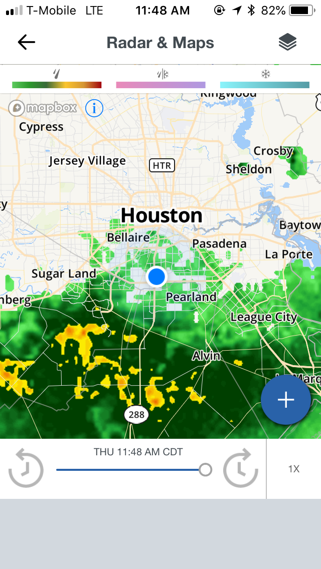
Houston, TX radar, during the late morning.

The heights area of Houston, TX, I think, during the late afternoon, on my way to where I live in northwest Houston, TX, from the pet resort that I work for in southeast Houston, TX.

Houston, TX radar, during the early evening.

At a Shell gas station on Hempstead, during the early evening, eating Wendy's for lunch.

Northwest Houston, TX, during the early evening, on my way to where I live in northwest Houston, TX.

Houston, TX radar, during the early night.
Locations: Northwest, southwest, southeast, the heights, and downtown Houston, TX.
Thoughts: The last remnants of moisture from the tropical wave that had been over the Houston, TX area the last couple of days brought another round of light to moderately heavy rain with some heavy rain, before leaving the Houston, TX area completely during the night.
Area Forecast Discussion
Issued by NWS Houston/Galveston, TX
Issued by NWS Houston/Galveston, TX
Versions: 1 2 3 4 5 6 7 8 9 10 11 12 13 14 15 16 17 18 19 20 21 22 23 24 25 26 27 28 29 30 31 32 33 34 35 36 37 38 3940 41 42 43 44 45 46 47 48 49 50
000
FXUS64 KHGX 220423
AFDHGX

Area Forecast Discussion
National Weather Service Houston/Galveston TX
1123 PM CDT Thu Jun 21 2018

.DISCUSSION...

06Z Aviation...Still seeing widespread cirrus clouds moving west
to east across SE TX. A few patches of low clouds near the coast,
but not any extending inland yet. Expect some areas of MVFR and
possibly IFR ceilings to form toward morning, but not as confident
as earlier on the extent of the coverage based on the latest
guidance. So I have opted for a TEMPO MVFR ceilings at many inland
TAF sites. Some patchy MVFR fog areas are possible as well toward
morning...but the thick cirrus should keep the fog patchy. 33

&&

.PREV DISCUSSION... /ISSUED 1014 PM CDT Thu Jun 21 2018/

DISCUSSION...
Made a few slight adjustments to grids with this update taking
precip chances out for the night based on radar trends and loss of
daytime heating. Remains extremely humid with dewpts in the mid
to upper 70s. Wouldnt be suprised some patchy fog in spots but
higher clouds an inhibiting factor. Models show ridging and drying
tomorrow so any shower and thunderstorm activity should be much
more limited. Kept 20 percent pops in for Friday afternoon with
max heating for possibility of isolated convection. 18

PREV DISCUSSION... /ISSUED 613 PM CDT Thu Jun 21 2018/

DISCUSSION...

00Z Aviation...A quiet radar this evening with just a couple
showers located south of CLL. The main concern for the next 24
hrs is the formation of low clouds in the MVFR/IFR range in the 8Z
to 14Z window. Have opted to include a ceiling of 1000 feet at
most inland TAF sites by 10Z based on model guidance and given the
abundant low-level moisture that is present. Could also see
patchy MVFR fog late tonight/early tomorrow as well. 33

&&

.PRELIMINARY POINT TEMPS/POPS...
College Station (CLL)      76  96  75  96  77 /  10  10  10  10  10
Houston (IAH)              77  95  77  94  79 /  20  20  10  10  10
Galveston (GLS)            81  88  81  89  82 /  10  10  10  10  10

&&

.HGX WATCHES/WARNINGS/ADVISORIES...
TX...NONE.
GM...NONE.
&&

$$

Discussion...33
Hazardous Weather Outlook
Hazardous Weather Outlook
National Weather Service Houston/Galveston TX
356 AM CDT Thu Jun 21 2018

TXZ163-164-176>179-195>200-210>214-226-227-235>238-300-313-
335>338-436>438-220900-
Austin-Brazoria Islands-Brazos-Burleson-Chambers-Coastal Brazoria-
Coastal Galveston-Coastal Harris-Coastal Jackson-
Coastal Matagorda-Colorado-Fort Bend-
Galveston Island and Bolivar Peninsula-Grimes-Houston-
Inland Brazoria-Inland Galveston-Inland Harris-Inland Jackson-
Inland Matagorda-Madison-Matagorda Islands-Montgomery-
Northern Liberty-Polk-San Jacinto-Southern Liberty-Trinity-Walker-
Waller-Washington-Wharton-
356 AM CDT Thu Jun 21 2018

This hazardous weather outlook is for portions of Southeast Texas..

.DAY ONE...Today and Tonight

Showers and thunderstorms today will be capable of producing
locally heavy rain across Southeast Texas. This threat is expected
to diminish by this evening.

.DAYS TWO THROUGH SEVEN...Friday through Wednesday

Heat index values may peak in the 102 to 108 degree range Friday,
Saturday, and Sunday across Southeast Texas. A Heat Advisory may
be needed at some point this weekend.

.SPOTTER INFORMATION STATEMENT...

Spotters are encouraged to report rain totals or any flooding
observed to the National Weather Service.

$$
No comments:
Post a Comment