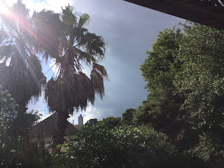
Northwest, maybe north Houston, TX, during the late morning.
Houston, TX radar, during the early afternoon.
North Houston, TX, during the early afternoon, at a Hyatt Regency hotel, about to leave, after volunteering to help The Houston Cat Club setup for a CFA cat show.
North, or maybe northwest Houston, TX, during the early afternoon, getting gas at a gas station.
Houston, TX radar, during the mid-afternoon.
Northwest, or maybe north Houston, TX, during the mid-afternoon.
Northwest Houston, TX, I think, during the mid-afternoon, at my house, I think.
Houston, TX radar, during the late afternoon.
Northwest Houston, TX, during the late afternoon, at my house.
Houston, TX radar, during the early evening.
Northwest Houston, TX, during the early evening, at my house.
Houston, TX radar, during the late evening.
Northwest Houston, TX, during the late evening, at my house.
Area Forecast Discussion
Issued by NWS Houston/Galveston, TX
Versions: 1 2 3 4 5 6 7 8 9 10 11 12 13 14 15 16 17 18 19 20 21 22 23 24 25 26 27 28 29 30 31 32 33 34 35 36 37 38 3940 41 42 43 44 45 46 47 48 49 50
000
FXUS64 KHGX 090450
AFDHGX

Area Forecast Discussion
National Weather Service Houston/Galveston TX
1150 PM CDT Fri Jun 8 2018

.AVIATION...
Little change in the 06Z update. VFR conditions will continue
through the morning hours. CLL still stands the best chance of
some potential MVFR ceilings in the early morning. LBX, SGR, and
CXO also may see ceilings lower along with some patchy fog around
09Z once the wind speeds become more light and variable. Have
lowered CXO visibilities slightly based on low level moisture and
winds becoming light to calm in the early morning. Southeast
winds should turn out of the south in the afternoon and increase
to 7-11 kts. Based on short-term model guidance trends have also added
VCSH at the metro and coastal TAF sites beginning late morning
and through the afternoon hours.

Hathaway

&&

.PREV DISCUSSION... /ISSUED 924 PM CDT Fri Jun 8 2018/

DISCUSSION...

Isolated showers and storms have dissipated. The current forecast
is on track. The only update is to adjust hourly temps and cloud
cover to the near term trends. 33

PREV DISCUSSION... /ISSUED 706 PM CDT Fri Jun 8 2018/

AVIATION...
Radar imagery this evening shows the remaining showers fizzling
out over southeast Texas. VFR conditions can be expected across
most of the terminals overnight and through the morning hours. CLL
still stands the best chance of some potential MVFR ceilings in
the early morning, similar to yesterday. LBX, SGR, and CXO also
may see ceilings lower along with some patchy fog around 09Z once
the wind speeds become more light and variable. Shortly after
sunrise, winds should turn from out of the southeast and by the
afternoon southerly winds should increase to 7-11 kts. Short term
guidance hints at isolated SHRA development near some of the
Houston metro sites and further west over LBX and SGR tomorrow.
Have included VCSH at LBX, SGR, and IAH for now beginning late
morning and through the afternoon hours.

Hathaway

&&

.PRELIMINARY POINT TEMPS/POPS...
College Station (CLL)      97  73  94  74  93 /  10  10  10  10  20
Houston (IAH)              95  74  93  75  92 /  20  10  20  10  30
Galveston (GLS)            88  80  87  81  87 /  20  10  20  10  30

&&

.HGX WATCHES/WARNINGS/ADVISORIES...
TX...NONE.
GM...NONE.
&&

$$

Discussion...33
Aviation/Marine...08
Locations: Northwest and north Houston, TX.
Thoughts: A relatively dry, hot, and sunny day, apart from the isolated
showers and thunderstorms. A isolated thunderstorm passed near my house
with lots of low rumbles of thunder and maybe a few lightning strikes
with a brief light sprinkle, during the early evening.


No comments:
Post a Comment