
Southeast, or maybe southwest Houston, TX, during the mid-morning, driving down Beltway 8, on my way to the pet resort that I work for in southeast Houston, TX. from my house in northwest Houston, TX.

Southeast Houston, TX, during the early afternoon, at McDonald's getting lunch.
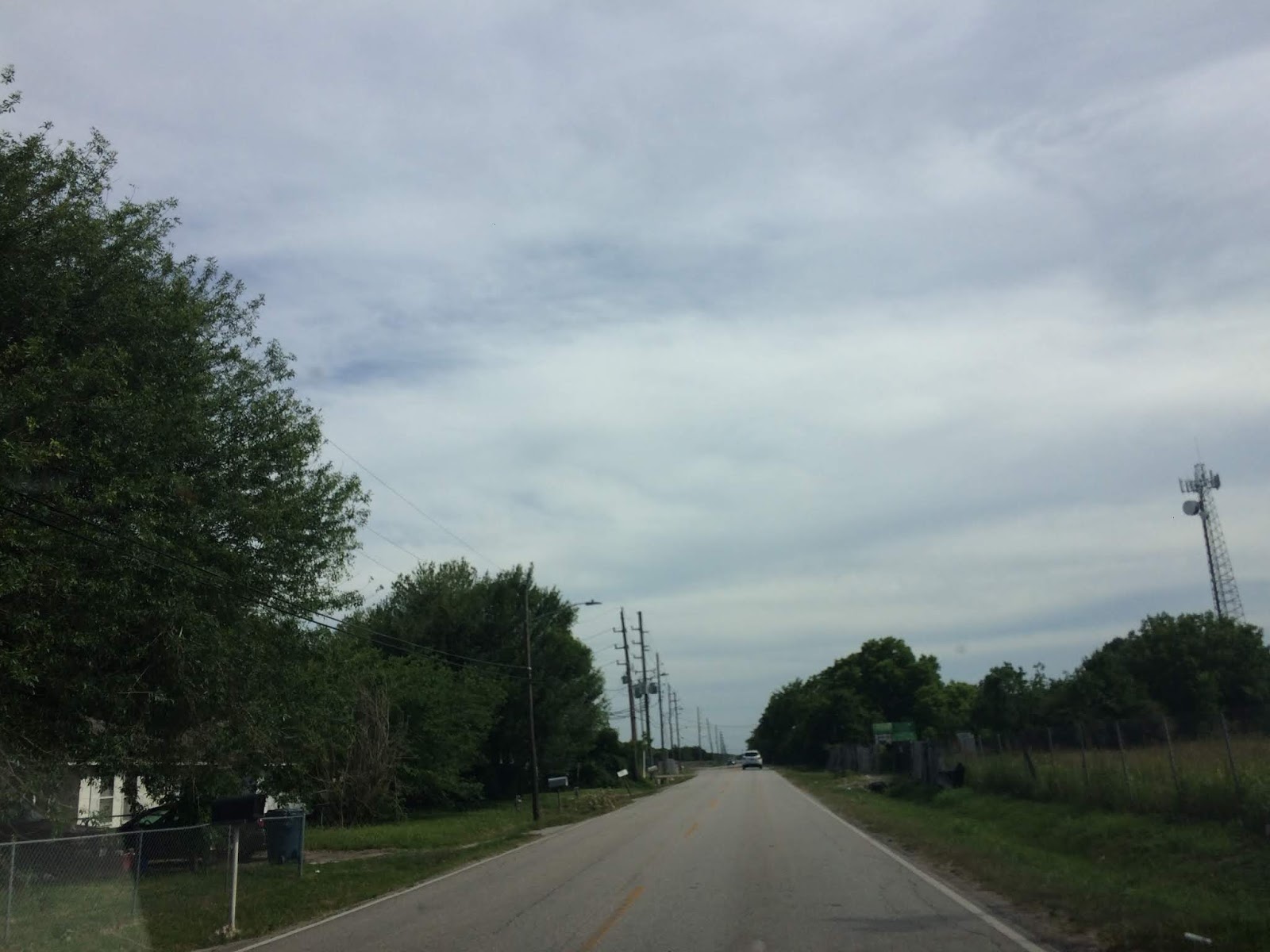
Southeast Houston, TX, during the late afternoon, on my way to my house in northwest Houston, TX.

Near the heights Houston, TX, I think, during the late afternoon, on my way home from the pet resort that I work at in southeast Houston, TX, to my house in northwest Houston, TX.

Near the heights Houston, TX, I think, during the early evening, on my way home from the pet resort that I work at in southeast Houston, TX, to my house in northwest Houston, TX.
Locations: Northwest, southwest, southeast, the heights, and downtown Houston, TX.
Thoughts: The day was very hot and sunny. I am eagerly awaiting some rain for Houston, TX. As of yet it doesn't look like Houston, TX will get any significant rainfall anytime soon.
Area Forecast Discussion
Issued by NWS Houston/Galveston, TX
Versions: 1 2 3 4 5 6 7 8 9 10 11 12 13 14 15 16 17 18 19 20 21 22 23 24 25 26 27 28 29 30 31 32 33 34 35 36 37 38 3940 41 42 43 44 45 46 47 48 49 50
000
FXUS64 KHGX 150240
AFDHGX

Area Forecast Discussion
National Weather Service Houston/Galveston TX
940 PM CDT Mon May 14 2018

.UPDATE...
No major changes.

11

&&

.PREV DISCUSSION... /ISSUED 620 PM CDT Mon May 14 2018/

AVIATION...
Generally VFR for SE TX TAFS the next day or so. Once again, could
see a brief period of MVFR CIGS and/or BR tomorrow morning (10-14Z)
and again on Wednesday morning at some sites (mainly north).  42

PREV DISCUSSION... /ISSUED 345 PM CDT Mon May 14 2018/

SHORT TERM/LONG TERM [Tonight Through Monday]...

Let`s review some Texas weather forecasting rules of thumb. First
all floods end in drought and all droughts end in floods. Second
when in drought, forecast more drought until it starts to rain -
when in flood, forecast more flood until it stops raining.
Drought monitor has some abnormal dryness and moderate drought to
the southwest of Houston. But Houston IAH is 2.55 inches below
normal rainfall since March 1 and 0.34 inches below for the year.
Houston HOU is down 3.65 inches below normal since March 1 and
3.49 inches below normal for the year. Given the current analysis
and forecast data going forward, there is little chance if any at
precipitation over the next 7 days.

Upper level analysis at the standard levels pretty much shows
upper level riding from 500mb up to 250mb over much of the Texas
Gulf Coast northeast to the Mid-South. Strong southwest jet stream
flow was noted from the southern Rockies across the Plains into
the Midwest which matches up pretty well with SPC`s day 1 slight
risk severe weather outlook. The area of no thunderstorms in the
outlook matches well with the location of the ridge. Surface
analysis shows weak high pressure over SW LA and SE Texas.

Looking at 500mb height analysis and forecasts from the
GFS/ECMWF/Canadian all pretty much show the same thing for the
next 7 days. Upper level ridging over the region remains in place
as a mean upper level trough sets up over the Great Basin through
the end of the week. This ridge may break down over the weekend
into early next week but the GFS/ECMWF hold onto higher heights
than the Canadian. The weak upper level trough over the eastern
Gulf takes its time meandering across that same region through the
end of the week. Models do takes this system inland over the
weekend and towards the Carolinas. Model run total precipitation
forecasts for each model range from 0 to 0.20 inches of rainfall
for the next 7 days across the area so think a dry forecast is
safe at this point. Temperatures are looking rather persistent
with high temperatures in the low 90s and low temperature sin the
low 70s maybe upper 60s in a few spots. High temperatures
Wednesday through Friday may reach the mid 90s as the upper ridge
builds more over the area.

We may need to really push heat safety this week. Heat index
values could reach the 96-100F range especially Thursday and
Friday this week. These are pretty typical numbers for later in
June but a bit high for mid May especially after a cool April.
People may not be quite acclimated to the heat and may overdo
outside activities leading to heat illnesses. The other factor to
consider will be the winds which with higher winds it will not
feel as hot. Winds will be around 5 mph for most of Thursday but
closer to 10 mph on Friday. This may make Thursday feel hotter
than Friday even though heat index values may be slightly higher
on Friday due to higher moisture.

Overpeck

MARINE...

Not a lot of changes expected with the upcoming marine forecast as
generally light onshore winds prevail through the short-term. This
pattern should shift a bit by mid-week as the surface high weakens
and a weak surface low develops near the FL panhandle. This should
result in a more W/SW low-level flow across the region during this
time frame. However, not expecting any issues with the system here
given the progged mid/upper pattern(s). Tides will continue to run
near normal. No Caution/Advisory flags through the week. 41

TROPICAL...

National Hurricane Center is tracking a non-tropical area of low
pressure over the eastern Gulf. Right now NHC has lowered the
probability of development down to 30 percent over the next 5
days. Biggest problem for any type of development will be drier
air on the west side of this area of low pressure seen on water
vapor imagery. This system should not affect the western Gulf at
this time and likely produce heavy rainfall/flooding over Florida
and the southeastern U.S.

Overpeck

&&

.PRELIMINARY POINT TEMPS/POPS...
College Station (CLL)      69  92  67  93  68 /   0   0   0   0   0
Houston (IAH)              70  94  70  94  71 /   0   0   0   0   0
Galveston (GLS)            75  84  74  88  75 /   0   0   0   0   0

&&

.HGX WATCHES/WARNINGS/ADVISORIES...
TX...NONE.
GM...NONE.
&&

$$

Discussion...11
Air Quality Alert
TXZ213-237-238-313-337-338-437-438-160000-

AIR QUALITY ALERT MESSAGE
TEXAS COMMISSION ON ENVIRONMENTAL QUALITY
RELAYED BY NATIONAL WEATHER SERVICE HOUSTON/GALVESTON TX
244 PM CDT Mon May 14 2018

...OZONE ACTION DAY FOR TUESDAY...

THE TEXAS COMMISSION ON ENVIRONMENTAL QUALITY (TCEQ)...HAS ISSUED AN
OZONE ACTION DAY FOR THE HOUSTON...GALVESTON...AND BRAZORIA AREAS FOR
TUESDAY... MAY 14 2018.

ATMOSPHERIC CONDITIONS ARE EXPECTED TO BE FAVORABLE FOR PRODUCING
HIGH LEVELS OF OZONE POLLUTION IN THE HOUSTON...GALVESTON AND
SURROUNDING AREAS ON TUESDAY. YOU CAN HELP PREVENT OZONE POLLUTION BY
SHARING A RIDE...WALKING...RIDING A BICYCLE...TAKING YOUR LUNCH TO
WORK...AVOIDING DRIVE THROUGH LANES...CONSERVING ENERGY AND KEEPING YOUR
VEHICLE PROPERLY TUNED.

FOR MORE INFORMATION ON OZONE:

OZONE: THE FACTS (WWW.TCEQ.TEXAS.GOV/AIRQUALITY/MONOPS/OZONEFACTS.HTML)
EPA AIR NOW:
(WWW.AIRNOW.GOV/INDEX.CFM?ACTION=AIRNOW.LOCAL_CITY&CITYID=236)
TAKE CARE OF TEXAS: (WWW.TAKECAREOFTEXAS.ORG/AIR/AIRQUALITY)

$$
No comments:
Post a Comment