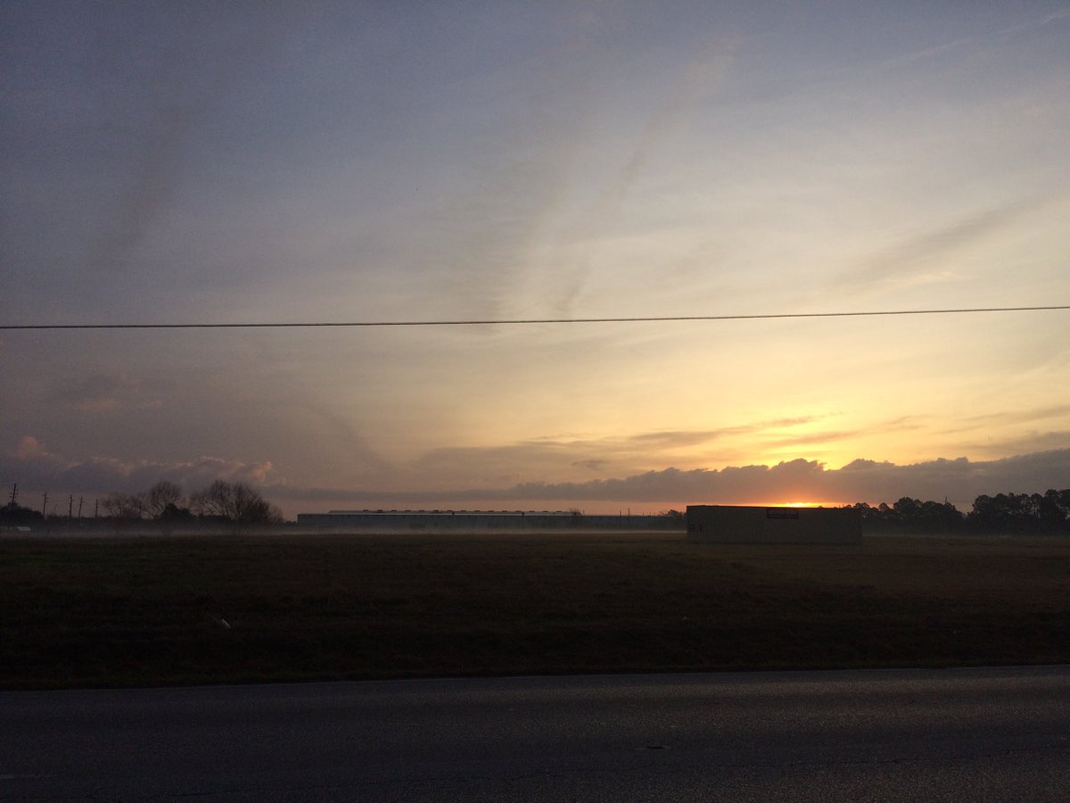
Northwest Houston, TX, during the early morning.
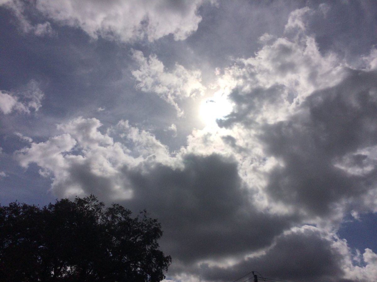
Northwest Houston, TX, during the early afternoon.
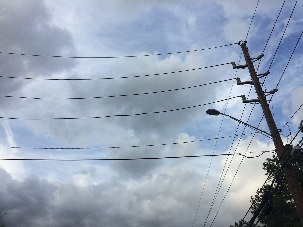
Northwest Houston, TX, during the early evening.
Summary: The day was mostly cloudy, sunny, and warm. I don't think Houston, TX got any precip. I don't remember seeing any rain on the radar, over the Houston, TX area, during anytime of the day. I think I felt a drop of precip, sometime during the afternoon. Alto stratus and status clouds looked to be scattered across the sky, during the early morning. Alto stratus and stratus clouds, looked to have started to cover most of the sky, sometime during the late, or maybe mid-morning, and continued to cover most of the sky, through the evening and maybe night. I think the wind speeds looked to be calm with gentle to moderate gusts and some moderately strong gusts. I think it felt cool, maybe very cool, during the early morning. I think it felt cool, during the mid-morning and night. I think it started to feel warm, during the late morning. It felt warm, during the afternoon and maybe early evening. I think it started to feel cool, or maybe a little cool, during the late evening. There was a Hazardous Weather Outlook issued for the Houston, TX area, by NOAA. There were no other watches, warnings, alerts, advisories, or weather statements/outlooks issued for the Houston, TX area, that I know of. The low temperatures were in the 50's, I think, and the high temperatures were in the low 70's with maybe some high 70's, I think, for the Houston, TX area.
Houston, TX Area Storm Summary: I don't think Houston, TX got any precip. I don't remember seeing any rain on the radar, over the Houston, TX area, during anytime of the day. I didn't see, or hear about any flooding, or damage to any of the locations in the Houston, TX area, during anytime of the day.
My Storm Summary: . I think I felt a drop of precip, sometime during the afternoon. There looked to be some precip producing clouds, where I was in northwest Houston, TX, throughout the day. The roads looked to be dry and the mud on the ground from recent rain looked to be drying up, where I was in northwest Houston, TX, during the day. I didn't see any lightning strikes, or hear any rumbles of thunder, where I was in northwest Houston, TX, during the day. I didn't see any flooding, or damage caused by the weather, where I was in northwest Houston, TX, during the day.
Locations: Northwest Houston, TX.
Thoughts: I enjoyed the warm weather.
Area Forecast Discussion
Issued by NWS Houston/Galveston, TX
Issued by NWS Houston/Galveston, TX
Versions: 1 2 3 4 5 6 7 8 9 10 11 12 13 14 15 16 17 18 19 20 21 22 23 24 25 26 27 28 29 30 31 32 33 34 35 36 37 38 3940 41 42 43 44 45 46 47 48 49 50
901
FXUS64 KHGX 020258
AFDHGX

Area Forecast Discussion
National Weather Service Houston/Galveston TX
858 PM CST Thu Feb 1 2018

.DISCUSSION...
Cold front is working its way toward the coast. A few showers have
developed along the boundary, and additional activity can be found
over parts of our Gulf waters. The front will clear the coast over
the next couple of hours. The grids look pretty good, and no major
changes are going to be made on the evening update.  42
&&

.PREV DISCUSSION... /ISSUED 617 PM CST Thu Feb 1 2018/

AVIATION...
Many northern and metro terminals will remain VFR through midnight
and fall into MVFR cats shortly thereafter with the approach and
passage of this evening`s cold front. More southern hubs will fall
sooner, or within the next few hours, with coastal sea fog
development a real possibility late this evening. A slight chance
of some light showers with post-frontal ceilings remaining at
MVFR through a good part of Friday morning. 31

PREV DISCUSSION... /ISSUED 344 PM CST Thu Feb 1 2018/

DISCUSSION...
Cold front/pre-frontal trough currently making its way into SE TX
this afternoon, but not seeing a lot of activity with its passage
thus far. Most of the showers appear to be moving SW-NE along the
coast (from Sargent to Winnie) and not really getting going until
it reaches LA. Based on these current trends, no changes with the
short-term forecast of mainly low POPS over the southern third of
the CWA through this evening ending with the passage of the front.
Cool and cloudy conditions expected Fri as the upper flow remains
from the SW and helps to keep mid/high clouds in place.

The persistent sub-tropical jet pattern should keep things active
across SE TX for this weekend as a series of disturbances move in
from the west/southwest and interact with a warm front lifting up
from the Gulf. This combined with progs of above average PWs (1.2
to 1.5 inches) does support the possibility of locally heavy rain
for Sat/Sat night as the front moves inland. Fog/sea fog may also
be an issue for Sat night/Sun morning.

Elevated rain chances will continue into Sun, with the passage of
the next cold front. Models shunting the brunt of the coldest air
off to our east as the associated upper low quickly tracks NE ac-
ross the Northern Plains. A brief period of clearing/cooling will
be on tap for the start of the week...but yet another upper level
disturbance is forecast to move across the region Tues. 41

MARINE...
Starting to see some rigs off the coast report intermittent
reductions in visibility. Expect sea fog to expand in coverage and
become dense at times prior to a frontal passage around midnight.
Fog should clear as offshore flow increases in its wake. Will hoist
the SCA flags at 2am and wouldn`t be surprised to see a few gusts to
near gale force offshore between 4am-noon. As high pressure moves
east, look for winds to veer to the east and southeast early
Saturday. Periods of rain, drizzle, mist and fog can be expected
thru the day. Though not exactly favorable wind conditions, higher
dewpoints lingering over colder waters may keep the threat of fog in
the water from time-to-time until the next front toward midweek.  47


&&

.PRELIMINARY POINT TEMPS/POPS...
College Station (CLL)      46  55  45  57  53 /  10  10  10  40  30
Houston (IAH)              50  56  42  59  55 /  10  10  10  50  40
Galveston (GLS)            51  56  51  61  56 /  20  20  20  50  40

&&

.HGX WATCHES/WARNINGS/ADVISORIES...
TX...NONE.
GM...Small Craft Advisory from 2 AM to noon CST Friday for the
     following zones: Galveston Bay...Matagorda Bay.

     Small Craft Advisory from 2 AM to 3 PM CST Friday for the
     following zones: Coastal waters from Freeport to the
     Matagorda Ship Channel out 20 NM...Coastal waters from High
     Island to Freeport out 20 NM...Waters from Freeport to the
     Matagorda Ship Channel from 20 to 60 NM...Waters from High
     Island to Freeport from 20 to 60 NM.

&&

$$
Hazardous Weather Outlook
Hazardous Weather Outlook
National Weather Service Houston/Galveston TX
358 AM CST Thu Feb 1 2018

TXZ163-164-176>179-195>200-210>214-226-227-235>238-021000-
Austin-Brazoria-Brazos-Burleson-Chambers-Colorado-Fort Bend-
Galveston-Grimes-Harris-Houston-Jackson-Liberty-Madison-Matagorda-
Montgomery-Polk-San Jacinto-Trinity-Walker-Waller-Washington-
Wharton-
358 AM CST Thu Feb 1 2018

This hazardous weather outlook is for portions of Southeast Texas..

.DAY ONE...Today and Tonight

Patchy inland fog will reduce visibilities to 1 mile or less at
times through mid-morning.

.DAYS TWO THROUGH SEVEN...Friday through Wednesday

No hazardous weather is expected at this time.

.SPOTTER INFORMATION STATEMENT...

Spotter activation will not be needed.

$$
No comments:
Post a Comment