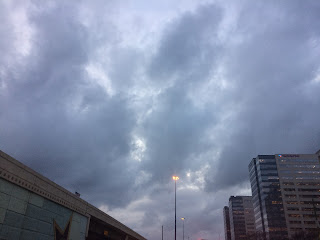
Houston, TX, during the early morning.
Northwest Houston, TX, during the early morning.
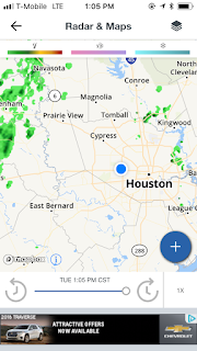
Houston, TX radar, during the early afternoon.
Northwest Houston, TX, during the late evening.
West Houston, TX, during the late evening.
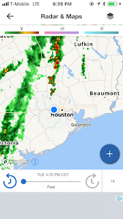
Houston, TX radar, during the early evening.
Houston, TX radar, during the early night.
Houston, TX radar, during the early night.
West Houston, TX, during the early night.
Locations: Northwest and west Houston, TX.
Thoughts: The predicted rain had not yet arrived yet, except for maybe in some locations in the Houston, TX area. The day was warm, dry, and cloudy.
Issued by NWS Houston/Galveston, TX
Versions: 1 2 3 4 5 6 7 8 9 10 11 12 13 14 15 16 17 18 19 20 21 22 23 24 25 26 27 28 29 30 31 32 33 34 35 36 37 38 3940 41 42 43 44 45 46 47 48 49 50
000
FXUS64 KHGX 210301
AFDHGX

Area Forecast Discussion
National Weather Service Houston/Galveston TX
901 PM CST Tue Feb 20 2018

.DISCUSSION...
At 7 PM, a cold front extended from about Paris to Gateville to
Fort Stockton. Scattered showers continue to develop just ahead
and behind the front. Earlier tonight, some moderately heavy rain
fell across Walker, Madison and Houston counties with Wyser Bluff
in Walker county receiving 1.58 between Noon and 7 PM. FWIW, the
radar is underestimating precip and the gages are showing 25-35%
higher totals. At 850 MB, a 45-50 kt low level jet is located
over East TX/West LA with a ribbon of higher moisture across
central LA into central TX. At 300 mb, upper level winds show a
broad split over N-NE Texas. Water vapor imagery shows a well
defined disturbance over northern Mexico. Storms were developing
in advance of this feature and will continue to do so. Both the
GFS/ECMWF show this speed max and this feature will approach the
middle coast placing SE TX in a LFQ. Feel convection will fill in
toward the middle coast tonight and move into SE TX prior to
sunrise. The 00z CRP sounding showed a PW value of 1.81 inches
which is one of the highest values I`ve ever seen in February. The
unseasonably high moisture coupled with the approaching speed max
and a slow moving cold front should set the stage for widespread
showers and thunderstorms early Wednesday. Some of the rain will
be locally heavy. Widespread rainfall of 1 to 3 inches looks
likely over most of the region with some isolated areas receiving
between 3 and 5 inches. Since the 00z models are not all in yet,
will hold off on a Flash Flood Watch but one might be required for
Wednesday morning. Temps are tricky as well and will fall
significantly in the wake of the cold front. Have raised PoPs for
09-12z and bumped up QPF grids. Rest of the forecast is in good
shape. 43

&&

.PREV DISCUSSION... /ISSUED 546 PM CST Tue Feb 20 2018/

AVIATION [00Z TAF Issuance]...
Pretty messy weather expected for the upcoming TAF period.
Ceilings have improved in most areas this afternoon but will
likely fall back down to IFR later this evening and overnight
tonight. The models are suggesting the front and associated
showers and storms may be arriving a little quicker than
previously indicated. Either way, the front will push through CLL
and UTS first with showers and thunderstorms before drifting into
the Houston Metro (IAH, HOU, SGR, CXO) early tomorrow morning and
sticking around for most of the day. Expect rounds of showers and
thunderstorms throughout the day tomorrow, potentially tapering
off to SHRA towards the tail end of the taf period. Ceilings may
improve to MVFR or even VFR briefly before the front arrives, but
should fall back down to IFR in the wake of the front. 11

PREV DISCUSSION... /ISSUED 344 PM CST Tue Feb 20 2018/

NEAR TERM [Through Tonight]...

Radar this afternoon has become more active from Columbus up to
Brenham/College Station to Madisonville. Based on SPC mesoanalysis
data, this activity seems to be rooted within the main moisture
axis of 1.6-1.8 inches of precipitable water. This is also where
the LLJ is the strongest with 850mb wind around 40-50 knots and
850mb dewpoints around 13-14C. This appears to be a more favored
area for convection and training of cells given the deep upper
level flow from the SW.

Upper air analysis shows a deep trough over the western U.S. with
a strong ridge in the western Atlantic. Sandwiched in between is
the Plains where the pattern is supportive of the cold front in
north Texas stalling over the area. However since there are 30-40
degree temperature drops behind the front and the shallow nature
of the front, this front will continue to push south and likely
reach the northern third of the forecast area around 12Z Wed.
Latest HRRR and WRF ARW/NMM all support this idea along with the
NAM. Synoptic models are slower to catch onto this trend. With
this shift in the forecast, temperatures will be falling behind
the front and this means the boundary will be more of a focus for
rainfall. Trends in the NAM and then the last couple of HRRR/RAP13
runs raise some eyebrows with their QPF output. If there is a WRF
model runs that lends support to these trends it might be the 12Z
WRF- ARW from Texas Tech while the NCEP WRF- ARW/NMM show less
precipitation through 12Z Wednesday.

Overpeck

SHORT TERM [Wednesday Through Thursday Night]...

Bottom line: it`s going to rain Wednesday and then begin to taper
off Thursday. From a pattern recognition standpoint, this
forecast for the next couple of days is not that hard. Upper
levels - we have a trough out west with SW jet stream flow and an
approaching jet streak. In fact the beginnings of the divergence
from this jet streak approaches S Texas and SE Texas Wednesday
morning. Deep moisture is in place with high dewpoint air through
the boundary layer. Precipitable water values peak around 1.6 to
1.8 inches which is right at the 30 year climo max for this time
of year. In fact, the 12z CRP sounding from today had a record of
1.61 inches of PW. Now let`s throw in a 30-40 knot LLJ from the
south that lines up normal to an approaching cold front. And
that`s the last ingredient: the cold front is now expected to push
off the coast and stall so there will be lift over the front with
all the deep moisture over the region. So overall, models are in
decent agreement with this pattern going forward. The devil will
be in the details of the mesoscale. That is where the recent
12Z/18Z NAM trends along with the HRRR/RAP may be onto something
that the other models are not resolving. Mesoscale interactions
will be critical as areas of training of storms and favored areas
of convection could shift and likely shift southward from the
original threat area for heavy rainfall. The NAM in particular
shows a meso-low feature forming on the front tied to the
divergence in the jet streak. This meso-low supports heavy
rainfall farther south and a trend to monitor overnight. Of course
the NAM has a history of not performing well in convective
situations, but still a trend to watch.

Heavy rain threat still looks to be for the northern third of the
forecast area from Brenham to Huntsville northward where 2-4
inches of rain look likely through 12Z Friday or a 2 day total for
Wednesday and Thursday. Farther south looks like 1 to 3 inches
are more likely with 1 inch along the coast. This is a little
higher than yesterday`s forecast and on track from the forecast
package from the overnight shift. However there very well could be
a shift southward in the threat area. This means that the
isolated areas of 3 inches could become more common but for now
this will serve as an alternate scenario. Overall confidence
remains in the higher rainfall amounts occurring over the
northern portions of the forecast area. The main impacts will be
still street flooding in urban areas and the usual low lying
areas/underpasses. This includes rural roads in valleys or near
creeks. For more impacts see the hydrology section below.

Thursday the cold front that stalled along or just off the coast
will push back north as a warm front. This will keep rain chances
going in the forecast with mainly elevated convection. PW values
still range from 1.6 to 1.8 inches but should be decreasing
Thursday night into Friday. Upper level forcing also moves off to
the NE which may limit the extent of convection later on Thursday.
There may still be some brief periods of heavy rainfall but not
as many convective clusters moving over the region. Rainfall
amounts look to be more in the tenth to a half inch amounts on
Thursday so the majority of the heavy rainfall threat will be on
Wednesday.

Overpeck

LONG TERM [Friday Through Tuesday]...

The warm front that will push through SE TX Thursday, will move
move well north of the region into the NE TX on Friday. Winds will
remain onshore behind this feature, allowing moisture to continue
funneling into the region. Precipitable water (PW)values will
rise back up to 1.3-1.4 inches. Therefore, showers and
thunderstorms will again be possible Friday and Saturday, with the
best coverage north of I-10 Friday into Saturday. Precip coverage
will then shift east by Saturday afternoon, with the best chance
for showers and thunderstorms east of I-45 and south of I-10.

Saturday night into Sunday morning an area of low pressure
associated with a frontal boundary tracks eastward across the
midwest. A Pacific airmass fills in behind this feature, as the
front pushes southward into the region reaching our northern zones
as early as Saturday afternoon. There is some discrepancy between
the global guidance regarding the timing of this front. The GFS
brings the cold front into the region faster than the ECMWF. GFS
also shows cooler temperatures behind the front in comparison to
the ECMWF, as drier air filters into the region. Forecast
soundings show a quick drop in PW values behind the front,
potentially falling as low as 0.4-0.6 inches according to both the
GFS and ECMWF. High temperatures behind the front will range
between the mid 60s-70s, with low temperatures in the low 50s-
60s.

Surface high pressure attempts to build back into the region
Monday into Tuesday, and a warming trend will commence.
Temperatures should rise back above normal climatological values
by the beginning of next week. Onshore flow will also return, as
winds turn out of the southeast.

Hathaway

MARINE...

South to southeast flow will continue through Wednesday
afternoon. This will keep the moisture flowing into and across the
coastal waters leading to areas of fog with some dense fog
possible. Have reissued the marine dense fog advisory for the 0-20
nm waters through Noon Wednesday. Improvement will be slow
Wednesday morning. The persistent flow will maintain seas of 5-8
feet well offshore so will extend the SCA through 12z Wednesday.
Winds relaxing as the front stalls which should allow seas to
slowly subside though as the front begins to retreat back
northward from the coastal areas the threat of fog returns
Thursday. The warm moist flow Thursday through Saturday will
likely lead to continued fog issues. Guidance in general shows a
front pushing off the coast early Sunday morning probably ending
the fog threat but with showers and thunderstorms.

Tides will continue to run well above normal though with the
lower amplitude tidal cycle don`t anticipate coastal flooding
issues. 45

HYDROLOGY...

In anticipation of heavy rainfall and resulting rises in rivers,
tributaries and bayous, here are some items to consider when
looking at hydrographs and forecasts from the WGRFC. River
forecasts include 24 hours of QPF. Based on the river forecast
output, no basins are expected to reach action stage. WGRFC did
run contingency forecasts with 48 hours of QPF which resulted in
some rises to action and minor flood stages for the Trinity,
Brazos and San Jacinto Rivers. These forecasts hinge on how much
rain ultimately falls upstream and is routed through the river
system so there is still time to monitor conditions and forecasts
for changes. Harris County bayous would need 4 inches of rainfall
or more to generate flooding but this is also dependent upon rain
fall rates and how quickly the rain falls. Bottom line: we will be
monitoring conditions for rises on rivers and bayous but biggest
impact still to be street flooding/flooding of low lying areas and
poor drainage areas.

KLG/SO

&&

.PRELIMINARY POINT TEMPS/POPS...
College Station (CLL)      78  54  56  43  59 /  70  90  90  70  60
Houston (IAH)              79  69  74  55  75 /  50  50  90  70  60
Galveston (GLS)            75  65  72  62  73 /  20  30  70  70  50

&&

.HGX WATCHES/WARNINGS/ADVISORIES...
TX...NONE.
GM...Dense Fog Advisory until noon CST Wednesday for the following
     zones: Coastal waters from Freeport to the Matagorda Ship
     Channel out 20 NM...Coastal waters from High Island to
     Freeport out 20 NM.

     SMALL CRAFT SHOULD EXERCISE CAUTION until 6 AM CST Wednesday for
     the following zones: Matagorda Bay.

     Small Craft Advisory until 6 AM CST Wednesday for the following
     zones: Waters from Freeport to the Matagorda Ship Channel
     from 20 to 60 NM...Waters from High Island to Freeport from
     20 to 60 NM.

&&

$$

Discussion...43
Hazardous Weather Outlook
Hazardous Weather Outlook
National Weather Service Houston/Galveston TX
549 PM CST Tue Feb 20 2018

TXZ163-164-176>179-195>200-210>213-226-227-235-220000-
Austin-Brazos-Burleson-Colorado-Fort Bend-Grimes-Harris-Houston-
Jackson-Liberty-Madison-Montgomery-Polk-San Jacinto-Trinity-
Walker-Waller-Washington-Wharton-
549 PM CST Tue Feb 20 2018

This hazardous weather outlook is for portions of Southeast Texas..

.DAY ONE...Tonight

Scattered to numerous showers and thunderstorms will possible
tonight. Some of the storms will produce locally heavy rain
especially north of a Columbus to Conroe to Livingston line. Minor
flooding in low lying and other flood prone areas will be
possible.

.DAYS TWO THROUGH SEVEN...Wednesday through Monday

Scattered showers and thunderstorms will persist for much of the
day. Rainfall could again be locally heavy, especially in the
morning.

No hazardous weather is expected at this time.

.SPOTTER INFORMATION STATEMENT...

Spotter activation will not be needed.

$$


No comments:
Post a Comment