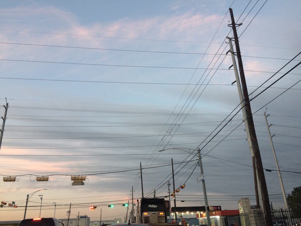
Northwest Houston, TX during the early evening.
Notes: Big to small, mostly bright white with some light to medium grey and blueish grey, thick, some thin, flat, puffy, some wavy high stratus and maybe cirrus clouds looked to be widely scattered across the sky in northwest and west Houston, TX during the morning, afternoon, evening, and night. The wind speeds looked to be calm with some moderate and some occasional strong gusts of wind in northwest and west Houston, TX during the morning, afternoon, evening, and night. It felt cold in northwest and west Houston, TX during the early morning. It started to feel cool in west Houston, TX during the mid-morning. It felt cool in west Houston, TX during the late morning. It started to feel warm in west Houston, TX during the early afternoon. It felt warm in west Houston, TX during the mid-afternoon. It started to feel cool in west Houston, TX during the late afternoon. It felt cool in northwest and west Houston, TX during the early evening. It felt cool in northwest Houston, TX during the late evening. It started to feel cold in northwest Houston, TX during the early night. It felt very cold in northwest Houston, TX during the late night. I didn't see, feel, or hear about any rain drops anywhere in, or near the Houston, TX area during the morning, afternoon, evening, or night.
Thoughts: I'm interested to see how much rain Houston, TX gets on Friday and this weekend. I feel very cold....
Disclaimer: This was my observation of the weather that occurred in northwest and west Houston, TX, where I was during the day.
Coastal Flood Watch
COASTAL HAZARD MESSAGE
NATIONAL WEATHER SERVICE HOUSTON/GALVESTON TX
138 PM CST THU DEC 1 2016

...INCREASING COASTAL WATER LEVELS FRIDAY INTO SATURDAY...

.A PERSISTENT EASTERLY FETCH INDUCED BY A DEVELOPING COASTAL
TROUGH OF LOW PRESSURE WILL PUSH A LONG PERIOD SWELL TOWARDS
EAST FACING BAY AND GULF SHORELINES FROM FRIDAY AFTERNOON THROUGH
SATURDAY MORNING. DURING LATE FRIDAYS AFTERNOON TO EARLY EVENING
HIGH TIDE...WATER LEVELS WILL LIKELY EXCEED 3 FEET. MAXIMUM WATER
LEVELS MAY APPROACH 4 FEET DURING HIGH TIDE TIMES.


TXZ213-214-237-238-031200-
/O.NEW.KHGX.CF.A.0002.161202T1800Z-161203T1200Z/
BRAZORIA-CHAMBERS-GALVESTON-HARRIS-
138 PM CST THU DEC 1 2016

...COASTAL FLOOD WATCH IN EFFECT FROM FRIDAY AFTERNOON THROUGH
EARLY SATURDAY MORNING...

THE NATIONAL WEATHER SERVICE IN HOUSTON/GALVESTON HAS ISSUED A
COASTAL FLOOD WATCH...WHICH IS IN EFFECT FROM FRIDAY AFTERNOON
THROUGH LATE FRIDAY NIGHT.

* COASTAL FLOODING...WATER LEVELS OF BETWEEN 3.3 FEET TO AROUND 4
  FEET WILL CAUSE COASTAL FLOODING ALONG EAST FACING SHORELINES.

* TIMING...FRIDAY AFTERNOON THROUGH THE OVERNIGHT SATURDAY MORNING
  HOURS.

* IMPACTS...GULF AND BAY WATERS WILL OVERCOME DUNES AND POSSIBLY
  OVERWASH PORTIONS OF HIGHWAY 87 ON THE BOLIVAR PENINSULA...AS
  WELL AS SECTIONS OF THE BLUE WATER HIGHWAY IN BRAZORIA COUNTY.
  LOW LYING ROADWAYS...SUCH AS TODDVILLE ROAD IN SEABROOK...MAY
  ALSO EXPERIENCE MINOR FLOODING.

PRECAUTIONARY/PREPAREDNESS ACTIONS...

A COASTAL FLOOD WATCH MEANS THAT CONDITIONS FAVORABLE FOR
FLOODING ARE EXPECTED TO DEVELOP. COASTAL RESIDENTS SHOULD BE
ALERT FOR LATER STATEMENTS OR WARNINGS...AND TAKE ACTION TO
PROTECT PROPERTY.

&&

$$
Area Forecast Discussion Issued by NWS Houston/Galveston, TXVersions: 1 2 3 4 5 6 7 8 9 10 11 12 13 14 15 16 17 18 19 20 21 22 23 24 25 26 27 28 29 30 31 32 33 34 35 36 37 3839 40 41 42 43 44 45 46 47 48 49 50
000 FXUS64 KHGX 020353 AFDHGX Area Forecast Discussion National Weather Service Houston/Galveston TX 953 PM CST Thu Dec 1 2016 .DISCUSSION... Evening forecast update is really just that, an update to ongoing temperature/dewpoint trends and sky conditions. Temperatures are falling into the 40s north of Houston but are slow to fall along the coast. E/SE winds should bring back moisture from the Gulf which will keep temperatures from decreasing too much with radiational cooling. Cloud cover should increase Friday morning with the onset of precipitation during the afternoon. Rest of the forecast looks on track. Previous discussion outlines latest forecast concerns and confidence in the event. New 00z guidance will be evaluated for any changes to the forecast and hopefully be able to highlight where any heavy rainbands set up and when. Rainfall totals have been increased and looking more probable for a flood watch sometime during the weekend. Overpeck && .PREV DISCUSSION... /ISSUED 623 PM CST Thu Dec 1 2016/ ..Locally Heavy Rain Possible This Weekend... DISCUSSION... High pressure over central Louisiana will continue to move east tonight. This will allow east winds to continue and and maintain a slight increase in low level moisture. Overnight low temperatures will be warmer than last night as clouds gradually increase from the southwest. Consider this the calm before the storm. On Friday...moisture levels really begin to ramp up and PW values are progged to increase to 1.50 inches by afternoon. The increase in moisture coupled with a weak disturbance will give the area a chance of precipitation by afternoon. This area of rain will expand north and increase in intensity toward evening as 925 mb winds increase. The 925-850 flow increases to 30 knots Fri night into Saturday and forecast soundings become super saturated Friday night into Saturday with PW values exceeding 1.70 inches. Have added locally heavy rain to the grids for Saturday and a Flash Flood Watch will probably be required at some point over the weekend and possibly as early as Saturday. The Hi-Res WRF ARW and NMM are showing some impressive rainfall totals right along the coast Friday night into Saturday. Quite possible that a tiered or staggered flash flood watch will be needed with the coastal counties first and then expanding as rain falls through the weekend. Looking at the synoptic model output, it looks like after Friday night`s rain event more rainfall could develop inland with isentropic lift and quite likely elevated convection. This could set up another band of heavy rainfall between Houston and Huntsville. This means there could be 2 bands of rainfall that exceed 6 inches of rainfall for the event. The hard part is that these bands could shift in location a few miles north/south which could put one band over Houston or just north. The other band could be just along the coast or far enough off the coast that coastal areas only get a couple of inches of rain. Regardless there is enough confidence that heavy rainfall could be more of a issue for a much larger area than previously thought. And it could get worse on Sunday as generally moderate rain continues but falls with rather saturated grounds by this point. Sunday night and Monday there is a growing concern for severe weather. While WPC has a good portion of our area in a slight risk for excessive rainfall, we do not want to neglect the severe weather threat Sunday night into Monday morning. Deep upper low over Mexico will begin to swing NE over Texas during this time. It is expected to be shearing out and weakening as it does but it will still have a negative tilt with a very strong jet. The higher severe weather threat that SPC highlights on day 5 is east of the area but the threat could develop sooner and back to the west more early Monday morning. It would then quickly move east through the day Monday. From 06Z to 12Z Monday the GFS is showing a good axis of 1.8 inch precipitable water, 500-1000 J/kg of CAPE, 20-25 kts of 0-1km shear, and 60-70 kts of 0-6km shear. Shear parameters are really high and could overcome the lack of instability. This should be a typical high shear/low CAPE type of event, but the really strong upper level ascent may be just enough out of phase that updrafts may struggle if there is not enough instability. By 12Z Monday the main PVA is still over the Rio Grande and does not reach SE TX until 18Z Monday. What is troublesome is that this is still a highly dynamic system with a strong 80-100kt jet core that will support surface cyclogenesis along the warm front over SE Texas. Warm sector very well could push inland giving what instability there is a chance to be realized and yield rotating updrafts. The threat here looks to be tornadoes and damaging winds with a much higher threat shifting NE through the day into Louisiana. Finally it is looking more likely we will have a solid arctic blast of cold air with a cold front pushing through Wednesday afternoon next week. A 1040mb ridge settles over the Texas Big Country by Thursday morning and 850mb temps drop to around freezing for north of I-10. Friday morning could potentially be one of the first strong freezes but model data not quite supporting that yet. Certainly something else to watch in this busy forecast cycle. Apologies for a delayed AFD as we had to troubleshoot some system failures. 43/39 AVIATION.../00Z TAF/ Despite some mid to high clouds working across, particularly towards the coast, the expectation across the area for most of the forecast period is for VFR conditions and diminishing easterly winds tonight. Winds will begin to pick up tomorrow, with clouds moving in from the west in the morning. Rain chances will begin to slide in from the southwest late, but have only included a mention of SHRA up to IAH. Of course, any changes in timing may impact this far end of the period in future cycles. Luchs MARINE... Forecast still on track for a warm front/coastal trough to setup along the Upper Texas Coast tomorrow and over the weekend. This will increase east winds above advisory criteria so small craft advisories have been issued for tomorrow and will likely need to be extended through the weekend. Strong winds and rough seas will persist through Sunday night. A surface low may form on the boundary Sunday night into Monday which will have winds southerly until mid morning and then shift to the west/northwest for the afternoon as a front pushes offshore. There will be a quick reprieve in advisory conditions before a strong cold front pushes off the coast next Wednesday night. Tides...With a strong and increasing easterly fetch of winds, above normal tides are expected over the weekend. Right now Gulf facing beaches may experience tides 1-2 feet above normal late Friday through Saturday morning. With astronomical tides already reaching 2 feet above MLLW possible that tides could be 3.7-3.9 feet above MLLW or approaching 1 ft above HAT. A coastal flood watch has been issued for these higher tides and a coastal flood warning or advisory may be needed. 39/25 && .PRELIMINARY POINT TEMPS/POPS... College Station (CLL) 46 65 52 56 49 / 10 40 70 90 80 Houston (IAH) 48 66 55 61 57 / 10 50 70 90 80 Galveston (GLS) 61 69 64 68 66 / 10 70 70 90 80 && .HGX WATCHES/WARNINGS/ADVISORIES... TX...Coastal Flood Watch from Friday afternoon through late Friday night for the following zones: Brazoria...Chambers... Galveston...Harris. GM...Small Craft Advisory from 3 PM Friday to 6 AM CST Saturday for the following zones: Galveston Bay...Matagorda Bay. SMALL CRAFT SHOULD EXERCISE CAUTION through Friday afternoon for the following zones: Galveston Bay...Matagorda Bay. Small Craft Advisory from 9 AM Friday to 6 AM CST Saturday for the following zones: Coastal waters from Freeport to the Matagorda Ship Channel out 20 NM...Coastal waters from High Island to Freeport out 20 NM...Waters from Freeport to the Matagorda Ship Channel from 20 to 60 NM...Waters from High Island to Freeport from 20 to 60 NM. SMALL CRAFT SHOULD EXERCISE CAUTION until 9 AM CST Friday for the following zones: Coastal waters from Freeport to the Matagorda Ship Channel out 20 NM...Coastal waters from High Island to Freeport out 20 NM...Waters from Freeport to the Matagorda Ship Channel from 20 to 60 NM...Waters from High Island to Freeport from 20 to 60 NM. && $$ Discussion...39
No comments:
Post a Comment