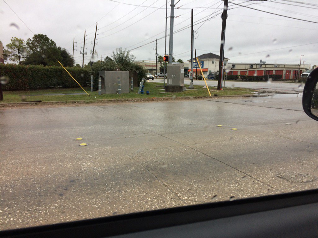
Northwest Houston, TX during the late afternoon.
Notes: Big to small, bright white to light grey, thick, puffy, low stratocumulus clouds looked to cover the whole sky in northwest Houston, TX during the morning and early and mid-afternoon. Big to small, bright white to light grey, thick, puffy, low stratocumulus clouds looked to cover the whole sky in northwest and west Houston, TX during the late afternoon. evening, and early night. The wind speeds looked to be relatively calm with maybe some moderate gusts in northwest Houston, TX during the morning and early and mid-afternoon. The wind speeds looked to be relatively calm with maybe some moderate gusts in northwest and west Houston, TX during the late afternoon. The wind speeds looked to be relatively calm with maybe some moderate gusts in west Houston, TX during th evening. The wind speeds looked to be relatively calm with maybe some moderate gusts in northwest and west Houston, TX during the early night. It felt cold in northwest Houston, TX during the early and mid-morning. It felt cold, almost cool in northwest Houston, TX during the late morning and early and mid-afternoon. It felt cold, almost cool in northwest and west Houston, TX during the late afternoon. It felt cold in west Houston, TX during the evening. It felt cold in northwest and west Houston, TX during the early night. Light to moderate, and some occasional heavy showers and maybe a few thunderstorms swirled around the Houston, TX area during the morning, afternoon, evening, and night. I witnessed mostly on and of light rain and drizzle with some occasional moderate to moderately heavy rain while I was in northwest and west Houston, TX.
Thoughts: Still very cold... Houston, TX has been getting a lot of rain. The next big event looks to be from a very strong cold front that is going to bring some possible freezing temps to parts of Houston, TX. I wonder if this cold air mass will be enough to ice the roads on Friday and Saturday morning when the possible freezing temps will be. I also wonder if Houston, TX will see some winter precip with this next cold front.
Disclaimer: This was my observation of the weather that occurred in northwest and west Houston, TX, where I was during the day.
Hazardous Weather Outlook
HAZARDOUS WEATHER OUTLOOK
NATIONAL WEATHER SERVICE HOUSTON/GALVESTON TX
750 AM CST SUN DEC 4 2016

TXZ200-210>214-226-227-235>238-051400-
AUSTIN-BRAZORIA-CHAMBERS-COLORADO-FORT BEND-GALVESTON-HARRIS-
JACKSON-LIBERTY-MATAGORDA-WALLER-WHARTON-
750 AM CST SUN DEC 4 2016

THIS HAZARDOUS WEATHER OUTLOOK IS FOR PORTIONS OF SOUTHEAST TEXAS.

.DAY ONE...TODAY AND TONIGHT

FLASH FLOOD WATCH REMAINS IN EFFECT. ANOTHER UPPER DISTURBANCE
WILL TRIGGER ANOTHER ROUND OF RAIN AND EMBEDDED STORMS. ANY
TRAINING HEAVIER CELLS WILL BE CAPABLE OF PRODUCING FLOODING WHERE
THE GROUND IS SATURATED. MOST AT RISK WILL BE COASTAL AREAS WHO
HAVE SEEN THE HEAVIEST RAIN ON SATURDAY.

.DAYS TWO THROUGH SEVEN...MONDAY THROUGH SATURDAY

THE THREAT OF FLASH FLOODING WILL CONTINUE THROUGH MONDAY AS A
SERIES OF DISTURBANCES PASS OVERHEAD. THE FLASH FLOOD WATCH MAY
NEED TO BE EXTENDED INTO MONDAY. STRONG THUNDERSTORMS MAY
ACCOMPANY A COLD FRONT MOVING THROUGH THE AREA WITH A LOW PRESSURE
SYSTEM NEAR THE THE COAST. HEAVY RAINFALL AND GUSTY WINDS MAY
ACCOMPANY THE STRONGER STORMS.

A STRONG COLD FRONT SWEEPS THROUGH THE REGION WEDNESDAY NIGHT AND
MUCH COLDER TEMPERATURES WILL OCCUR. THE FIRST FREEZE OF THE
SEASON MAY DEVELOP FRIDAY MORNING FOR PARTS OF THE AREA.

.SPOTTER INFORMATION STATEMENT...
HEIGHTENED SPOTTER AWARENESS OVER THE NEXT SEVERAL DAYS.

$$
Flash Flood Watch
FLOOD WATCH
NATIONAL WEATHER SERVICE HOUSTON/GALVESTON TX
325 PM CST SUN DEC 4 2016

TXZ200-213-214-237-238-051800-
/O.EXT.KHGX.FF.A.0012.000000T0000Z-161205T1800Z/
/00000.0.ER.000000T0000Z.000000T0000Z.000000T0000Z.OO/
BRAZORIA-CHAMBERS-GALVESTON-HARRIS-LIBERTY-
INCLUDING THE CITIES OF...ALVIN...ANAHUAC...ANGLETON...
CLEVELAND...DAYTON...FREEPORT...FRIENDSWOOD...GALVESTON...
HOUSTON...HUMBLE...KATY...LAKE JACKSON...LEAGUE CITY...LIBERTY...
MONT BELVIEU...PASADENA...PEARLAND...TEXAS CITY...TOMBALL...
WINNIE
325 PM CST SUN DEC 4 2016

...FLASH FLOOD WATCH NOW IN EFFECT THROUGH MONDAY MORNING...

THE FLASH FLOOD WATCH IS NOW IN EFFECT FOR

* A PORTION OF SOUTHEAST TEXAS...INCLUDING THE FOLLOWING
  COUNTIES...BRAZORIA...CHAMBERS...GALVESTON...HARRIS AND
  LIBERTY.

* THROUGH MONDAY MORNING

* THE COMBINATION OF STEADY LIGHT RAINFALL TODAY AND EXCESSIVE
  AMOUNTS THAT FELL ACROSS PARTS OF THE AREA ON SATURDAY...GROUNDS
  ARE SATURATED. A COASTAL LOW WILL DEVELOP OFF THE LOWER TEXAS
  COAST MOVE TOWARD THE UPPER TEXAS COAST OVERNIGHT AND ON
  MONDAY. ANOTHER ROUND OF RAIN WITH EMBEDDED STORMS ARE EXPECTED
  AS THIS OCCURS. ANY TRAINING HEAVIER CELLS THAT DEVELOP ACROSS
  THE WATCH AREA WILL QUICKLY RUNOFF AND PRODUCE FLASH FLOODING.
  DRAINAGE WILL AGAIN BE SLOW SINCE TIDE LEVELS IN THE BAY AND
  NEARSHORE GULF ARE EXPECTED TO INCREASE AGAIN. IN
  GENERAL...EXPECT ANOTHER 3/4 INCH TO 2 INCHES THROUGH EARLY
  MONDAY AFTERNOON WITH LOCALIZED MUCH HIGHER AMOUNTS A
  POSSIBILITY. IN THIS SITUATION...IT IS IMPORTANT TO FOCUS ON THE
  SHORTER TERM RAINFALL RATES THAN THE TOTAL FORECAST
  PRECIPITATION. EVEN BRIEF HEAVY RATES CAN CAUSE IMPACTS.

* STREET FLOODING AND FLOODING OF LOW LYING AREAS WILL BE THE MOST
  LIKELY IMPACT. WE WILL CONTINUE TO MONITOR AREA RIVERS...
  STREAMS AND BAYOUS.

PRECAUTIONARY/PREPAREDNESS ACTIONS...

A FLASH FLOOD WATCH MEANS THAT CONDITIONS MAY DEVELOP THAT LEAD
TO FLASH FLOODING. FLASH FLOODING IS A VERY DANGEROUS SITUATION.

YOU SHOULD MONITOR LATER FORECASTS AND BE PREPARED TO TAKE ACTION
SHOULD FLASH FLOOD WARNINGS BE ISSUED.

&&

$$
No comments:
Post a Comment