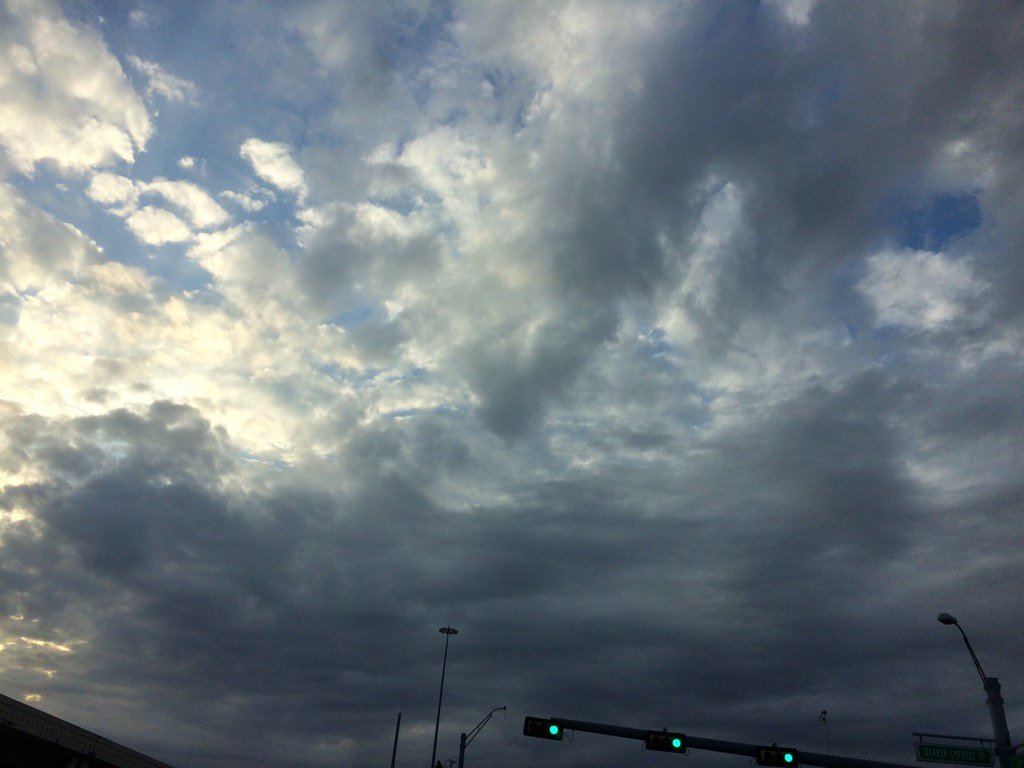
Katy, TX during the late afternoon.
Notes: Big to small, bright white with some light to dark grey, thick, puffy, low to high stratus clouds looked to cover most of and sometimes the whole sky in northwest Houston, TX during the morning and afternoon. Big to small, bright white with light to dark grey, thick, flat, puffy low stratus clouds looked to cover most of the sky in west Houston, TX and Katy, TX during the late afternoon. Big to small, Big to small, bright white with light to dark grey, thick, flat, puffy low stratus clouds looked to cover most of the sky in Katy, TX during the evening. Big to small, bright white, thick, flat, puffy, high stratus clouds looked to be widely scattered across the sky in northwest and west Houston, TX and Katy, TX during the early night. The wind speeds were relatively calm to moderate with moderately strong to really strong gusts in northwest Houston, TX during the morning and afternoon, and early night. The wind speeds were relatively calm to moderate with moderately strong to really strong gusts in west Houston, TX and Katy, TX during the late afternoon and early night. The wind speeds were relatively calm to moderate with moderately strong to really strong gusts in Katy, TX during the evening. It felt really cold in northwest Houston, TX during the morning. It felt cold, almost really cold in northwest Houston, TX during the afternoon. It felt really cold in west Houston, TX and Katy, TX during the late afternoon. It felt really cold in Katy, TX during the evening. It felt really cold in Northwest and west Houston, TX and Katy, TX during the early night. There looked to be some isolated light rain/ winter mix showers on the radar to the west of Houston, TX, near Katy, Magnolia, Columbus, and Cypress, TX, during the early morning before sunrise. I saw some more light winter mix on the radar near Katy, TX during the evening. I don't know if any of the winter mix ever reached the ground, or not. I didn't hear about any winter precip, But I did see some winter precip on the radar. So I don't know if any of the area near Houston, TX got any winter precip, or not. There were no hints of winter precip, or winter storm warnings, or watches issued.
Thoughts: It has been really cold today in Houston and Katy, TX. It looks like Houston and Katy, TX may have had some light winter precip. Unfortunately I didn't see any. This is the first time that I can remember that the Houston, TX area has had temperatures barely get over 40 degrees since sometime during January of 2015, where Houston, TX was under the threat of winter precip/ freezing rain that never came. It is supposed to get into the upper 20's for tomorrow's low. I can't remember when the last time that happened. Probably sometime during early 2014, or 2015, in the Houston, TX area.
Hazardous Weather Outlook
HAZARDOUS WEATHER OUTLOOK
NATIONAL WEATHER SERVICE HOUSTON/GALVESTON TX
523 AM CST SUN DEC 18 2016

TXZ163-164-176>179-195>200-210>214-226-227-235>238-191130-
AUSTIN-BRAZORIA-BRAZOS-BURLESON-CHAMBERS-COLORADO-FORT BEND-
GALVESTON-GRIMES-HARRIS-HOUSTON-JACKSON-LIBERTY-MADISON-MATAGORDA-
MONTGOMERY-POLK-SAN JACINTO-TRINITY-WALKER-WALLER-WASHINGTON-
WHARTON-
523 AM CST SUN DEC 18 2016

THIS HAZARDOUS WEATHER OUTLOOK IS FOR PORTIONS OF SOUTHEAST TEXAS.

.DAY ONE...TODAY AND TONIGHT

WIND ADVISORY IN EFFECT THROUGH THIS MORNING FOR STRONG AND GUSTY
NORTH WINDS. A FREEZE WARNING IS IN EFFECT FOR AREAS NORTH AND
WEST OF HOUSTON THROUGH THIS MORNING. WIND CHILL READINGS WILL BE
IN THE TEENS TO LOW 20S THIS MORNING AND AGAIN TONIGHT.

.DAYS TWO THROUGH SEVEN...MONDAY THROUGH SATURDAY

A FREEZE WARNING MAY BE NEEDED FOR THE SOUTHERN HALF OF SOUTHEAST
TEXAS INCLUDING THE COASTAL AREAS FOR MONDAY MORNING. A HARD
FREEZE WARNING MAY BE NEEDED FOR BURLESON, BRAZOS, MADISON, AND
HOUSTON COUNTIES FOR TEMPERATURES BELOW 24 DEGREES FOR MORE THAN
1-2 HOURS. A WIND CHILL ADVISORY MAY BE NEEDED FOR THESE SAME
COUNTIES AS WIND CHILL READINGS COULD DROP BELOW 13 DEGREES.

TEMPERATURES MAY DROP BELOW FREEZING AGAIN TUESDAY MORNING.

.SPOTTER INFORMATION STATEMENT...

SPOTTER ACTIVATION IS NOT EXPECTED.

$$
Freeze Warning
URGENT - WEATHER MESSAGE
NATIONAL WEATHER SERVICE HOUSTON/GALVESTON TX
813 PM CST SUN DEC 18 2016

...HARD FREEZE WARNING EXPANDED...
...FREEZE WARNING IN EFFECT...

.A VERY COLD AND DRY NIGHT ON TAP. TEMPERATURES GENERALLY ALONG
AND NORTH OF A LINE FROM BRENHAM TO NAVASOTA TO NEAR MADISONVILLE
TO CROCKETT WILL LIKELY FALL TO LESS THAN 25 DEGREES FOR 2 TO 4
HOURS LEADING TO A HARD FREEZE.

ELSEWHERE TEMPERATURES SHOULD FALL TO OR BELOW FREEZING RANGING
FROM 31 TO 32 DEGREES IN THE INLAND AREAS OF THE COASTAL COUNTIES
FOR A FEW HOURS TO 30 TO 25 DEGREES ALONG AND NORTH OF THE HIGHWAY
59 CORRIDOR. NORTH WINDS OF 5 TO 15 MPH WINDS WILL MAKE THE
TEMPERATURE FEEL EVEN COLDER. TEMPERATURES SHOULD RISE ABOVE
FREEZING AROUND 9 AM THOUGH A FEW LOW LYING POCKETS IN THE NORTH
MAY LINGER AROUND FREEZING UNTIL 10 OR 11 AM.

TXZ164-177>179-199-200-210>214-226-227-235>238-191500-
/O.CON.KHGX.FZ.W.0004.161219T0600Z-161219T1500Z/
AUSTIN-BRAZORIA-CHAMBERS-COLORADO-FORT BEND-GALVESTON-HARRIS-
JACKSON-LIBERTY-MATAGORDA-MONTGOMERY-POLK-SAN JACINTO-TRINITY-
WALKER-WALLER-WHARTON-
INCLUDING THE CITIES OF...ALVIN...ANAHUAC...ANGLETON...BAY CITY...
BELLVILLE...BROOKSHIRE...CLEVELAND...COLDSPRING...COLUMBUS...
CONROE...CORRIGAN...DAYTON...EAGLE LAKE...EDNA...EL CAMPO...
FREEPORT...FRIENDSWOOD...GALVESTON...GROVETON...HEMPSTEAD...
HOUSTON...HUMBLE...HUNTSVILLE...KATY...LAKE JACKSON...
LEAGUE CITY...LIBERTY...LIVINGSTON...MISSOURI CITY...
MONT BELVIEU...ONALASKA...PALACIOS...PASADENA...PEARLAND...
PIERCE...PRAIRIE VIEW...RICHMOND...ROSENBERG...SEALY...SHEPHERD...
SUGAR LAND...TEXAS CITY...THE WOODLANDS...TOMBALL...TRINITY...
WEIMAR...WHARTON...WILLIS...WINNIE
813 PM CST SUN DEC 18 2016

...FREEZE WARNING REMAINS IN EFFECT FROM MIDNIGHT TONIGHT TO 9 AM
CST MONDAY...

* EVENT...SUB FREEZING TEMPERATURES IN THE UPPER 20S TO LOWER
  30S.

* TIMING...AROUND MIDNIGHT THROUGH EARLY MONDAY MORNING HOURS.

* IMPACT...PROTECT THE 4 PS. PEOPLE...PETS...PLANTS AND PIPES.
  FOLKS WITHOUT SUFFICIENT SHELTER OR HEAT SHOULD BE LOOKED
  AFTER...PETS PLACED INSIDE...SENSITIVE VEGETATION COVERED OR
  PLACED INDOORS...AND EXPOSED EXTERIOR WATER PIPES WRAPPED WITH
  INSULATING MATERIAL.

PRECAUTIONARY/PREPAREDNESS ACTIONS...

A FREEZE WARNING MEANS SUB FREEZING TEMPERATURES ARE IMMINENT OR
HIGHLY LIKELY. THESE CONDITIONS WILL KILL CROPS AND OTHER
SENSITIVE VEGETATION.

&&

$$
No comments:
Post a Comment