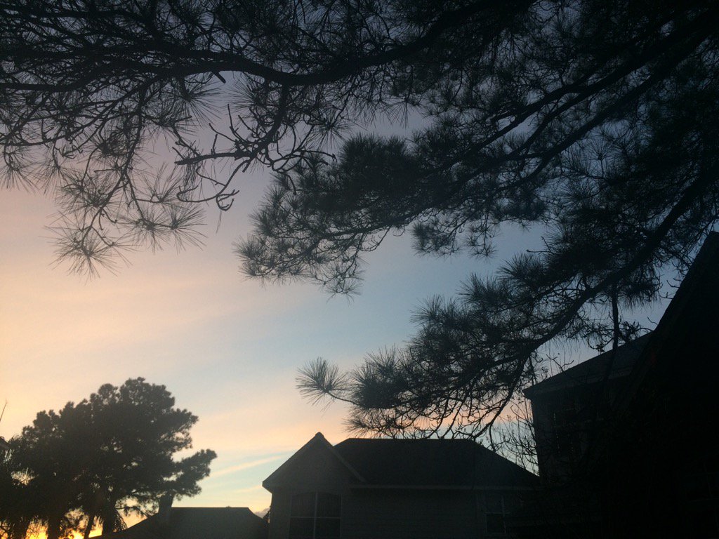
Northwest Houston, TX during the early evening.
Notes: Big to small, mostly bright white, some bright white mixed with light to dark grey and maybe some blueish grey, thick, flat, low stratus clouds looked to cover the whole sky in northwest Houston, TX during the early and mid-morning. Big to small, mostly bright white, some bright white mixed with light to dark grey and maybe some blueish grey, thick and puffy, low stratus clouds looked to cover most of and maybe sometimes the whole sky in northwest Houston, TX during the late morning and early and maybe mid-afternoon. Big to small, bright white, thick, flat, wavy, high stratus clouds looked to cover most of the sky in northwest Houston, TX, from sometime during the late, or maybe mid-afternoon thru most of the early night. A big, bright white, barely view-able, very high stratus cloud looked to cover the whole sky in northwest Houston, TX, from sometime during the early night thru the rest of the night. The wind speeds looked to be calm with maybe some moderate gusts in northwest Houston, TX during the morning, afternoon, and evening, and maybe night. It felt warm, maybe a little cool in northwest Houston, TX during the morning and night. It felt warm in northwest Houston, TX during the afternoon and evening. There looked to be a light dense fog when I looked out of my house's window, during the early and mid-morning. The light dense fog looked to have dissipated sometime during the late morning. A big line of light to moderately heavy and maybe some really heavy showers and maybe thunderstorms looked to have formed somewhere in southeast Houston, TX and moved south thru Galveston, TX, when I looked at the radar, during the morning. A quick, few minute, light to moderate shower passed over my house, sometime during the early afternoon.
Thoughts: Houston, TX has been getting a lot of rain this weekend. A great start to the new year! It looks like there is some more rain to come in the extended forecast with also some possible cool to cold temps. But no snow.
Issued by NWS Houston/Galveston, TX
Versions: 1 2 3 4 5 6 7 8 9 10 11 12 13 14 15 16 17 18 19 20 21 22 23 24 25 26 27 28 29 30 31 32 33 34 35 36 37 3839 40 41 42 43 44 45 46 47 48 49 50
000
FXUS64 KHGX 020439
AFDHGX

Area Forecast Discussion
National Weather Service Houston/Galveston TX
1039 PM CST Sun Jan 1 2017

.UPDATE...
Just issued a dense fog advisory over Galveston Bay and the Gulf
waters within 20 nm east of Freeport. The visibility should be
nearing or getting below 1 nm over portions of the bay as seen by
area cameras. Will monitor for possible expansion of the advisory
further down the coast.

40

&&

.PREV DISCUSSION... /ISSUED 1005 PM CST Sun Jan 1 2017/

CLIMATE...
There were 27 daily records set last month at the first-order
climate sites with 11 set at the city of Galveston alone. The
following is a listing of the records tied or set in September at
College Station (CLL), Galveston (GLS), Hobby Airport (HOU), and
Houston (IAH).

     ...Record Temperature and Rainfall Data for December 2016...

Site    Date     Record Type       New Record    Prev Record

 CLL    12/24    High Min Temp         68        66 in 1987 #
                                                 66 in 1948 *
 CLL    12/25    High Min Temp         70        62 in 1942 *
                                                 61 in 1971 #
 CLL    12/26    High Max Temp         80        Tied 1988 #
                                                 Tied 1916 *
 CLL    12/28    High Max Temp         82        80 in 1984 #
                                                 80 in 1921 *

 GLS    12/03    Rainfall             7.68       2.64 in 1965
 GLS    12/13    High Max Temp         81        77 in 1933
 GLS    12/17    High Min Temp         69        Tied 1999
 GLS    12/17    High Max Temp         77        75 in 2006
                                                  and prev
 GLS    12/24    High Max Temp         77        76 in 2012
 GLS    12/25    High Max Temp         76        Tied 2015
 GLS    12/26    High Max Temp         78        76 in 2015
 GLS    12/27    High Min Temp         69        67 in 1889
 GLS    12/27    High Max Temp         78        74 in 2015
                                                  and prev
 GLS    12/28    High Min Temp         68        67 in 1889
 GLS    12/28    High Max Temp         76        73 in 2005

 HOU    12/17    High Max Temp         82        80 in 2006
 HOU    12/26    High Max Temp         82        81 in 2015
 HOU    12/27    High Min Temp         70        63 in 1984
 HOU    12/27    High Max Temp         82        80 in 1971
 HOU    12/28    High Min Temp         70        Tied 1984
 HOU    12/28    High Max Temp         82        80 in 1996
                                                  and prev

 IAH    12/17    High Max Temp         81        80 in 1990
                                                  and prev
 IAH    12/26    High Max Temp         84        80 in 2015
 IAH    12/27    High Min Temp         67        65 in 1937
 IAH    12/27    High Max Temp         83        81 in 1971
 IAH    12/28    High Min Temp         70        Tied 1946
 IAH    12/28    High Max Temp         82        80 in 1996

Notes:
* Previous record for College Station 6 SW COOP (1903 to
  July 1951)
# Previous record for Easterwood Field (August 1931 to present)

40

PREV DISCUSSION... /ISSUED 957 PM CST Sun Jan 1 2017/

UPDATE...
Area of storms moving across W Texas at 9:30 PM were associated
with a strong upper level shortwave trough. The main items of
concern continue to be the impact of the upper level shortwave
across SE Texas overnight tonight and Monday morning. Patchy fog
over the inland areas and sea fog along the coast are other
concerns.

The latest Texas Tech WRF had a decent handle on the location of
the storms at 9 PM. The model shows development ahead of the
system beginning between 3 and 6 AM. There were also indications
that showers and isolated thunderstorms will develop over the
coastal waters and coastal counties after midnight. The HRRR
picked up on this development as well with showers moving inland
after midnight. A slight risk for severe storms continues as can
be seen on the 00Z CRP and LCH soundings where the MU Cape values
ranged from 1600 to near 2300. Forecast helicity values reach 260
ahead of the main line of storms, also. Regarding fog--the high
res models showed the potential for patchy fog development
overnight as well. The current forecast continues on track.

40

PREV DISCUSSION... /ISSUED 549 PM CST Sun Jan 1 2017/

AVIATION.../00Z TAF/
Surface analysis at 23Z has low pressure in west Texas in response
to an advancing short wave trough over the southern Rockies on
water vapor imagery. Light southerly winds tonight should increase
tonight. Hi-res mesoscale models have strong/severe convection
forming in central Texas and then pushing east rapidly through the
morning hours into SE Texas. Ahead of the line expect patchy fog
and IFR ceilings. Look for a transition from VFR/MVFR to IFR from
04Z to 06Z tonight with IFR through about 15-16Z when convection
pushes through. TAFs will keep mention of VCTS and tempo TSRA for
morning hours of 12-16Z since this looks like the time frame in
which a line of storms will push through the area. Hi-res models
and NAM keep strongest convection north of KCLL/KUTS while the GFS
consistently hits all of SE Texas hard with convection. Upper
level support will be strongest north of the area and based on
model soundings weak capping may be an issue as boundary layer
flow veers from SE at the surface to SW at 850MB. Will need to
watch Hi-res model trends the next few hours to see if any changes
need to be made to timing and intensity of convection.

Overpeck

PREV DISCUSSION... /ISSUED 354 PM CST Sun Jan 1 2017/

DISCUSSION...
The main highlights for the upcoming forecast will be a messy
entrance into January for Southeast Texas as a thunderstorm
complex moves across the region overnight, warm (and possibly near
record temperatures) behind this complex on Monday, and a return
of colder temperatures as Arctic air spills into the region mid to
late week.

Visible satellite imagery this afternoon shows that drier mid-
level air working its way into the region has thinned cloud cover
across the central and northern counties. This has allowed for
enough insolation for a few showers to pop up along the Interstate
10 corridor; have extended mention of isolated showers through 6
PM tonight as a result, but anticipate all activity to dissipate
with loss of heating later this afternoon. A dry evening is
expected across the region, but the approach of a shortwave trough
from the west will quickly herald in an unsettled period of
weather by early Monday morning.

Located over southern Arizona/New Mexico on afternoon water vapor
imagery, this compact disturbance will continue to translate east
across Texas tonight. Height falls associated with this feature
will result in scattered thunderstorms developing across West and
West Central Texas tonight, with upscale growth into a
thunderstorm complex expected after midnight tonight. This
thunderstorm complex will continue to propagate eastward across
Texas, aided by its parent shortwave, reaching the western
counties of Southeast Texas after 5-6 AM CST on Monday morning.
Ahead of this complex, an intensifying 40-50 knot low level jet
after 4 AM and increasing mid/upper level lift overspreading the
region may also result in the development of isolated showers and
thunderstorms.

High resolution guidance continues to waffle between whether or
not this pre-thunderstorm complex activity will develop and what
the intensity of this activity would be, likely owing to the
presence of a weak capping inversion present around 900 MB on area
soundings. Regardless, environmental conditions continue to remain
favorable for the development of severe weather both ahead of and
with the main thunderstorm complex. The intensifying low level jet
will contribute to increasingly curved hodographs and 0-1 KM storm
relative helicity values in excess of 150 J/kg across much of the
region, representing the presence of at least an isolated tornado
threat. This threat would likely materialize with any of the
discrete thunderstorms that develop ahead of the main thunderstorm
complex approaching from the west. Even if thunderstorms are not
able to develop owing to the weak cap in place, any shower that
develops ahead of the complex will be able to transport at least
some of the strong winds above the surface to the ground. The
somewhat negative tilt to the shortwave trough will also encourage
steep mid-level lapse rates (around 7-8 C/km) to spread across
much of the region, resulting in the risk for large hail as well
as damaging winds as the main thunderstorm complex moves across
the region.

Expect the main thunderstorm complex to clear the region by 12 PM
CST on Monday. Behind the complex, clearing skies and deep
westerly flow spreading across the region will result in
temperatures rising rapidly into the mid 70s to near 80 degrees on
Monday afternoon. Have continued to trend warmer than model
guidance for this time period given the depth of the westerly
flow. These temperatures may even warm enough to result records
being tied or broken. For reference, Galveston`s record high on
January 2 is 78. This would also be the record warmest temperature
for the month of January.

The next cold front approaches the region on Tuesday, clearing
Southeast Texas by Tuesday night. With limited moisture recovery
in the wake of Monday`s system, have continued with a dry forecast
for the mid-week portion of the forecast. Modified Arctic air
spilling into the region behind the front looks to drop
temperatures back down near (to below) seasonal normals, with
highs in the 50s to near 60 and lows in the upper 30s to 40s.

A reinforcing cold front reaches the region late in the week
(with considerable medium range differences persisting on timing)
and this will keep temperatures below seasonal normals through the
end of the week. Have continued to utilize a blend of model
guidance for the weekend portion of the forecast, with the
deterministic GFS attempting to develop a coastal trough and
return Southeast Texas to a rainy pattern and the European
maintaining offshore flow and a drier solution.

Huffman

MARINE...
Sea fog (some dense) will continue to be possible until a line of
showers and thunderstorms moves through the area during the day on
Monday. South winds are expected to strengthen tonight ahead of
the storms, and small craft advisories might be needed for the
winds as well as building seas. Winds will shift to the west and
weaken in the late morning through afternoon hours after the
storms move through. A couple of cold fronts during the week will
bring north to northeast winds to the area with both winds and
seas possibly reaching advisory levels. 42

&&

.PRELIMINARY POINT TEMPS/POPS...
College Station (CLL)      63  75  49  72  42 /  60  70   0   0   0
Houston (IAH)              68  77  52  74  46 /  40  80   0   0   0
Galveston (GLS)            67  79  60  72  52 /  30  70   0   0   0

&&

.HGX WATCHES/WARNINGS/ADVISORIES...
TX...NONE.
GM...SMALL CRAFT SHOULD EXERCISE CAUTION through Monday morning for
     the following zones: Coastal waters from Freeport to the
     Matagorda Ship Channel out 20 NM...Coastal waters from High
     Island to Freeport out 20 NM...Galveston Bay...Matagorda
     Bay.

     Dense Fog Advisory until 9 AM CST Monday for the following
     zones: Coastal waters from High Island to Freeport out 20
     NM...Galveston Bay.

     Small Craft Advisory until noon CST Monday for the following
     zones: Waters from Freeport to the Matagorda Ship Channel
     from 20 to 60 NM...Waters from High Island to Freeport from
     20 to 60 NM.

&&

$$

Discussion...40
Aviation/Marine...39
No comments:
Post a Comment