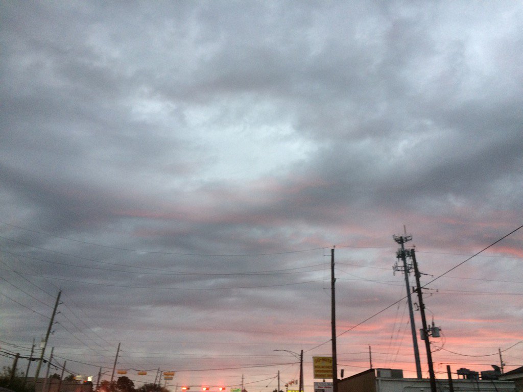
Northwest Houston, TX during the early morning.
Notes: Big to small, bright white, bright white mixed with light to dark grey, mostly blueish grey, thick, flat, puffy, low stratus clouds looked to cover most, or maybe the whole sky in northwest and west Houston, TX during the early morning. Big to small, bright white, thick, flat, some puffy, low and high stratus clouds looked to be widely scattered across the sky in west Houston, TX during the mid and late morning, afternoon, and evening. Big to small, bright white, thick, flat, puffy, low stratus clouds looked to cover the whole, or maybe most of the sky in northwest, southwest, and west Houston, TX during the early night. The wind speeds looked to be calm with maybe some moderate to moderately strong gusts in northwest and west Houston, TX during the early morning. The wind speeds looked to be calm to relatively calm with moderate to moderately strong and maybe some really strong gusts in west Houston, TX during the mid and late morning. The wind speeds looked to be calm to relatively calm with moderate to moderately strong and some really strong (20-25 mph) gusts in west Houston, TX during the afternoon, evening, and early night. The wind speeds looked to be calm with moderate to moderately strong and some really strong (20-25 mph) gusts in northwest and southwest Houston, TX during the early night. It felt warm in northwest and west Houston, TX during the early morning. It felt warm in west Houston, TX during the mid and late morning. It felt warm, maybe very warm with a cool wind in west Houston, TX during the afternoon. It felt warm with a cool wind in west Houston, TX during the evening, and early night. It felt warm with a cool wind in northwest and southwest Houston, TX during the early night. There was a slight chance (20 to 40%) for rain for the Houston, TX area during the morning, afternoon, evening, and night. I saw some light to moderately heavy showers in and around the Houston, TX area on the radar, during the evening and early night. I didn't see, or feel any rain drops anytime during the day. I also didn't see any fog. There was a dense fog advisory issued for the coastal areas of southeast Houston, TX during the morning and night. Some of the fog was reported to have moved inland, but I didn't see any.
Thoughts: Still wondering if Houston, TX is going to get any rain this weekend and early next week. So far I haven't seen much.
Area Forecast Discussion
Issued by NWS Houston/Galveston, TX
Issued by NWS Houston/Galveston, TX
Versions: 1 2 3 4 5 6 7 8 9 10 11 12 13 14 15 16 17 18 19 20 21 22 23 24 25 26 27 28 29 30 31 32 33 34 35 36 37 3839 40 41 42 43 44 45 46 47 48 49 50
000
FXUS64 KHGX 140408
AFDHGX

Area Forecast Discussion
National Weather Service Houston/Galveston TX
1008 PM CST Fri Jan 13 2017

.DISCUSSION...
A cold front hung up along the I-35 corridor has keep this warm
and moist air mass in place across southeastern Texas. A weak
shortwave moving through within the upper southwesterly flow has
provided just enough lift within a slightly more unstable coastal
environment to generate scattered showers. This light -RA activity
has formed and moved north generally along the Gulf Freeway into
the city...now passing into Montgomery County this hour. Light
showers will occasionally spring up through Saturday...an
unstable enough lower 7-8 k ft layer to support under-the-cap
showers within a continued warm and moist regional air mass (as
the cold frontal boundary is forecast to wash out as it moves
back to the northwest early Saturday). A light southeast wind with
slight rain chances through Sunday. Overnight minimum temperatures
in the average middle 60s...a mostly cloudy Saturday as afternoon
temperatures warm into the middle to upper 70s. A 67 year old
record maximum temperature record of 80 F at College Station may
be threatened but record maximum Ts around the city are in the (20
year old record) lower to middle 80s and these records may hold.
A few cloud breaks can quickly shoot early afternoon temperature
readings up so we`ll see if any records fall or are tied Saturday.
Dense sea fog will again be an issue late this evening and this
deck will persist well into the daytime hours tomorrow across the
marine communities. Fog/low overcast may wreck havoc on tomorrow`s
temperature forecast...current thinking is that fog or a low deck
across the coastal counties will keep many in the low to mid 70s.
31

&&

.PREV DISCUSSION... /ISSUED 534 PM CST Fri Jan 13 2017/

AVIATION...
IFR/LIFR cigs and/or fog will roll in from from the coast this
evening and overnight. These unfavorable conditions will persist
until the late morning hours Saturday inland and linger into the
afternoon hours at the coast before any improvement occurs. Model
guidance is indicating the potential for some spotty shra, which
if occurs will provide some temporary improvement where that
occurs. Not enough confidence to include the mention in the tafs
however. 47

&&

PREV DISCUSSION... /ISSUED 312 PM CST Fri Jan 13 2017/
Sea fog has largely pulled back from land areas this afternoon,
but will continue to be a potential hazard for immediate coastal
areas through the weekend, particularly in the nights and morning
hours. While low potential for showers or a thunderstorm will also
be present through the weekend, the best potential for rain looks
to come early next week. Rain may be locally heavy, but at this
time the best potential for heavy rain should be north of our
area. After that, look for a cooling trend only into the midweek
before temperatures go back on the upswing.

Through this weekend...
Observations show the cold front has stalled northwest of our
area, leaving us in continued higher moisture air and onshore
flow. Fog or low stratus is in place over the nearshore waters and
immediate coastal areas, while satellite shows more of a cloud
street pattern oriented with the generally southeasterly flow for
the rest of Southeast Texas and only limited vertical growth
thanks to capping. This stalled front is unlikely to move much
for most of the weekend, though eventually should be dragged back
northwards as a warm front later on Sunday in advance of a new
cold front. As such, expect continued warmth and sea fog potential
through the weekend. Front-perpendicular flow prompts some low
PoPs as there should be some gentle upglide. But, with capping in
place and a subtle patch of dry air swinging through, not
expecting much activity on Saturday. Sunday, an upper trough
swinging through the Panhandles while a jet streak noses towards
the area may support a little better chance of showers or a storm,
but the main show looks to hold off until after midnight and early
next week.

Late Sunday night through Tuesday night...
As the upper trough continues to eject to the northeast, the
surface low will follow on a path from the Red River Valley
towards the Great Lakes. Unlike the current front that failed to
reach our area, this should manage to make it to the coastline
before stalling Tuesday night (though not much farther). As a
consequence, PoPs should increase dramatically for Monday. Progged
precipitable water doesn`t look nearly as robust as previous model
cycles, only in the 1-1.3 inch range rather than 1.5 inches, with
the higher moisture pool looking to occur more over Northeast
Texas. This should limit rainfall potential some for us, but we`re
still looking boundary-parallel flow, so don`t write off heavy
rain potential. Specifics are still a bit sketchy as models have
the same general idea, but still show some differences both in
timing, and the character of how midlevel vorticity streams
through.

Wednesday and beyond...
As the trough axis moves through and the front stalls, we should
see a modestly cooler and drier airmass attempt to work into the
area, bringing us some cooler temperatures for the midweek. But
temperature falls don`t look too dramatic, only falling to near or
even still a little above seasonal averages. From here, model
consensus really breaks down, introducing some pretty significant
model uncertainty. The GFS, which has been more discrete/pulsy in
moving vort maxes through, has a pretty potent bowling ball over
Southeast Texas for Thursday, which develops a surface reflectance
from the stalled frontal zone and rides along that boundary
through Southeast Texas. The result is a pretty good blast of rain
with that coastal low. On the other extreme, the Euro still shows
a vort max, but is much more modest - likely as it keeps a more
elongated upper trough in place opposed to the GFS` staccato
bursts of vorticity advection. For what it`s worth, the Canadian
shows characteristics of both solutions, but the result on
sensible weather seems to more closely parallel the Euro. Since
rapid fire bursts of closed upper lows seems a bit out of the
norm, the forecast leans strongly towards the Euro`s picture, but
does include chance PoPs Wednesday and Thursday in deference to
the plausible, if seemingly less likely, scenario posed by the
GFS. But, with southwest flow aloft, there is greater confidence
for rising temperatures in the back half of the week. 25/39

&&

MARINE...
Per satellite, an area of sea fog has persisted just off the upper
TX coast from High Island to the San Luis Pass through this after-
noon. Did issue an update earlier this afternoon to keep the Dense
Fog advisory up for these areas for the rest of the day. This same
update also re-issued the Dense Fog advisory for both bays and the
entire length of our nearshore waters for this evening through to-
morrow morning. These advisories will likely be extended (in parts
or as a whole) through the weekend as this weather pattern remains
in place. Long-range models not showing any sort of change/frontal
passage until perhaps next Tues. 41

&&

.PRELIMINARY POINT TEMPS/POPS...
College Station (CLL)      65  77  61  75  63 /  20  20  20  30  50
Houston (IAH)              65  78  63  75  64 /  20  20  20  30  30
Galveston (GLS)            65  71  62  70  64 /  40  10  20  20  20

&&

.HGX WATCHES/WARNINGS/ADVISORIES...
TX...NONE.
GM...Dense Fog Advisory until 9 AM CST Saturday for the following
     zones: Coastal waters from Freeport to the Matagorda Ship
     Channel out 20 NM...Coastal waters from High Island to
     Freeport out 20 NM...Galveston Bay...Matagorda Bay.

&&

$$

Discussion...31/47
Hazardous Weather Outlook
HAZARDOUS WEATHER OUTLOOK
NATIONAL WEATHER SERVICE HOUSTON/GALVESTON TX
436 AM CST FRI JAN 13 2017

TXZ163-164-176>179-195>200-210>214-226-227-235>238-141045-
AUSTIN-BRAZORIA-BRAZOS-BURLESON-CHAMBERS-COLORADO-FORT BEND-
GALVESTON-GRIMES-HARRIS-HOUSTON-JACKSON-LIBERTY-MADISON-MATAGORDA-
MONTGOMERY-POLK-SAN JACINTO-TRINITY-WALKER-WALLER-WASHINGTON-
WHARTON-
436 AM CST FRI JAN 13 2017

THIS HAZARDOUS WEATHER OUTLOOK IS FOR PORTIONS OF SOUTHEAST TEXAS..

.DAY ONE...TODAY AND TONIGHT

AREAS OF SEA FOG WILL LINGER NEAR THE COAST TODAY. VISIBILITIES
WILL VARY GREATLY...RANGING BETWEEN 1 AND 6 MILES. LOCALLY DENSE
FOG WILL BE POSSIBLE ALONG THE BARRIER ISLANDS WITH VISIBILITY
DROPPING BELOW A 1/2 MILE AT TIMES.

.DAYS TWO THROUGH SEVEN...SATURDAY THROUGH THURSDAY

AN APPROACHING UPPER LEVEL SYSTEM WILL BRING INCREASING SHOWER AND
THUNDERSTORM CHANCES MONDAY THROUGH WEDNESDAY...WITH LOCALLY HEAVY
RAIN AND A FEW STRONG STORMS POSSIBLE DURING THIS TIME.

.SPOTTER INFORMATION STATEMENT...

SPOTTER ACTIVATION WILL NOT BE NEEDED.

$$
No comments:
Post a Comment