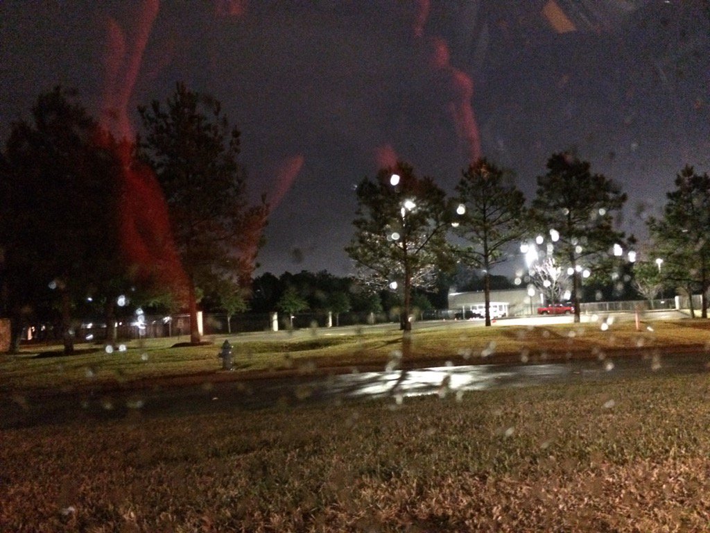
Northwest Houston, TX during the early morning.
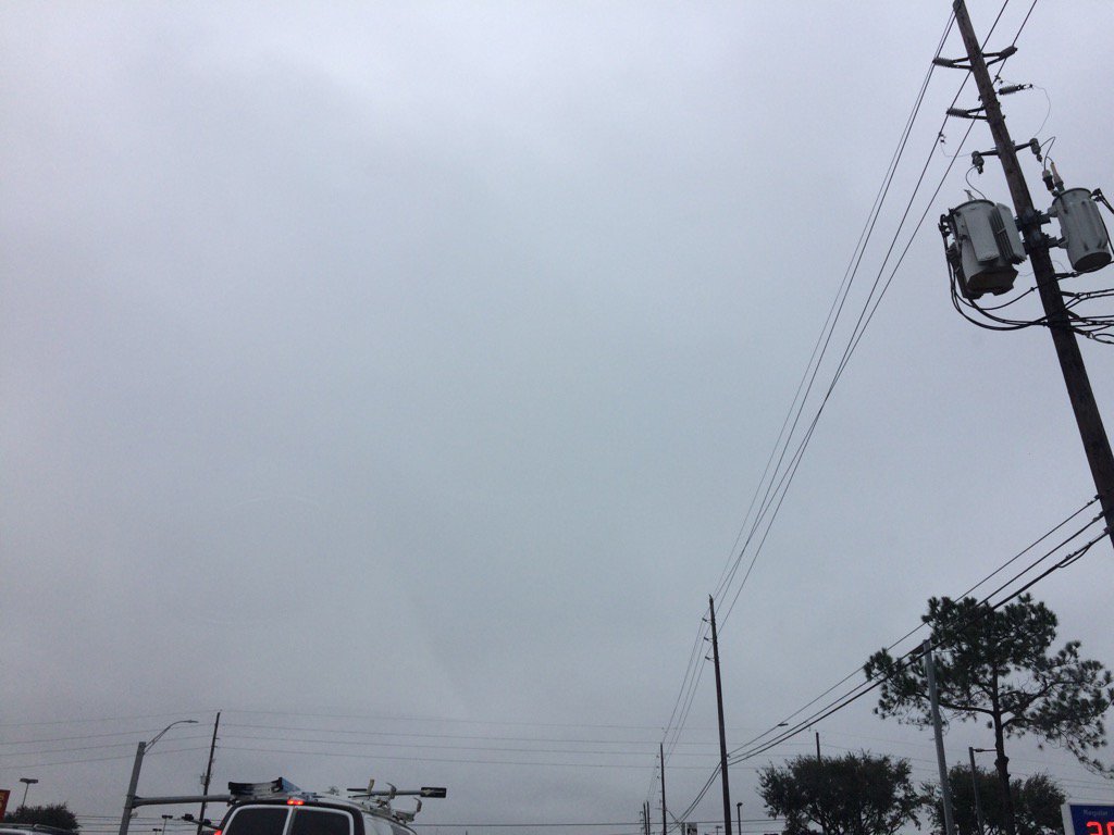
Northwest Houston, TX during the late afternoon.
Notes: A thick layer of bright white mixed with light to dark grey and blueish grey, thick, flat, puffy, low stratus clouds covered the whole sky in northwest and west Houston, TX during the early morning. A thick layer of bright white mixed with light to dark grey and blueish grey, thick, flat, puffy, low stratus clouds still covered the whole sky in west Houston, TX during the mid and late morning and afternoon. A thick layer of bright white mixed with light to dark grey and blueish grey, thick, flat, puffy, low stratus clouds covered the whole sky in northwest Houston, TX during the late afternoon and evening. A thick layer of bright white mixed with light to dark grey, thick, flat, puffy, low stratus clouds looked to cover the whole sky in northwest Houston, TX during the early night. The wind speeds looked to be calm with maybe some moderate to moderately strong gusts in northwest and west Houston, TX during the early morning. The wind speeds looked to be calm with maybe some occasional moderate to moderately strong and really strong gusts in west Houston, TX during the mid and late morning, and afternoon. The wind speeds looked to be calm with maybe some occasional moderate to moderately strong and really strong gusts in northwest Houston, TX during the late afternoon, evening, and early night. It felt warm in northwest and west Houston, TX during the early morning. It started to feel a little cool in west Houston, TX during the late, or maybe mid-morning. It felt cool in west Houston, TX during the afternoon. It felt cool in northwest Houston, TX during the late afternoon, evening, and night. There was a dense fog advisory for the coastal areas of Houston, TX during the morning, afternoon, and maybe evening and night. I didn't see, or hear about any other advisories, watches, or warnings. There was a 20 to 90 percent chance for rain for the Houston, TX area during the morning, afternoon, evening, and night.
Summary: There looked to be a light dense fog when I was in northwest and west Houston, TX during the early morning and late afternoon. Light to really heavy showers and maybe some thunderstorms were widely scattered across the Houston, TX area throughout the day. I saw some possible light drizzle on my way to work in west Houston, TX from northwest Houston, TX during the early morning. Light to moderately heavy and maybe some really heavy rain passed over where I work in west Houston, TX during the mid and late morning, and afternoon. I saw some more light to moderately heavy and possible really heavy rain in northwest Houston, TX during the early night and maybe evening. I heard some possible thunder and what looked to be a possible lightning strike when I was at work in west Houston, TX, sometime during the late, or maybe mid-morning. There didn't look to be any damage, or flooding reported from the showers and maybe thunderstorms. The streets stayed mostly wet with some drying, with a few scattered large, deep puddles.
Thoughts: Lots of rain this week with some cooler temps back in the forecast. It looks like the front has passed. There is still more rain to come.
Area Forecast Discussion
Issued by NWS Houston/Galveston, TX
Issued by NWS Houston/Galveston, TX
Versions: 1 2 3 4 5 6 7 8 9 10 11 12 13 14 15 16 17 18 19 20 21 22 23 24 25 26 27 28 29 30 31 32 33 34 35 36 37 3839 40 41 42 43 44 45 46 47 48 49 50
000
FXUS64 KHGX 172356
AFDHGX

Area Forecast Discussion
National Weather Service Houston/Galveston TX
556 PM CST Tue Jan 17 2017

.AVIATION...
Messy weather expected through this forecast period for the TAFS
given the proximity of the stalled front over our northern zones
and the persistent SW flow aloft. Timing of the embedded distur-
bances within this pattern will be the main forecast issue going
forward tonight/tomorrow. As such, did not make a lot of changes
with the going trends in the TAFS...keeping the mention of SHRA/
TSRA in through tomorrow. 41

&&

.PREV DISCUSSION... /ISSUED 335 PM CST Tue Jan 17 2017/

Unsettled weather continues as the stalled front near the coast
begins to drag back northward, before another front finally clears
things out for a brief time later on Thursday. In this period,
look for scattered to numerous showers and possibly a
thunderstorm. Do not necessarily expect long stretches of
continuous rain as the extended high rain chances imply, but think
of have the potential for showers at any given time be relatively
high. Still expect breaks of up to several hours between showers.
Training showers introduce a marginal potential for excessive
rainfall, and perhaps some localized flooding issues. Also, low
level shear should be enhanced in the frontal area, which could
help sustain organized updrafts. A damaging wind gust, or even a
weak tornado is possible, if not terribly likely. After a short
dry stretch, another front will bring back a chance for some
showers Saturday (night). Behind the front, there are indications
for some pretty significant wind - stay tuned for details to
become more refined on this potential.

Rest of today through Thursday morning...
The front has stalled near the coast this morning, with a fairly
impressive temperature gradient across the front: temperatures
are in the 50s behind the front, and in the low to mid 70s on the
warm side of the front along the coast. Though it`s been every so
slowly sagging southward through the day, expect this front
tonight to slowly work its way back northward, more or less as a
warm front for a coastal low to develop tonight and slide up
through the area through Wednesday. This low and the frontal
boundaries will serve as foci for continued shower and storm
development through tonight, particularly as a shortwave trough
passes overhead late tonight/very early Wednesday morning. Front-
parallel flow and anomalously high moisture content does introduce
some concern for flooding issues by creating a situation in which
we could see training of locally intense cells. The Euro perhaps
hints at this potential, as do the HRRR, TTU WRF, and NCAR
Ensemble. Since they only hint, and the big rainfall potential
requires a fairly fragile setup, don`t want to hit it too
hard...but don`t want to write it off completely, either, since
we`ve had a couple days with numerous showers already. Showers
will continue into Thursday morning before the low moves off to
the northeast and its trailing cold front pushes offshore.

Thursday afternoon through Saturday... Though there may be a
short period of offshore flow that wraps around the coastal low,
winds should quickly turn back to onshore flow as a new upper
trough (and the typical lee cyclogenesis off the Front Range) sets
us up for the next frontal passage at the end of the weekend. The
GFS suggests we`ll see enough moisture return for some low end
rain chances, while the Euro stays dry. Suspect that after several
days of rain, the Euro is more correct, but with some deference to
the GFS, have brought in very low end PoPs, mainly over the Gulf
waters. Otherwise, look for a warming trend, with temps to bounce
back into the 70s as we see the sun reappear until clouds build
back Friday night and Saturday. By Saturday, and with another
front approaching, think there will be a little better potential
for some rain development, going with a chance of rain.

Sunday and beyond...
Sometime very early Sunday, expect a frontal passage, with very
gusty winds to follow in its wake. A wind advisory seems like a
very strong possibility, though there is of course a natural
amount of uncertainty associated with a day 6 forecast. Both the
Euro and GFS show 80 knots near the nose of a 700 dry slot just
behind the front near the Gulf coast. Seeing this, the voice of a
grizzled fire weather program leader in Green Bay rings in my
head, "Watch out for the dry slot!" - a favorite of his critical
weather patterns for high wind. Once through this unsettled
pattern with marginal severe and excessive rainfall potential,
focus seems likely to shift to this timeframe for windy weather.

Luchs

MARINE...
Seas of 5 feet have continued well offshore this afternoon and with
the drop in winds expect these to slowly subside but probably short
lived. Winds from the south increase again Wednesday late morning
and will probably see a return of 4-5 foot seas well offshore. Two
more nights with greater chance of sea fog then with slightly drier
air pushing into the coastal areas fog threat should diminish
Thursday morning. Fog threat may return if drier air aloft doesn`t
linger on Friday afternoon/evening but would be a short lived
threat. Saturday a storm system sweeps in from the west and will
usher in gale force winds Sunday morning. Very favorable temp/wind
profiles for strong downward momentum transfer and will see
wind gusts in excess of 40 knots and wouldn`t rule out 50+ knot
gusts. This is the third run with this going on and confidence is
increasing that we may even flirt with a Storm Watch/Warning
scenario. Haven`t had one of those in very long time. Seas of 14+
feet well offshore after developing in this wind regime. Prolonged
west and northwest winds will drive down water levels and low
water advisory conditions will a big concern as well.
Stay tuned.

45

FIRE WEATHER...
The weather continues with excellent recovery through Thursday then
will probably see some drying. Eyes focusing on next big impact
that may be the storm system late Saturday that brings very strong
west/northwesterly winds and very dry air. Sunday and Monday will
likely be elevated fire weather to even critical Monday.  Again
stay tuned.

45

&&

.PRELIMINARY POINT TEMPS/POPS...
College Station (CLL)      54  61  52  71  54 /  80  90  50  30   0
Houston (IAH)              63  71  58  72  57 /  80  80  70  50  10
Galveston (GLS)            65  70  62  68  61 /  50  60  70  60  10

&&

.HGX WATCHES/WARNINGS/ADVISORIES...
TX...NONE.
GM...NONE.
&&

$$
Hazardous Weather Outlook
HAZARDOUS WEATHER OUTLOOK
NATIONAL WEATHER SERVICE HOUSTON/GALVESTON TX
1013 PM CST TUE JAN 17 2017

TXZ163-164-176>179-195>200-210>214-226-227-235>238-190415-
AUSTIN-BRAZORIA-BRAZOS-BURLESON-CHAMBERS-COLORADO-FORT BEND-
GALVESTON-GRIMES-HARRIS-HOUSTON-JACKSON-LIBERTY-MADISON-MATAGORDA-
MONTGOMERY-POLK-SAN JACINTO-TRINITY-WALKER-WALLER-WASHINGTON-
WHARTON-
1013 PM CST TUE JAN 17 2017

THIS HAZARDOUS WEATHER OUTLOOK IS FOR PORTIONS OF SOUTHEAST TEXAS..

.DAY ONE...TONIGHT

SHOWERS AND EMBEDDED THUNDERSTORMS WILL INCREASE IN AREAL COVERAGE
OVERNIGHT. DUE TO THE TRAINING NATURE OF THE RAINFALL...WE WILL BE
ON THE LOOKOUT FOR LOCALIZED HIGHER AMOUNTS THAT MAY PRODUCE SOME
MINOR STREET FLOODING TYPE PROBLEMS. THERE COULD BE AN ISOLATED
STRONG TO SEVERE STORM GENERALLY BETWEEN INTERSTATE 10 AND THE
COAST WHERE A STALLED FRONTAL BOUNDARY IS SITUATED.

AREAS OF DENSE SEA FOG CAN BE EXPECTED NEAR THE COAST.

.DAYS TWO THROUGH SEVEN...WEDNESDAY THROUGH MONDAY

PERIODS OF SHOWERS AND THUNDERSTORMS ARE EXPECTED INTO THURSDAY.
WE WILL MONITOR FOR THE SAME HAZARDS DESCRIBED ABOVE.

A STRONG WEATHER SYSTEM WILL MOVE INTO THE REGION ON SUNDAY.
THOUGH SCATTERED PRECIPITATION IS POSSIBLE, WE ARE KEEPING AN EYE
ON THE POTENTIAL FOR SOME VERY STRONG WEST WINDS IN ITS WAKE.

.SPOTTER INFORMATION STATEMENT...

SPOTTER ACTIVATION MAY BE NEEDED LATE TONIGHT OR WEDNESDAY.

$$
No comments:
Post a Comment