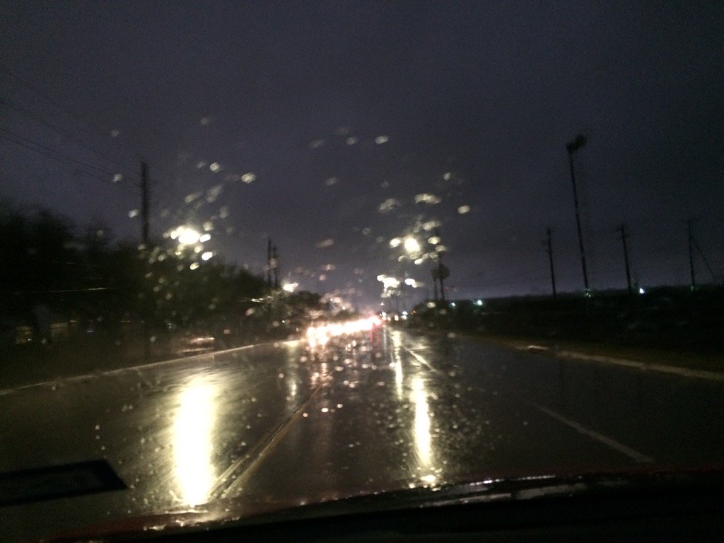
West Houston, TX during the early morning.
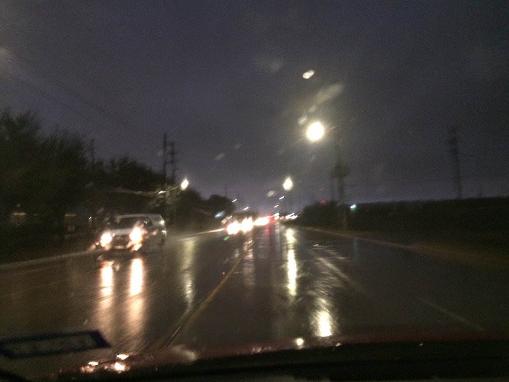
Katy, TX during the early evening.
Katy, TX during the late evening.
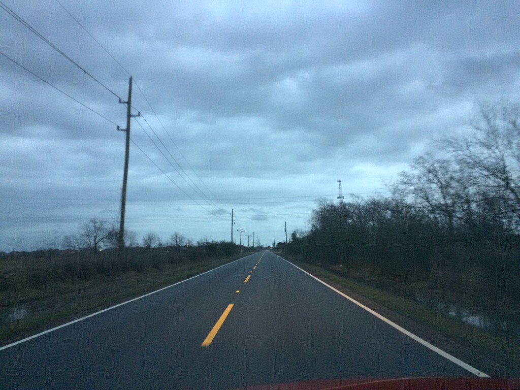
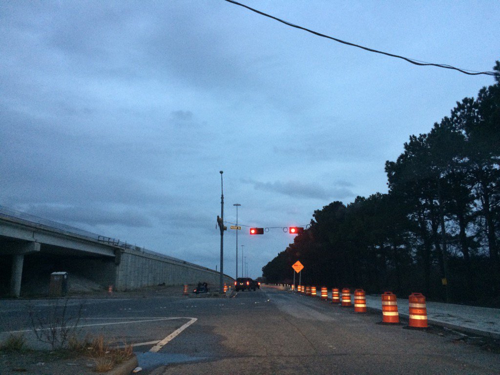
Notes: Big, bright white, mostly dark grey and black/purplish, flat, puffy, low stratus clouds looked to cover the whole sky in northwest and west Houston, TX during the early morning. Big to small, bright white, mostly light to dark grey and blueish grey, thick, flat, puffy, low stratus clouds looked to cover the whole and maybe sometimes only most of the sky in west Houston, TX during the mid and late morning and afternoon. Big to small, bright white, mostly light to dark grey and blueish grey, thick, flat, puffy, low stratus clouds looked to cover the whole and maybe sometimes only most of the sky in Katy, TX during the late afternoon and evening. Big to small, bright white with maybe some light to dark grey, thick, flat, puffy, low, or maybe high stratus clouds looked to cover most of and maybe sometimes the whole sky in northwest Houston, TX during the night. The wind speeds looked to be calm with moderate to moderately strong to really strong gusts in northwest and west Houston, TX during the early morning. The wind speeds looked to be calm with moderate to moderately strong to really strong gusts in west Houston, TX during the mid and late morning and afternoon. The wind speeds looked to be calm with maybe some moderate to moderately strong to really strong wind gusts in Katy, TX during the late afternoon and evening. The wind speeds looked to be calm with moderate to moderately strong to really strong gusts in northwest Houston, TX during the night. It felt warm in northwest and west Houston, TX during the early morning. It felt warm in west Houston, TX during the mid and late morning, and afternoon. It felt warm in Katy, TX during the late afternoon and evening. It felt warm in northwest Houston, TX during the night.
Summary: A cluster of light to really heavy showers and thunderstorms passed over most of the Houston, TX and Katy, TX area during the early morning, followed by some isolated light to maybe moderate showers through the rest of the day. There were tornado warnings and flash flood watches and warnings issued. There was a tornado reported in north Houston, TX at around highway 99 and I-45. It ripped up roofs and blew a few trees and fences down. Other than that there were just a few big puddles and blown leaves left over from the thunderstorms and showers. My parents said that they saw high wind and that our power went out for a few seconds at our house in northwest Houston, TX, from a strong thunderstorm that passed over during the early morning. I just saw some moderately heavy to really heavy rain, but no wind, or lightning and thunder, as I was driving towards west Houston, TX, where I work, during the early morning. The rain had stopped when I arrived at work in west Houston, TX during the early morning. Most of the heavy rain was located in Katy, TX and northwest Houston, TX during the early morning. I didn't see any rain after the early morning showers and thunderstorms.
Video of the tornado can be viewed here: http://www.khou.com/
Thoughts: Well a tornado went through Houston, TX today. That was unexpected. It was only a F-0, but it still caused some significant damage.
Area Forecast Discussion
Issued by NWS Houston/Galveston, TX
Issued by NWS Houston/Galveston, TX
Versions: 1 2 3 4 5 6 7 8 9 10 11 12 13 14 15 16 17 18 19 20 21 22 23 24 25 26 27 28 29 30 31 32 33 34 35 36 37 3839 40 41 42 43 44 45 46 47 48 49 50
000
FXUS64 KHGX 162350
AFDHGX

Area Forecast Discussion
National Weather Service Houston/Galveston TX
550 PM CST Mon Jan 16 2017

.AVIATION...
Weak, shallow frontal boundary continues to sag into northern
parts of se Tx. This feature will be slow moving and eventually
pull up stationary from maybe roughly Edna-Houston-Cleveland late
Tue afternoon. Moisture will override this boundary, and weak
impulses in the upper flow will initiate periods of shra (maybe
some very iso tstms) along and north of the front overnight
tonight thru at least Wed. Flying conditions will be varied
depending on frontal location and precip, but in general
anticipate MVFR/IFR conditions to mostly prevail. Sea fog will
also be a concern in the metro area southward later tonight and
Tue morning as well.  47

&&

.PREV DISCUSSION... /ISSUED 355 PM CST Mon Jan 16 2017/
Though in a relative lull in activity this afternoon, the story
for most of the week will be continued unsettled weather. Like
we`ve seen today, the character of expected precipitation is not
expected to be continuous rain, but there will be high chances for
off and on showers and storms through Thursday, occasionally
enhanced by passing weather features. The severe weather around
the Houston metro this morning was likely the best opportunity for
severe weather in this period, but some more is possible ahead of
a cold front today, and can`t be totally ruled out along the coast
tomorrow. Friday does look to be drier in the wake of a coastal
low, but some chance for precipitation should return for the
weekend. Finally, a cold front Sunday morning should clear things
out for the first half of next week.

Rest of today through Thursday...
Radar shows showers still ongoing in our north, and while there
have been a smattering of light echoes farther south, the limited
vertical extent of cumulus outside the window implies the cap has
indeed been too strong to overcome, despite the extra heating.
Indeed, SPC mesoanalysis shows at least moderate instability for
the region, but MLCAPE is significantly lower (and with CINH!),
and it appears that is what`s winning out. Winds at College
Station have switched to consistently northwest, and the dewpoint
has dropped to 62, suggesting it has seen the arrival of the
oncoming front. However, this appears to be a bit of a vanguard,
as an APRS site in Madison County and Crockett appear to be ahead
of or just entering the frontal zone at 3pm.

The front should continue to advance, and provide a focus for
continued showers and perhaps a storm. There does seem to be a
modest amount of low level shear near the front, so don`t want to
rule out some organized updrafts for the strongest cells,
especially if, like this morning, we get low-topped convection. Similar
to the SBCAPE/MLCAPE comparison mentioned earlier, while MLCAPE
is limited at this hour, mesoanalysis shows available MUCAPE, and
the front may be enough to tap into any remaining instability for
the nighttime hours. That said, none of the HRRR, TTU WRF, or NCAR
WRF ensemble spark more than numerous light showers until a subtle
midlevel shortwave comes through Tuesday night into Wednesday
morning. So, this concern may simply be for naught.

After the subtle midlevel trough passes through to enhance PoPs
for Tuesday night and Wednesday, we drop back down to more of a
"baseline" high chance inland, while PoPs remain elevated near the
coast as a coastal trough/weak surface low develops Thursday and
moves up the coast. Once it moves through, some brief offshore
flow wrapping around the low pressure center looks to dry things
out briefly, though onshore flow should return by sunrise Friday.

Friday and beyond...
Though the models suggest some light rain near the coast Friday,
opting for now to stay dry until perhaps Friday night or Saturday
and a closer approach of the next front. As the next bowling ball
upper low ejects through the area Sunday, we should see a surface
low roll through Oklahoma, and bring a clearing front through
Southeast Texas Sunday morning. After that, brief midlevel ridging
should keep things quiet into early next week. Luchs

&&

MARINE...
Seas of 5 to 6 feet offshore this afternoon should gradually come
down tonight as winds relax and cold front creeps southward over
SETX. Expect the very moist airmass with dewpoints in the upper 60s
to flow over the cooler shelf water which should become more
favorable for the formation of sea fog if a little more dry air just
above the surface isn`t present than what soundings indicate. Fog
threat especially after midnight through mid morning and possibly
longer as winds back to the east southeast. This pattern holds
through Wednesday before a more potent short wave kicks through and
could increase winds and veer them to more southerly in direction
possibly lessening the fog threat.  Potent system arriving
Sunday/Monday and will likely bring SCA and possibly westerly Gale
conditions to the coastal waters. 45

&&

Fire Weather...
Wet across the area through Saturday for the most part so low fire
concerns. Potent Pacific frontal system will swing through late
weekend/early Monday and has the potential to bring dry/very dry
conditions with abundant wind so may have a slight uptick in fire
threat Monday. 45

&&

.PRELIMINARY POINT TEMPS/POPS...
College Station (CLL)      57  60  53  66  54 /  70  60  80  70  50
Houston (IAH)              65  70  62  74  60 /  60  70  80  80  70
Galveston (GLS)            66  70  63  72  62 /  40  40  70  70  70

&&

.HGX WATCHES/WARNINGS/ADVISORIES...
TX...NONE.
GM...SMALL CRAFT SHOULD EXERCISE CAUTION until 6 PM CST this evening
     for the following zones: Waters from Freeport to the
     Matagorda Ship Channel from 20 to 60 NM...Waters from High
     Island to Freeport from 20 to 60 NM.

&&

$$
Hazardous Weather Outlook
HAZARDOUS WEATHER OUTLOOK
NATIONAL WEATHER SERVICE HOUSTON/GALVESTON TX
419 AM CST MON JAN 16 2017

TXZ163-164-176>179-195>200-210>214-226-227-235>238-171030-
AUSTIN-BRAZORIA-BRAZOS-BURLESON-CHAMBERS-COLORADO-FORT BEND-
GALVESTON-GRIMES-HARRIS-HOUSTON-JACKSON-LIBERTY-MADISON-MATAGORDA-
MONTGOMERY-POLK-SAN JACINTO-TRINITY-WALKER-WALLER-WASHINGTON-
WHARTON-
419 AM CST MON JAN 16 2017

THIS HAZARDOUS WEATHER OUTLOOK IS FOR PORTIONS OF SOUTHEAST TEXAS..

.DAY ONE...TODAY AND TONIGHT

A LINE OF SLOW MOVING SHOWERS AND THUNDERSTORMS WILL BRING PARTS
OF SOUTHEAST TEXAS LOCALLY HEAVY RAIN TODAY. THE BEST CHANCE FOR
HEAVY RAIN WILL WET OF A CROCKETT TO CONROE TO BAY CITY LINE.
ALTHOUGH THESE THESE STORMS ARE NOT SUPERCELL IN NATURE, THERE IS
PLENTY OF SHEAR AND SOME THESE SHOWERS OR THUNDERSTORMS COULD
PRODUCE A BRIEF WEAK TORNADO.

.DAYS TWO THROUGH SEVEN...TUESDAY THROUGH SUNDAY

A STRONG AND SLOW MOVING UPPER LEVEL DISTURBANCE WILL BRING
PERIODS OF SHOWERS AND THUNDERSTORMS TO SOUTHEAST TEXAS THROUGH
THURSDAY. SOME OF THE RAIN COULD AGAIN BE LOCALLY. RAINFALL
AMOUNTS TUESDAY THROUGH THURSDAY SHOULD RANGE BETWEEN 2 AND 4
INCHES WITH SOME ISOLATED HIGHER AMOUNTS POSSIBLE.

.SPOTTER INFORMATION STATEMENT...

SPOTTER ACTIVATION WILL NOT BE NEEDED.

$$
No comments:
Post a Comment