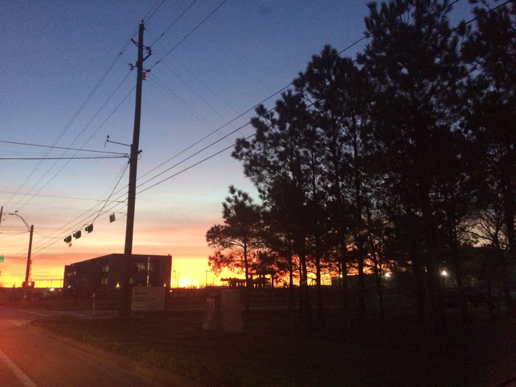
Northwest Houston, TX during the early morning.
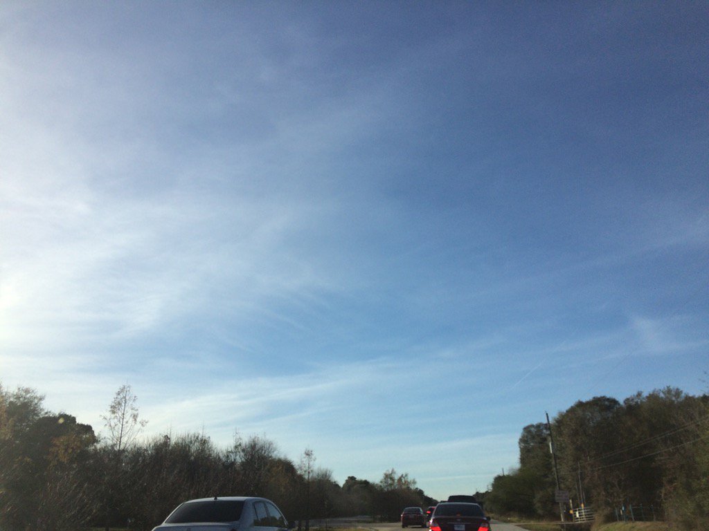
Northwest Houston, TX during the late afternoon.
Notes: Big to small, bright white, thick and thin, flat, some long, high stratus clouds looked to be widely scattered across the sky in northwest and west Houston, TX during the morning, afternoon, and evening. The sky looked to be mostly clear with maybe some big to small, bright white, thin, flat, wavy high stratus, or cirrus clouds in northwest Houston, TX during the night. The wind speeds looked to be calm in northwest and west Houston, TX during the early morning. The wind speeds looked to be relatively calm with moderate gusts in west Houston, TX during the mid-morning and maybe late morning and afternoon. The wind speeds looked to be relatively calm with maybe some moderate gusts in northwest Houston, TX during the late afternoon and evening. The wind speeds looked to be moderate with moderately strong gusts in northwest Houston, TX during the the first part of the early night. The wind speeds looked to be calm with maybe some moderate gusts in northwest Houston, TX during the rest of the early night. It felt cool in northwest and west Houston, TX during the early morning. It felt cool in west Houston, TX during the mid-morning. It started to feel warm in west Houston, TX during the late morning. It felt warm in west Houston, TX during the early and mid-afternoon. It felt warm in northwest and west Houston, TX during the late afternoon. It felt warm in northwest Houston, TX during the early evening. It started to feel cool in northwest Houston, TX during the late evening. It felt cool in northwest Houston, TX during the early night. I didn't hear about, see, or feel any drops anywhere in, or near Houston, TX.
Thoughts: Another warm day. It looks like Houston, TX may get some winter precip this Friday. I'll just have to wait and see. Houston, TX has been getting a lot of way above average warm to way below average cold days this winter. This is pretty interesting. I wonder what's going on.
Area Forecast Discussion
Issued by NWS Houston/Galveston, TX
Issued by NWS Houston/Galveston, TX
Versions: 1 2 3 4 5 6 7 8 9 10 11 12 13 14 15 16 17 18 19 20 21 22 23 24 25 26 27 28 29 30 31 32 33 34 35 36 37 3839 40 41 42 43 44 45 46 47 48 49 50
000
FXUS64 KHGX 040212
AFDHGX

Area Forecast Discussion
National Weather Service Houston/Galveston TX
812 PM CST Tue Jan 3 2017

.DISCUSSION...
Surface obs at 8pm or 02z show cold front has pushed through
Houston and almost to the coast. Temperatures have dropped into
the 40s from College Station to Crockett with 50s across the rest
of the forecast area behind the front. There were still a few
temperatures in the 60s along the coast just ahead of the front.
Low temperatures in the 40s look on track with north winds. Wind
chill readings should be in the 30s. Overall only forecast
adjustments were to keep up with T/Td/Sky trends in the grids.
Rest of the forecast looks on track.

Overpeck

&&

.PREV DISCUSSION... /ISSUED 522 PM CST Tue Jan 3 2017/

AVIATION...
Main difference from the previous TAF cycle has been to strip MVFR
ceilings from most sites for most hours. There is indeed a deck of
low clouds behind the front in Northeast Texas, but satellite
trends and hi res guidance both seem to indicate it will pass just
east of the I-45 sites. While there`s good confidence in yanking
the MVFR cigs at CLL, it`s a little less uncertain for the other
sites, as it is a hard edge that will pass very close to the area.
Do have MVFR ceilings in place from IAH coastward beginning
tomorrow afternoon, still. Otherwise, look for winds to become
gusty for a period in the wake of the front, diminishing tomorrow
afternoon.

Luchs

PREV DISCUSSION... /ISSUED 407 PM CST Tue Jan 3 2017/

DISCUSSION...
A cold front continues to push south towards the region this
afternoon, stretching along a Midland to Granger to Longview line
as of 2 PM CST. Ahead of the front, warm westerly winds have
allowed the region to warm into the 70s to even low 80s around
Matagorda Bay. In fact, Galveston had set their record high
temperature for today as well as the month of January when it
reached 79 earlier this afternoon. Cooler conditions are on the
way tonight as the front sweeps through Southeast Texas later this
afternoon and evening, with temperatures falling into the upper
30s and 40s by Wednesday morning.

Low clouds look to build into the northern half of the region
behind the front, but this cloud deck looks to erode as it
encounters drier air over the region. Will need to keep an eye on
how this lower cloud deck evolves tonight, as it will either help
to keep temperatures warmer (if it moves farther south into the
region) or cooler (if it dissipates earlier than anticipated).
Wednesday will be another dry day, with cold air advection behind
the front only allowing temperatures to rise into the 50s under
partly to mostly cloudy skies.

Model guidance has come into better agreement regarding the
forecast for Thursday and beyond, with the GFS trending more
towards the ECMWF and Canadian for the late week forecast.
Afternoon water vapor imagery shows a compact upper low just off
the Pacific Northwest coast this afternoon as a longwave trough is
becoming established across the eastern CONUS. A wave of energy
diving into this trough on Thursday will send another strong cold
front into the region by Thursday evening.

Weak onshore flow ahead of this front will allow high
temperatures to moderate a bit into the mid 50s to low 60s, with a
periods of light rain possible by the afternoon as isentropic
ascent on the 295K surface increases along the Upper Texas coast.
The cold front will move off the coast by early Friday morning,
but continued upglide behind the front will keep periods of light
rain in the forecast for much of the day Friday and Friday
evening. Cold air filtering in behind the front on Friday will
keep high temperatures only in the 40s. As temperatures continue
to fall Friday evening, forecast soundings indicate that areas
north of a Caldwell to Livingston line may see a brief mix of
light rain and sleet Friday evening given a shallow saturated
freezing layer around 750 MB, with a warm nose only 2-3 degrees
warmer than surface temperatures and another saturated freezing
layer from 950 through about 875 MB. Lapse rates within this lower
saturated layer may not be quite strong enough to produce sleet,
resulting moreso in freezing drizzle more than anything. As of
now, surface temperatures during this time are expected to be in
the mid to upper 30s and no impacts from this are anticipated...
but adjustments to this portion of the forecast are likely.

The Pacific Northwest trough will continue to shear out over the
next few days, finally rejoining the main upper flow and crossing
the Southern Plains Friday afternoon and night. Drier air
filtering into the region will cause precipitation to end from
north to south, with dry conditions becoming established overnight
Friday as temperatures fall below freezing. This would result in a
relatively uneventful passage of the energy from the Pacific
Northwest trough as it swoops across the region, with dry
northwest flow in its wake keeping the region precipitation free
on Saturday and Sunday. Low temperatures on Saturday and Sunday
morning are expected to be below freezing for most locations
outside of the coastal counties, with highs in the mid 40s to low
50s.

Onshore flow will gradually resume by Monday, allowing
temperatures to moderate again back into the mid 60s to low 70s by
the end of the forecast period.

Huffman

MARINE...
The cold front will push off the coast this evening. Winds and
possibly seas are expected to increase to caution levels behind
the boundary. The next cold front arriving Thursday night through
Friday morning will bring much stronger offshore winds and very
rough seas to our waters. Advisories will be needed behind this
boundary. Look for onshore winds to return to the area late in the
weekend and strengthen into early next week. 42

&&

.PRELIMINARY POINT TEMPS/POPS...
College Station (CLL)      38  52  41  60  36 /   0   0   0  10  10
Houston (IAH)              43  55  45  59  41 /   0   0   0  20  30
Galveston (GLS)            49  56  56  60  47 /   0   0   0  20  30

&&

.HGX WATCHES/WARNINGS/ADVISORIES...
TX...NONE.
GM...SMALL CRAFT SHOULD EXERCISE CAUTION through Wednesday morning
     for the following zones: Coastal waters from Freeport to
     the Matagorda Ship Channel out 20 NM...Coastal waters from
     High Island to Freeport out 20 NM...Waters from Freeport to
     the Matagorda Ship Channel from 20 to 60 NM...Waters from
     High Island to Freeport from 20 to 60 NM.

&&

$$

Discussion...39
No comments:
Post a Comment