West Houston, TX during the early morning.

West Houston, TX during the early night.
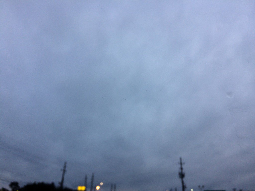
Notes: I saw some light flurries in west Houston, TX during the early afternoon. There was light to really heavy rain in the Houston, TX area during the morning and afternoon. I saw light to really heavy rain in west Houston, TX during the morning. There was no thunder, or lightning that I know of. I didn't see any lightning, or hear any thunder. The day was cloudy and very cold/freezing. There might have been some freezing rain/ice pellets in Houston, TX during the morning and afternoon. There also might have been ice on the road, but I don't know. The puddles on the road did look like they were becoming iced over, or were already iced over when I was on my way home from work during the early night, in northwest and west Houston, TX. It was also pretty windy with moderately strong and some really strong gusts. There was no damage seen, or reported, that I know of.
Area Forecast Discussion
Issued by NWS Houston/Galveston, TX
Area Forecast Discussion
Issued by NWS Houston/Galveston, TX
Versions: 1 2 3 4 5 6 7 8 9 10 11 12 13 14 15 16 17 18 19 20 21 22 23 24 25 26 27 28 29 30 31 32 33 34 35 36 37 3839 40 41 42 43 44 45 46 47 48 49 50
000
FXUS64 KHGX 070104
AFDHGX

Area Forecast Discussion
National Weather Service Houston/Galveston TX
704 PM CST Fri Jan 6 2017

.UPDATE...
Observations were running a touch cooler than what was in the
forecast grids, so made a slight adjustment through tomorrow
morning to bring them closer in line. While the resultant low
temperature forecast is now a little colder than before, it
does not look to notably change the end impacts, so previous
headlines are all still appropriate. Tied to this, skies are
clearing just northwest of our area this evening, and so I also
brought that clearing into Southeast Texas just a little bit
sooner as well.

Luchs

&&

.PREV DISCUSSION... /ISSUED 533 PM CST Fri Jan 6 2017/

AVIATION...
MVFR ceilings will become VFR overnight through tomorrow morning with
SKC during the day tomorrow. Gusty north winds (especially in/around
GLS) will gradually weaken overnight with much lighter north winds
during the day tomorrow (except again in/around GLS where higher
winds and gusts will persist into the afternoon).  42

PREV DISCUSSION... /ISSUED 407 PM CST Fri Jan 6 2017/

DISCUSSION...
Continuing to monitor as a few lingering bands of precip push off
the coast. Conditions will continue to dry out as we move into the
evening hours. Forecast soundings are indicating dry air filtering
into the upper levels of the atmosphere and eroding down into the
lower layers this evening. Model guidance also supports an area
of high pressure moving in behind the moisture this evening. This
should keep conditions dry throughout the weekend.

The big story for this weekend will be chilly temperatures.
Expecting lows to get into the low-mid 20s in counties north of I-
10, excluding Harris county. Therefore, a hard freeze warning has
been issued for this evening beginning at 10 pm. To the south of
this boundary and including Harris County, a freeze warning will be
in effect beginning at 10 pm. Most places along the immediate coast
will see freezing conditions for the first time this season. Harris,
Fort Bend, and Wharton counties will begin to see freezing
temperatures between 8 and 10 pm. For places not along the immediate
coast, a freeze warning has been reissued for some of these counties
that have already seen freezing conditions earlier this season. This
is due to the abnormally warm temperatures that were experienced
last week, which resulted in a false bloom in some vegetation.

Winds will continue to be strong out of the north, into the evening
and then lowering slightly overnight as the temperature gradient
weakens. The wind advisory that is currently out, will continue
through 6 am tomorrow morning. Wind speeds will lower by Saturday
mid-day, and begin to veer out of the southwest by Monday
morning. As the onshore flow returns, temperatures and moisture
will also be on the rise beginning next week. Tuesday high
temperatures will push into the upper 70s, resulting in another
unseasonably warm few days.

Hathaway

MARINE...
Strengthened Advisory level offshore winds will maintain their
magnitudes through the overnight early Saturday morning hours. The
combination of cold air advection over warmer waters leading to a
tight offshore pressure gradient will keep 20 knot sustained...gusting
to near 30 knots..winds occurring through early Saturday afternoon.
These winds have generated rough bay conditions and elevated seas...
nearshore 5 to 6 foot average seas heights...near 10 or 11 foot offshore
seas...through Saturday morning. Frequent gusts to gale force across the
far offshore waters has a Gale Warning in effect from sunset tonight
through Saturday`s sunrise. Weakening northeasterlies veering
easterly early Sunday and coming onshore Sunday afternoon. High
pressure off the eastern U.S. coastline early next week will create
a prolonged period of moderate onshore winds. This onshore fetch
will persist through a late Friday/early Saturday cold frontal
passage. 31

&&

.PRELIMINARY POINT TEMPS/POPS...
College Station (CLL)      20  40  21  49  35 /   0   0   0   0   0
Houston (IAH)              26  41  24  49  39 /  10   0   0   0   0
Galveston (GLS)            31  43  36  52  50 /  20  10   0   0  10

&&

.HGX WATCHES/WARNINGS/ADVISORIES...
TX...Hard Freeze Warning from 10 PM this evening to 10 AM CST
     Saturday for the following zones: Austin...Brazos...
     Burleson...Colorado...Grimes...Houston...Liberty...
     Madison...Montgomery...Polk...San Jacinto...Trinity...
     Walker...Waller...Washington.

     Freeze Warning from 10 PM this evening to 10 AM CST Saturday for
     the following zones: Brazoria...Chambers...Fort Bend...
     Galveston...Harris...Jackson...Matagorda...Wharton.

     Wind Advisory until 6 AM CST Saturday for the following zones:
     Brazoria...Chambers...Galveston...Jackson...Matagorda...
     Wharton.

GM...Small Craft Advisory until noon CST Saturday for the following
     zones: Coastal waters from Freeport to the Matagorda Ship
     Channel out 20 NM...Coastal waters from High Island to
     Freeport out 20 NM...Galveston Bay...Matagorda Bay.

     SMALL CRAFT SHOULD EXERCISE CAUTION Saturday afternoon for the
     following zones: Galveston Bay...Matagorda Bay.

     SMALL CRAFT SHOULD EXERCISE CAUTION from Saturday afternoon
     through Saturday evening for the following zones: Coastal
     waters from Freeport to the Matagorda Ship Channel out 20
     NM...Coastal waters from High Island to Freeport out 20 NM.

     Small Craft Advisory from 6 AM to 6 PM CST Saturday for the
     following zones: Waters from Freeport to the Matagorda Ship
     Channel from 20 to 60 NM...Waters from High Island to
     Freeport from 20 to 60 NM.

     SMALL CRAFT SHOULD EXERCISE CAUTION Saturday evening for the
     following zones: Waters from Freeport to the Matagorda Ship
     Channel from 20 to 60 NM...Waters from High Island to
     Freeport from 20 to 60 NM.

     Gale Warning until 6 AM CST Saturday for the following zones:
     Waters from Freeport to the Matagorda Ship Channel from 20
     to 60 NM...Waters from High Island to Freeport from 20 to
     60 NM.

&&

$$

Discussion...25
Hazardous Weather Outlook
HAZARDOUS WEATHER OUTLOOK NATIONAL WEATHER SERVICE HOUSTON/GALVESTON TX 440 PM CST FRI JAN 6 2017 TXZ213-214-226-227-235>238-072245- BRAZORIA-CHAMBERS-FORT BEND-GALVESTON-HARRIS-JACKSON-MATAGORDA- WHARTON- 440 PM CST FRI JAN 6 2017 THIS HAZARDOUS WEATHER OUTLOOK IS FOR PORTIONS OF SOUTHEAST TEXAS. .DAY ONE...TONIGHT FREEZE WARNING IS IN EFFECT TONIGHT. SENSITIVE VEGETATION WILL BE THE MAIN CONCERN. A WIND ADVISORY WILL BE IN EFFECT OVERNIGHT. .DAYS TWO THROUGH SEVEN...SATURDAY THROUGH THURSDAY ANOTHER COLD NIGHT IS EXPECTED SATURDAY EVENING, AND CONDITIONS WILL BEGIN TO WARM UP SUNDAY AFTERNOON. .SPOTTER INFORMATION STATEMENT... SPOTTER ACTIVATION WILL NOT BE NEEDED. $$Freeze Warning
URGENT - WEATHER MESSAGE NATIONAL WEATHER SERVICE HOUSTON/GALVESTON TX 316 PM CST FRI JAN 6 2017 ...STRONG NORTHERLY WINDS TODAY... .NORTH WINDS OF 20 TO 30 MPH WILL PREVAIL TODAY AND TONIGHT FOR THE COASTAL AND SOUTHWESTERN COUNTIES OF SOUTHEAST TEXAS. WIND GUSTS OF 25 TO 35 MPH WILL BE LIKELY AND ARE EXPECTED TO RELAX SATURDAY. FREEZING TEMPERATURES WILL COVER SE TEXAS TONIGHT... ESPECIALLY IMPACTING THE IMMEDIATE COAST WHICH HAS NOT HAD A FREEZE YET THIS SEASON. A HARD FREEZE OF 22 TO 25 DEGREES CAN BE EXPECTED ALONG AND NORTH OF A LINE FROM COLUMBUS TO CONROE TO LIBERTY. TEMPERATURES SHOULD WARM ABOVE FREEZING COME MID- MORNING. TXZ213-227-070530- /O.EXT.KHGX.FZ.W.0001.170107T0400Z-170107T1600Z/ HARRIS-FORT BEND- INCLUDING THE CITIES OF...HOUSTON...PASADENA...KATY...TOMBALL... HUMBLE...SUGAR LAND...MISSOURI CITY...RICHMOND...ROSENBERG 316 PM CST FRI JAN 6 2017 ...FREEZE WARNING NOW IN EFFECT FROM 10 PM THIS EVENING TO 10 AM CST SATURDAY... * EVENT...FREEZING TEMPERATURES OF 28 TO 32 DEGREES. * TIMING...10 PM THROUGH 10 AM SATURDAY. * IMPACT...SENSITIVE VEGETATION. PRECAUTIONARY/PREPAREDNESS ACTIONS... A FREEZE WARNING MEANS SUB-FREEZING TEMPERATURES ARE IMMINENT OR HIGHLY LIKELY. THESE CONDITIONS WILL KILL CROPS AND OTHER SENSITIVE VEGETATION. && $$
No comments:
Post a Comment