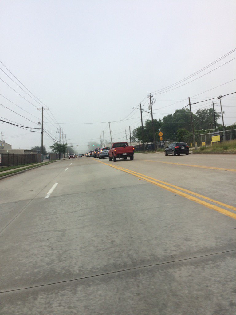
Northwest Houston, TX, during the early morning.
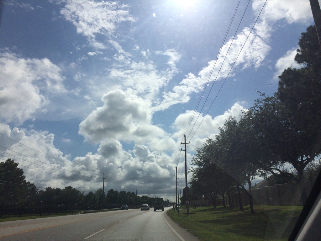
Northwest Houston, TX, during the late afternoon.
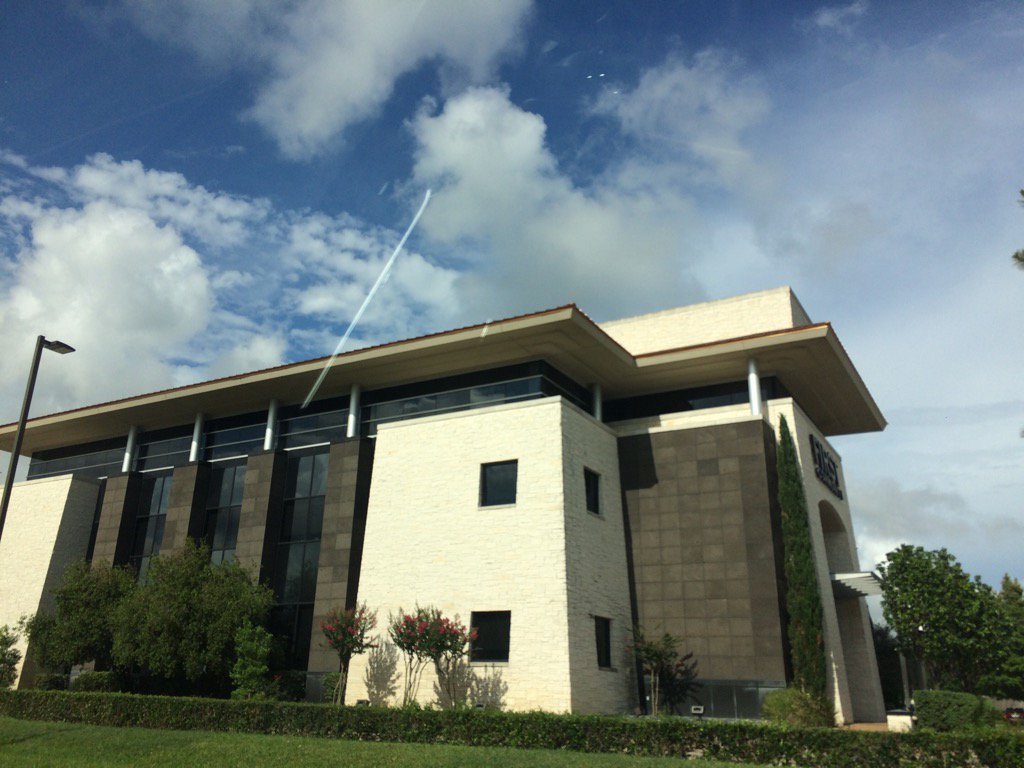
Northwest Houston, TX, during the early evening.
Summary: The day was mostly cloudy, wet, and warm. Scattered showers and thunderstorms were spread in and around the Houston, TX area, during the late morning, through the late evening. There still looked to be some scattered light showers in and around the Houston, TX area, on the TWC radar, during the early night. The sky stayed mostly cloudy to sometimes cloudy from the early morning, through the late evening, and maybe night. The wind speeds looked to be calm with maybe some moderate to moderately strong wind gusts. It felt warm during the morning, afternoon, evening, and night. There was a flood advisory and a special weather statement for brief funnels and tornadoes, for the Houston, TX area, for the showers and thunderstorms. There was also a hazardous weather statement issued by NOAA for today. The low temps looked to be in the 70's and the high temps looked to be in the 80's with maybe some 90's, for the Houston, TX area. There was some flash flooding from the showers and thunderstorms. I didn't hear about any storm damage. I did see some small to medium sized branches that fell and I did hear some loud rumbles of thunder with lightning.
Locations: Northwest Houston, TX
Thoughts: I did really enjoy the heavy rain and the loud thunder with lightning today.
Area Forecast Discussion
Issued by NWS Houston/Galveston, TX
Issued by NWS Houston/Galveston, TX
Versions: 1 2 3 4 5 6 7 8 9 10 11 12 13 14 15 16 17 18 19 20 21 22 23 24 25 26 27 28 29 30 31 32 33 34 35 36 37 3839 40 41 42 43 44 45 46 47 48 49 50
935
FXUS64 KHGX 022327
AFDHGX

Area Forecast Discussion
National Weather Service Houston/Galveston TX
627 PM CDT Fri Jun 2 2017

.AVIATION...
Expect any remaining isolated shra to dissipate in the next
couple hours with the loss of heating. Otherwise, will be looking
for some 1000-2000ft stratus to develop overnight. Confidence
isn`t that high as to how widespread ceiling will be however. Saw
that we even had some IFR & LIFR cigs/vis last night, and with
light winds and mclear skies for most of the evening, we`ll keep
an eye on trends there but not planning to go there yet. Precip-
wise, I`d expect mostly a persistence type fcst with some activity
developing closer to the coast prior to sunrise...then transition
inland during the day with heating. 47

&&

.PREV DISCUSSION... /ISSUED 345 PM CDT Fri Jun 2 2017/
To sum up the weather today...brief heavy rainfall causing street
flooding, frequent lightning, gusty winds and of course funnel
clouds. The 12Z CRP and LCH soundings had anywhere from 1.7 to 1.9
inches of precipitable water and the scattered showers and storms
reflected this moist airmass. Upper level flow is weak so storms
are not moving quickly and can produce brief heavy rainfall before
dissipating as outflow cuts off the updraft. The problem is that
these outflow boundaries are colliding producing new convection
and the cycle continues. So with this environment in place through
the next few days, the expectation is for scattered showers and
thunderstorms to be possible each day.

Water vapor imagery and upper air analysis show on trough over
west Texas and a second trough over the southern Rockies. The
focus will shift to the second trough as this system will slowly
move east this weekend and reach central Texas on Sunday. This
supports increasing large scale ascent over much of SE Texas and
the Gulf coast only increasing the chances of more numerous
thunderstorms Sunday through Tuesday. This trough finally moves
east of the area mid next week as a deep trough develops over the
Great Lakes into the mid-Atlantic states. Given the very moist
airmass, upper level support and a plethora of mesoscale
boundaries, thunderstorms and the potential for heavy rainfall
will exist through early next week. The highest chances look to be
Sunday and Monday. Areawide there should be 1 to 2 inches of
rainfall but as we have already observed there will be isolated
pockets of 3 inches or more. Not only that, the 3 inches of rain
could occur in 1 to 2 hours. If there are enough storms that do
this, then flooding will become more of a concern.

Models continue to support a frontal boundary pushing into the
area late Tuesday into Wednesday. By Wednesday afternoon the GFS
shows precipitable water values dropping below 1 inch. This drier
air looks to be in place through the end of next week. This will
allow for a greater diurnal range in temperatures with low
temperatures in the 60s instead of 70s and high temperatures in
the upper 80s to low 90s. But hey, at least it will be a dry heat
right? Overpeck

MARINE...
Generally light to moderate E/SE winds are expected tonight/tomorrow
as the gradient remains very weak across the region. Some strengthen-
ing of the winds over the offshore waters is possible Sat night into
Sun as a weak trough of low pressure develops over the SW Gulf. This
system should not have much impact on the marine forecast here, save
for scattered showers and thunderstorms. Models are still bringing a
cold front/wind shift into the coastal waters Tue...with an offshore
progged through Thur. 41

TROPICS...
Beatriz has pushed inland across far south Mexico. Moisture from
this system may combine with high moisture already in the Bay of
Campeche. Forecast models have been inconsistent to say the least
on any type of tropical development in the Gulf of Mexico. There
is still a subtropical jet and even a branch of the polar jet with
the upper level trough over the southern Rockies. These upper
level winds will support strong enough shear that it will be
difficult for tropical development. Not only that, but if
something did form, intensification will be difficult as the
system will be sheared and remain a weak messy system. Overpeck

&&

.PRELIMINARY POINT TEMPS/POPS...
College Station (CLL)      70  88  71  87  71 /  20  40  40  70  50
Houston (IAH)              73  88  73  87  73 /  20  40  30  60  50
Galveston (GLS)            78  84  78  84  78 /  20  30  40  50  50

&&

.HGX WATCHES/WARNINGS/ADVISORIES...
TX...NONE.
GM...NONE.

&&

$$
Hazardous Weather Outlook
Hazardous Weather Outlook
National Weather Service Houston/Galveston TX
410 AM CDT Fri Jun 2 2017

TXZ163-164-176>179-195>200-210>214-226-227-235>238-030915-
Austin-Brazoria-Brazos-Burleson-Chambers-Colorado-Fort Bend-
Galveston-Grimes-Harris-Houston-Jackson-Liberty-Madison-Matagorda-
Montgomery-Polk-San Jacinto-Trinity-Walker-Waller-Washington-
Wharton-
410 AM CDT Fri Jun 2 2017

This hazardous weather outlook is for portions of Southeast Texas..

.DAY ONE...Today and Tonight

Daytime heating will trigger scattered showers and thunderstorms
today. The airmass is very moist and buoyant and fast developing
storms could briefly produce a funnel cloud or waterspout. Storm
motion will be slow and locally heavy rain will be possible in the
stronger storms.

.DAYS TWO THROUGH SEVEN...Saturday through Thursday

An upper level low will trigger scattered to numerous showers and
thunderstorms Sunday through Tuesday. Storm motion will remain
slow and locally heavy rain will be possible. Some flooding issues
might be possible on Monday but this will be dependent on how
much rain falls on Friday, Saturday and Sunday.

.SPOTTER INFORMATION STATEMENT...

Spotter activation will not be needed.

$$
No comments:
Post a Comment