Northwest Houston, TX, during the early morning.
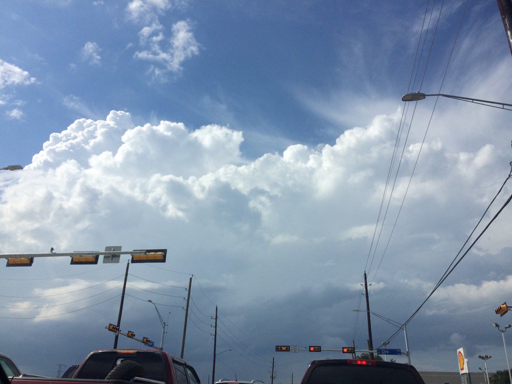
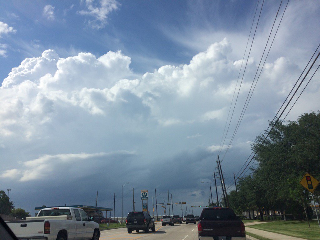
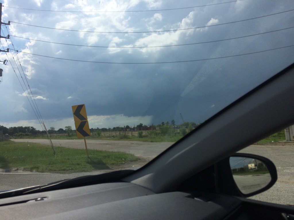
Northwest Houston, TX, during the late afternoon.
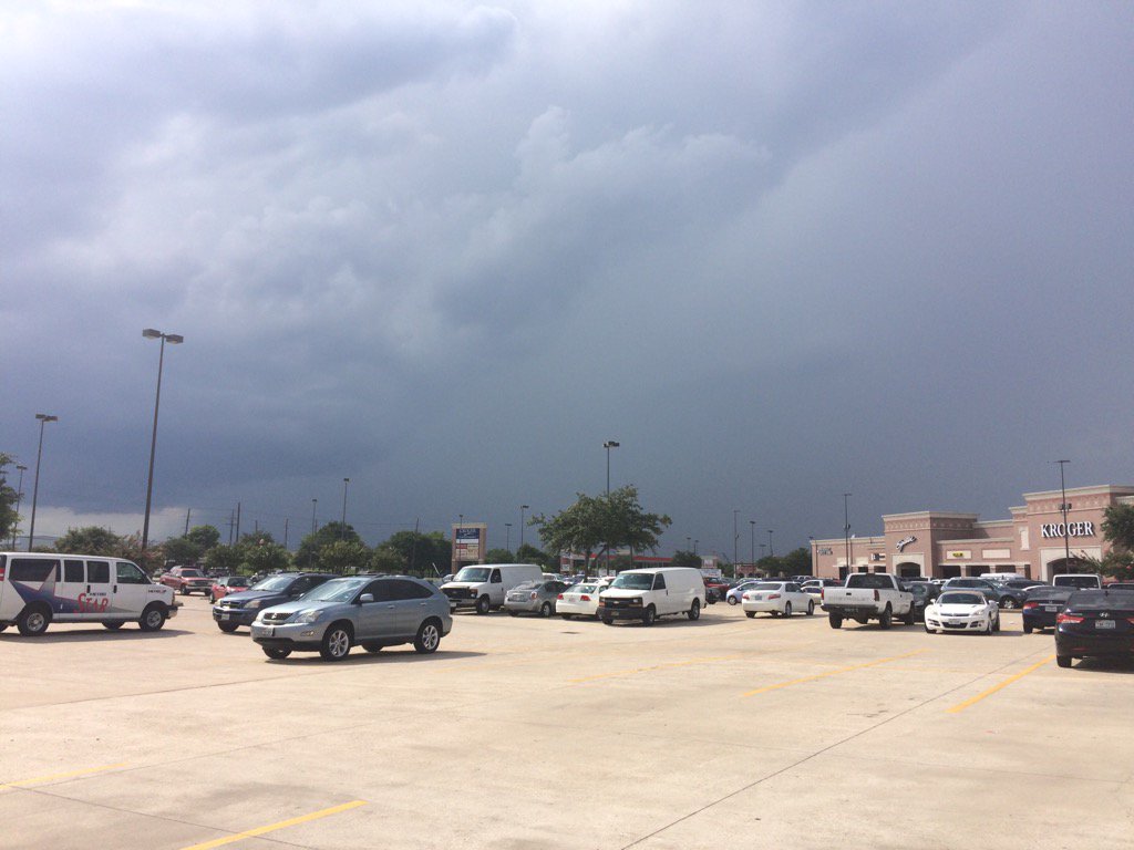
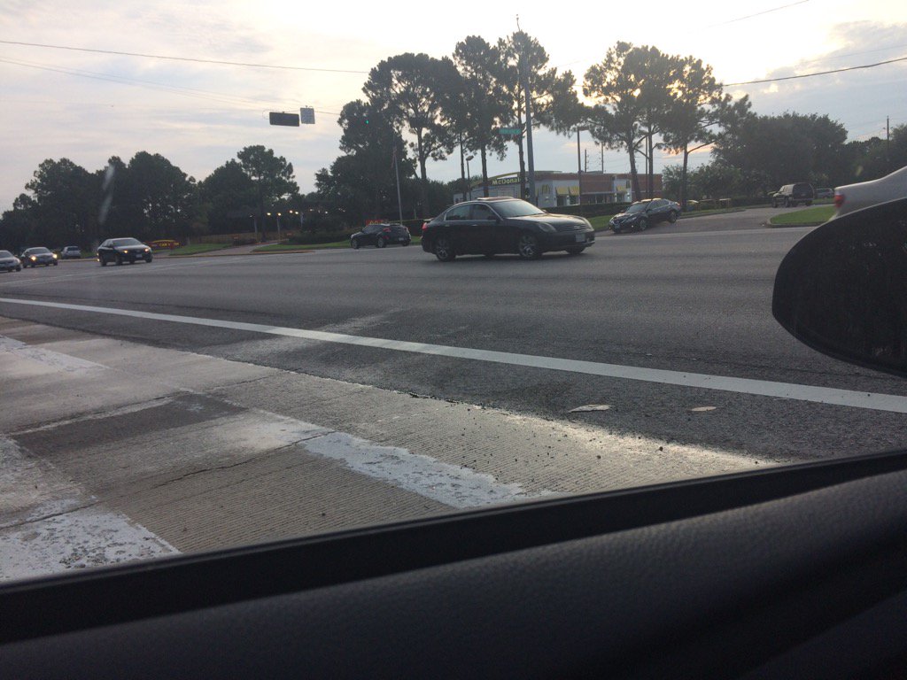
Northwest Houston, TX, during the early evening.
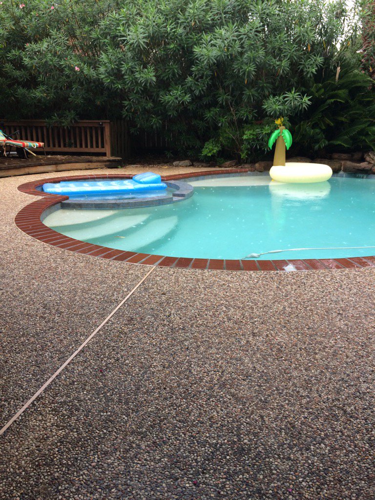
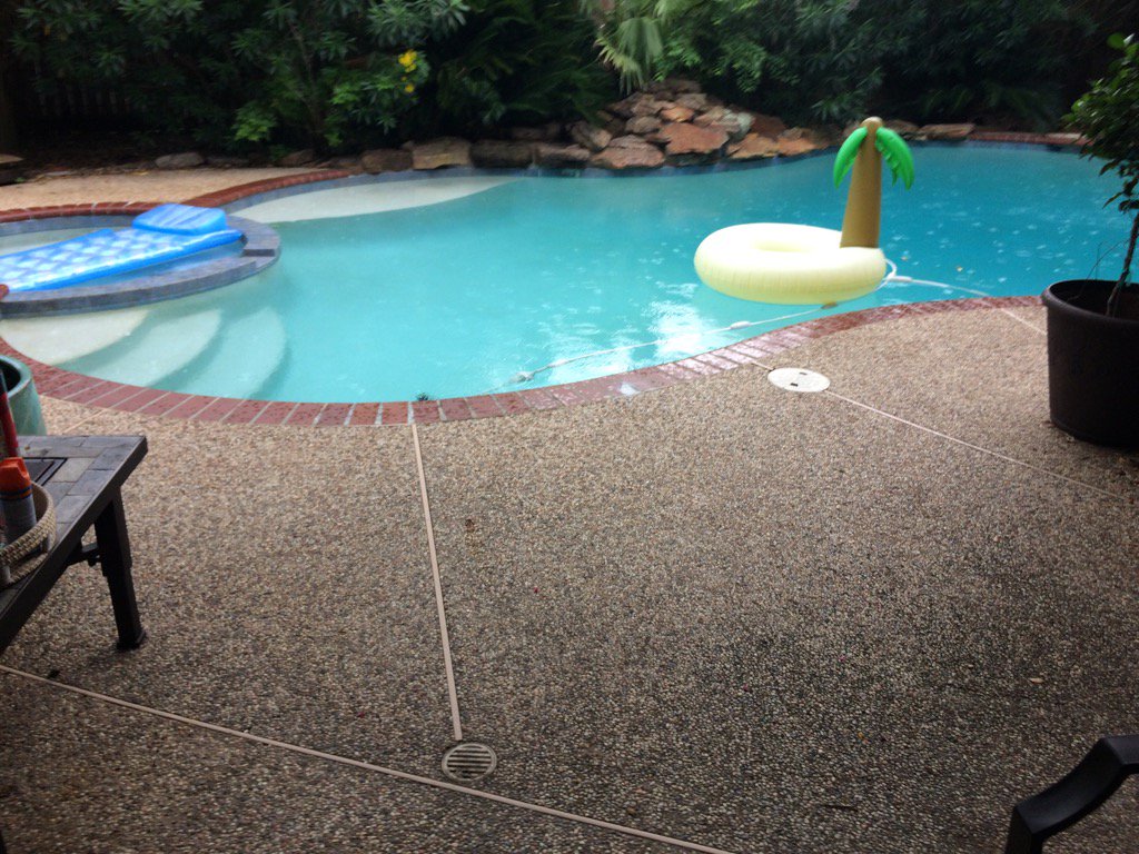
Northwest Houston, TX, during the late evening.
Summary: The day was warm, mostly cloudy, and a little wet. Light to heavy showers and thunderstorms were scattered across the Houston, TX area, during the morning, afternoon, evening, and night. Light to moderate and some moderately heavy rain fell at my house in northwest Houston, TX, during the evening and early night. I didn't see anymore rain after that. I didn't see any lightning, but I think I heard some distant rumbles of thunder, at my house in northwest Houston, TX, during the evening and early night. Stratocumulus, stratus, and nimbus clouds looked to cover most of the sky, during the morning, afternoon, evening, and night. The wind speeds looked to be calm with gentle gusts and some moderate gusts. It felt warm during the morning, evening, and night. It felt hot during the afternoon. There was a hazardous weather outlook issued for the Houston, TX area, by NOAA and there were some flood advisories issued for southeast Houston, TX. There were no other watches, warnings, alerts, advisories, or weather statements issued for the Houston, TX area, that I know of. The low temps looked to be in the 70's and the high temps looked to be in the 80's with maybe some 90's, for the Houston, TX area.
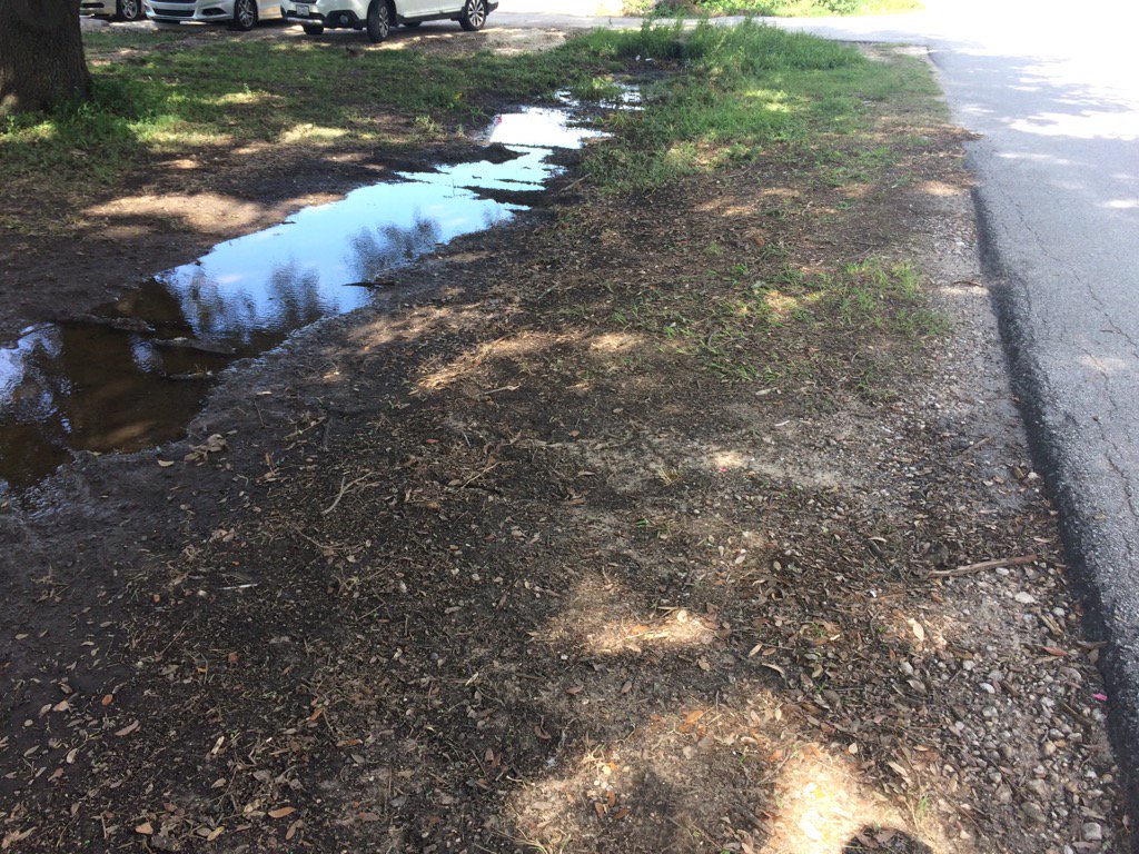
Storm Summary: There were reports of flash flooding in and around the Houston, TX area, during the late afternoon, evening and night. I didn't see any flooding, just some wet roads and left over puddles from yesterdays showers and thunderstorms. I didn't see, or hear about any storm damage.
Locations: Northwest Houston, TX.
Thoughts: I didn't think I was going to see any rain today, but I managed to see some.
Hazardous Weather Outlook
Hazardous Weather Outlook
National Weather Service Houston/Galveston TX
444 AM CDT Mon Jun 26 2017

TXZ163-164-176>179-195>200-210>214-226-227-235>238-270945-
Austin-Brazoria-Brazos-Burleson-Chambers-Colorado-Fort Bend-
Galveston-Grimes-Harris-Houston-Jackson-Liberty-Madison-Matagorda-
Montgomery-Polk-San Jacinto-Trinity-Walker-Waller-Washington-
Wharton-
444 AM CDT Mon Jun 26 2017

This hazardous weather outlook is for portions of Southeast Texas..

.DAY ONE...Today and Tonight

Scattered to occasionally numerous showers and thunderstorms are
expected today. Very localized heavy rainfall and 20 to 40 mph
wind gusts will be a possibility in the strongest cells. Several
inches of rain could fall in a short time period...quickly running
off to produce street and small stream flooding.

.DAYS TWO THROUGH SEVEN...Tuesday through Sunday

Periods of showers and thunderstorms should persist into the
middle to late parts of the work week. With a similar weather
pattern remaining in place, we will continue to monitor the
possibility for some localized heavy rainfall.

.SPOTTER INFORMATION STATEMENT...

Spotter activation is not anticipated at this time.

$$
Area Forecast Discussion
Issued by NWS Houston/Galveston, TX
Versions: 1 2 3 4 5 6 7 8 9 10 11 12 13 14 15 16 17 18 19 20 21 22 23 24 25 26 27 28 29 30 31 32 33 34 35 36 37 3839 40 41 42 43 44 45 46 47 48 49 50
000
FXUS64 KHGX 270220
AFDHGX

Area Forecast Discussion
National Weather Service Houston/Galveston TX
920 PM CDT Mon Jun 26 2017

.DISCUSSION...
At 7:00 PM, surrounding upper air sites had PW/s near 2 to 2.1
inches over the southern two-thirds of the forecast area. Over the
north, SHV had a PW of 1.4 inches. This was indicative of the
drier air that was trying to filter down into SE Texas from the
north. The moisture was evident up through 850 (15 to 16 Celsius)
and 700 mb (5 to 6 Celsius). Plenty of lift will be available
tonight with a 500 mb trough moving across the area overnight
coupled with a few surface boundaries in place from earlier and
ongoing convection. The tricky part about the forecast for the
remainder of the night will be to determine how far southward the
drier airmass will push into the area. The models differed
somewhat with the higher resolution/short term models making a
case for a bit of a push southward. Decided to keep the lessor
pops over the northeast but to also nudge the 20 percent area a
bit farther to the northeast.

Otherwise, chances for showers and thunderstorms will continue
through the night. Will have a chance for some of the slower
moving storms to generate 1 to 3 inches of rain in spots which may
in turn cause isolated minor flooding. Bit tough to determine
actually where this will occur but best chances for the isolated
heavier rainfall will be generally across the Interstate 10
corridor given the moisture axis present at 700 mb.

40

&&

.PREV DISCUSSION... /ISSUED 642 PM CDT Mon Jun 26 2017/

AVIATION.../00Z TAF/
The radar is still pretty active this evening with boundary
collisions from outflows causing new development. TAFs will carry
VCSH/VCTS through 01-02Z this evening. Radar and GOES 16 vis
imagery shows outflow coming from Cleveland towards KIAH so will
need to monitor that for new development. Otherwise any new
development should be from KCXO to KUTS/KCLL. There are a couple
new showers between KSGR/KHOU and new activity in the gulf headed
towards KLBX. Again lots to monitor and likely see some amending
until convection dissipates. Convection should dissipate with the
loss of heating, but there is still a moist airmass over the area
which given a couple hours to recharge could produce new storms
later tonight.

Overnight while there could be a few lingering showers/storms,
think overall should have VFR conditions. There might be some
MVFR/IFR conditions for KCLL and maybe KCXO/KLBX should skies
clear enough and fog/low clouds develop.

Tomorrow looks to same as today with 2 inch precipitable water
airmass over the region. Convective temperatures in the mid/upper
80s should still trigger storms along any existing boundaries.
Should get scattered activity again with multiple outflow boundary
collisions providing lift for storms.

Overpeck

&&

.PRELIMINARY POINT TEMPS/POPS...
College Station (CLL)      72  89  71  91  74 /  20  50  10  40  10
Houston (IAH)              73  87  73  89  75 /  30  50  20  50  30
Galveston (GLS)            78  86  78  86  79 /  40  50  50  50  50

&&

.HGX WATCHES/WARNINGS/ADVISORIES...
TX...NONE.
GM...NONE.
&&

$$

Discussion...40
Aviation/Marine...39
No comments:
Post a Comment