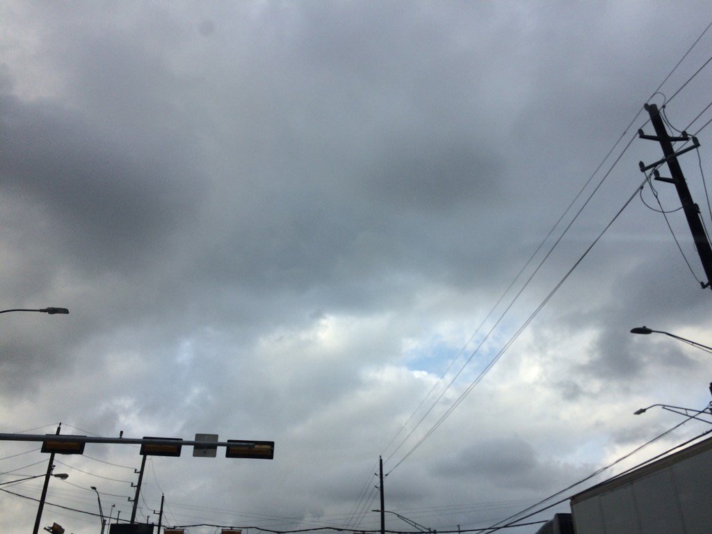
Northwest Houston, TX, during the early morning.
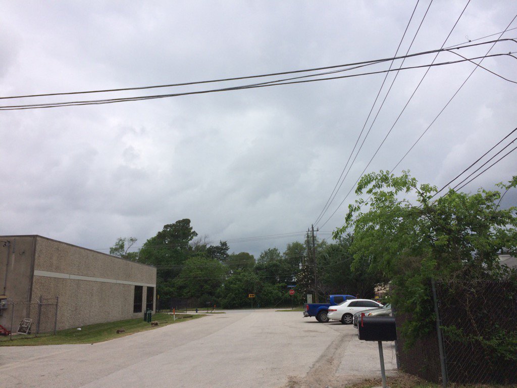
West Houston, TX, during the early afternoon.
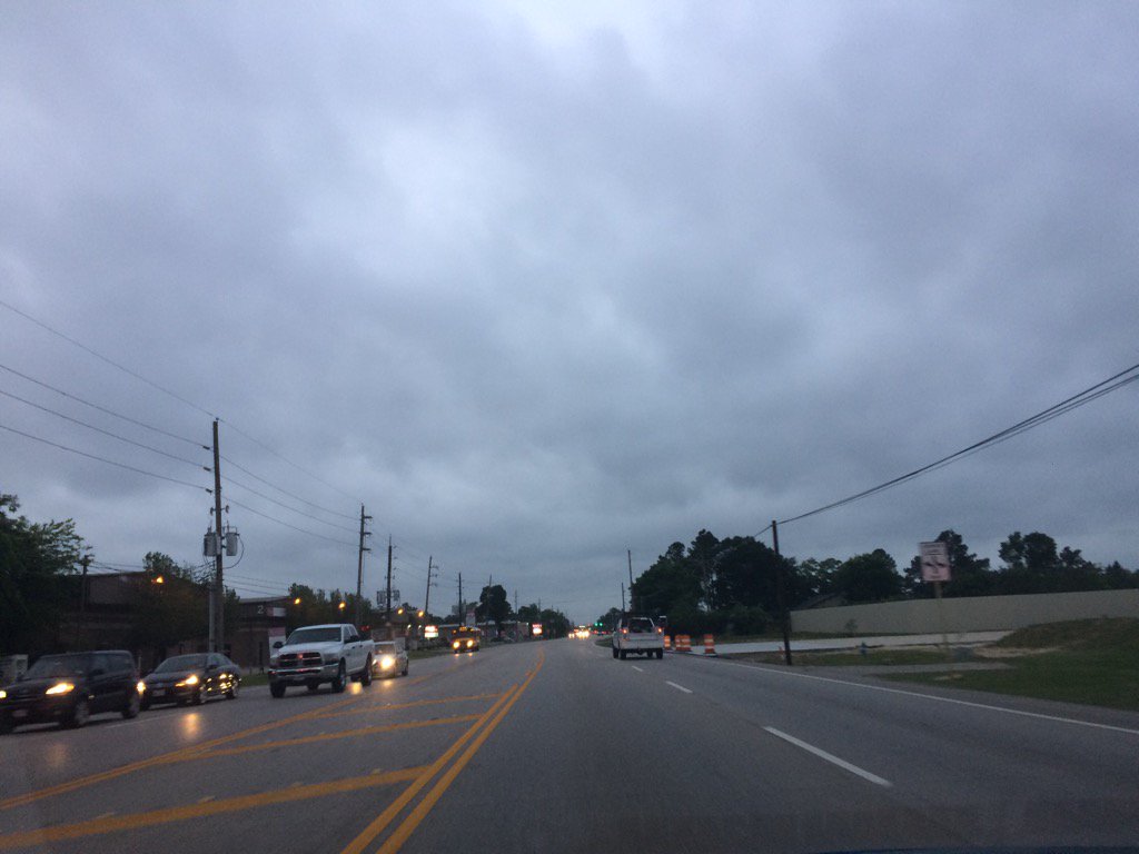
Northwest Houston, TX, during the early evening.
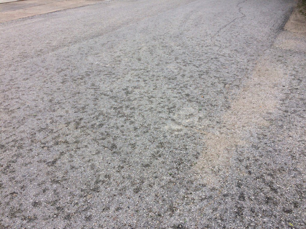
Summary: The day was mostly cloudy, a little wet, and warm. Light to moderately heavy and some really heavy showers and maybe a few thunderstorms passed through the Houston, TX area, during the morning, afternoon, evening, and night. I saw some light sprinkles in west Houston, TX during the morning and then a series of brief light to moderately heavy showers passed through where I work in west Houston, TX, during the afternoon. The wind speeds were calm with moderate to moderately strong gusts. No advisories, watches, warnings, alerts, or weather statements \were issued for the Houston, TX area, that I know of. The sky stayed mostly cloudy to cloudy all day. The low temps were in the 60's, I think with highs in the 80's, or maybe 70's, for the Houston, TX area.
Locations: Northwest and west Houston, TX.
Thoughts: I saw more rain than I thought I would. I am wondering if Houston, TX will get anymore rain on Tuesday. Houston, TX hasn't had that much rain lately.
Area Forecast Discussion
Issued by NWS Houston/Galveston, TX
Issued by NWS Houston/Galveston, TX
Versions: 1 2 3 4 5 6 7 8 9 10 11 12 13 14 15 16 17 18 19 20 21 22 23 24 25 26 27 28 29 30 31 32 33 34 35 36 37 3839 40 41 42 43 44 45 46 47 48 49 50
000
FXUS64 KHGX 110322
AFDHGX

Area Forecast Discussion
National Weather Service Houston/Galveston TX
1022 PM CDT Mon Apr 10 2017

.UPDATE...
A challenging forecast continues to unfold for Southeast Texas
this evening with surface analysis showing a nearly stationary
cold front draped north and west of the region (roughly along a
Dryden- Lampasas- Mount Pleasant line). Regional radar mosaic
shows thunderstorms continuing to develop and intensify along this
line, possibly aided by upper level lift from a disturbance
lifting into West Texas from New Mexico. With these aforementioned
features remaining well removed from the region and aircraft
soundings out of Houston showing a persistent capping inversion
around 700 mb, shower and thunderstorm activity near the region
diminished with loss of heating earlier this evening and has
remained minimal. Have lowered rain chances and rain totals
through the remainder of the evening as a result. Other changes to
the forecast include updating temperatures and dew points based on
hourly trends with overnight lows in the 60s to near 70 under
mostly cloudy skies.

Convective evolution for the overnight period and through most of
the day Tuesday still contains considerable uncertainty. High
resolution guidance has been indicating that the disturbance over
West Texas may provide enough lift to allow thunderstorms along
the front to grow upscale and generate a strong enough cold pool
to allow this complex to propagate away from the front and into
Central or Southeast Texas tonight and into tomorrow morning.
However, this guidance continues to struggle with placement and
timing of this feature... likely owing to the presence of the
strong cap in place across Southeast Texas. Were this system to
develop, anticipate it to lose much of its intensity during the
early morning hours as it approaches the Interstate 10 corridor
as a result of the cap in place.

The frontal boundary north of the region is not expected to make
much southward progress overnight, but maintaining the Flash Flood
Watch in place across the northern two tiers of counties given the
potential for activity along the stalled frontal boundary to move
off of the boundary. Environmental conditions still remain very
favorable for a flash flood threat to materialize across these
areas (SPC Mesoanalysis showing precipitable water values across
the Flash Flood Watch area 1.5-1.7 inches), but the focusing
mechanism for thunderstorms capable of heavy rain development is
still uncertain at this time with the front still north of the
region and any potential thunderstorm complexes having not yet
developed.

With the disturbance over West Texas reaching East Texas sometime
during the day tomorrow (possibly as late as tomorrow afternoon),
the stalled frontal boundary should receive enough of a push to
move into the region. This would result in another round of shower
and thunderstorm development (especially if the front were able to
move through late enough in the day to take advantage of any
destabilization from diurnal heating) but timing for this
potential round remains uncertain at best... sometime Tuesday
morning or later, depending on the speed of the disturbance.

Huffman

&&

.PREV DISCUSSION... /ISSUED 612 PM CDT Mon Apr 10 2017/

AVIATION...
Confidence remains low with regard to convective potential
tonight. Will maintain the tempo for thunder at both KCLL and KUTS
but confidence wanes quickly for TAF sites south of these
airports. Prefer to take a cautious approach and just mention
VCSH/VCTS after 09z for the Houston terminals southward. The
latest HRRR and RAP want to take the precip west of the region and
fcst soundings show the best potential for precip to be early
Tuesday morning between 10-16z. AMDAR soundings currently show a
very stout cap in place over Houston. Fcst soundings keeps skies
generally cloudy with MVFR cigs. Think there will be enough mixing
to of dry air above 800 mb to create VFR conds by late aftn. 43

PREV DISCUSSION... /ISSUED 340 PM CDT Mon Apr 10 2017/

DISCUSSION...
Obs at 20Z show cold front now from San Angelo to the DFW
Metroplex. Convection is forming along the front but not very
strong. A strong/severe storm has formed over Milam County in
central Texas so we getting some indication that the capping
inversion from the elevated mixed layer may be eroding. AMDAR and
CRP/DRT/LCH soundings this morning all had a strong cap around
850-700mb. AMDAR soundings do show that capping inversion still in
place but weaker north of Houston. Weak ascent from ageostrophic
circulation with the cold front may indeed be enough to locally
weaken the cap allowing for surface based storms in the warm
sector. Aloft water vapor imagery really does not show much in the
way of a jet streak for shortwave for lift so overall neutral
vorticity advection. There is a shortwave back over Arizona which
could impact the area Tuesday morning.

Severe Threat Tonight...With at least some heating, cap slowly
eroding, dewpoints in the low 70s and the front pushing south,
there is a window for severe weather this evening and tonight
mainly north of a Wharton/Cleveland line. The main threat will be
more closer to Brenham/Livingston northward, but should the line
of storms evolve like the HRRR suggests with its many recent runs,
a line of storms could push south. With capping stronger to the
south, the line of storms would likely decrease in intensity but
still pose a threat for hail/wind. Instability at least for the
next 4-6 hours with day time heating will support CAPE of
2000-3000 J/kg over much of the threat area. Lapse rates are steep
on area soundings so large hail will be a threat. Deep layer shear
should be strong enough to support rotating cells like the one in
Milam County which will help with hail threat. Look for any
supercell to eventually gust out and possibly form into a line or
bowing segment. Basic timing for the storms will be mainly from
now through midnight. After midnight HRRR keeps most of the
convection over central Texas with a line of storms driving south.

Heavy rainfall threat...main threat for heavy rainfall and flash
flooding exists again over the same area for severe weather. This
area is mainly from Brenham to Livingston. Storm motions will be
around 20 knots so storms with rain rates of 1-2 inches an hour
could produce locally heavy rainfall. If rain rates are higher,
flood threat will only increase. There should be plenty of
moisture with 1.6-1.8 inches of precipitable water. Of particular
interest is the increase winds on KHGX VAD wind profile at
1000-4000FT AGL with now 35 knots at 2000-3000FT. This will
certainly help with heavy rainfall threat if this LLJ can be
maintained through the night and provide inflow to storms moving
along the cold front. Since the environment supports the potential
for flash flooding, a flash flood watch has been issued for the
northern 1/3 of counties in SE Texas and matches up with the watch
for central Texas. Rainfall amounts in the watch area will likely
be 2-3 inches but a few HRRR runs shows isolated amounts of 4-6
inches. Given the environment this may be the upper end of
rainfall amounts but enough for a flood threat.

Tuesday is a challenging forecast since it largely depends on what
happens tonight. There is a shortwave trough coming across Texas
from Arizona. Seems to reason that there will be another round of
storms for the area so will keep some rain chances going for the
forecast. But the mesoscale could really mess up the forecast.
Overnight convection with a squall line could very well stabilize
the boundary layer for much of the day Tuesday and lead to a rain
cool but dry day with no rain. For now rather count on the
shortwave trough acting as a trigger for more convection assuming
there may be enough recovery of moisture/instability from previous
convection.

Overpeck

MARINE...
A moderate/strong onshore flow will persist across the marine areas
the rest of the this afternoon into this evening. We should see the
gradient relax overnight as a cold front approaches from the north.
This boundary is expected to stall just north of SE TX, but a large
area of storms developing along this system could track south
into SE TX. However, not expecting these storms to reach the
coastal waters at this time. This front should wash out/move back
to the north by Wed. Generally moderate onshore winds will
persist the remainder of the week. 41

&&

.PRELIMINARY POINT TEMPS/POPS...
College Station (CLL)      65  76  63  82  64 /  70  60  20  20  10
Houston (IAH)              67  77  64  82  65 /  40  50  20  20  10
Galveston (GLS)            72  76  70  79  70 /  20  30  20  10  10

&&

.HGX WATCHES/WARNINGS/ADVISORIES...
TX...Flash Flood Watch until 7 AM CDT Tuesday for the following
     zones: Brazos...Burleson...Grimes...Houston...Madison...
     Trinity...Walker...Washington.

GM...SMALL CRAFT SHOULD EXERCISE CAUTION until 1 AM CDT Tuesday for
     the following zones: Galveston Bay...Matagorda Bay.

     SMALL CRAFT SHOULD EXERCISE CAUTION until 5 AM CDT Tuesday for
     the following zones: Coastal waters from Freeport to the
     Matagorda Ship Channel out 20 NM...Coastal waters from High
     Island to Freeport out 20 NM.

     Small Craft Advisory until 5 AM CDT Tuesday for the following
     zones: Waters from Freeport to the Matagorda Ship Channel
     from 20 to 60 NM...Waters from High Island to Freeport from
     20 to 60 NM.

&&

$$

Discussion...14
Hazardous Weather Outlook
Hazardous Weather Outlook
National Weather Service Houston/Galveston TX
255 PM CDT Mon Apr 10 2017

TXZ163-164-176>179-195>200-210>214-226-227-235>238-112000-
Austin-Brazoria-Brazos-Burleson-Chambers-Colorado-Fort Bend-
Galveston-Grimes-Harris-Houston-Jackson-Liberty-Madison-Matagorda-
Montgomery-Polk-San Jacinto-Trinity-Walker-Waller-Washington-
Wharton-
255 PM CDT Mon Apr 10 2017

This hazardous weather outlook is for portions of Southeast Texas..

.DAY ONE...This Afternoon and Tonight

Strong to severe storms will be possible tonight over southeast
Texas mainly north of a Columbus...Conroe...Livingston line. The
main threats will be large hail and damaging winds. These storms
may also produce heavy rainfall which could lead to flash
flooding. A flash flood watch has been issued through tomorrow
morning for the area. Severe weather and flooding is not expected
to push into the Houston and coastal areas, but we will be
monitoring for the possibility of a line of storms to push into
the area later tonight. This line may weaken as it pushes south.

.DAYS TWO THROUGH SEVEN...Tuesday through Sunday

Hazardous weather is not expected at this time.

.SPOTTER INFORMATION STATEMENT...

Spotter activation may be needed tonight.

$$
No comments:
Post a Comment