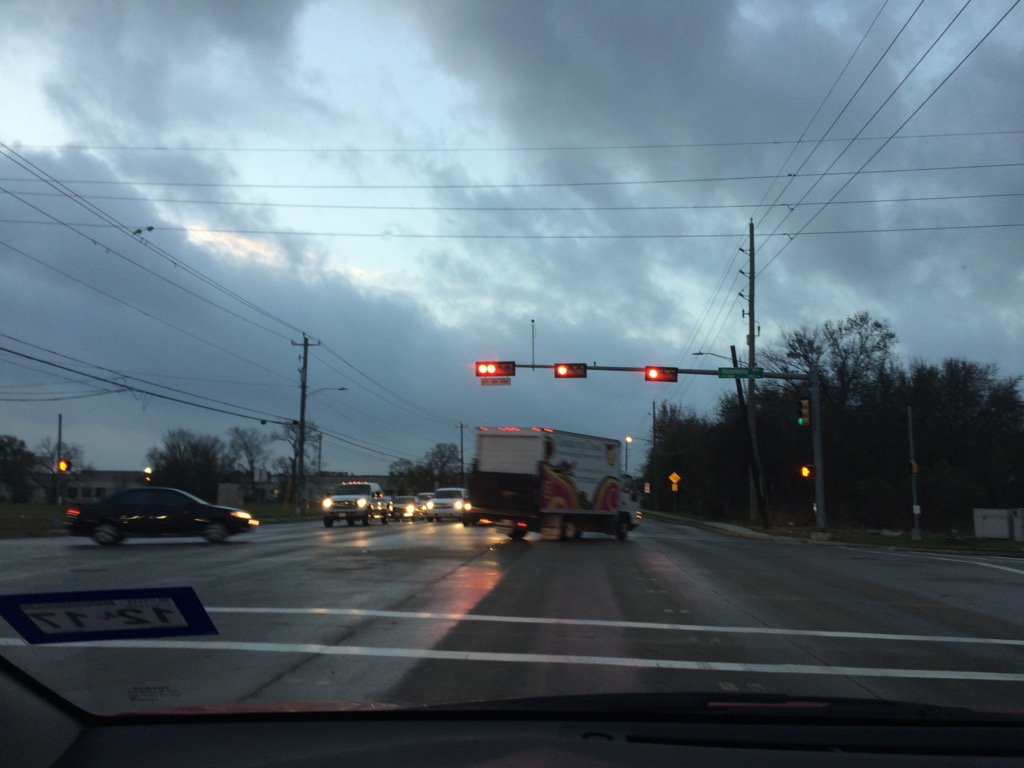
West Houston, TX during the early morning.
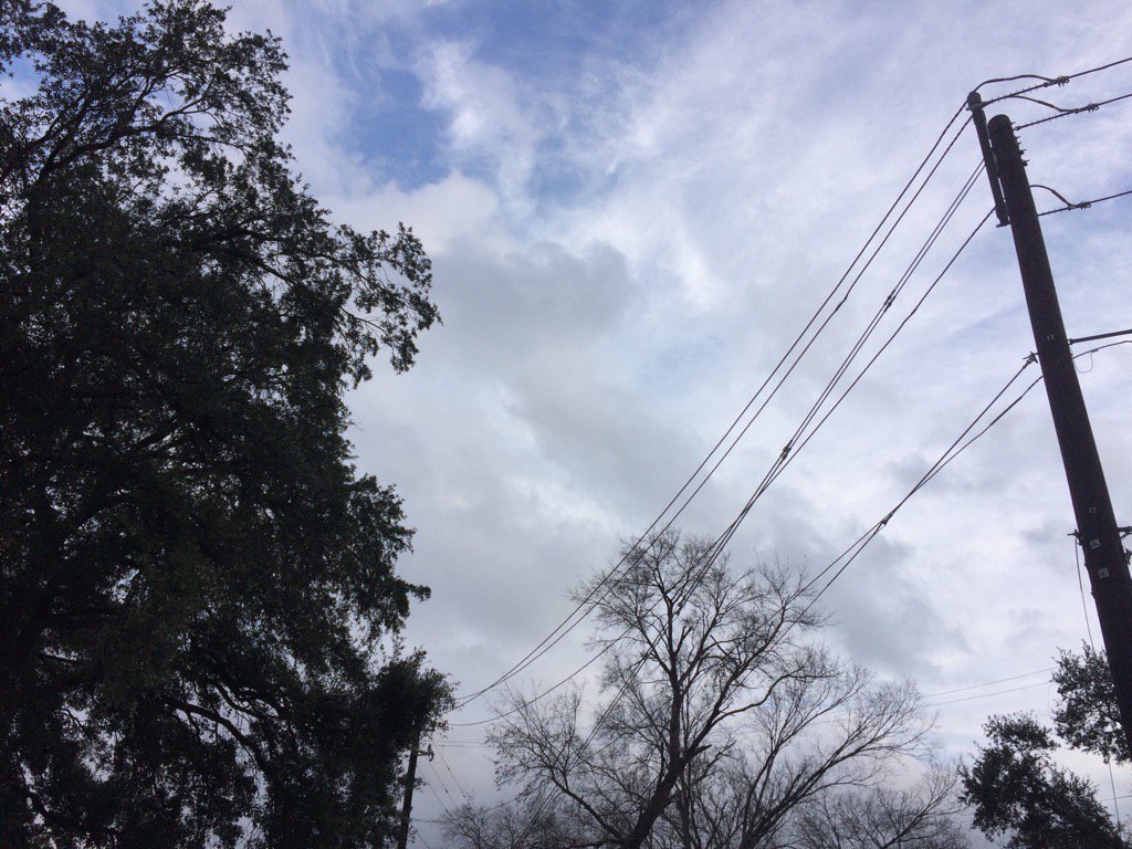
West Houston, TX during the early evening.
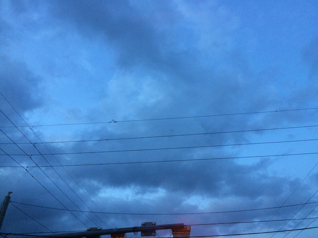
Northwest Houston, TX during the late evening.
Notes: Big to small, bright white, mostly bright white mixed with light to dark grey and maybe some blueish grey, thick, flat, puffy, low stratus clouds looked to cover most of the sky in northwest and west Houston, TX during the early morning. Big to small, bright white, mostly bright white mixed with light to dark grey and maybe some blueish grey, thick, flat, puffy, low stratus clouds looked to cover most of the sky in west Houston, TX during mid to late morning, afternoon, and early evening. Big to small, bright white, mostly bright white mixed with light to dark grey and maybe some blueish grey, thick, flat, puffy, low stratus clouds looked to cover most of the sky in northwest Houston, TX during the late evening. A big layer of bright white mixed with light to dark grey, thick, flat, puffy, low stratus clouds looked to cover whole sky, or maybe most of the sky in northwest Houston, TX during the early night. The wind speeds looked to be calm with maybe some moderate to moderately strong gusts in northwest and west Houston, TX, during the early morning. The wind speeds looked to have risen to relatively calm with moderate and moderately strong gusts in west Houston, TX, sometime during the morning. The wind speeds looked to be relatively calm with moderate and moderately strong gusts in west Houston, TX during the afternoon and early evening. The wind speeds looked to be relatively calm with moderate and moderately strong gusts in northwest Houston, TX during the late evening. The wind speeds looked to be relatively calm with moderate and moderately strong gusts and some really strong (20-25 mph) gusts in northwest Houston, TX during the early night. It felt warm in northwest and west Houston, TX during the early morning. It felt warm in west Houston, TX during the mid-morning. It felt warm, or maybe really warm in west Houston, TX during the late morning and afternoon. It felt warm in west Houston, TX during the early evening. It felt warm in northwest Houston, TX during the late evening and early night. There was a 10 to 30 percent chance for rain for the Houston, TX area, during the day. There were no advisories, watches, or warnings issued for the Houston, TX area, that I know of. The temps were in the low 60's to 70's during the morning and night and in the mid to high 70's and maybe low 80's during the afternoon.
Summary: The day was warm and mostly cloudy and dry. Isolated light to maybe moderate and possibly some moderately heavy showers were scattered in and around the Houston, TX area during the morning, afternoon, and maybe evening and night. I passed through a few light to moderate showers in northwest and west Houston, TX, on my way to work. I didn't see, or hear about any flooding, or damages in any of the areas that got showers.
Thoughts: I actually wasn't expecting to see any rain during the day, so I was surprised to run into a few showers this morning. And there is still some minor chances for rain tomorrow and next week. At least it will be warm. Houston, TX might even break some records Tuesday and Wednesday.
Area Forecast Discussion
Issued by NWS Houston/Galveston, TX
Issued by NWS Houston/Galveston, TX
Versions: 1 2 3 4 5 6 7 8 9 10 11 12 13 14 15 16 17 18 19 20 21 22 23 24 25 26 27 28 29 30 31 32 33 34 35 36 37 3839 40 41 42 43 44 45 46 47 48 49 50
000
FXUS64 KHGX 070331
AFDHGX

Area Forecast Discussion
National Weather Service Houston/Galveston TX
931 PM CST Mon Feb 6 2017

.UPDATE...
Tweaked overnight low temperatures upward a bit. Dewpoints were
already in the mid 60s as far inland as CLL. The dryline will
probably not make it to the College Station area until mid
morning on Tuesday.

40

&&

.PREV DISCUSSION... /ISSUED 539 PM CST Mon Feb 6 2017/

AVIATION...
Surface analysis shows a decent pressure gradient over much of
the area allowing for gusty southerly winds and VFR ceilings. The
expectation is for VFR ceilings to continue for a couple more
hours until the night time inversion begins to develop and the
boundary layer saturates. Models again look to be way too
pessimistic with LIFR ceilings and visibility. Since winds will
remain above 5 kts for much of the night and a 30 kt LLJ, ceiling
are more likely to remain IFR to MVFR for the area. IFR may
develop 05-07Z tonight and continue through the morning with
heights ranging from 700-1200ft. Tomorrow winds veer to the SW as
a Pacific front approaches the area. There should be enough mixing
to allow for ceilings to rise late morning and become VFR in the
afternoon. There may be another set up for IFR again tomorrow
night as shallow moisture continues in the boundary layer.

Overpeck

PREV DISCUSSION... /ISSUED 311 PM CST Mon Feb 6 2017/

DISCUSSION...
Another unseasonably warm day across SE TX with high temperatures
at 80 degrees across much of the area. Sfc analysis shows high
pressure over the northern Gulf and low pressure over the western
high plains. The pressure gradient has tightened and south winds
have increased to 15 to 20 mph and gusty. Winds are not expected
to decouple overnight and clouds will hang around too so expecting
another warm night with min temps only cooling into the upper 60s.
A well defined short wave will approach SE TX later tonight and
the region will lie in a LFQ of a 110 knot jet. PW values are
around 1.30 inches so would expect some increase in shower
activity overnight, especially over the eastern half of the CWA.
The warm dew points moving over slightly cooler shelf waters will
also be somewhat favorable for sea fog but warming Gulf waters
coupled with a S-SW sfc wind making sea fog less of a threat.

The short wave will exit the region early Tuesday and any
remaining showers will end by 15-16z. Forecast soundings show
clouds eroding by 18z, quite a bit of mid level dry air and
warming at 850 mb. Some of this dry air will mix to the surface
and have lowered sfc dew pts a bit below the superblend. RH values
will fall to near 30 percent over the north. Winds are not
expected to be as strong as today but parts of the north will need
to be monitored for elevated fire weather conditions. Warm 850
temps and dry air will translate into very warm sfc temperatures
with highs warming into the lower and possibly mid 80s on Tuesday.
850 temps warm even more on Wednesday with even slightly warmer
temps possible on Wednesday. Records for Tue/Wed are below:

          TUE          WED
CLL    83/1999       82/1994
IAH    80/1957       82/1932
HOU    82/1950       83/1962
GLS    76/1904       76/1950

A weak cold front will cross the area Wednesday night with cooler
temperatures on Thursday and Friday. Onshore winds return by
Friday so the cool down will be brief as warmer temperatures
return by next weekend. Upper level riding over the eastern Gulf
will amplify into East Texas over the weekend as a deep upper low
over NV drops south into AZ. Temps over the weekend will once
again warm to near 80. A cold front will move into Texas Sunday
night and stall somewhere over east Texas. Rain chances will start
to increase as the upper low shifts east early next week. Some
timing differences with the frontal passage between the GFS and
the ECMWF but the latest consensus brings the front through next
Tuesday. 43

MARINE...
Moderate onshore winds will persist the next couple of days.
Slightly stronger winds are possible over the offshore waters,
and caution flags might be needed at times. Sea fog development
will also remain possible the next few days. With the passage
of the next front, the fog threat will come to an end and winds
will become northwest Wednesday night and then northeast on
Thursday. Caution flags and/or advisories are possible in the
wake of the front. South to southeast winds return to the area
at the end of the week and persist over the weekend. Caution
flags might be needed for increasing winds and building seas. 42

&&

.PRELIMINARY POINT TEMPS/POPS...
College Station (CLL)      68  84  61  84  51 /  20  10   0   0   0
Houston (IAH)              68  83  65  85  55 /  20  10  10   0   0
Galveston (GLS)            64  76  65  77  60 /  20  10  10  10   0

&&

.HGX WATCHES/WARNINGS/ADVISORIES...
TX...NONE.
GM...Dense Fog Advisory until 9 AM CST Tuesday for the following
     zones: Coastal waters from High Island to Freeport out 20
     NM...Galveston Bay.

&&

$$

Discussion...40
Aviation/Marine...39
No comments:
Post a Comment