
Northwest Houston, TX, during the early morning.

Northwest Houston, TX, during the early afternoon.

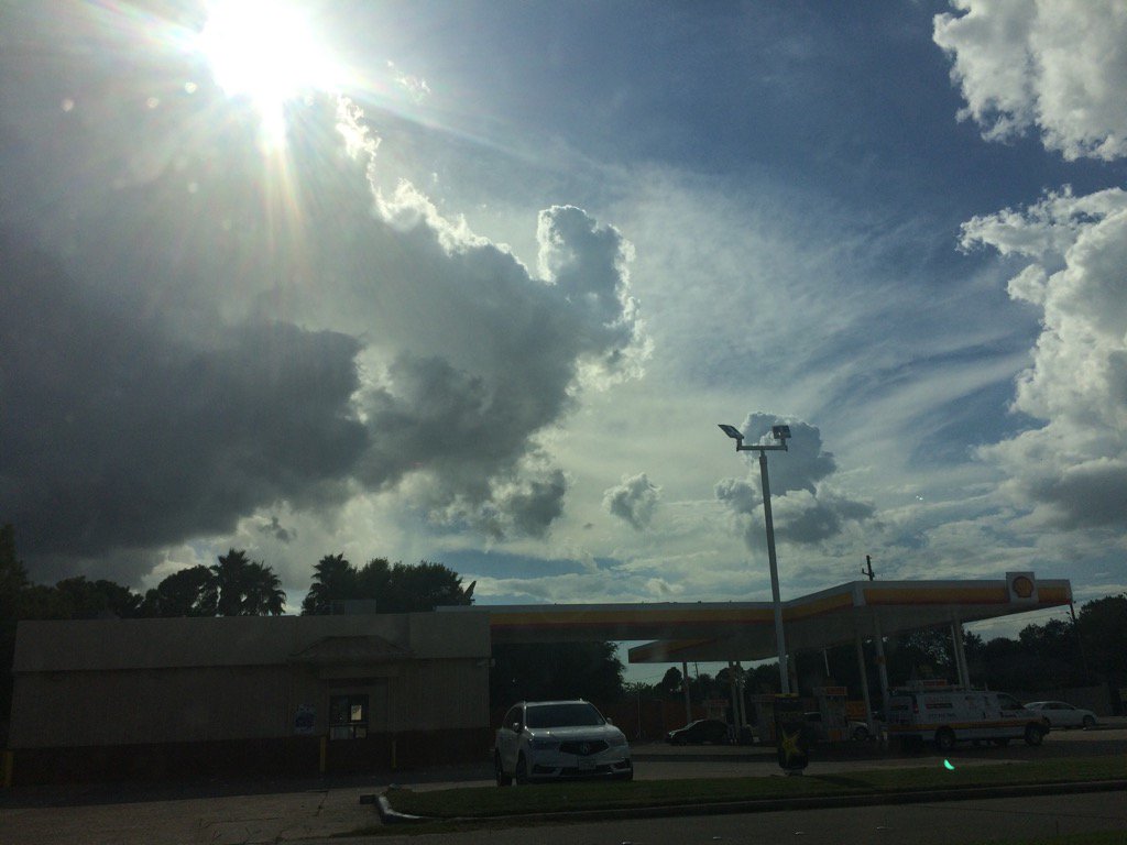
Northwest Houston, TX, during the late afternoon.
Northwest Houston, TX, during the early evening.

Northwest Houston, TX, during the late evening.
Summary: The day was very warm, sunny, and mostly dry. Isolated light to moderately heavy and heavy showers and maybe a few thunderstorms passed through the Houston, TX area, during the morning, afternoon, evening, and maybe night. I felt and saw a few rain drops in northwest Houston, TX, during the early afternoon. I felt a few more possible rain drops in northwest Houston, TX, during the early evening. My house also looked to have gotten some rain, sometime during the afternoon. Stratus and stratocumulus clouds looked to be scattered across the sky, during the morning, afternoon, evening, and maybe night. There looked to be some possible nimbus clouds, during the afternoon and early evening. The wind speeds looked to be calm with gentle to moderate gusts with some moderately strong gusts. It felt warm, during the early morning and late evening. It felt very warm, during the mid-morning. It felt hot, during the late morning and afternoon. It started to feel very warm, becoming warm, during the early evening. There were no watches, warnings, alerts, advisories, or weather statements/outlooks issued for the Houston, TX area, that I know of. The low temps looked to be in the 70's with maybe some 80's and the high temps looked to be in the 90's with maybe some 80's, for the Houston, TX area.
Storm Summary: All areas of Houston, TX looked to have gotten at least some rain drops. I didn't hear, or see any reports of flooding, or storm damages anywhere in, or near the Houston, TX area.
My Storm Summary: Dark stratocumulus and a few possible nimbus clouds started to pass over and near where I work in northwest Houston, TX, during the early afternoon and were still present through the early evening, when I arrived home in northwest Houston, TX, during the early evening. The pavement looked wet, from a recent moderately heavy, or maybe shower, or thunderstorm, when I was driving through my neighborhood, near my house in northwest Houston, TX, during the early evening. I saw and felt a few drops of rain, where I work in northwest Houston, TX, during the early afternoon. I felt a more possible rain drops when I was walking towards my car in a Walmart parking lot, in my neighborhood, in northwest Houston, TX, during the early evening. I didn't see, feel, or hear any more rain drops after that. I didn't see any flooding, just some small, deep puddles. I didn't see any storm damage. I didn't hear any thunder, or see any lightning.
Locations: Northwest Houston, TX.
Thoughts: I am starting to see more rain and cooler temps in the Houston, TX area. I am looking forward to seeing more rain and cooler temps. There is also a chance for tropical weather later this week, according to NOAA. I hope Houston, TX will be prepared if that does occur. I think I might have to prepare. I will be monitoring this. I guess we will see what happens.
Area Forecast Discussion
Issued by NWS Houston/Galveston, TX
Issued by NWS Houston/Galveston, TX
Versions: 1 2 3 4 5 6 7 8 9 10 11 12 13 14 15 16 17 18 19 20 21 22 23 24 25 26 27 28 29 30 31 32 33 34 35 36 37 38 3940 41 42 43 44 45 46 47 48 49 50
066
FXUS64 KHGX 220021
AFDHGX

Area Forecast Discussion
National Weather Service Houston/Galveston TX
721 PM CDT Mon Aug 21 2017

.AVIATION...
Storms have moved out of the Metro terminals with only a few left
on the radar near 66R and east and southeast of CLL. Overnight VFR
with the possibility (though slim) that brief MVFR fog/cigs
develop at UTS/LBX/CXO toward morning. Model soundings showing
increased subsidence with drier air aloft and less low level
moisture to work with so have tweaked TAFS to mainly VCSH after
18z. Winds decouple tonight then come back up after sunrise but
only 4-8kts for the most part out of the SE...overall quiet
aviation wx.
45

&&

.PREV DISCUSSION... /ISSUED 414 PM CDT Mon Aug 21 2017/

DISCUSSION...
Mainly scattered showers (only storm at the bottom of the hour
was in central Liberty County) beginning to get going across the
second tier counties this afternoon...quickly moving northwest and
dissipating after a half an hour with new convection forming
along their westward propagating outflow boundaries. Ambient
temperatures climbed into the average lower 90s...interior dew
points mixing out into the lower 70s affording near 100 F heat
indices. Closer to the coast where there is less cloud cover post
seas breeze passage...heat indices are closer to 103 to 105 F as
dew points remain in the mid to upper 70s. Static synoptic pattern
in store for tomorrow so not much change from today. Overnight
middle 70s/ lower 80s at coast under mainly clear skies with the
only subtle change being on Maximum T numbers. Stronger western
Texas ridging nudging eastward may push mid to late afternoon
interior temperatures up into the middle 90s. 30 POPs in the
vicinity of the sea breeze front to mainly account for towering cu
reaching their full potential during the heat of the day.

The buzz around the local offices has been about how the NWP model
suite is handling the evolution of what may become TC Harvey.
They are very aggressive in taking the remnants of Harvey across
the Yucatan tomorrow and placing them into the southern Bay of
Campeche by tomorrow night into Wednesday morning....eventually
taking a tropical storm or hurricane into the Valley and meandering
it across south/central Texas through the weekend. Granted that
this wave will be entering a less sheared environment as the
central Gulf wide cyclonic circulation/inverted trough moves into
the western Gulf...but much remains uncertain especially since
Harvey is currently a wave heading west towards the Belize
coastline. Have remained conservative on increasing POPS/impacts
from mid week onward due to very low confidence....primarily stuck
to the generic 30-40 daily precipitation chances until better
focus comes into play (that time affords) from the evolution of
this wave across the Yucatan peninsula. So...in essence...if the
deterministic runs pan out then it will become a very busy week
for south and central Texas. The other scenario of this wave/Harvey
moving into southern Bay of Campeche and then steering west into
central Mexico makes this a persistent forecast of partially cloudy
days...mid-upper 70s/low-mid 90s and late morning through afternoon
20 to near 40 POPs. Let`s prepare for the former and hope for the
latter scenario.....31

MARINE...
Continued light/moderate winds and low seas are expected into
midweek. Scattered late night and morning showers and thunderstorms
will also persist. The forecast becomes considerably more uncertain
during the second half of the week. We`ll be keeping an eye on the
remnants of Harvey and whether or not it can redevelop once it moves
into the Bay of Campeche sometime Wed. Guidance seems to think
that`s a possibility and would send some elevated swells toward the
Texas coast if that`s the case. Nudged seas up a touch in this
forecast package...maybe not enough if it does. Prefer to watch
trends before going much higher attm.  47

&&

.PRELIMINARY POINT TEMPS/POPS...
College Station (CLL)      75  98  76  99  75 /  10  20  10  20  30
Houston (IAH)              76  95  77  96  77 /  20  30  10  30  30
Galveston (GLS)            82  92  82  91  82 /  20  30  10  30  20

&&

.HGX WATCHES/WARNINGS/ADVISORIES...
TX...NONE.
GM...NONE.
&&

$$

Discussion...41
Aviation/Marine...45
No comments:
Post a Comment