
Northwest Houston, TX, during the early afternoon.

Northwest Houston, TX, during the early evening.

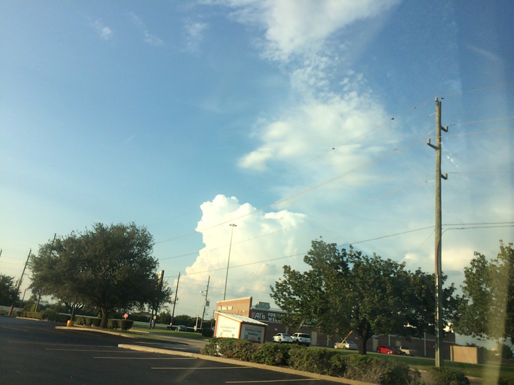
West Houston, TX, during the early evening.

Katy, TX, during the early evening.
Katy, TX, during the late evening.

Northwest Houston, TX, during the late evening.

Cypress, TX, during the late evening.
Summary: The day was hot, sunny, and dry. A few isolated moderate to moderately heavy to heavy showers and possible thunderstorms were scattered in and around the Houston, TX area, during the afternoon, evening, and maybe morning and night. I felt and saw a few rain drops, during the early afternoon. Alto stratus, stratus and stratocumulus clouds looked to be widely scattered across the sky, during the morning, afternoon, evening, and maybe night. There also looked to be a few nimbus clouds, during the late evening and maybe early afternoon. The wind speeds looked to be calm with gentle to moderate gusts with some moderately strong and possible really strong gusts. It felt warm, during the early morning, late evening, and night. It began to feel hot, sometime during the late or maybe mid-morning. It felt hot, during the afternoon. It felt very warm, during the early evening. There was a Hazardous Weather Outlook, Storm Surge Watch, or maybe warning, Tropical Storm Watch and Statement, Hurricane Local Statement, and a Special Weather Statement with maybe some other tropical weather statements and watches, issued for the Houston, TX area, by NOAA. The low temps looked to be in the 70's with maybe some 80's and the high temps looked to be in the 90's with maybe some 80's, for the Houston, TX area.
Storm Summary: There were no reports of flooding, or storm damage, anywhere in, or near the Houston, TX area, that I know of.
My Storm Summary: I felt and saw a few rain drops during the early afternoon That was the only rain drops that I saw. I didn't see, hear, or feel any more rain drops after that. I saw some storm looking stratus and maybe a few nimbus clouds during the early afternoon and late evening. The sky looked to be becoming dark, during the afternoon, but then became bright again. I saw some tall stratocumulus, or maybe nimbus clouds, during the late evening. I didn't see any flooding, or storm damage. I saw some wet roads in northwest Houston, TX, that looked to have been from a shower, but might have been from a sprinkler system.I didn't hear any thunder, or see any lightning.
Locations: Northwest and west Houston, TX, Cypress, TX, and Katy, TX.
Thoughts: I am interested in seeing what happens with the remnants of Harvey. It looks like Houston, TX is going to get a lot of rain.
Area Forecast Discussion
Issued by NWS Houston/Galveston, TX
Issued by NWS Houston/Galveston, TX
Versions: 1 2 3 4 5 6 7 8 9 10 11 12 13 14 15 16 17 18 19 20 21 22 23 24 25 26 27 28 29 30 31 32 33 34 35 36 37 38 3940 41 42 43 44 45 46 47 48 49 50
000
FXUS64 KHGX 240314
AFDHGX

Area Forecast Discussion
National Weather Service Houston/Galveston TX
1014 PM CDT Wed Aug 23 2017

.UPDATE...
Further update with storms still ongoing but showing a general
weakening trend have raised POPS a little further south down into
the Houston Metro for the midnight to 6 am period. Outflow could
slowly sag south with weak flow into and across the boundary will
probably see mainly showers but a few thunderstorms will probably
continue through the remainder of the night. Temperatures also
running cooler back in the rain cooled air.

Tropics...
Still no real changes to the first 72-96 hours but NHC did make
some changes to the 96+ hr time period taking the storm westward
out of the area but they also stressed that confidence is low at
that point which is clearly shown in the forecast cone - very
large and nearly circular forecast at the end period. Where it
drifts to is still very much in question.

45


&&

.PREV DISCUSSION... /ISSUED 747 PM CDT Wed Aug 23 2017/

UPDATE...
Storms over Brenham to College Station to Madisonville to near
Crockett continue to sag southward along the frontal boundary.
Heavy rainfall and gusty winds of 20-40 mph the main threat there.
Have done a quick update to the forecast for the evening hours.

Tropics...
Hurricane hunters could not find a tropical storm force winds so
Harvey remains a TD. It is drifting very slowly northwest. No
changes to the current watches.

45

PREV DISCUSSION... /ISSUED 715 PM CDT Wed Aug 23 2017/

AVIATION...
SHRA/TSRA will continue to linger through mid-evening around CLL,
UTS, CXO, and IAH with stronger activity resulting in IFR to MVFR
visibility restrictions and variable and gusty winds approaching
20 knots. Dry conditions are expected near the terminals overnight
with isolated SHRA developing along the coast (near GLS) around
sunrise and spreading inland as scattered SHRA/TSRA early
afternoon. Otherwise, expect VFR to prevail outside of TSRA/SHRA
with winds varying between northeast and southeast at 10 knots or
less.

Huffman

PREV DISCUSSION... /ISSUED 412 PM CDT Wed Aug 23 2017/

DISCUSSION...
Monitoring for a Significant Multi-Day Heavy Rainfall Event...

The ongoing concern is the impacts of Harvey over the next several
days. Of course, this will depend upon the eventual track of the
storm. The weakness in the upper level ridge currently over
Southeast Texas is not expected to change over the next several
days. This could lead to rainfall impacts from Harvey over a
multi-day period from late Friday through Monday. If the storm or
its remnants slow down after landfall the heavy rainfall potential
could continue into Tuesday.

The flood threat could be heightened by higher than normal tides
along the coast combined with high seas will keep the rivers and
bayou system from draining as it would normally drain. Because of
this, there is a potential for event-total rainfall to range from
10 to 15 inches with isolated locations receiving 20 inches or
more. The locations for the greatest rainfall still looks to be
from the Interstate 10 corridor southward to the coast.

Timing of the event will depend upon the track of Harvey. As of
now, it does not appear that widespread rainfall will occur
tonight or Thursday. However, an unsettle airmass due to the
shearing out upper low over the far northwestern Gulf this
afternoon will keep at scattered showers and thunderstorms in
place on Thursday. The coverage will then become more widespread
on Friday particularly over the southern half of the forecast
area. Widespread rain chances are then expected on Saturday,
Sunday, and Monday. The forecast after Monday will depend upon
where Harvey or its remnants travel. The GFS and ECMWF show that
the system will be in between two upper level high pressure
areas--a rather concerning pattern for Southeast Texas.

40

MARINE...
Marine fcst is obviously tied to the evolution of Harvey. We should
start seeing some swell arrive in the coastal waters Thursday,
probably building to SCA criteria Thurs night...followed by
a continuing wind/sea/surge/tide increase and wx conditions into
landfall. Water levels will remain elevated & hamper inland precip
drainage probably thru the weekend into early next week.

Best estimate of marine related impacts & decision points based on
what we currently know:

* Onset of 7+ foot seas: Thurs night
* Onset of tropical storm force winds within 20 NM - Friday
* Onset of hurricane force winds (if any) - Fri night
* Onset of coastal flood threat - Thurs night
* Reasonable worst case surge: 4-6 feet above ground near landfall,
  2-4 feet further away
* High risk of rip currents and building surf thru the day Thursday.
* Discharge from elevated rivers after landfall may continue to
  impact navigation.

47

&&

.PRELIMINARY POINT TEMPS/POPS...
College Station (CLL)      76  95  74  89  74 /  70  40  30  40  60
Houston (IAH)              77  93  77  85  75 /  30  40  30  60  70
Galveston (GLS)            81  88  79  85  80 /  20  50  60  70  70

&&

.HGX WATCHES/WARNINGS/ADVISORIES...
TX...Hurricane Watch for the following zones: Brazoria...Jackson...
     Matagorda.

     Tropical Storm Watch for the following zones: Austin...
     Chambers...Colorado...Fort Bend...Galveston...Harris...
     Liberty...Waller...Wharton.

GM...Hurricane Watch for the following zones: Coastal waters from
     Freeport to the Matagorda Ship Channel out 20 NM...
     Matagorda Bay...Waters from Freeport to the Matagorda Ship
     Channel from 20 to 60 NM.

     Tropical Storm Watch for the following zones: Coastal waters
     from High Island to Freeport out 20 NM...Galveston Bay...
     Waters from High Island to Freeport from 20 to 60 NM.

&&

$$

Discussion...45
Hazardous Weather Outlook
Hazardous Weather Outlook
National Weather Service Houston/Galveston TX
539 AM CDT Wed Aug 23 2017

GMZ330-335-350-355-370-375-TXZ163-164-176>179-195>200-210>214-226-
227-235>238-241045-
Austin-Brazoria-Brazos-Burleson-Chambers-
Coastal waters from Freeport to the Matagorda Ship Channel out
20 NM-Coastal waters from High Island to Freeport out 20 NM-
Colorado-Fort Bend-Galveston-Galveston Bay-Grimes-Harris-Houston-
Jackson-Liberty-Madison-Matagorda-Matagorda Bay-Montgomery-Polk-
San Jacinto-Trinity-Walker-Waller-Washington-
Waters from Freeport to the Matagorda Ship Channel from 20 to
60 NM-Waters from High Island to Freeport from 20 to 60 NM-
Wharton-
539 AM CDT Wed Aug 23 2017

This hazardous weather outlook is for portions of Southeast Texas..

.DAY ONE...Today and Tonight

The National Hurricane Center is continuing to monitor the remnants
of tropical system Harvey, which is currently located over the
eastern Bay of Campeche, and is expected to move northwestward
over the western Gulf of Mexico. Environmental conditions are
favorable for development, and a tropical depression or tropical
storm is very likely to form today or tonight.

.DAYS TWO THROUGH SEVEN...Thursday through Tuesday

The tropical system will move into the northwestern Gulf of
Mexico on Friday, and possibly slow down over the region. A slow
moving tropical system such as this can produce copious tropical
rainfall amounts. In the past, slow moving tropical systems have
produced amounts in excess of 20 inches leading to widespread
dangerous flooding. Tropical storm to hurricane force winds could
be possible, as well as tornadoes and storm surge. High tides
along the upper Texas Coast will likely cause impacts from
dangerous rip currents to storm surge flooding. The range of
possibilities with storm surge are varied given the highly
uncertain track of this system. Evacuations may be possible.

Marine impacts will include high winds and large dangerous seas
possible by Friday again depending on the strength and track of
the system.

Persons in Southeast Texas should be monitoring the weather
closely.

.SPOTTER INFORMATION STATEMENT...

Spotter activation is likely at some point between Thursday night
and Monday.

$$
Hurricane Local Statement
Tropical Depression Harvey Local Statement Advisory Number 14 TXZ163-164-176>179-195>200-210>214-226-227-235>238-241130- Tropical Depression Harvey Local Statement Advisory Number 14 National Weather Service Houston/Galveston TX AL092017 1029 PM CDT Wed Aug 23 2017 This product covers Southeast Texas **HARVEY DRIFTING ERRATICALLY NORTHWESTWARD TOWARDS THE TEXAS COAST AS A TROPICAL DEPRESSION** NEW INFORMATION --------------- * CHANGES TO WATCHES AND WARNINGS: - None * CURRENT WATCHES AND WARNINGS: - A Storm Surge Watch and Hurricane Watch are in effect for Brazoria, Jackson, and Matagorda - A Tropical Storm Watch is in effect for Austin, Colorado, Fort Bend, Liberty, Waller, and Wharton - A Storm Surge Watch and Tropical Storm Watch are in effect for Chambers, Galveston, and Harris * STORM INFORMATION: - About 530 miles south-southeast of Galveston TX - 21.9N 92.6W - Storm Intensity 35 mph - Movement Northwest or 325 degrees at 2 mph SITUATION OVERVIEW ------------------ Tropical Depression Harvey has not moved much today but is expected to strengthen as it moves NW towards the Texas Coast. TD Harvey is expected to continue to strengthen into a tropical storm or hurricane during the next couple of days. The primary impact from Harvey remains heavy rainfall and subsequent flooding, but there will still be a threat for tropical storm to hurricane force winds and storm surge along the coast. The most likely arrival time for Tropical Storm force winds to reach the Upper Texas Coast is during the day on Friday. Harvey is forecast to remain somewhere in the vicinity of S to SE Texas through the weekend and will continue to pose a heavy rainfall and flooding threat into early next week. Coastal flooding will likely be an ongoing issue Friday through the weekend as tides will remain elevated. POTENTIAL IMPACTS ----------------- * FLOODING RAIN: Prepare for life-threatening rainfall flooding having possible extensive impacts across Southeast Texas. Potential impacts include: - Major rainfall flooding may prompt many evacuations and rescues. - Rivers and tributaries may rapidly overflow their banks in multiple places. Small streams, creeks, canals, and ditches may become dangerous rivers. Flood control systems and barriers may become stressed. - Flood waters can enter many structures within multiple communities, some structures becoming uninhabitable or washed away. Many places where flood waters may cover escape routes. Streets and parking lots become rivers of moving water with underpasses submerged. Driving conditions become dangerous. Many road and bridge closures with some weakened or washed out. * SURGE: Prepare for life-threatening surge having possible significant impacts across the Upper Texas Coast. Potential impacts in this area include: - Areas of inundation with storm surge flooding accentuated by waves. Damage to several buildings, mainly near the coast. - Sections of near-shore escape routes and secondary roads become weakened or washed out, especially in usually vulnerable low spots. - Major beach erosion with heavy surf breaching dunes. Strong and numerous rip currents. - Moderate damage to marinas, docks, boardwalks, and piers. Several small craft broken away from moorings, especially in unprotected anchorages. Also, prepare for locally hazardous surge having possible limited impacts across northern Galveston Bay and Trinity Bay. Elsewhere across Southeast Texas, little to no impact is anticipated. * WIND: Prepare for dangerous wind having possible significant impacts across the Upper Texas Coast, primarily near Matagorda Bay. Potential impacts in this area include: - Some damage to roofing and siding materials, along with damage to porches, awnings, carports, and sheds. A few buildings experiencing window, door, and garage door failures. Mobile homes damaged, especially if unanchored. Unsecured lightweight objects become dangerous projectiles. - Several large trees snapped or uprooted, but with greater numbers in places where trees are shallow rooted. Several fences and roadway signs blown over. - Some roads impassable from large debris, and more within urban or heavily wooded places. A few bridges, causeways, and access routes impassable. - Scattered power and communications outages, but more prevalent in areas with above ground lines. * TORNADOES: Prepare for a tornado event having possible limited impacts across Southeast Texas. Potential impacts include: - The occurrence of isolated tornadoes can hinder the execution of emergency plans during tropical events. - A few places may experience tornado damage, along with power and communications disruptions. - Locations could realize roofs peeled off buildings, chimneys toppled, mobile homes pushed off foundations or overturned, large tree tops and branches snapped off, shallow-rooted trees knocked over, moving vehicles blown off roads, and small boats pulled from moorings. PRECAUTIONARY/PREPAREDNESS ACTIONS ---------------------------------- * EVACUATIONS: If you are exceptionally vulnerable to wind or water hazards from tropical systems, consider voluntary evacuation, especially if being officially recommended. Relocate to a predetermined shelter or safe destination. If evacuating away from the area or relocating to a nearby shelter, leave early before weather conditions become hazardous. * OTHER PREPAREDNESS INFORMATION: Now is the time to check your emergency plan and take necessary actions to secure your home or business. Deliberate efforts should be underway to protect life and property. Ensure that your Emergency Supplies Kit is stocked and ready. When making safety and preparedness decisions, do not focus on the exact forecast track as there are inherent forecast uncertainties which must be taken into account. If you live in a place that is particularly vulnerable to high wind, such as a mobile home, an upper floor of a high rise building, or on a boat, plan to move to safe shelter. Take enough supplies for you and your family for several days. If you live in a place particularly vulnerable to flooding, such as near the ocean or a large inland lake, in a low lying or poor drainage area, in a valley or canyon, or near an already swollen river, plan to move to safe shelter on higher ground Always heed the advice of local officials and comply with any orders that are issued. Do not needlessly jeopardize your life or the lives of others. When securing your property, outside preparations should be conducted as soon as possible before conditions deteriorate. The onset of strong gusty winds and heavy rain can cause certain preparedness activities to become unsafe. Be sure to let friends and other family members know of your intentions and whereabouts for surviving the storm. For emergency purposes, have someone located away from the threatened area serve as your point of contact. Share vital contact information with others. Keep cell phones handy and well charged. Be a Good Samaritan and check on those who may not be fully aware of the situation or who are unable to make personal preparations. Visitors to the area should become familiar with nearby surroundings. If you are a visitor, know the name of the county or parish in which you are located and where it is relative to current watches and warnings. If staying at a hotel, ask the management staff about their onsite disaster plan. Listen for evacuation orders, especially pertaining to area visitors. Closely monitor NOAA Weather Radio or other local news outlets for official storm information. Listen for possible changes to the forecast. * ADDITIONAL SOURCES OF INFORMATION: - For information on appropriate preparations see ready.gov - For information on creating an emergency plan see getagameplan.org - For additional disaster preparedness information see redcross.org NEXT UPDATE ----------- The next local statement will be issued by the National Weather Service in Houston/Galveston TX around 430 AM CDT, or sooner if conditions warrant. $$Tropical Storm Watch
Harvey Local Watch/Warning Statement/Advisory Number 14 National Weather Service Houston/Galveston TX AL092017 1015 PM CDT Wed Aug 23 2017 TXZ213-241115- /O.CON.KHGX.SS.A.1009.000000T0000Z-000000T0000Z/ /O.CON.KHGX.TR.A.1009.000000T0000Z-000000T0000Z/ Harris- 1015 PM CDT Wed Aug 23 2017 ...STORM SURGE WATCH REMAINS IN EFFECT... ...TROPICAL STORM WATCH REMAINS IN EFFECT... * WIND - LATEST LOCAL FORECAST: Below tropical storm force wind - Peak Wind Forecast: 10-20 mph with gusts to 30 mph - CURRENT THREAT TO LIFE AND PROPERTY: Elevated - The wind threat has remained nearly steady from the previous assessment. - Emergency planning should include a reasonable threat for tropical storm force wind of 39 to 57 mph. - To be safe, prepare for the potential of limited wind impacts. Efforts should now be underway to secure all properties. - Hazardous wind is possible. Failure to adequately shelter may result in serious injury. - POTENTIAL IMPACTS: Limited - Damage to porches, awnings, carports, sheds, and unanchored mobile homes. Unsecured lightweight objects blown about. - Many large tree limbs broken off. A few trees snapped or uprooted, but with greater numbers in places where trees are shallow rooted. Some fences and roadway signs blown over. - A few roads impassable from debris, particularly within urban or heavily wooded places. Hazardous driving conditions on bridges and other elevated roadways. - Scattered power and communications outages. * STORM SURGE - LATEST LOCAL FORECAST: Life-threatening storm surge possible - Peak Storm Surge Inundation: The potential for 2-4 feet above ground somewhere within surge prone areas - Window of concern: Begins Friday morning - CURRENT THREAT TO LIFE AND PROPERTY: Moderate - The storm surge threat has remained nearly steady from the previous assessment. - Emergency plans should include a reasonable threat for dangerous storm surge flooding of greater than 3 feet above ground. - To be safe, earnestly prepare for the potential of significant storm surge flooding impacts. Evacuation efforts should now be brought to completion. Evacuations must be complete before driving conditions become unsafe. - Life-threatening inundation is possible. Failure to heed evacuation orders may result in serious injury or loss of life. Leave if evacuation orders are given for your area. Consider voluntary evacuation if recommended. Poor decisions may needlessly risk lives. - POTENTIAL IMPACTS: Significant - Areas of inundation with storm surge flooding accentuated by waves. Damage to several buildings, mainly near the coast. - Sections of near-shore escape routes and secondary roads become weakened or washed out, especially in usually vulnerable low spots. - Major beach erosion with heavy surf breaching dunes. Strong and numerous rip currents. - Moderate damage to marinas, docks, boardwalks, and piers. Several small craft broken away from moorings, especially in unprotected anchorages. * FLOODING RAIN - LATEST LOCAL FORECAST: - Peak Rainfall Amounts: Additional 8-12 inches, with locally higher amounts - CURRENT THREAT TO LIFE AND PROPERTY: High - The flooding rain threat has remained nearly steady from the previous assessment. - Emergency planning should include a reasonable threat for major flooding where peak rainfall totals well exceed amounts conducive for flash flooding and rapid inundation. Rescues and emergency evacuations are likely. - To be safe, aggressively prepare for the potential of extensive flooding rain impacts. - Life-threatening flooding is possible. Failure to take action may result in serious injury or significant loss of life. If flood related watches and warnings are issued, heed recommended actions. Poor decisions may result in being cut off or needlessly risk lives. If vulnerable, relocate to safe shelter on higher ground before flood waters arrive. - POTENTIAL IMPACTS: Extensive - Major rainfall flooding may prompt many evacuations and rescues. - Rivers and tributaries may rapidly overflow their banks in multiple places. Small streams, creeks, canals, and ditches may become dangerous rivers. Flood control systems and barriers may become stressed. - Flood waters can enter many structures within multiple communities, some structures becoming uninhabitable or washed away. Many places where flood waters may cover escape routes. Streets and parking lots become rivers of moving water with underpasses submerged. Driving conditions become dangerous. Many road and bridge closures with some weakened or washed out. * TORNADO - LATEST LOCAL FORECAST: - Situation is somewhat favorable for tornadoes - CURRENT THREAT TO LIFE AND PROPERTY: Elevated - The tornado threat has remained nearly steady from the previous assessment. - Emergency planning should include a reasonable threat for isolated tornadoes, mostly with shorter and narrower damage paths. - To be safe, prepare for the potential of limited tornado impacts. - Listen for tornado watches and warnings. Be ready to shelter quickly if a tornado approaches. - POTENTIAL IMPACTS: Limited - The occurrence of isolated tornadoes can hinder the execution of emergency plans during tropical events. - A few places may experience tornado damage, along with power and communications disruptions. - Locations could realize roofs peeled off buildings, chimneys toppled, mobile homes pushed off foundations or overturned, large tree tops and branches snapped off, shallow-rooted trees knocked over, moving vehicles blown off roads, and small boats pulled from moorings. $$
No comments:
Post a Comment