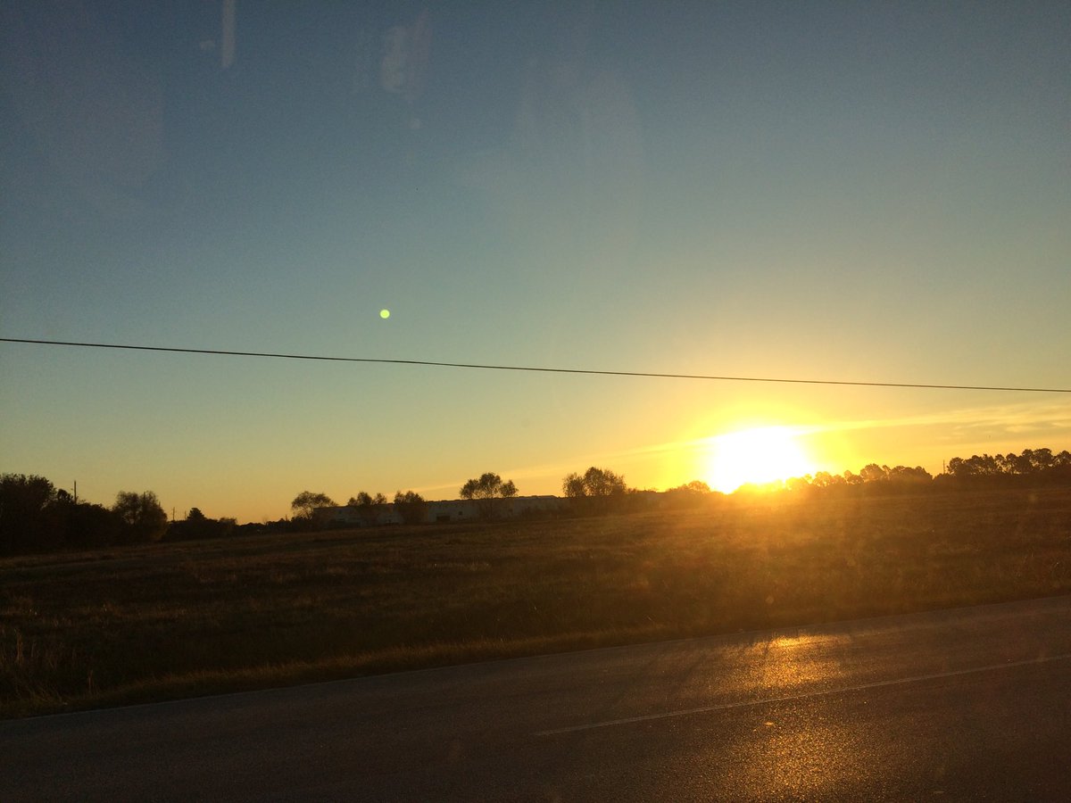
Northwest Houston, TX, during the early morning.
Northwest Houston, TX, during the early afternoon.
Summary: The day was cool, sunny, and dry. There didn't look to be any precip in any of the locations in the Houston, TX area, during anytime of the day. I didn't see any precip on the radar, over the Houston, TX area, during anytime of the day. I didn't feel, see, or hear any drops of precip, at any of the locations that I was in, during anytime of the day. Wavy thick and thin flat alto stratus clouds looked to be scattered across the sky, during the morning, afternoon, evening, and maybe night. The wind speeds looked to be calm with gentle to moderate gusts and some occasional really strong 20 mph gusts. It felt cold, during the early morning and early night. It felt very cool, during the mid-morning. It felt a little cool, during the late morning. It felt warm with a very cool wind gusts, during the afternoon. It felt cool with a very cool wind gust, during the early evening. It felt very cool with a cold wind gusts, during the late evening. It felt very cold, during the late night. There were no watches, warnings, alerts, advisories, or weather statements/outlooks issued for the Houston, TX area, that I know of. The low temperatures looked to be in the mid to high 30's and the high temperatures looked to be in the low ot mid 60's with maybe some high 60's, for the Houston, TX area.
Houston, TX Storm Summary: There didn't look to be any precip in any of the locations in the Houston, TX area, during anytime of the day. I didn't see any precip on the radar, over the Houston, TX area, during anytime of the day. I didn't see, or hear about any reports of flooding, or damage caused by the weather, at any of the locations in the Houston, TX area, during anytime of the day.
My Storm Summary: I didn't feel, see, or hear any drops of precip, at any of the locations that I was in, during anytime of the day. I didn't see any precip producing, or thunderstorm type clouds, during anytime of the day. I didn't see any flooding, wet roads, puddles, wet ground, or damage, caused by the weather/ I didn't see any lighting strikes, or hear any rumbles of thunder, during anytime of the day.
Locations: Northwest Houston, TX.
Thoughts: Here comes the cold again...
Issued by NWS Houston/Galveston, TX
Home | Current Version | Previous Version | Text Only | Print | Product List | Glossary Off
Versions: 1 2 3 4 5 6 7 8 9 10 11 12 13 14 15 16 17 18 19 20 21 22 23 24 25 26 27 28 29 30 31 32 33 34 35 36 37 38 39 40 41 42 43 44 45 46 47 48 49 50
000
FXUS64 KHGX 130526
AFDHGX
Area Forecast Discussion
National Weather Service Houston/Galveston TX
1126 PM CST Tue Dec 12 2017
.AVIATION...
VFR conditions are expected through the period. 11
&&
.PREV DISCUSSION... /ISSUED 836 PM CST Tue Dec 12 2017/
DISCUSSION...
High pressure over west-central Texas will bring clear skies,
light winds and dry air into SE TX tonight. Ideal radiational
cooling should allow for a light freeze over the NE counties
tonight and very cold temperatures elsewhere. Forecast is in good
shape and no significant changes in the short term is needed. 43
PREV DISCUSSION... /ISSUED 347 PM CST Tue Dec 12 2017/
NEAR TERM [Through Tonight]...
With the KHGX radar down along with THOU, it makes it hard to
detect smoke plumes from prescribed burns along the coast. GOES
East still works with GOES 16 en-route so we can still pick up a
couple of hot spots in Brazoria County and Chambers County along
with smoke plumes on visible. The burns are controlled despite
conditions being elevated for fire growth. Humidity levels have
dropped to around 25% across the area with winds around 10 to 15
mph and a few gusts near 20 mph. Tonight temperatures should drop
to the mid 30s for most areas and maybe the low 30s for areas
north of Houston and east of I-45. Freeze warnings have already
been issued for the cold season so that will not be a concern.
Hard freeze warning will be for temperatures at or below 25
degrees and temperatures will not be getting that cold.
SHORT TERM [Wednesday Through Thursday Night]...
Conditions will be fairly quiet tomorrow with maybe elevated fire
weather concerns since relative humidity drop below 30% but winds
will be from the southwest around 10 mph. High temperatures may
reach a couple of degrees higher than forecast right now but
depends upon when cold advection ends and how much boundary layer
mixing occurs. Wednesday into Thursday a clipper system moves
across the Great Lakes and reaches the Mid-Atlantic Thursday. A
cold front with this system should push through the area
relatively unnoticed. This front stalls off the coast and then
Thursday night frontogenetic lift begins to increase along with
divergence aloft due to SW/W flow aloft. An upper low begins to
develop over western portions of Mexico which will support the
enhanced jet stream flow aloft. Rain chances should increase along
the coast and offshore Thursday night into Friday. ECMWF has much
more QPF than the GFS, but the trends are there to increase rain
chances during this time along the coast.
LONG TERM [Friday Through Tuesday]...
Forecast models are trending with a faster, more progressive
pattern compared to yesterday for the weekend time frame. ECMWF
and GFS both develop a closed upper level low over western Mexico
with a stronger short wave trough in the mean NW flow aloft over
the central Rockies. This trough should help move the closed low
but there will likely be some timing issues. For now we have
shifted highest rain chances from Sunday to more late Saturday
into Saturday night. ECMWF now produces quite a bit of QPF and
likely bringing higher moisture into the region. GFS brings
precipitable water values up to 1.5 inches along the coast with a
plume of 1.8 inches towards Lake Charles.
By 00Z Sunday, upper level low over Mexico has moved east into
Texas per ECMWF with the GFS slower. Strong divergence aloft and
quasi-geostrophic forcing will support coastal cyclogenesis with
a surface low forming just off the upper Texas coast Saturday into
Saturday night. This system then pushes into Louisiana with rain
chances pushing as the upper low moves east. Highest rain chances
look to be Saturday night in the 30-40 percent range but could go
higher if models continue to trend with more consistent timing of
the trough. Forecast also leaves some slight rain chances Sunday
given the uncertainty in the forecast and timing differences. Rain
chances could quite possibly clear out sooner, but depending upon
the models, best rain chances could be pushed back. Overall looks
like a decent chance of rain with weather hazard remaining low.
There could be enough elevated instability for a few isolated
storms but otherwise looking for scattered showers to develop.
There certainly will be enough low level and deep layer shear for
storm organization but instability will be lacking for a severe
threat. Nonetheless we do not want to let our guard down since
there will be a strong LLJ which could enhance storms, especially
with regards to rotation but also with rain rates. At this time,
it looks like any heavy rainfall will occur off the coast with the
coast low.
Monday and Tuesday next week high pressure should move over the
area as a cold front moves east with the upper level system.
Temperatures will be close to normal for mid December.
Overpeck
MARINE...
North winds over the bays/coastal waters have already begun to de-
crease this afternoon...and have dropped the SCEC for all but the
offshore waters through this evening. Light offshore flow tonight
should give way to a light W/SW flow tomorrow as the surface high
moves off to the east. However, we should see the return of north
winds by Thurs with the passage of a reinforcing cold front. SCEC
and/or SCA flags will likely be needed by Thurs evening/overnight
into early Fri behind the front. Onshore winds expected to resume
early Sat and then rapidly strengthen as the next system deepens/
develops across the Plains. With a warm/moist flow developing and
overriding the cooler nearshore shelf waters, sea fog could be an
issue for our bays/nearshore waters until the next stronger front
clears the coast late Sunday. 41
FIRE WEATHER...
Elevated fire weather conditions are ongoing this afternoon with
RH values bottoming out between 20-30% along with increasing wind
speeds. Gusts between 15-20 mph will be possible from mid morning
to mid/late afternoon. Similar conditions are expected Wednesday
with winds turning around to the southwest. Winds speeds may not
be as high as today, but humidity levels may drop below 30% again
by afternoon.
Overpeck
&&
.PRELIMINARY POINT TEMPS/POPS...
College Station (CLL) 35 65 41 63 37 / 0 0 10 10 10
Houston (IAH) 38 63 44 65 41 / 0 0 10 10 10
Galveston (GLS) 45 60 53 67 47 / 0 0 10 10 20
&&
.HGX WATCHES/WARNINGS/ADVISORIES...
TX...NONE.
GM...NONE.
&&
$$
Discussion...43
Aviation/Marine...11
No comments:
Post a Comment