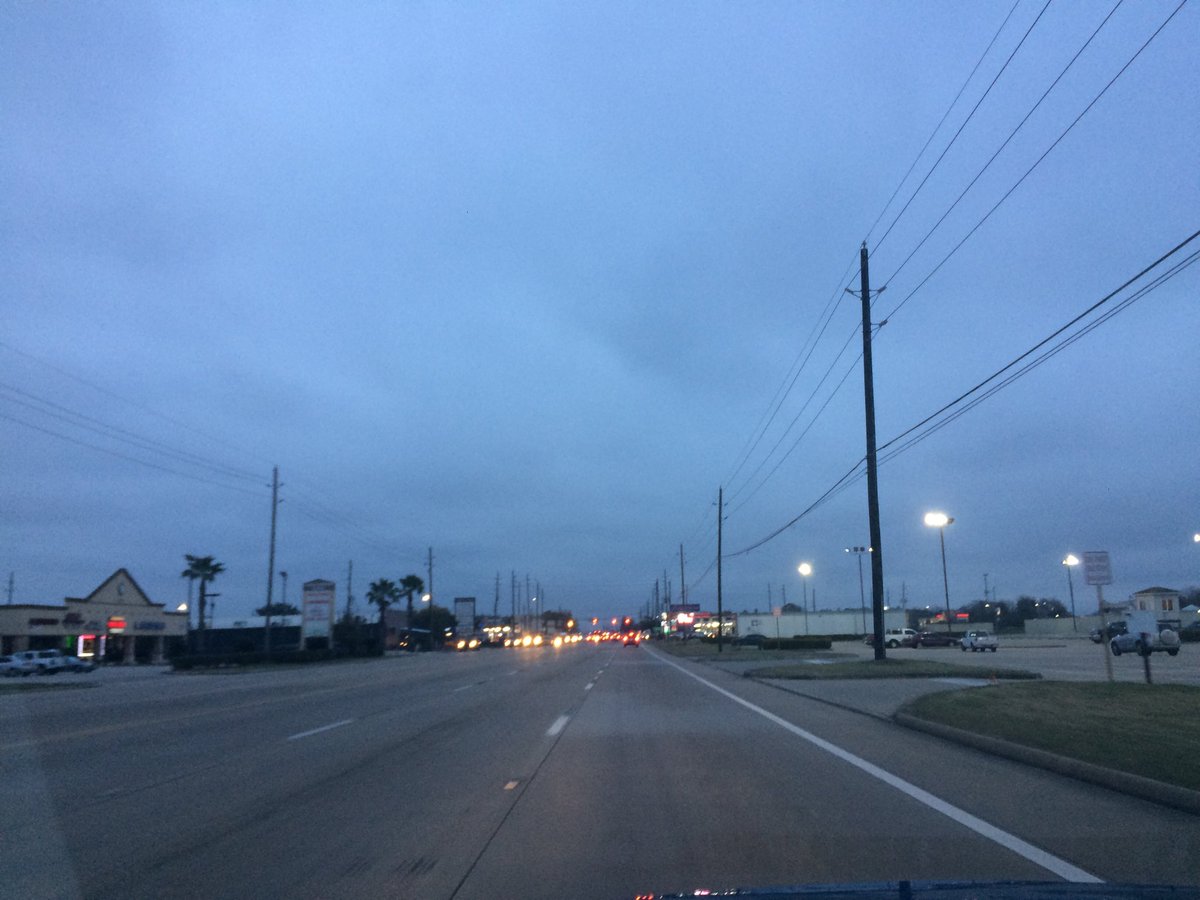
Northwest Houston, TX, during the early morning.
Summary: The day was cold, cloudy, and mostly dry. Some light drizzle and maybe some light rain, for the Houston, TX area. I don't remember seeing any precip on the radar, over the Houston, TX area, during anytime of the day. Some on and off light to moderate drizzle fell, where I was in northwest Houston, TX, during the morning, and maybe afternoon, evening, and night. Thick, low stratus clouds looked to cover the whole sky, during the morning, afternoon, evening, and night. The wind speeds looked to be calm with maybe some gentle to moderate gusts and some moderately strong gusts. I think it felt very cold, during the morning and evening, and night. I think it felt cold, during the afternoon. There were no watches, warnings, alerts, advisories, or weather statements/outlooks issued for the Houston, TX area, that I know of. The low temperatures looked to be in the low 40's with maybe some high to mid 30's, and the high temperatures looked to be in the mid 40's, I think, for the Houston, TX area.
Houston, TX Storm Summary: Some light drizzle and maybe some light rain, for the Houston, TX area. I don't remember seeing any precip on the radar, over the Houston, TX area, during anytime of the day. I didn't see, or hear about any reports of flooding, or damage caused by the weather, in any of the locations in the Houston, TX area, during anytime of the day.
My Storm Summary: Some on and off light to moderate drizzle fell, where I was in northwest Houston, TX, during the morning, and maybe afternoon, evening, and night. The roads and ground got a little wet, but I didn't see any puddles. I didn't hear any rumbles of thunder, or see any flashes of lightning. I didn't see any flooding, or damage caused by the weather. My co-worker thought that the drizzle that fell in the morning and maybe early afternon, looked like snow flurries, or some type of winter precip/ It looked like just rain to me, but they could have been sleet, or maybe ice pellets.
Locations: Northwest Houston, TX.
Thoughts: I am wondering if Houston, TX will get more winter precip this weekend.
Area Forecast Discussion
Issued by NWS Houston/Galveston, TX
Issued by NWS Houston/Galveston, TX
Versions: 1 2 3 4 5 6 7 8 9 10 11 12 13 14 15 16 17 18 19 20 21 22 23 24 25 26 27 28 29 30 31 32 33 34 35 36 37 38 3940 41 42 43 44 45 46 47 48 49 50
000
FXUS64 KHGX 290520
AFDHGX

Area Forecast Discussion
National Weather Service Houston/Galveston TX
1120 PM CST Thu Dec 28 2017

.AVIATION...
MVFR/IFR ceilings should persist through the TAF period with the possible
exception of our northern sites (CLL, UTS and maybe CXO) where some
drier air might get ceilings into VFR levels tomorrow afternoon. Starting
to see some weak radar echoes heading toward southern TAF sites, and
if this trend continues we might to amend and add some -RA and/or -DZ.
Winds are still expected to turn to the E then SE during the day tomorrow,
and this might eventually set the stage for lowering ceilings and/or
visibilities as we head on into tomorrow evening and tomorrow night.
42
&&

.PREV DISCUSSION... /ISSUED 917 PM CST Thu Dec 28 2017/

UPDATE...
Though we initially were seeing some breaks in the clouds this
afternoon, it appears that things have gone back over to overcast,
and so the big change in the forecast for tonight is to back off
on cooling tonight in parts of the area, and to nudge hourly
trends to be in line with obs, and to slightly raise low temp
forecasts. It`s not a significant change, but should allow a
little more cushion over freezing well north of Houston.

Another consequence of the clouds is seen in the gradually
decreasing trends in ceilings. We`re largely at MVFR/VFR thanks to
some lower dry air brought in by northeasterly winds. So far our
only ob shows a light shower at Angleton. However, lowering in
ceilings could indicate resaturation of the low levels, and so
will go with the potential for drizzle tonight - a harbinger of
things to come more this weekend. Think that we may manage enough
mixing out of moisture to slip back to clouds and light rain
showers Friday during the day, but in the long run, the trend will
be towards drizzle and - near the coast - fog.

Luchs

PREV DISCUSSION... /ISSUED 349 PM CST Thu Dec 28 2017/

DISCUSSION...
Some areas are starting to see a few breaks of sun peak through
late this afternoon, but expect clouds to fill back in overnight.
As pressures fall to the west, look for winds to gradually begin
veering to the east and southeast Friday and Friday night,
bringing the return of patchy drizzle and/or -ra to the southern
parts of the area. Dewpoints will climb offshore - bringing the
threat of sea fog back to the coastal waters Friday night and
Saturday.

The much talked about strong cold front is still on target to
push thru the region on Sunday. Today`s model suite is generally
drier, scouring the bulk of moisture out prior to the onset of
freezing temps Sunday evening and night. Lowered POPs about 10%,
but kept a brief time period of the possibility of some fzra for
areas north of a Cleveland-Brenham line Sunday night. Chances are
low, but want to see another run or two of consistency before
yanking the mention altogether. Unless, something drastic changes,
not expecting frozen precip in the Houston metro area Sunday
night. That said, we always need to keep an eye on any residual
moisture on roads when readings are below freezing, but hopefully
elevated winds will help with drying too. The freezing line will
extend to roughly I-10 by sunrise Monday.

With the exception of the Canadian, models have generally backed
off the threat of precip inland Monday night-Tue morning as an
upper disturbance passes through. To its credit, the Canadian has
been consistent and previous runs of the ECMWF jumped on board
for a while also (it has since dried inland). Will continue to
watch future trends and amend the fcst if necessary, but will
maintain a dry inland fcst for now next week.

The primary wx threats will be the temperatures and wind chills
for the holiday and upcoming week with a few reinforcing surges
of cold air making it in. Wind chills in the teens and 20s will
be an issue at times. Several nights with freezing temps are
expect including a few hard freezes. Beaches may even see freezing
temps Tue and Wed mornings.  47

MARINE...
NE winds will continue to decrease through the evening as high pres-
sure settles over the region. Winds will be veering to the east Fri
afternoon as the high shifts east and a weak trough of low pressure
begins to develop in the lee of the Rockies. The development of the
warm (and moist) onshore flow on Sat will help to set the stage for
sea fog by Sat afternoon and then likely persist on through Sun. No
changes with the model timing(s) of a strong cold front moving into
the coastal waters Sun afternoon and strong NNE winds developing in
its wake. Small Craft Advisories will likely be needed by Sun after-
noon through most of Mon, however, this could be upgraded to a Gale
Warning if some of the progs do verify. 41

&&

.PRELIMINARY POINT TEMPS/POPS...
College Station (CLL)      38  52  46  62  45 /  20  10  10  20  30
Houston (IAH)              40  52  46  63  51 /  20  10  20  20  30
Galveston (GLS)            45  54  53  64  55 /  20  10  20  20  30

&&

.HGX WATCHES/WARNINGS/ADVISORIES...
TX...NONE.
GM...SMALL CRAFT SHOULD EXERCISE CAUTION until 9 AM CST Friday for
     the following zones: Waters from Freeport to the Matagorda
     Ship Channel from 20 to 60 NM...Waters from High Island to
     Freeport from 20 to 60 NM.

&&

$$
No comments:
Post a Comment