


Northwest Houston, TX, early morning, before sunrise.

Current conditions, showing snow, at my house in northwest Houston, TX, during the early morning, before sunrise.
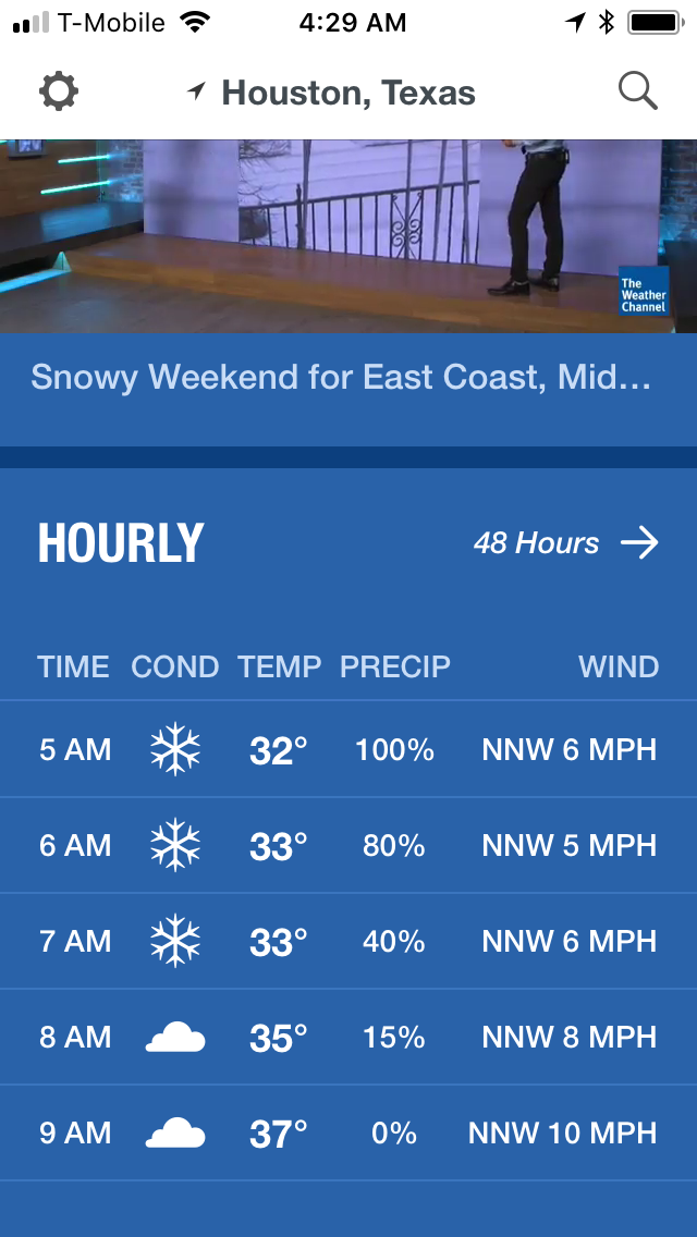
Current forecast for my house in northwest Houston, TX, during the early morning.
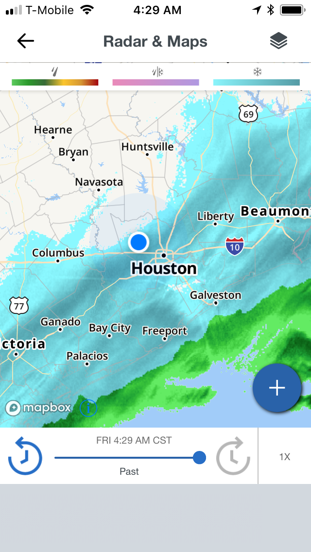
Houston, TX radar, before sunrise, during the early morning.
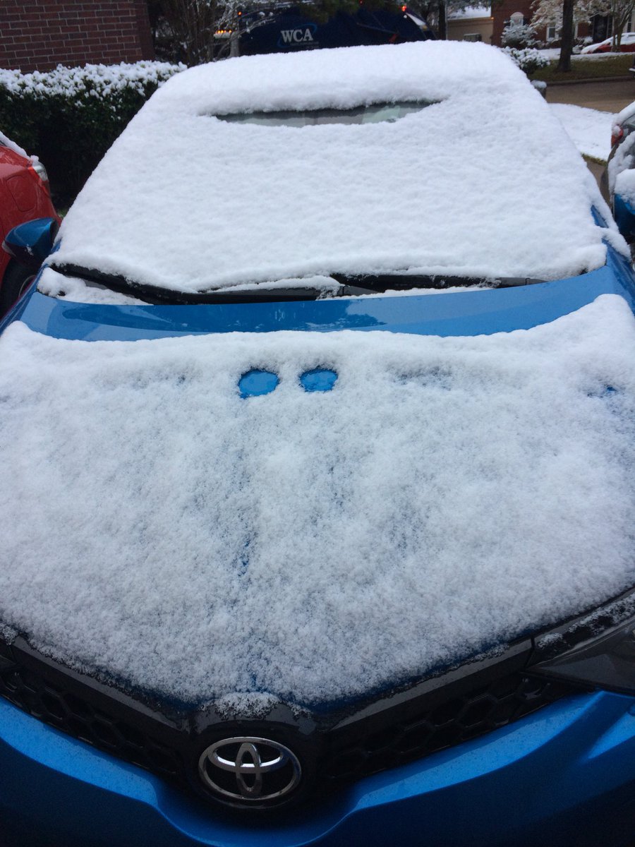
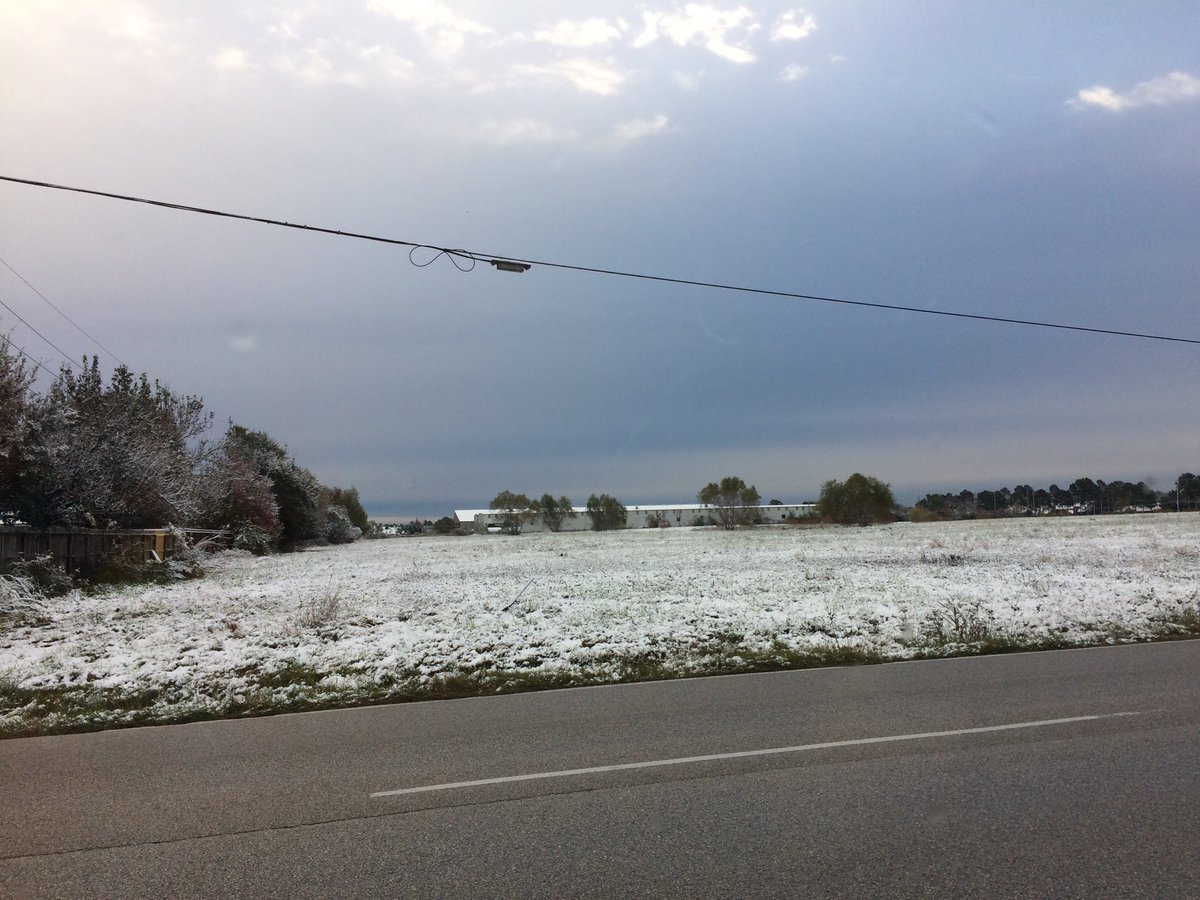
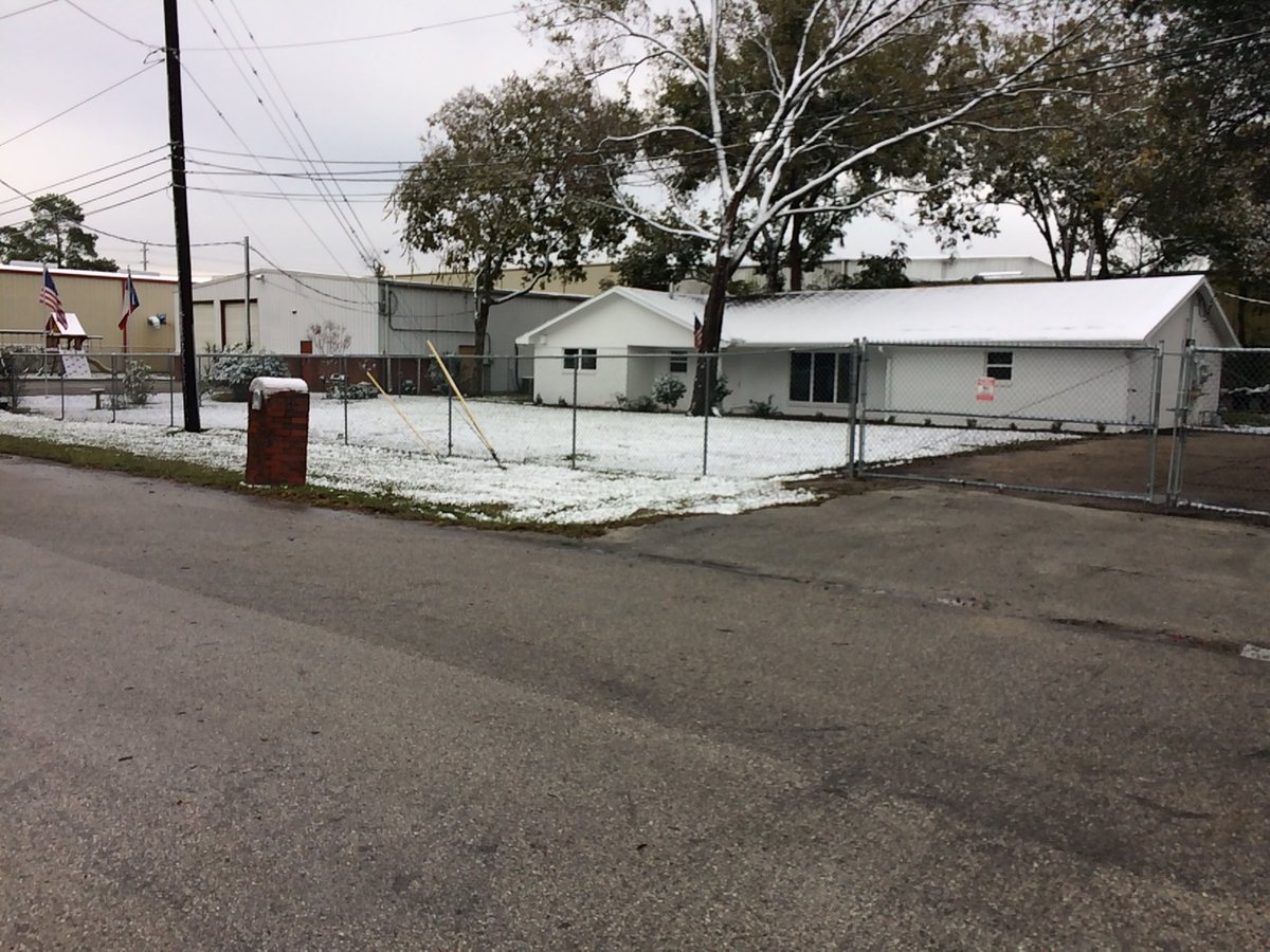
Northwest Houston, TX, during the early morning, after sunrise.
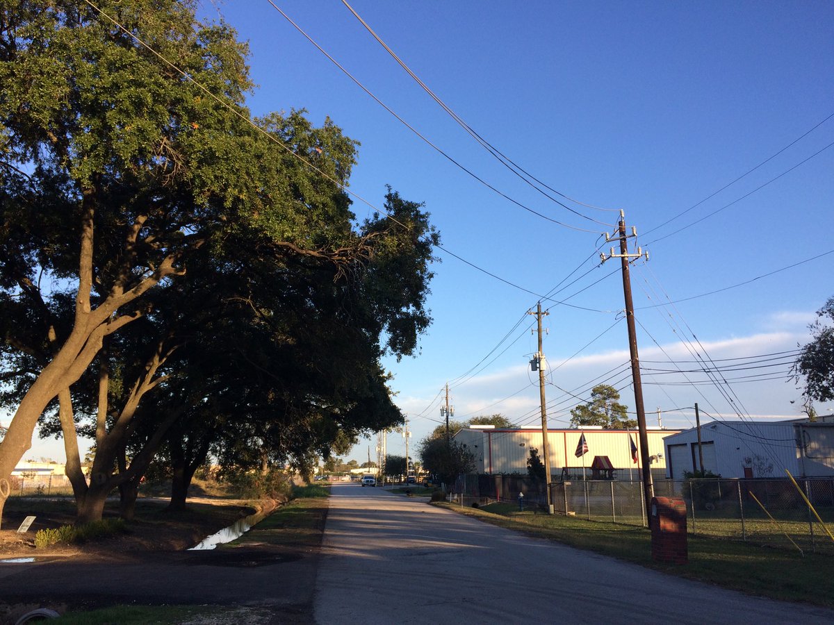
Northwest Houston, TX, during the early evening.
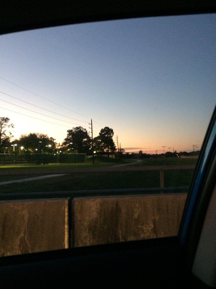
Northwest Houston, TX, during the late evening.
Summary: The day was very cold, mostly cloudy, and mostly wet. Light to moderately heavy snow showers with maybe a few heavy to very heavy snow showers passed through the Houston, TX area, during the early morning, with maybe a few lingering snow showers in some locations of the Houston, TX area, during the mid and late morning. There didn't look to be any more snow, or precip in any of the locations in the Houston, TX area, after that. Light to moderately heavy and maybe sometimes heavy to really heavy snow looked to have fallen at my house in northwest Houston, TX, during the early morning, before sunrise, and then maybe a light dusting, during the early morning, after sunrise. Light to dark grey and blueish grey, thick, flat, low stratus clouds looked to cover the whole sky, during the morning, and then only most of the sky, during the afternoon. There looked to be only some thick, flat, wavy, alto stratus clouds scattered across the sky, during the evening and maybe night. The sky looked to have become clear, during the night. The wind speeds looked to be calm with gentle to moderate gusts with some moderately strong gusts and some occasional really strong 20 to maybe 25 mph gusts. It felt freezing, during the early morning and late night. It felt very cold, during the mid and late morning, late evening and early night. It felt cold, almost very cool, during the afternoon. There was a Winter Weather Advisory and maybe a Freeze Watch, or Warning issued for the Houston, TX area. There was also a Hazardous Weather Outlook issued for the Houston, TX area, by NOAA. There were no other watches, warnings, alerts, advisories, or weather statements/outlooks issued for the Houston, TX area, that I know of. The low temperatures looked to be in the low 30's and the high temperatures looked to be in the mid to high 40's, for the Houston, TX area.
Houston, TX Storm Summary: Light to moderately heavy snow showers with maybe a few heavy to very heavy snow showers passed through the Houston, TX area, during the early morning, with maybe a few lingering snow showers in some locations of the Houston, TX area, during the mid and late morning. There didn't look to be any more snow, or precip in any of the locations in the Houston, TX area, after that. I didn't hear about any reports of flooding, or damage caused by the weather, in any of the locations in the Houston, TX area, during anytime of the day.
My Storm Summary: Light to moderately heavy and maybe sometimes heavy to really heavy snow looked to have fallen at my house in northwest Houston, TX, during the early morning, before sunrise, and then maybe a light dusting, during the early morning, after sunrise. I saw lots of snow, looked to be a few inches, covering the ground. I didn't see any flooding, or damage caused by the weather. I didn't see any ice, or icicles. I didn't see any lightning, or hear any rumbles of thunder.
Locations: Northwest Houston, TX.
Thoughts: Well that was fun! I enjoyed seeing the snow. I am glad to be able to see some snow. That will probably be the last snow that I will see for awhile in Houston, TX. I may see some more snow in my life, but who knows. It was fun while it lasted.
Area Forecast Discussion
Issued by NWS Houston/Galveston, TX
Issued by NWS Houston/Galveston, TX
Versions: 1 2 3 4 5 6 7 8 9 10 11 12 13 14 15 16 17 18 19 20 21 22 23 24 25 26 27 28 29 30 31 32 33 34 35 36 37 38 3940 41 42 43 44 45 46 47 48 49 50
000
FXUS64 KHGX 090341
AFDHGX

Area Forecast Discussion
National Weather Service Houston/Galveston TX
941 PM CST Fri Dec 8 2017

.UPDATE...
Clear skies and light winds overnight will allow for widespread
freezing temperatures to occur across SE TX. A Hard Freeze
Warning has been issued for the northeastern counties of our
forecast area where temperatures are expected to lower to between
21 to 24 degrees. A Hard Freeze Warning is defined locally by low
temperatures at or below 24 degrees occuring for 2 hours or more,
and this will extend through 8 AM Saturday morning. Therefore,
only major adjustments to the forecast were to account for current
observational trends in both temperatures and dew points. With
another night of frigid temperatures, remember to protect the four
P`s: plants, pets, pipes, and people!

Hathaway

&&

.PREV DISCUSSION... /ISSUED 531 PM CST Fri Dec 8 2017/

AVIATION...
Surface ridging will promote light and variable winds for the
inland Southeast Texas terminals tonight and westerly winds 5-10
knots at GLS. West to northwesterly winds around 8-10 knots are
expected to become established 16-18Z as surface ridging slides
east. VFR conditions are expected to prevail through the period
with a few passing high clouds around FL250.

Huffman

PREV DISCUSSION... /ISSUED 353 PM CST Fri Dec 8 2017/

DISCUSSION...
Skies are continuing to clear across SE TX this afternoon...with
the back edge of the cloud deck nearly to the coast. With clear-
ing skies/decreased winds...very favorable radiational cooling is
expected tonight. Most locations (except those at/near the coast)
should see freezing/below freezing temperatures overnight. As per
grids, northern/northeastern areas of the CWA could see up to 10
hours of freezing/below freezing temperatures tonight thru early
Sat morning...central areas (not including downtown Houston) may
see from 2 to 4 hours.

Otherwise, not a lot of issues with the upcoming forecast as the
upper pattern remains largely dominated by the amplified ridging
out west through the weekend and into the start of next week. We
could start to see some changes by the middle/end of the week as
a closed low moves into/deepens over the California Baja region.
The return of clouds/low-level moisture could bring POPS back to
the CWA (from the SW) by next Fri night/Sat. 41

MARINE...
Winds/seas will be on a downward trend as high pres builds into the
area. Will let the SCA ride in the offshore waters into the evening
considering seas are still 7-8 feet, but suspect they`ll be well
below that by the 930pm update.

Tides are running about 1/2-3/4` below normal in northern parts of
the bays. They`ll likely remain below normal there this weekend, but
have doubts they`ll get much below 1` below normal needed Low Water
Advisory considering the weakening wind speeds.

Otherwise, look for light nw/w thru the weekend, followed by the
next front that should push off the coast early Tuesday. May see
winds pick up to around caution criteria then.  47

&&

.PRELIMINARY POINT TEMPS/POPS...
College Station (CLL)      27  60  36  64  40 /   0   0   0   0   0
Houston (IAH)              28  60  36  63  39 /   0   0   0   0   0
Galveston (GLS)            38  58  45  60  48 /   0   0   0   0   0

&&

.HGX WATCHES/WARNINGS/ADVISORIES...
TX...Hard Freeze Warning until 8 AM CST Saturday for the following
     zones: Houston...Liberty...Madison...Montgomery...Polk...
     San Jacinto...Trinity...Walker.

GM...Small Craft Advisory until midnight CST tonight for the
     following zones: Waters from Freeport to the Matagorda Ship
     Channel from 20 to 60 NM...Waters from High Island to
     Freeport from 20 to 60 NM.

     SMALL CRAFT SHOULD EXERCISE CAUTION until 4 AM CST Saturday for
     the following zones: Waters from Freeport to the Matagorda
     Ship Channel from 20 to 60 NM...Waters from High Island to
     Freeport from 20 to 60 NM.

&&

$$

Update...08
Hazardous Weather Outlook
Hazardous Weather Outlook
National Weather Service Houston/Galveston TX
926 PM CST Fri Dec 8 2017

TXZ195>198-210>214-226-227-235>238-100330-
Austin-Brazoria-Brazos-Burleson-Chambers-Colorado-Fort Bend-
Galveston-Grimes-Harris-Jackson-Matagorda-Waller-Washington-
Wharton-
926 PM CST Fri Dec 8 2017

This hazardous weather outlook is for portions of Southeast Texas..

.DAY ONE...Tonight

Temperatures will be near freezing tonight. Temperatures are
expected to rise above freezing around 9 AM.

.DAYS TWO THROUGH SEVEN...Saturday through Thursday

No hazardous weather is expected at this time.

.SPOTTER INFORMATION STATEMENT...

Spotter activation will not be needed.

$$
No comments:
Post a Comment