
Northwest Houston, TX, during the early morning.
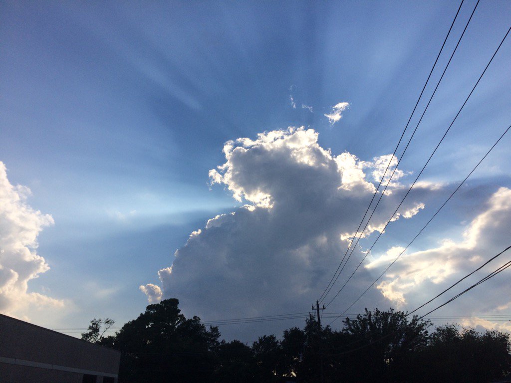
Northwest Houston, TX, during the early evening.
Summary: The day was mostly cloudy, very warm, and dry. There looked to be isolated light to moderately heavy and heavy showers and thunderstorms scattered across the Houston, TX area, during the morning, afternoon, evening, and maybe night. I felt a light drizzle, sometime during the late, or maybe mid-morning. Stratus clouds looked to cover the whole sky, during the early and mid-morning. Stratus and stratocumulus clouds looked to have started to cover most of the sky, sometime during the late morning, or maybe early afternoon. Stratus and stratocumulus clouds looked to cover most of the sky, during the afternoon, evening, and maybe night. The wind speeds looked to be calm with gentle to moderate gusts with maybe some moderately strong gusts. It felt warm with a slightly cool wind, during the early and mid-morning. It felt very warm, or maybe warm, during the late morning. It felt hot during the afternoon. It felt very warm, during the early evening. It felt warm, during the late evening and night. There was a Hazardous Weather Outlook issued by NOAA, for the Houston, TX area. There were no other watches, warnings, alerts, advisories, or weather statements/outlooks issued for the Houston, TX area, that I know of. The low temps looked to be in the 70's and the high temps looked to be in the 90's, for most of the Houston, TX area.
Storm Summary: I didn't hear about any reports of flooding, or storm damage.
My Storm Summary: I didn't see much in the way of storm clouds, or rain. I felt a light drizzle outside of where I work in northwest Houston, TX, sometime during the late, or maybe mid-morning. I didn't see any flooding, or storm damages. The roads, cars, or parking lots didn't even get wet.
Locations: Northwest Houston, TX.
Thoughts: I wasn't really expecting to see any rain today. It is starting to feel cooler in the mornings. But not cool yet.
Issued by NWS Houston/Galveston, TX
Home | Current Version | Previous Version | Text Only | Print | Product List | Glossary Off
Versions: 1 2 3 4 5 6 7 8 9 10 11 12 13 14 15 16 17 18 19 20 21 22 23 24 25 26 27 28 29 30 31 32 33 34 35 36 37 38 39 40 41 42 43 44 45 46 47 48 49 50
838
FXUS64 KHGX 040210
AFDHGX
Area Forecast Discussion
National Weather Service Houston/Galveston TX
910 PM CDT Thu Aug 3 2017
.DISCUSSION...
As expected, convection has dissipated with the loss of day time
heating. Based on short term convective allowing guidance, showers
should not start until after 6Z to 9Z focused off the coast of the
Upper Texas coast again. Day time heating should yield more pulse
type showers and storms. With a moist airmass around and weak flat
ridging aloft, look for 40 to 50 percent rain chances to continue
through early next week. Thunderstorm chances and cloud cover may
should keep high temperatures in check. Instead of low 100s which
can happen the first week of August, high temperatures in the
low/mid 90s look reasonable.
Overpeck
&&
.PREV DISCUSSION... /ISSUED 650 PM CDT Thu Aug 3 2017/
AVIATION...
Lingering showers on the wane this evening. Think should be
generally precipitation free rest of the night except for
perhaps a few streamer showers toward daybreak at the coast.
Have included VCSH for GLS to indicate this. Showers and
thunderstorms should become more widespread once again during
the afternoon...but still generally scattered. For most sites
have included a VCTS for mainly afternoon and a PROB30 for
Houston area airports for most likely period...mainly early to mid
afternoon. For LBX window a few hours earlier. 18
PREV DISCUSSION... /ISSUED 257 PM CDT Thu Aug 3 2017/
DISCUSSION...
Radar is looking pretty quiet this afternoon but continued heating
will likely trigger some late afternoon/early evening showers and
a few thunderstorms. Most of the activity will die off with the
loss of heating but moisture levels remain high and can`t rule out
an isolated shower overnight. Diffluence gets a bit stronger
toward sunrise and remains pronounced for much of the day. PW
values are between 1.95 and 2.25 inches on Friday with convective
temps between 86-88 degrees. Rain chances look a bit better on
Friday than they did today but have some concern that residual
cloud cover could limit heating and precip coverage. Will
broad brush 40 PoPs for now but these might a bit low if all the
ingredients come together. Will carry PoPs into the evening with a
break overnight and precip picking up again near the coast toward
sunrise Saturday morning. PW values on Saturday once again range
from 1.95 to 2.15 inches but convective temps warm to around 89
degrees. A weak but breakable cap forms in the 850-700 layer. Jet
dynamics look rather meager as well so not all that enamored with
rain chances for Saturday.
PW values decrease further Saturday night with values dropping to
1.75 inches. A capping inversion develops near 850 mb with 850
temps warming overnight. The NAM is much stronger with the cap on
Sunday and is suggestive of max temps in the upper 90s. The GFS
shows the cap but it`s a bit weaker. The GFS also carries deeper
moisture with PW values increasing to 2.20 inches. Both the NAM
and the GFS have convective temps in the lower 90s so what ever
convection develops will require strong heat and will likely not
develop until late in the day. Monday looks similar to Sunday with
PW values between 2.00 and 2.20 inches with convective temps in
the lower 90s. There is short wave that will be moving across
North Texas on Monday that could provide some extra lift but this
feature looks a little too far west and north of the region to
provide much in the way of lift. One difference, despite similar
moisture parameters, is that the T/Td traces are further apart
implying less saturation. Soundings also show weaker capping at
850 mb so the mixed signals don`t imply much confidence. Will
maintain the chance PoPs as currently forecast.
Can`t rule out scattered afternoon showers and thunderstorms
through the end of the week with afternoon highs reaching the mid
90`s and convective temps in the lowers. Fcst soundings show some
weak capping in the 850-700 mb layer but 300 mb winds do show a
weak split/weak diffluence aloft so can`t completely rule out some
showers each afternoon. 43
MARINE...
Shower and thunderstorm chances will remain in the forecast through
the end of the week and on into the weekend. Expect higher winds
and seas in and near the storms. More persistent south winds and
gradually building seas are anticipated over the weekend and into
the start of next week under a slightly tighter pressure gradient.
Generally expecting to see south winds at 10 to 15 knots, but small
craft advisories might be needed late Saturday night through early
Sunday morning as winds might increase into a 15 to 20 knot range.
42
TROPICS...
There is an area of disturbed weather in the western Caribbean Sea
that is being watched for possible tropical development early
next week. The GFS/ECMWF and GEM all show some type of low
approaching the Mexican coast late next week. The ECMWF is the
strongest with this system while the GFS/GEM are considerably
weaker. A model consensus would take the system well south of
Brownsville but it is something that will need to be monitored. 43
&&
.PRELIMINARY POINT TEMPS/POPS...
College Station (CLL) 74 93 75 95 77 / 20 40 30 40 30
Houston (IAH) 76 92 76 91 78 / 20 40 30 40 30
Galveston (GLS) 80 88 81 88 82 / 30 40 30 40 30
&&
.HGX WATCHES/WARNINGS/ADVISORIES...
TX...NONE.
GM...NONE.
&&
$$
Discussion...39
Hazardous Weather Outlook
Hazardous Weather Outlook
National Weather Service Houston/Galveston TX
642 AM CDT Thu Aug 3 2017

TXZ163-164-176>179-195>200-210>214-226-227-235>238-041145-
Austin-Brazoria-Brazos-Burleson-Chambers-Colorado-Fort Bend-
Galveston-Grimes-Harris-Houston-Jackson-Liberty-Madison-Matagorda-
Montgomery-Polk-San Jacinto-Trinity-Walker-Waller-Washington-
Wharton-
642 AM CDT Thu Aug 3 2017

This hazardous weather outlook is for portions of Southeast Texas..

.DAY ONE...Today and Tonight

Scattered thunderstorms will be possible across Southeast Texas
today. Some of these thunderstorms will be capable of brief heavy
rain.

.DAYS TWO THROUGH SEVEN...Friday through Wednesday

Scattered thunderstorms will be possible across Southeast Texas
Friday through Wednesday. Some of these thunderstorms may be
capable of brief heavy rainfall.

.SPOTTER INFORMATION STATEMENT...

Spotter activation will not be needed.

$$
We had haboobs (dust storms) and monsoons this afternoon with even a little tornado touching down Southwest of Downtown Phoenix. Lots of flooding and rain but in our part of the valley no rain, go figure :)
ReplyDeletebetty
Dust storms and a tornado?
DeleteYeah, that always happens to me... I rarely get to see the good stuff. : /
: )