Northwest Houston, TX, during the early morning.

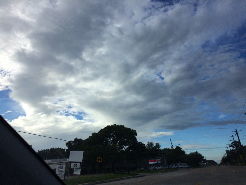
Northwest Houston, TX, during the early afternoon.
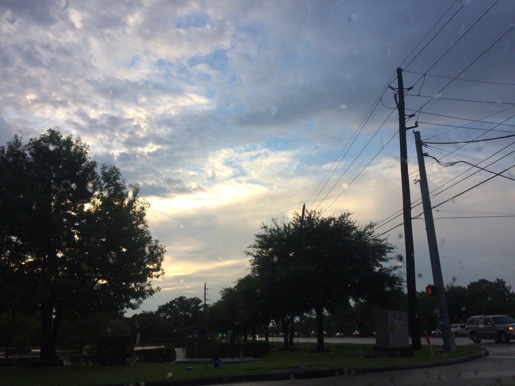
Northwest Houston, TX, during the early evening.
Summary: The day was warm, wet, and mostly cloudy. A slow moving stationary front brought heavy rain to the Houston, TX area, during the early morning and then some isolated to scattered light to moderate showers, during the mid and late morning, afternoon, and evening. Heavy thunderstorms passed over my house in northwest Houston, TX, during the early morning. I saw some on and off light to moderate rain and drizzle, during the late and maybe mid-morning and during the afternoon, and maybe early evening. Stratus, stratocumulus, and some occasional nimbus clouds looked to cover the whole sky, during the morning and then most of the sky, during the afternoon and evening. The wind speeds looked to be calm with maybe some gentle to moderate gusts. It felt warm, during the morning, afternoon, evening, and night. There were numerous flood watches, warnings, and advisories issued, along with a Special Weather Statement. There was also a Hazardous Weather Outlook issued for the Houston, TX area, by NOAA. The low temps looked to be in the 70's and the high temps looked to be in the 80's, for the Houston, TX area.
Storm Summary: There were reports of flooding on roads and highways with cars and trucks getting stuck and stalling out. I also heard of a downed tree. So there looks to have been some storm damage as well.
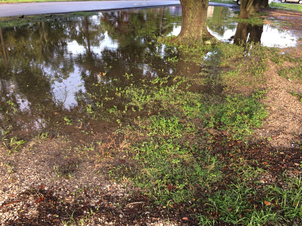
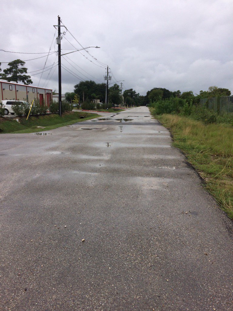
My Storm Summary: Lots of heavy rain with loud thunder and bright lightning, maybe some cloud-to-ground. I am pretty sure there was a lightning strike right next to my house. I heard the thunder right as the lighting was striking, instead of a few seconds later, like I usually do. I witness some flash flooding on the roads that I take to work in northwest Houston, TX, during the early morning and early evening. There still looked to be some flooding on the roads on my way home in northwest Houston, TX, during the early evening. I didn't see any storm damage, but I heard of a downed tree, from a co-worker, who said there was a downed tree in her neighborhood.
Locations: Northwest Houston, TX.
Thoughts: Well I guess I should have guessed that there would be flooding when I heard that their was going to be stalled front,or maybe low passing through Houston, TX yesterday and today. I just didn't really think about it.
Area Forecast Discussion
Issued by NWS Houston/Galveston, TX
Issued by NWS Houston/Galveston, TX
Versions: 1 2 3 4 5 6 7 8 9 10 11 12 13 14 15 16 17 18 19 20 21 22 23 24 25 26 27 28 29 30 31 32 33 34 35 36 37 38 3940 41 42 43 44 45 46 47 48 49 50
000
FXUS64 KHGX 090202
AFDHGX

Area Forecast Discussion
National Weather Service Houston/Galveston TX
902 PM CDT Tue Aug 8 2017

.DISCUSSION...
For the evening update, we have added Galveston County (mainly for
the Bolivar Peninsula area where some heavy rainfall fell late this
afternoon through early this evening) to the Flash Flood Watch.
There is some potential for additional shower and thunderstorm
development overnight closer to the center of the slow moving low that
we have been dealing with for the last couple of days. Hard to pinpoint
exactly where the heaviest rains might fall, but best potential looks
to maybe be setting up between the Houston and Beaumont areas where
WPC upgraded their slight risk to a moderate risk in their Day 1 Excessive
Rainfall Outlook. Any heavy rains falling on already saturated grounds
will quickly lead to flash flooding.  42
&&

.PREV DISCUSSION... /ISSUED 717 PM CDT Tue Aug 8 2017/

AVIATION...
Widespread scattered showers and thunderstorms are continuing to
spiral around the area of low pressure currently centered just east
of IAH. Expecting most precip to diminish for a short period of time
this evening around 23-01Z, resulting in a lull in showers and
thunderstorms until the late evening hours. Short term guidance such
as the HRRR and ARW indicate redevelopment for the northern TAF
sites around 02Z, shifting a line of convection southeastward
through the IAH/HOU/SGR region by 09Z. Additionally, a second band
of showers and thunderstorms pinned along the coast also redevelops
around 07Z and pushes northward impacting LBX and GLS through the
afternoon.

Although there will definitely be the potential for scattered
showers and thunderstorms circulating around the area of low
pressure overnight, there is less confidence in how this low
propagates. If the center of the low moves further eastward, we
could see a shift in the rainfall more to the east, resulting in
less impacts to all TAFs sites. Short term guidance has appeared to
be sliding the precip further east in the most recent runs and
forecasting the center to move eastward, so will have to continue to
monitor to see if this trend continues.

Otherwise, VFR conditions through late evening, with a MVFR deck
expected to develop around midnight and hold through early morning.
Overnight, winds will vary in direction around the center of the
low, but should remain less than 5 kts inland and between 5-10 kts
along the coast.

Hathaway

PREV DISCUSSION... /ISSUED 319 PM CDT Tue Aug 8 2017/

DISCUSSION...
The main item of concern for this evening through Wednesday
morning is the possibility of heavy rainfall mainly over the
eastern areas. To that end, have continued the flash flood watch
for Harris, Chambers, Liberty, Montgomery, Polk and San Jacinto
counties through 8:00 AM Wednesday. A consensus of the models are
fitting the location of the MCV (mesoscale convective vortex)
which was near San Jacinto County at 2:30 PM. Because the area of
the heavier rainfall looks to occur mainly from Chambers County
northward, have dropped the watch for Waller and Fort Bend
counties.

From an overall perspective, a weakness in the upper level high
pressure ridge will likely cause the MCV to meander a bit. Most
models show the feature drifting southeastward and turning
northward tonight. If the MCV shears apart, another MCV could
develop if another mesco-scale convective complex forms tonight.
With all the uncertainty, confidence in the model solutions are
moderate at best. WPC 50th percentile showed heaviest rainfall
possible across and east of Chambers, far eastern Harris and
Liberty counties. Higher resolution models then have potential
into San Jacinto and Polk counties. Best chances for showers and
thunderstorms will be over the eastern and coastal counties on
Wednesday.

For Thursday scattered coverage of showers and thunderstorms is
expected. As the upper level ridge builds overhead from the west,
only slight chances are expected Friday through the weekend and
into early next week. The building ridge will lead to less cloud
coverage and increasing daytime temperatures into the mid 90s
over the inland locations. Moisture from the Gulf could also
increase and lead to an increase in the heat index to between 105
and 107 over the weekend.

MARINE...
Scattered showers and thunderstorms are possible once again tonight
given the proximity of the upper level disturbance over SE TX. Best
rain chances will be over the bays and nearshore waters. Otherwise,
winds will remain light and from the SW overnight. Winds are expect-
ed to become more SE and slowly strengthen by late tomorrow evening
as this system moves out of the area. This increasingly moderate on-
shore flow will be coupled with the possibility of increased swells
from Franklin as it moves into the Bay of Campeche. Seas could
range from 4-6 feet by Weds night through Thurs before gradually
tapering off by this weekend. Rain chances should also be
decreasing through the rest of the week with progs of an upper
level ridge building in from the west. 41

&&

.PRELIMINARY POINT TEMPS/POPS...
College Station (CLL)      74  90  75  96  76 /  20  30  30  30  10
Houston (IAH)              75  90  77  92  77 /  50  50  20  40  10
Galveston (GLS)            79  88  81  88  82 /  70  50  40  40  10

&&

.HGX WATCHES/WARNINGS/ADVISORIES...
TX...Flash Flood Watch until 8 AM CDT Wednesday for the following
     zones: Chambers...Galveston...Harris...Liberty...
     Montgomery...Polk...San Jacinto.

GM...NONE.
&&

$$

Discussion...42
Aviation/Marine...08
Hazardous Weather Outlook
Hazardous Weather Outlook
National Weather Service Houston/Galveston TX
910 PM CDT Tue Aug 8 2017

TXZ163-164-176>179-195>200-210>214-226-227-235>238-091300-
Austin-Brazoria-Brazos-Burleson-Chambers-Colorado-Fort Bend-
Galveston-Grimes-Harris-Houston-Jackson-Liberty-Madison-Matagorda-
Montgomery-Polk-San Jacinto-Trinity-Walker-Waller-Washington-
Wharton-
910 PM CDT Tue Aug 8 2017

This hazardous weather outlook is for portions of Southeast Texas.

.DAY ONE...Tonight

A Flash Flood Watch is in effect until 8 AM Wednesday for Chambers,
Galveston, Harris, Liberty, Montgomery, Polk and San Jacinto counties.
The potential exists for flash flooding in the watch area as additional
rainfall is possible tonight. The greatest potential for heavy rain
is between the Houston and Beaumont areas, and also portions of the
Bolivar Peninsula. If you are in or near a Flash Flood Warning and
are in a safe place, do not attempt to leave. If you must be on the
roads, do not drive through flooded roadways and report any flooding
to local law enforcement.

.DAYS TWO THROUGH SEVEN...Wednesday through Monday

Scattered to numerous showers and storms will be possible on Wednesday.
Some of these thunderstorms may be capable of brief heavy rainfall.

.SPOTTER INFORMATION STATEMENT...

Spotters should report any flooding to the National Weather Service
or local law enforcement if they can do so safely.

$$
Flash Flood Watch
Flood Watch
National Weather Service Houston/Galveston TX
844 PM CDT Tue Aug 8 2017

TXZ178-179-199-200-213-214-091300-
/O.CON.KHGX.FF.A.0007.000000T0000Z-170809T1300Z/
/00000.0.ER.000000T0000Z.000000T0000Z.000000T0000Z.OO/
Chambers-Harris-Liberty-Montgomery-Polk-San Jacinto-
Including the cities of Anahuac, Cleveland, Coldspring, Conroe,
Corrigan, Dayton, Houston, Humble, Katy, Liberty, Livingston,
Mont Belvieu, Onalaska, Pasadena, Shepherd, The Woodlands,
Tomball, Willis, and Winnie
844 PM CDT Tue Aug 8 2017

...FLASH FLOOD WATCH REMAINS IN EFFECT UNTIL 8 AM CDT WEDNESDAY...

The Flash Flood Watch continues for

* A portion of southeast Texas...including the following
  counties...Chambers...Harris...Liberty...Montgomery...Polk and
  San Jacinto.

* Until 8 AM CDT Wednesday

* Shower and thunderstorm coverage is expected to increase across
  portions of the watch area overnight. Storms that repeatably
  move over the same locations have the potential to produce
  rainfall rates of up to 3 inches per hour which could lead to
  flooding. High rainfall amounts over the past few days have led
  to saturated soil conditions in some areas, and any additional
  rainfall overnight could lead to flooding.

PRECAUTIONARY/PREPAREDNESS ACTIONS...

Do not drive your vehicle into areas where the water covers the
roadway.  The water depth may be too great to allow your car to
cross safely. Vehicles caught in rising water should be abandoned
quickly. If your vehicle stalls...abandon it and seek higher ground
immediately. Rapidly rising water may engulf your vehicle and its
occupants and sweep them away. Move to higher ground.

A Flash Flood Watch means that conditions may develop that lead
to flash flooding. Flash flooding is a very dangerous situation.

You should monitor later forecasts and be prepared to take action
should Flash Flood Warnings be issued.

&&

$$
Seemed like several big storms in your area, Joseph. Our monsoons have temporarily left us; bringing warmer temps, but no humidity. I can live with that :)
ReplyDeletebetty
Lol, that's good! Houston can always use a day without humidity.
Delete: )