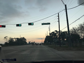
Summary: It was a warm day with low stratus clouds scattered across the sky through the early night. The sky looked to have become covered with low white and grey stratus clouds, at my house in Copperfield, during the late night. The wind speeds were light with moderate gusts, I think. Spotty off and on moderate and some moderately heavy showers and drizzle fell in and around the Houston, TX area, during the evening and night. I drove through a moderate shower in west Houston and in Missouri CIty, TX, during the early night. I thought I saw a lightning strike in west Houston, TX, during the early night on my way to Petsmart in Katy, TX, but I was not sure. I was happy to see some rain!
Area Forecast Discussion
Issued by NWS Houston/Galveston, TX
000
FXUS64 KHGX 160454
AFDHGX

Area Forecast Discussion
National Weather Service Houston/Galveston TX
1154 PM CDT Thu Oct 15 2020

.AVIATION [06Z TAF Issuance]...

The cold front is presently making its way across SE TX and should
be off the coast just after 09Z (based on current extrapolations).
This boundary is not producing a lot of activity but we are seeing
some stronger cells along this line. May have to re-introduce VCTS
for a couple of sites as this front continues to move south. While
things are fairly quiet with the surface front at this time, we`ll
have to keep an eye out for the lagging 85h front as shorter-range
progs are keeping scattered (likely SHRA for the most part) mostly
across the southern third of the CWFA through the overnight hours,
likely helping to keep CIGS low (MVFR) as well. The stronger/gusty
N/NE winds are also trailing the surface cold front by a bit. This
elevated flow is expected to decrease over inland areas during the
afternoon, but could remain high over coastal locations (i.e. GLS)
into the early evening tomorrow. Otherwise, VFR conditions will be
in place by late tomorrow morning/early afternoon. 41

&&

.PREV DISCUSSION... /ISSUED 1006 PM CDT Thu Oct 15 2020/

Leading edge of cold front situated from roughly Columbus-
Huntsville-Lufkin will continue to make gradual southward progress
and off the coast later tonight. Thin band of precip can be seen
along the boundary, but as the previous discussion pointed out,
the lagging H85 front will likely become more of a focusing
mechanism overnight. Hires guidance suggests increasing areal
coverage along the southern 2-3 tiers of counties after 8Z. Not
anticipating much of significance, but there is some elevated
instability so wouldn`t be surprised to hear a few claps of
thunder. Precip should taper off across most locations toward mid-
late morning. Small Craft Advisory remains in tact behind the
front. With water temps still around 80, anticipate wind speeds to
quickly ramp up with gusts >30kt a pretty good bet. Short fuse
wind advsy may be required at the immediate coast in the morning.
47

&&

.PRELIMINARY POINT TEMPS/POPS...
College Station (CLL)      58  73  52  79  67 /  30   0   0   0  10
Houston (IAH)              60  71  56  79  68 /  60  40   0   0   0
Galveston (GLS)            64  73  67  80  75 /  60  60   0  10  10

&&

.HGX WATCHES/WARNINGS/ADVISORIES...
TX...NONE.
GM...Small Craft Advisory from 3 AM to 4 PM CDT Friday for the
     following zones: Coastal waters from Freeport to Matagorda
     Ship Channel TX out 20 NM...Coastal waters from High Island
     to Freeport TX out 20 NM...Galveston Bay...Matagorda Bay.

     Small Craft Advisory from 3 AM to 7 PM CDT Friday for the
     following zones: Waters from Freeport to Matagorda Ship
     Channel TX from 20 to 60 NM...Waters from High Island to
     Freeport TX from 20 to 60 NM.

&&

$$


No comments:
Post a Comment