Northwest Houston, TX, during the early morning.
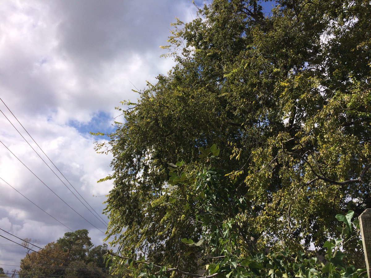
Northwest Houston, TX, during the early afternoon.
Northwest Houston, TX, during the early evening.
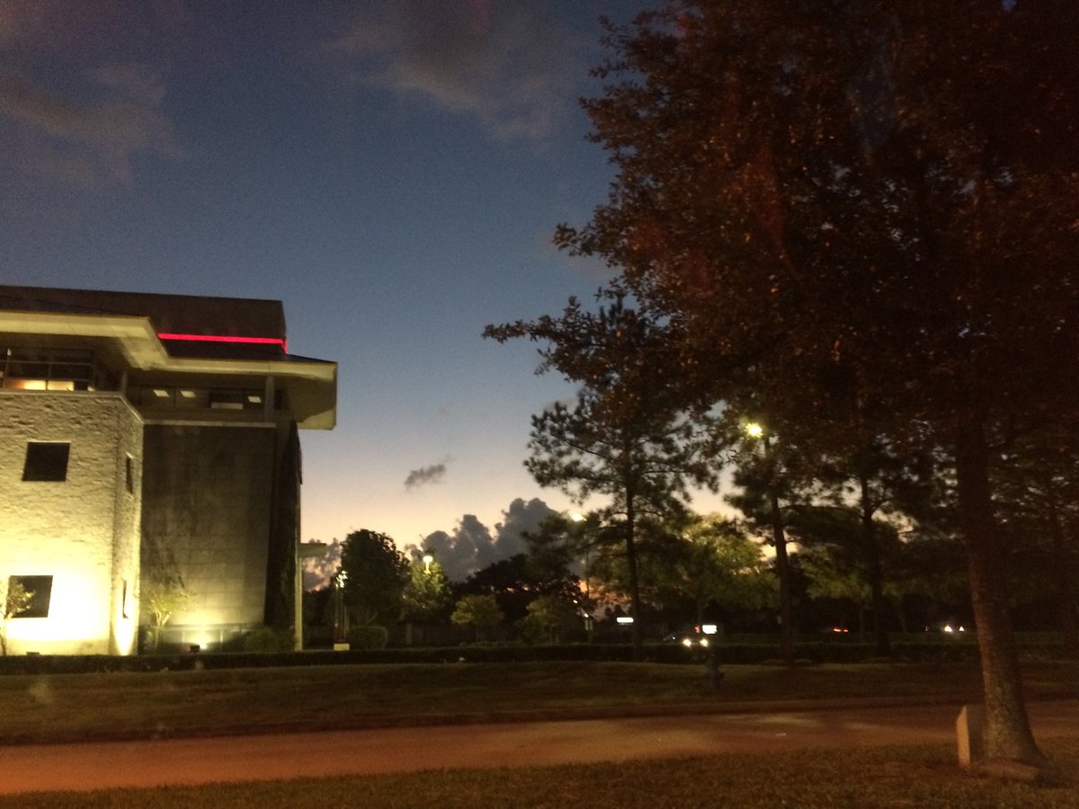
Northwest Houston, TX, during the early night.
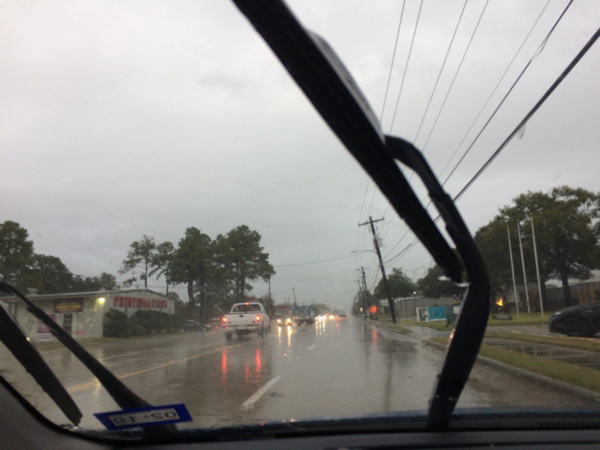
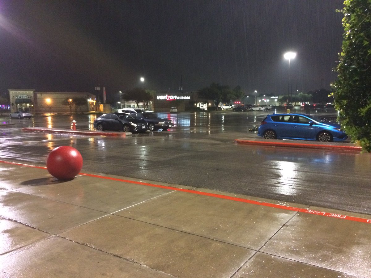
Summary: The day was Mostly wet, cloudy, and warm. I started to see light to moderately heavy and maybe some heavy rain pop up on the radar, over the Houston, TX area, during the early afternoon. Light to Moderately heavy to heavy rain continued to pour over some of the Houston, TX area, during the rest of the early afternoon.. Light to moderate and some moderately heavy to heavy rain looked to have passed over most of the Houston, TX area, during the mid and late afternoon, evening, and early night. Most of the rain, except for maybe a few small light to maybe moderate showers looked to have left the Houston, TX area, by the late night. I started to see light to moderate rain, where I work in northwest Houston, TX, during the early afternoon. Light to moderate and moderately heavy to heavy rain continued to pour with a few breaks in between, where I work, during the mid and late afternoon. Light to moderate and moderately heavy to heavy rain continued to fall where I work and where I live, in northwest Houston, TX, during the evening and early night. There looked to maybe have been a few light showers where I live in northwest Houston, TX, during the late night. Stratus with maybe some alto stratus clouds, looked to cover most of the sky, during the morning. The sky looked to have become completely covered in stratus clouds, sometime during the mid, or maybe early afternoon. The sky looked to be completely covered in stratus clouds, during the late afternoon, evening, and night. The wind speeds looked to be calm with gentle to moderate gusts with some moderately strong gusts and some really strong 20 to 25 mph gusts, during a few of the rain showers, during the afternoon. It felt a little cool, during the early morning and night. It felt warm, during the mid and late morning, afternoon, and evening. There was a Hazardous Weather Outlook issued for the Houston, TX area, by NOAA. There were no other watches, warnings, alerts, advisories, or weather statements/outlooks issued for the Houston, TX area, that I know of. The low temperatures looked to be in the 60's with maybe a few 50's and the high temperatures looked to be in the 70's, with maybe a few low 80's, for the Houston, TX area.
Houston, TX Storm Summary: I started to see light to moderately heavy and maybe some heavy rain pop up on the radar, over the Houston, TX area, during the early afternoon. Light to Moderately heavy to heavy rain continued to pour over some of the Houston, TX area, during the rest of the early afternoon.. Light to moderate and some moderately heavy to heavy rain looked to have passed over most of the Houston, TX area, during the mid and late afternoon, evening, and early night. Most of the rain, except for maybe a few small light to maybe moderate showers looked to have left the Houston, TX area, by the late night. There were no reports of flooding, or storm damages, anywhere in the Houston, TX area, that I know of.
My Storm Summary: I started to see some rain producing like clouds, during the late morning. I started to see light to moderately heavy and maybe some heavy rain pop up on the radar, over the Houston, TX area, during the early afternoon. Light to Moderately heavy to heavy rain continued to pour over some of the Houston, TX area, during the rest of the early afternoon.. Light to moderate and some moderately heavy to heavy rain looked to have passed over most of the Houston, TX area, during the mid and late afternoon, evening, and early night. Most of the rain, except for maybe a few small light to maybe moderate showers looked to have left the Houston, TX area, by the late night. I did see some huge puddles, very wet roads, and ground. I didn't see any flooding, lightning, or storm damage. I didn't hear any rumbles of thunder.
Locations: Northwest Houston, TX.
Thoughts: This was one of the few Halloweens that I have witnessed. I think this is the wettest Halloween that I have witnessed, where the trick-o-treaters were not able to walk outside, but had to be driven around by their parents.
Area Forecast Discussion
Issued by NWS Houston/Galveston, TX
Issued by NWS Houston/Galveston, TX
Versions: 1 2 3 4 5 6 7 8 9 10 11 12 13 14 15 16 17 18 19 20 21 22 23 24 25 26 27 28 29 30 31 32 33 34 35 36 37 38 3940 41 42 43 44 45 46 47 48 49 50
000
FXUS64 KHGX 010152
AFDHGX

Area Forecast Discussion
National Weather Service Houston/Galveston TX
852 PM CDT Tue Oct 31 2017

.UPDATE...
A bit of a break in the rains across the Metro area as cluster of
storms along and south of the front lifts out to the northeast at
8 pm. But as the LLJ intensifies overnight and the front waffles
back and forth am expecting the coverage of the showers to
increase mainly after 9-10 pm in the southwest counties and spread
northeastward. Will have the concerns of brief heavy downpours
(2"/hr quite reasonable given the speed of motion) and the very
low probability of tornadoes. Any storms near coming in off the
Gulf and nearing the frontal boundary will need to be watches as
LL shear increases toward midnight. Main threat though should be
brief heavy downpours. Updated grids based on current obs/trends
and short term guidance.

45
&&

.DISCUSSION...


&&

.PREV DISCUSSION... /ISSUED 728 PM CDT Tue Oct 31 2017/

AVIATION...
SHRA with embedded TSRA continue to move northeast across most of
the Southeast Texas terminals tonight, save GaLS. Expect rain to
persist at CLL, UTS, and CXO for most of the night as best lift
remains north of Interstate 10 with a secondary round of SHRA
developing 04-06Z along a stalled boundary stretching from VCT-
IAH-JAS as a 30-40 knot low level jet sets up. Embedded TSRA will
be possible Thursday morning after 10Z along and south of this
boundary. Ample atmospheric moisture will result in IFR to MVFR
visibility and ceiling restrictions should terminal impacts
occur. As an upper level trough clears the region after 12Z
Thursday, expect rain to taper off and ceilings to lift to VFR
from northwest to southeast late morning into the afternoon as
increasingly southwest flow aloft brings in drier air.

Otherwise, north to northeast winds 5 knots or less north of the
boundary to south to southeast winds less than 10 knots south of
the boundary will gradually become southwest and increase to 10-15
knots by the end of the TAF period.

Huffman

PREV DISCUSSION... /ISSUED 342 PM CDT Tue Oct 31 2017/

DISCUSSION...
Clustering (primarily) rain cells progressively moving northeast
across Wharton...northern Fort Bend and western Harris Counties
this hour. There are a few embedded thunderstorms within this
activity as it travels off at around 20 mph. Rainfall amounts
have ranged from between a half an inch to two inches...locally
higher amounts exceeding 3 inches. Although most everyone in
southeast Texas will pick up measurable rain through tomorrow...
but it does not look like Halloween night will be a wash out.
Certainly have a plan to quickly seek cover if out tonight as there
are good chances that there will be vicinity showers and/or storms.
The main threat will be from strong thunderstorms...a quick 1 to
2 inches may create nuisance flooding of low-lying areas and
roadways around metro. Also be aware and listen for thunder as
there will be lightning. When the thunder roars...go indoors!
Overcast and occasionally wet with early evening temperatures in
the upper 50s to lower 60s north of the stationary boundary draped
over the central forecast area...upper 60s south of the front
towards the coast. All and all...with the rain and overcast...it
will be cooler than it was a year ago when it was in the 80s at
trick or treat time.

A somewhat messy pattern to evolve overnight that may wreck havoc
on this short term forecast. All of the ingredients are there for
a wet night/early Wednesday. A series of upstream shortwave
disturbance passages may add that extra lift...but the best focus
for convective clustering will occur along wherever this stationary
boundary sets up. Current forecast has the bulk of the rain (1 to
3 inches with locally 3 to 4 inches) to occur through Wednesday
morning. Wednesday afternoon is tricky as POPS will be dependent
upon the eventual movement of the boundary and any precedent
overnight activity. Rain chances should significantly decline from
west-to- east through the afternoon as mid to upper level flow
veers more westerly with the eastward advancement of a very shallow
upper trough across the Great Lakes region. The passage of a couple
Red River shortwave troughs thursday and Friday should remain far
enough north to not really impact our region. Southern-based
upper ridging expanding north out of Mexico should suppress any
mentionable late week/weekend rainfall. As all of this unfolds
through mid to late week...southeastern Texas will be witness to
subsequent day warming back into the middle 80s/upper 60 to lower
70 minimum temperatures. So...we will enter November on an
unsettled note and end the week unseasonably warm. 31

MARINE...
Look for increasing onshore winds and building seas tonight ahead of
an approaching upper level disturbance. Will be hoisting the Small
Craft Advisory flags offshore this evening. Showers and thunderstorms
should increase in areal coverage late tonight and into Wednesday
morning then wind down by early afternoon. Onshore winds and seas
will begin to diminish, but remain between 10-15 knots for most
of the week. 47

&&

.PRELIMINARY POINT TEMPS/POPS...
College Station (CLL)      56  78  66  86  69 /  80  30  10  20  10
Houston (IAH)              67  79  69  86  70 /  80  80  20  20  20
Galveston (GLS)            71  77  74  83  74 /  60  70  30  20  20

&&

.HGX WATCHES/WARNINGS/ADVISORIES...
TX...NONE.
GM...SMALL CRAFT SHOULD EXERCISE CAUTION until 7 AM CDT Wednesday for
     the following zones: Coastal waters from Freeport to the
     Matagorda Ship Channel out 20 NM...Coastal waters from High
     Island to Freeport out 20 NM.

     Small Craft Advisory until 7 AM CDT Wednesday for the following
     zones: Waters from Freeport to the Matagorda Ship Channel
     from 20 to 60 NM...Waters from High Island to Freeport from
     20 to 60 NM.

&&

$$

Discussion...45
Hazardous Weather Outlook
Hazardous Weather Outlook
National Weather Service Houston/Galveston TX
918 PM CDT Tue Oct 31 2017

TXZ200-213-214-226-227-235>238-020230-
Brazoria-Chambers-Fort Bend-Galveston-Harris-Jackson-Liberty-
Matagorda-Wharton-
918 PM CDT Tue Oct 31 2017

This hazardous weather outlook is for portions of Southeast Texas..

.DAY ONE...Tonight
Scattered to numerous showers and isolated storms tonight with a
stationary front draped across the area. Storms will move
northeast across the region and be capable of brief heavy
downpours. Rainfall totals of 1 to 3 inches will be possible.
Minor flooding possible of low areas and flood prone streets.

.DAYS TWO THROUGH SEVEN...Wednesday through Monday

Scattered showers and thunderstorms Wednesday morning across the
region should gradually shift eastward out of the area by late
afternoon. During the 6 am to 11 am period isolated strong
thunderstorms possible mainly along and southeast of the Highway
59 corridor. Damaging wind gusts and a short lived brief tornado
are the primary threats.

Scattered showers and isolated storms today will become more
widespread overnight. Locally heavy rainfall is possible, and if
it falls over low areas and streets, could cause localized
flooding issues.

.SPOTTER INFORMATION STATEMENT...

Spotter activation will not be needed.

$$
No comments:
Post a Comment