
Houston, TX radar, during the early morning.

Northwest Houston, TX, during the mid-morning.

Houston, TX radar, during the late morning.

Houston, TX radar, during the early evening.
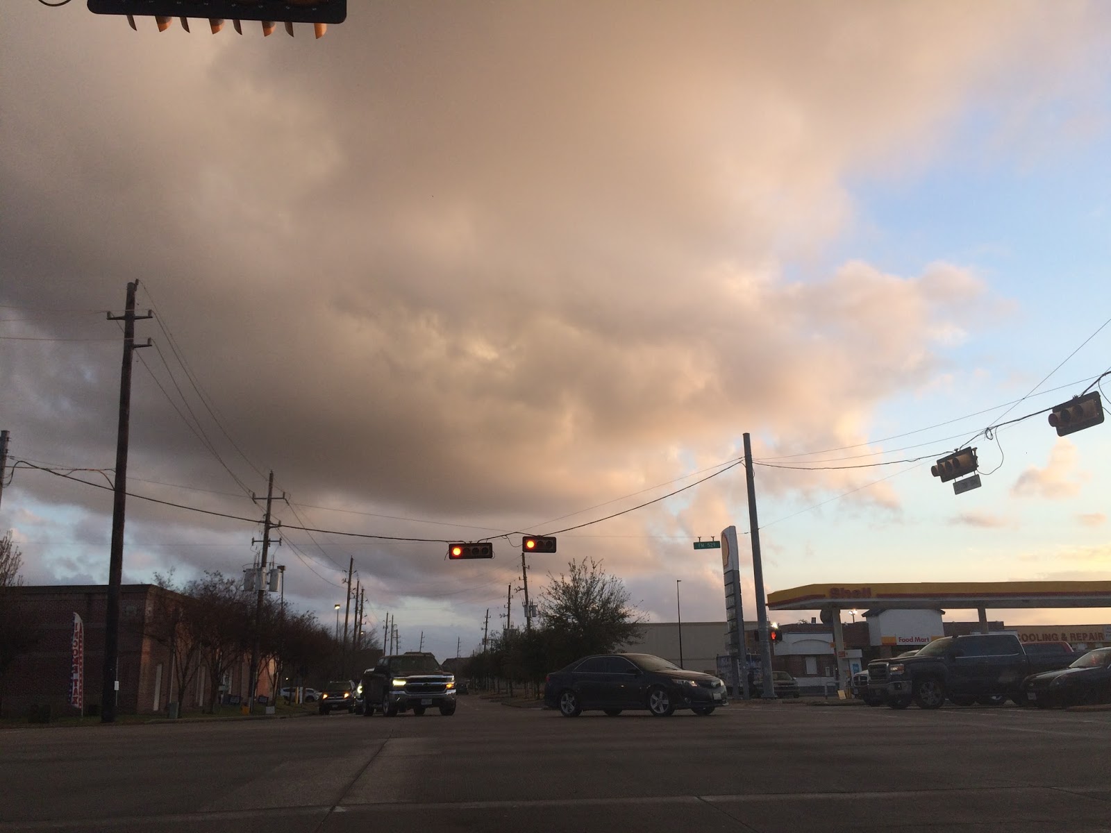
Northwest Houston, TX, during the early evening.

Houston, TX radar, during the early night.
Summary: The day was mostly cloudy, partly wet, and warm. Isolated light to moderate drizzle and rain looked to have fallen in some locations in the Houston, TX area, during the morning, afternoon, evening, and night. There looked to be some moderate to possibly very dense dog, in some locations in the Houston, TX area, during the morning and night. I saw and felt some brief light sprinkles at my house in northwest Houston, TX, during the afternoon, and maybe evening and night. There looked to be some moderate dense fog, at my house in northwest Houston, TX, during the early and mid-morning. Stratus with maybe some alto stratus clouds looked to cover most of the sky, during the morning, afternoon, and evening. I think stratus clouds looked to cover the whole sky, during the night. The wind speeds looked to be calm with gentle to moderate gusts and some moderately strong gusts. It felt cool, during the early and maybe mid-morning. It started to feel warm, during the late, or maybe mid-morning. It felt warm, during the afternoon, evening, and night. There was a Hazardous Weather Outlook issued for the Houston, TX area, by NOAA. There were no other watches, warnings, alerts, advisories, or weather statements/outlooks issued for the Houston, TX area, that I know of. The low temperatures looked to be in the low 50's and the high temperatures looked to be in the low to mid 70's with maybe some high 70's, for the Houston, TX area.
Houston, TX Storm Summary: Isolated light to moderate drizzle and rain looked to have fallen in some locations in the Houston, TX area, during the morning, afternoon, evening, and night. I didn't see, or hear about any flooding, or damage caused by the weather to any of the locations in the Houston, TX area, during anytime of the day.
My Storm Summary: I saw and felt some brief light sprinkles at my house in northwest Houston, TX, during the afternoon, and maybe evening and night. I didn't hear any rumbles of thunder, or see any lightning strikes, where I was in northwest Houston, TX, during the day. The roads stayed partly wet, during the morning, afternoon, evening, and nigh, where I was in northwest Houston, TX. From all of the available moisture and humidity, during the day. There looked to be some moderate dense fog, at my house in northwest Houston, TX, during the early and mid-morning. I didn't see any flooding, or damage caused by the weather, where I was, during the day.
Locations: Northwest Houston, TX.
Thoughts: I am really enjoying this warm weather! I really wish it was warm enough to swim in the pool though. The pool thermometer read 48 degrees, when I checked, sometime during the afternoon.
Area Forecast Discussion
Issued by NWS Houston/Galveston, TX
Versions: 1 2 3 4 5 6 7 8 9 10 11 12 13 14 15 16 17 18 19 20 21 22 23 24 25 26 27 28 29 30 31 32 33 34 35 36 37 38 3940 41 42 43 44 45 46 47 48 49 50
000
FXUS64 KHGX 210300
AFDHGX

Area Forecast Discussion
National Weather Service Houston/Galveston TX
900 PM CST Sat Jan 20 2018

.UPDATE...
Current radar imagery shows a few light showers situated over
Fort Bend, Harris, and Liberty counties with the occasional
drizzle across the coastal tier of counties. As the next cold
front approaches the region, the potential for shower development
will begin in our northern most counties from Houston to Madison
to Burleson during the overnight hours. Otherwise, shower coverage
should continue to diminish late Saturday into early Sunday
across I-10 and southward.

Cloud cover will continue to thicken across the region and into
Sunday morning. Minor changes to the forecast tonight to account
for trends in observations for cloud cover and temperatures.
Lowered minimum temperatures by a degree or two tonight in the
northern counties where cloud cover is not as thick, and raised
temperatures across the Houston Metro where cloud decks have
filled in becoming overcast. Dewpoints have rebounded nicely with
the help of onshore flow, and have nudged up dewpoints slightly to
account for current observations. With this return moisture, the
threat for sea fog is present again this evening across the bays
and nearshore waters. Specifically, patchy to dense fog
conditions are possible tonight in Galveston Bay. Areas of fog are
expected across SE TX tonight, with the best chance for
development again in our western zones.

Hathaway

&&

.PREV DISCUSSION... /ISSUED 547 PM CST Sat Jan 20 2018/

AVIATION [00Z TAF Issuance]...

Radar showing a weak training line of showers from KLBX to east
of KHOU. Showers may go right over KLBX and cause lower visibility
during rain along with lower ceilings. As a whole ceilings are
sitting at MVFR/VFR levels with the expectation of BKN/OVC MVFR
ceilings developing in the next 3 to 6 hours. KHGX VAD wind
profile shows basically 20-25 knots through the lowest few
thousand feet of the boundary layer. Model guidance shows LLJ
increasing to around 30-35 knots tonight over the next 6 hours.
SFC winds should also remain around 7-10kts across the area with
very little if any decoupling. If this occurs, ceilings will
likely stay in the low MVFR maybe high IFR categories and
visibility from fog may only be 3-6SM. As such most TAFs have
ceilings dropping to MVFR with maybe a few hours of IFR during
the daybreak hours handled with a TEMPO group. Winds then mix down
late morning hour so expecting tomorrow to be windy with ceilings
increasing to MVFR/VFR levels. In the extended portion of the
TAFS, cold front expected Sunday night should be closer to the
06-12Z Monday time frame so may need a line for FROPA in the IAH
TAF for the 06Z TAF update.

Overpeck

PREV DISCUSSION /Issued 331 PM CST Sat Jan 20 2018/...

Warmer and humid conditions with periods of rain and fog will
continue across Southeast Texas through Sunday before a cold front
ushers in drier and somewhat cooler air Monday. The KHGX radar
this afternoon shows a thin band of showers stretching from near
Moss Hill to San Leon. Within the band, isolated one-half inch to
one inch amounts have been observed as this activity continues to
move towards the northeast. Behind the band, warm air advection
has led to not only renewed development of isolated showers but
has promoted afternoon temperatures into the low to mid 70s
southwest of the Houston metro. This warm air advection will keep
the potential for a few showers in the forecast through Sunday as
well as only allow overnight lows to fall into the lower 60s. Fog
is expected again inland overnight but stronger winds may preclude
or shorten any dense fog development.

Afternoon water vapor imagery shows an upper trough stretching
from the Great Basin down towards Baja California and as this
feature reaches the Southern Plains Sunday, a lee surface low
will result in breezy southerly winds during the day Sunday as an
associated Pacific front pushes across North and Central Texas
and towards the region. The arrival of a 120 knot upper level jet
streak Sunday afternoon will not only help the lee cyclone eject
across the Southern Plains, but will provide enough lift for
thunderstorms to develop along the Pacific front as it slides into
the region. While the best jet dynamics associated with this
feature look to remain across North Texas and the Ark-La-Tex, mid-
level lapse rates steepening to near 7 C/km indicate the
potential for enough updraft acceleration to promote a gusty wind
threat. This is contingent on thunderstorms being able to develop,
however, as increasing deep southwesterly flow may result in a
building cap and cloud cover may further inhibit instability...
ultimately limiting how far south along the Pacific front activity
is able to build. As of now, expect the best potential for any
strong to possibly severe thunderstorms to be north of a College
Station to Livingston line. This aforementioned capping may only
allow a thin band of showers to develop farther south along the
Pacific front before it is overtaken by a secondary cold front
Sunday night. Temperatures Sunday afternoon are expected to rise
into the low to mid 70s ahead of both fronts.

Expect the cold front to move off the coast Monday morning and
shunt any remaining showers or thunderstorms into the coast with
it, leaving breezy and drier conditions in its wake on Monday.
Highs Monday through mid-week will remain in the mid to upper 60s,
moderating only slightly into the lower 60s as a backdoor front
arrives on Wednesday. Rain chances don`t return to the forecast
until the beginning of the weekend as onshore flow allows for Gulf
moisture to return back into the region.

Huffman

MARINE...
Periods of showers and sea fog are expected across the waters
until a cold front pushes off the coast late Sunday night/early
Monday morning. The sea fog may become dense at times. Caution
flags will likely be required both for moderate onshore flow ahead
of the front as well as moderate offshore winds in the wake of
the front. NW winds in the immediate wake of the front will
gradually become ENE by Tuesday. Caution flags may be required at
times throughout the week. Another front will push off the coast
next weekend. 11

FIRE WEATHER...
A cold front will push through the region Sunday night, bringing
dry and breezy conditions in its wake. Relative humidity could get
below 30% with sustained NW winds of 10 to 15 mph Monday
afternoon. Tuesday will likely be dry as well, but winds should be
much lighter. Finer fuels are already pretty dry across the
region following this week`s hard freeze. Although a Red Flag
Warning will likely not be required, elevated fire conditions will
be a concern for Monday. 11

&&

.PRELIMINARY POINT TEMPS/POPS...
College Station (CLL)      59  74  47  65  37 /  20  50  60   0   0
Houston (IAH)              63  75  55  68  40 /  20  30  70   0   0
Galveston (GLS)            62  70  57  68  46 /  20  20  60  10   0

&&

.HGX WATCHES/WARNINGS/ADVISORIES...
TX...NONE.
GM...SMALL CRAFT SHOULD EXERCISE CAUTION through Sunday afternoon for
     the following zones: Waters from Freeport to the Matagorda
     Ship Channel from 20 to 60 NM...Waters from High Island to
     Freeport from 20 to 60 NM.

&&

$$

Update...08
Hazardous Weather Outlook
Hazardous Weather Outlook
National Weather Service Houston/Galveston TX
344 PM CST Sat Jan 20 2018

GMZ330-335-350-355-370-375-TXZ213-214-235>238-212145-
Brazoria-Chambers-
Coastal waters from Freeport to the Matagorda Ship Channel out
20 NM-Coastal waters from High Island to Freeport out 20 NM-
Galveston-Galveston Bay-Harris-Jackson-Matagorda-Matagorda Bay-
Waters from Freeport to the Matagorda Ship Channel from 20 to
60 NM-Waters from High Island to Freeport from 20 to 60 NM-
344 PM CST Sat Jan 20 2018

This hazardous weather outlook is for portions of Southeast Texas..

.DAY ONE...This Afternoon and Tonight

Sea fog along the coast may expand in coverage and move inland
this evening. Expect it to become dense at times.

.DAYS TWO THROUGH SEVEN...Sunday through Friday

Periods of dense sea fog will likely persist until the next
frontal passage early Monday morning. Small craft advisories may
be required in the wake of the front on Monday as northerly winds
increase.

.SPOTTER INFORMATION STATEMENT...

Spotter activation is not anticipated at this time.

$$
No comments:
Post a Comment