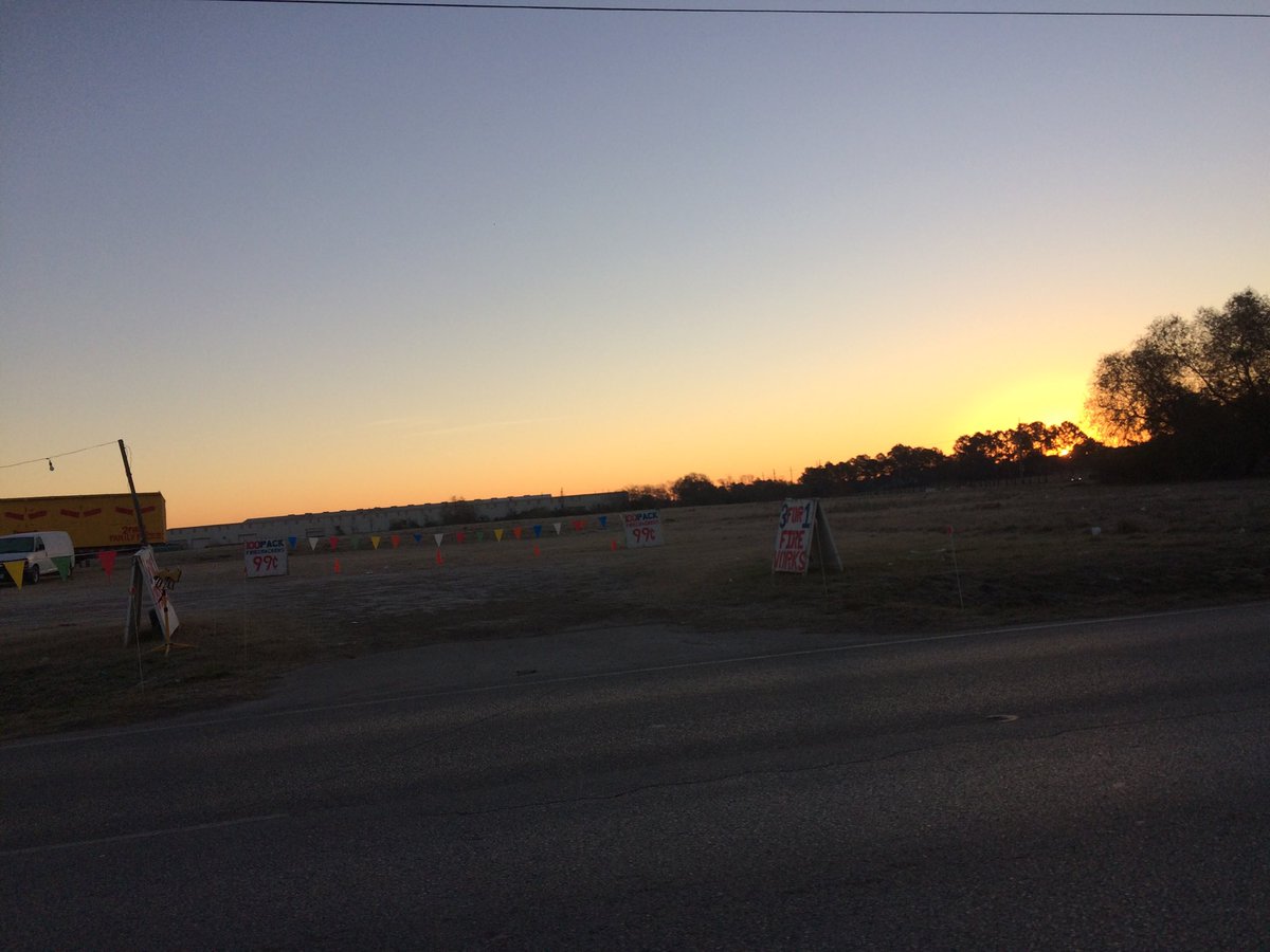
Northwest Houston, TX, during the early morning.
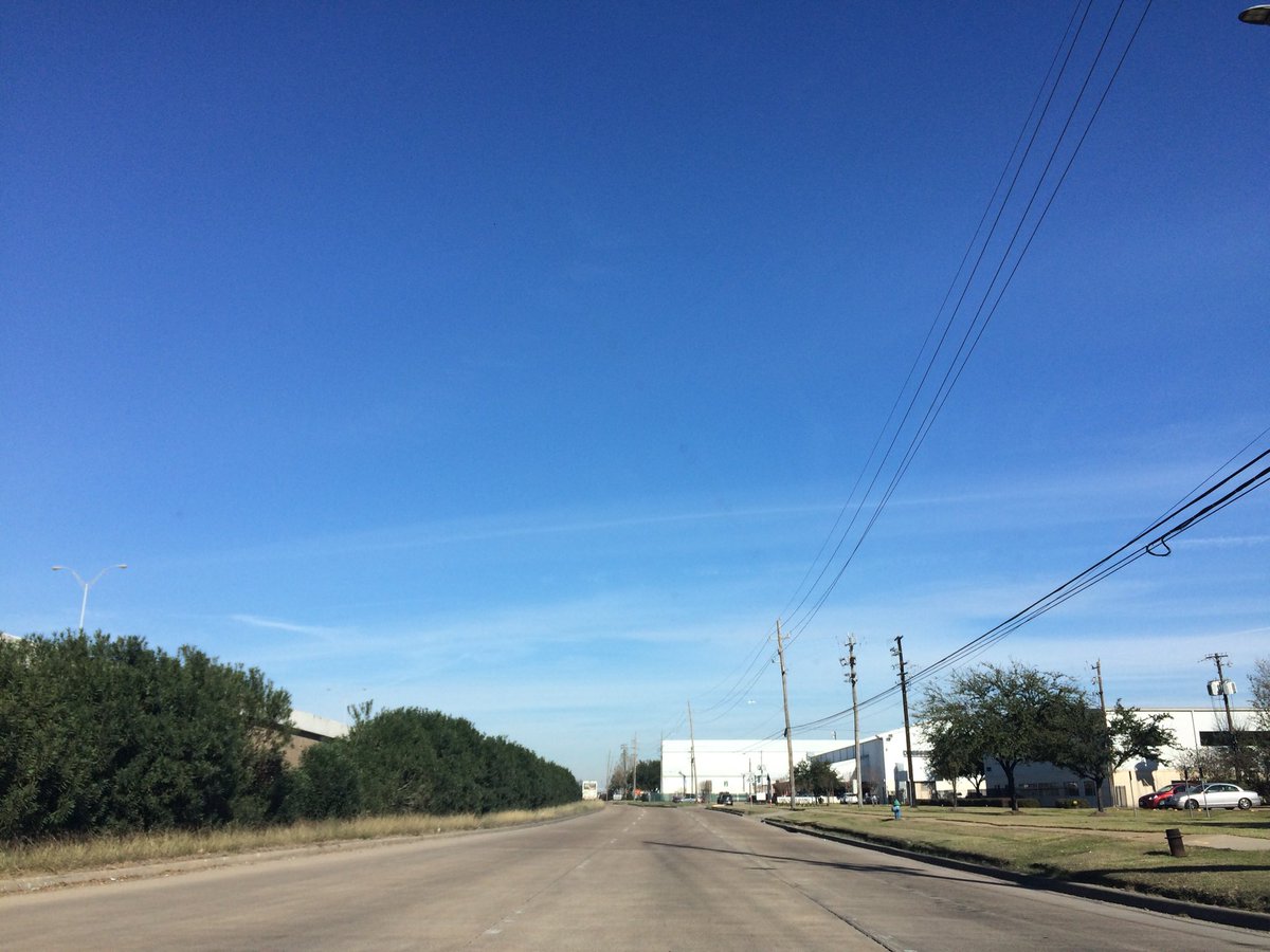
Northwest Houston, TX, during the late morning.
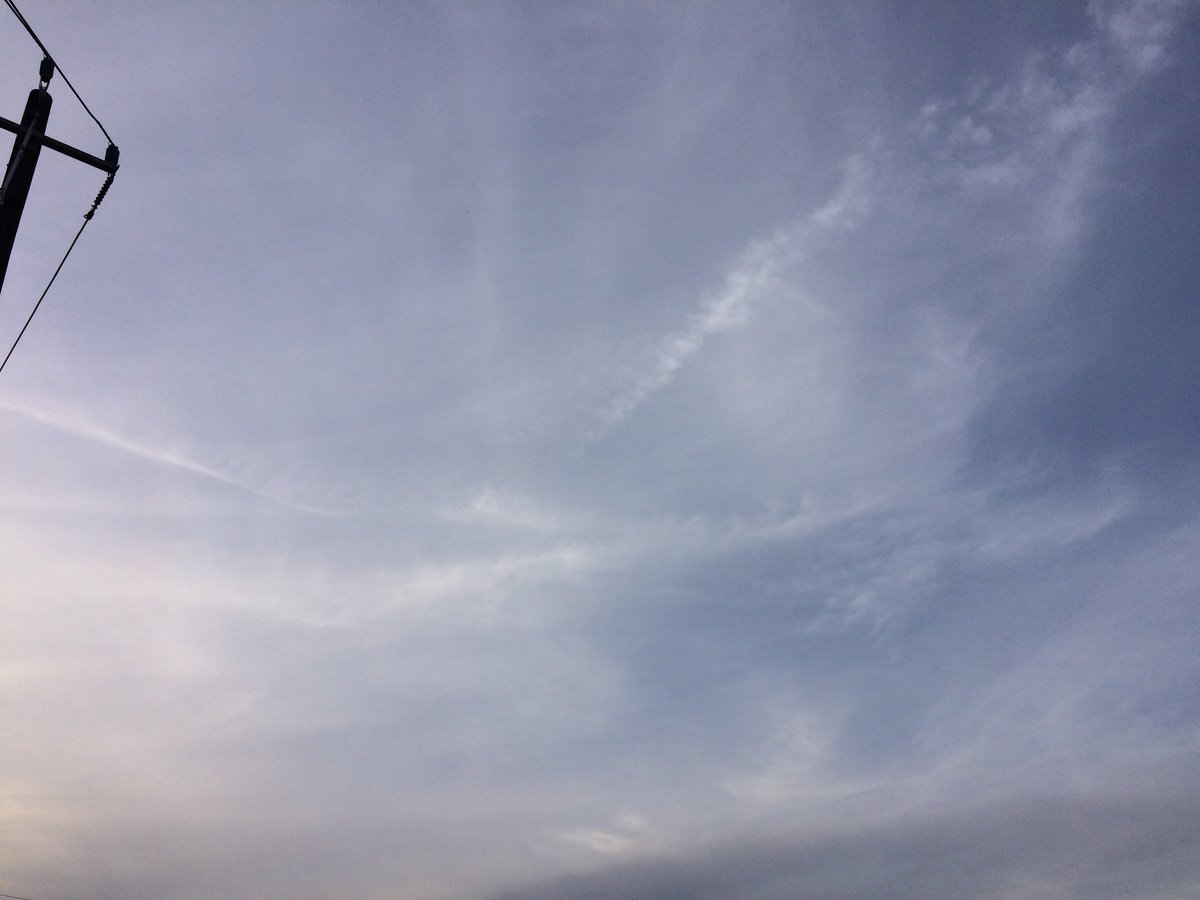
Northwest Houston, TX, during the late afternoon.
Summary: The day was very cool, sunny, and dry. I don't remember seeing any rain, on the radar, over the Houston, TX area, during anytime of the day. I didn't see, feel, or hear any drops of precip, where I was, during the day. I did see lots of frost on the ground and on my car's windshield, on my way to work, in northwest Houston, TX, during the early morning. The sky looked to be mostly clear with a few wavy alto stratus clouds, during the early and maybe mid-morning. Wavy alto stratus clouds looked to be scattered across the sky, during the late morning. Wavy alto stratus clouds looked to have started to cover most of the sky, sometime during the afternoon and looked to have continued to cover most of the sky, through the evening and maybe early night. I think there looked to be only some wavy alto stratus clouds in the sky, if at all, during the late night and parts of the early night. I think the wind speeds looked to be calm with gentle to moderate gusts and some moderately strong gusts. It felt very cold, during the early morning and late night. I think it felt cold, during the mid-morning. It felt very cool, during the late morning, afternoon, and early evening. It started to feel cold, during the late evening. It felt cold, during the early night. There were no watches, warnings, alerts, advisories, or weather statements/outlooks issued for the Houston, TX area, that I know of. The low temperatures looked to be in the low to mid 30's with maybe some high 20's, I think, and the high temperatures looked to be in the high 50's, with maybe some low to mid 60's, I think, for the Houston, TX area.
Houston, TX Storm Summary: I don't remember seeing any rain, on the radar, over the Houston, TX area, during anytime of the day. I didn't see, or hear about any reports of flooding, ice, or damage caused by the weather, to any of the locations, in the Houston, TX area, during anytime of the day.
My Storm Summary: I didn't see, feel, or hear any drops of precip, where I was, during the day. I did see lots of frost on the ground and on my car's windshield, on my way to work, in northwest Houston, TX, during the early morning. The frost on my cars windshield became so thick that I wasn't able to get it off of my car's windshield, using the windshield wipers. I had to wait for my car's front windshield to defrost using the car's defroster. I could barely see out of my car's front window! It was a pretty scary drive through my neighborhood. Fortunately I was able to see and the frost did eventually melt away from my car's front window. Other the the morning frost, the ground remained dry, through the rest of the day. The roads looked to have stayed dry, from lack of precip, during the day. I didn't see any puddles, as there was no precip to produce any. I didn't see any precip producing, or thunderstorm type clouds, during anytime of the day. I didn't see any lightning strikes, or hear any rumbles of thunder. I didn't see any flooding, ice, or damage caused by the weather.
Locations: Northwest Houston, TX.
Thoughts: The days are getting warmer.
Area Forecast Discussion
Issued by NWS Houston/Galveston, TX
Issued by NWS Houston/Galveston, TX
Versions: 1 2 3 4 5 6 7 8 9 10 11 12 13 14 15 16 17 18 19 20 21 22 23 24 25 26 27 28 29 30 31 32 33 34 35 36 37 38 3940 41 42 43 44 45 46 47 48 49 50
000
FXUS64 KHGX 050517
AFDHGX

Area Forecast Discussion
National Weather Service Houston/Galveston TX
1117 PM CST Thu Jan 4 2018

.AVIATION...
VFR conditions are expected to prevail through the TAF period with
high clouds around FL250 tonight lowering to near FL080 by Friday
morning. Regional radar mosaic shows a few light showers west of
LBX and SGR in response to an approaching shortwave trough but
AMDAR soundings out of Houston show a very dry profile below FL180.
Cannot rule out a sprinkle or two near LBX or SGR should enough
top-down moistening occur, but the probability of this given the
dry air in place is too low to include in the TAFs. Light and
variable winds tonight will become south to southeast 5 to 7 knots
by 18Z and decrease below 5 knots after 00Z as surface ridging
clears the region.

Huffman

&&

.PREV DISCUSSION... /ISSUED 1000 PM CST Thu Jan 4 2018/

DISCUSSION...

High and mid level cloudiness continues to increase over the area
this evening. We are seeing a much warmer eve compared to
yesterday eve. Temps are currently in the 40s across the sw half
of the area and in the mid 30s across the northeast half. Bumped
temps up a couple of degrees across central and sw areas.
Northeast areas will see a freeze again tonight, but not a hard
freeze. As mid level clouds lower overnight across w-sw areas a
few sprinkles may make it to the ground. A very low chance of
measurable rain though. 33

&&

.PRELIMINARY POINT TEMPS/POPS...
College Station (CLL)      35  55  37  64  49 /  10  10  10  10  10
Houston (IAH)              35  54  39  62  49 /  10  10  10  10  10
Galveston (GLS)            42  53  50  61  56 /  10  10   0  10  10

&&

.HGX WATCHES/WARNINGS/ADVISORIES...
TX...NONE.
GM...Low Water Advisory until midnight CST tonight for the following
     zones: Galveston Bay.

&&

$$

Discussion...33
Aviation/Marine...14
No comments:
Post a Comment