Northwest Houston, TX, during the early morning.

Northwest Houston, TX, during the early morning.

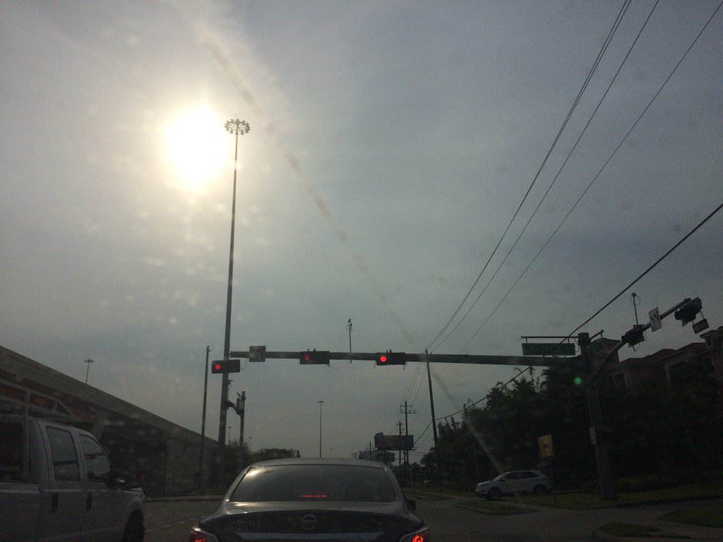
Northwest Houston, TX, during the early afternoon.

Northwest Houston, TX, during the late afternoon.
West Houston, TX, during the early evening.

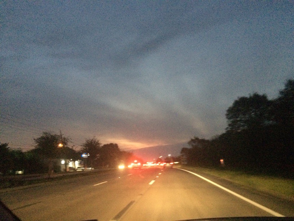
Northwest Houston, TX, during the late evening.
Summary: The day was warm, sunny, and dry. No rain. I didn't see any rain on the radar, over the Houston, TX area, during anytime of the day. I didn't see, feel, or hear any rain drops. Alto, or maybe cirro stratus clouds looked to cover most of the sky and then the whole sky, during the early morning. Alto, or maybe cirro stratus clouds stratus clouds still looked to cover the whole sky, during the rest of the morning and afternoon. Alto stratus, or maybe cirro stratus clouds looked to cover most of the sky, during the evening and maybe night. The wind speeds looked to be calm with gentle to moderate gusts with some moderately strong gusts, and maybe some occasional really strong (20 mph) gusts. It felt a little cool, during the early morning. It felt warm, during the mid and late morning, late evening, and night. It felt very warm, during the afternoon and early evening. There was an Air Quality Alert issued for today and tomorrow, for the Houston, TX area. There were no other watches, warnings, alerts, advisories, or weather statements/outlooks issued for the Houston, TX area, that I know of. The low temps looked to be in the 60's with maybe some 70's, or 70's with maybe some 60's and the high temps looked to be in the 80's, for the Houston, TX area.
Houston, TX Storm Summary: I didn't see any rain on the radar, over the Houston, TX area, during anytime of the day. I don't know if there are still any roads covered with water in the Houston, TX area. There are still road closures going on in the Houston, TX area, I didn't see any storm damages. Just lots of heavy traffic and some broken traffic lights.
My Storm Summary: I didn't see, feel, or hear any rain drops. I didn't see any storm looking clouds, or lightning strikes. I didn't hear any rumbles of thunder. The roads all looked to be dry. I didn't see any flooding, but there looked to be lots of damaged property from flood waters that covered roads, when I was driving through west Houston, TX, during the early evening.
Locations: Northwest Houston, TX
Thoughts: Today was the first cloudy day, since Harvey.
Issued by NWS Houston/Galveston, TX
Home | Current Version | Previous Version | Text Only | Print | Product List | Glossary Off
Versions: 1 2 3 4 5 6 7 8 9 10 11 12 13 14 15 16 17 18 19 20 21 22 23 24 25 26 27 28 29 30 31 32 33 34 35 36 37 38 39 40 41 42 43 44 45 46 47 48 49 50
855
FXUS64 KHGX 140240
AFDHGX
Area Forecast Discussion
National Weather Service Houston/Galveston TX
940 PM CDT Wed Sep 13 2017
.DISCUSSION...
Everything looks good with the forecast package. No major updates were
made on the evening update. 42
&&
.PREV DISCUSSION... /ISSUED 736 PM CDT Wed Sep 13 2017/
AVIATION...
Another period of VFR cats. A light variable to calm overnight wind
field will wake up from the south and remain light through Thursday.
Cirrus will thin...still remain the dominant cloud. 31
PREV DISCUSSION... /ISSUED 400 PM CDT Wed Sep 13 2017/
DISCUSSION...
Lingering high clouds have helped to keep temperatures down a few
degrees across much of SE TX this afternoon. These clouds are ex-
pected to move out tonight given the persistent NW flow aloft and
with the clearing skies/light winds, some very patchy fog will be
possible overnight/early tomorrow morning. The return of more SE/
S winds (and corresponding increase of low-level moisture) tomor-
row along with more sun/daytime heating will help to produce more
summer-like conditions tomorrow.
Low rain chances will be returning to the forecast by the weekend
as moisture levels continue to deepen and the seabreeze becomes a
little more active during the afternoons near the coast. However,
storm coverage will be hampered over most inland locations by the
building upper ridge. Highs should
Extended guidance coming in a bit more wet for next week with PWs
progged to climb into the 2.0-2.3" range and models weakening the
upper ridge over the region. Will keep with a general 20% POP for
this time period at this time. 41
MARINE...
No issues for the marine waters as light/moderate SE winds return
tonight and persist the next several days. 41
&&
.PRELIMINARY POINT TEMPS/POPS...
College Station (CLL) 69 93 71 91 73 / 0 0 10 10 10
Houston (IAH) 70 92 72 91 73 / 0 0 10 10 10
Galveston (GLS) 77 88 78 87 78 / 0 0 10 10 10
&&
.HGX WATCHES/WARNINGS/ADVISORIES...
TX...NONE.
GM...NONE.
&&
$$
31/42
Air Quality Alert
TXZ213-237-238-150000-

AIR QUALITY ALERT MESSAGE
TEXAS COMMISSION ON ENVIRONMENTAL QUALITY
RELAYED BY NATIONAL WEATHER SERVICE HOUSTON/GALVESTON TX
207 PM CDT Wed Sep 13 2017

...OZONE ACTION DAY FOR THURSDAY...

THE TEXAS COMMISSION ON ENVIRONMENTAL QUALITY (TCEQ)...HAS ISSUED AN
OZONE ACTION DAY FOR THE HOUSTON...GALVESTON...AND BRAZORIA AREAS FOR
THURSDAY... SEPTEMBER 14 2017.

ATMOSPHERIC CONDITIONS ARE EXPECTED TO BE FAVORABLE FOR PRODUCING
HIGH LEVELS OF OZONE POLLUTION IN THE HOUSTON...GALVESTON AND
SURROUNDING AREAS ON THURSDAY. YOU CAN HELP PREVENT OZONE POLLUTION BY
SHARING A RIDE...WALKING...RIDING A BICYCLE...TAKING YOUR LUNCH TO
WORK...AVOIDING DRIVE THROUGH LANES...CONSERVING ENERGY AND KEEPING YOUR
VEHICLE PROPERLY TUNED.

FOR MORE INFORMATION ON OZONE:

OZONE: THE FACTS (WWW.TCEQ.TEXAS.GOV/AIRQUALITY/MONOPS/OZONEFACTS.HTML)
EPA AIR NOW:
(WWW.AIRNOW.GOV/INDEX.CFM?ACTION=AIRNOW.LOCAL_CITY&CITYID=236)
TAKE CARE OF TEXAS: (WWW.TAKECAREOFTEXAS.ORG/AIR/AIRQUALITY)

$$
No comments:
Post a Comment