
Northwest Houston, TX, or maybe Cypress, TX, during the mid-afternoon.
Northwest Houston, TX, or maybe Katy, TX, during the mid-afternoon.

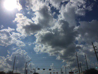
Katy, TX, during the late afternoon.

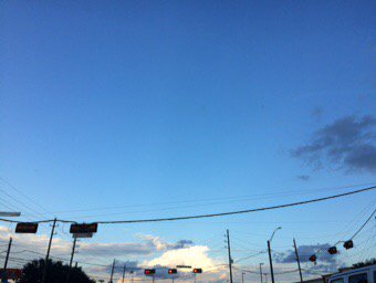
Katy, TX, during the early evening.
Cypress, TX, during the early evening.
Summary: The day was very warm, sunny, and mostly dry. Isolated moderate to moderately heavy with some heavy showers and maybe thunderstorms were scattered across the Houston, TX area, during the morning, afternoon, and evening. There might have still been a few light to moderately heavy showers and possible thunderstorms in the Houston, TX area, during the night. There might have also been some fog, during the morning. I didn't see, feel, or hear any rain drops, or fog. Alto stratus, stratus and stratocumulus clouds looked to be widely scattered across the sky, during the morning, afternoon, and evening. I also saw some nimbus clouds, during the early evening. The sky looked to be clear with maybe some cirro stratus clouds, during the early night. The wind speeds looked to be calm with gentle to moderate gusts with some moderately strong gusts. It felt warm, during the early morning, evening, and night. It felt very warm, during the mid-morning. It started to feel hot, during the late morning. It felt hot, during the early afternoon. It felt very warm, almost hot, during the mid and late afternoon. There were no watches, warnings, alerts, advisories, or weather statements/outlooks issued for the Houston, TX area, that I know of. The low temps looked to be in the 70's and the high temps looked to be in the 90's, for the Houston, TX area.
Houston, TX Storm Summary: Isolated moderate to moderately heavy with some heavy showers and maybe thunderstorms were scattered across the Houston, TX area, during the morning, afternoon, and evening. There might have still been a few light to moderately heavy showers and possible thunderstorms in the Houston, TX area, during the night. All of the roads that were closed because of Harvey look to now to be open and fully operational! I didn't hear about any reports of flooding, or storm damages.
My Storm Summary: I didn't see, feel, or hear any rain drops. I saw some storm looking clouds in northwest Houston, TX, at my house, during the early afternoon. I then saw a storm cloud when I was in Katy, TX, during the early evening. I saw what looked like puddles from a recent shower on my way towards my house in northwest Houston, TX, from Katy, TX, in Katy TX and maybe parts of northwest Houston, TX, during the early evening. I didn't see any flooding, lightning, or storm damages. I didn't hear any rumbles of thunder.
Locations: Northwest Houston, TX, Cypress, TX, and Katy, TX.
Thoughts: Well I guess all of the roads that were closed due to Harvey are now open, in the Houston, TX area.
Area Forecast Discussion
Issued by NWS Houston/Galveston, TX
Issued by NWS Houston/Galveston, TX
Versions: 1 2 3 4 5 6 7 8 9 10 11 12 13 14 15 16 17 18 19 20 21 22 23 24 25 26 27 28 29 30 31 32 33 34 35 36 37 38 3940 41 42 43 44 45 46 47 48 49 50
000
FXUS64 KHGX 250158
AFDHGX

Area Forecast Discussion
National Weather Service Houston/Galveston TX
858 PM CDT Sun Sep 24 2017

.UPDATE...
A shower or two are still lingering out there this evening but
should continue to die off over the next hour or so. A quiet
night is in store with some patchy fog expected to develop across
the northern half of the CWA by sunrise. Another round of
scattered showers and thunderstorms is expected tomorrow
afternoon.
11

&&

.PREV DISCUSSION... /ISSUED 745 PM CDT Sun Sep 24 2017/

AVIATION...
Lone storm near 11R should dissipate shortly. VFR conditions
through 07z then expect some patchy fog with VISBY falling into
IFR ranges for a few hours toward sunrise at CXO and possibly at
LBX. Scattered showers should redevelop Monday afternoon dotting
the area. VCSH at most inland sites may need a tempo as storms
develop and get closer to IAH/HOU/CXO/UTS sites between 18-00z.
45

PREV DISCUSSION... /ISSUED 250 PM CDT Sun Sep 24 2017/

DISCUSSION...
Influx of low level moisture along axes of convergence continues
to support widely scattered showers and thunderstorms this
afternoon in moderately unstable airmass. These will remain hit-
or-miss into the early evening before diminishing quickly by
sunset. We could see a few patches of fog once again tonight given
the abundant surface moisture in place.

All in all, expect very little change over the next several days
with models maintaining a chance of mostly afternoon showers and
thunderstorms into mid week. Better chances will remain nearer the
coast. We will also remain warm and humid each day with afternoon
highs topping out around 90f, with overnight lows near 80 along
the coast and in the lower 70s farther inland.

Some relief is in the forecast at least as a cool front is
forecast to backdoor into the area Friday into Saturday, dipping
temps 5-10 degrees with a more noticeable reduction in dew points
behind the front next weekend.

48

MARINE...
Low pressure over the central plains will maintain onshore winds
through Monday. A weak area of low pressure will develop over the southern
Gulf and this will allow winds to back to the east mid week. A cold
front will cross the coastal waters on Friday and winds will become NE
and increase Friday night into Saturday. Tide levels will remain slightly
elevated this week due to the persistent onshore flow.  43


&&

.PRELIMINARY POINT TEMPS/POPS...
College Station (CLL)      72  90  72  90  74 /  10  20  10  20  30
Houston (IAH)              74  87  73  89  72 /  10  30  10  30  10
Galveston (GLS)            79  88  80  88  79 /  10  40  10  30  10

&&

.HGX WATCHES/WARNINGS/ADVISORIES...
TX...NONE.
GM...NONE.
&&

$$

Discussion...11
No comments:
Post a Comment