
Northwest Houston, TX, during the early morning.
West Houston, TX, during the late afternoon.

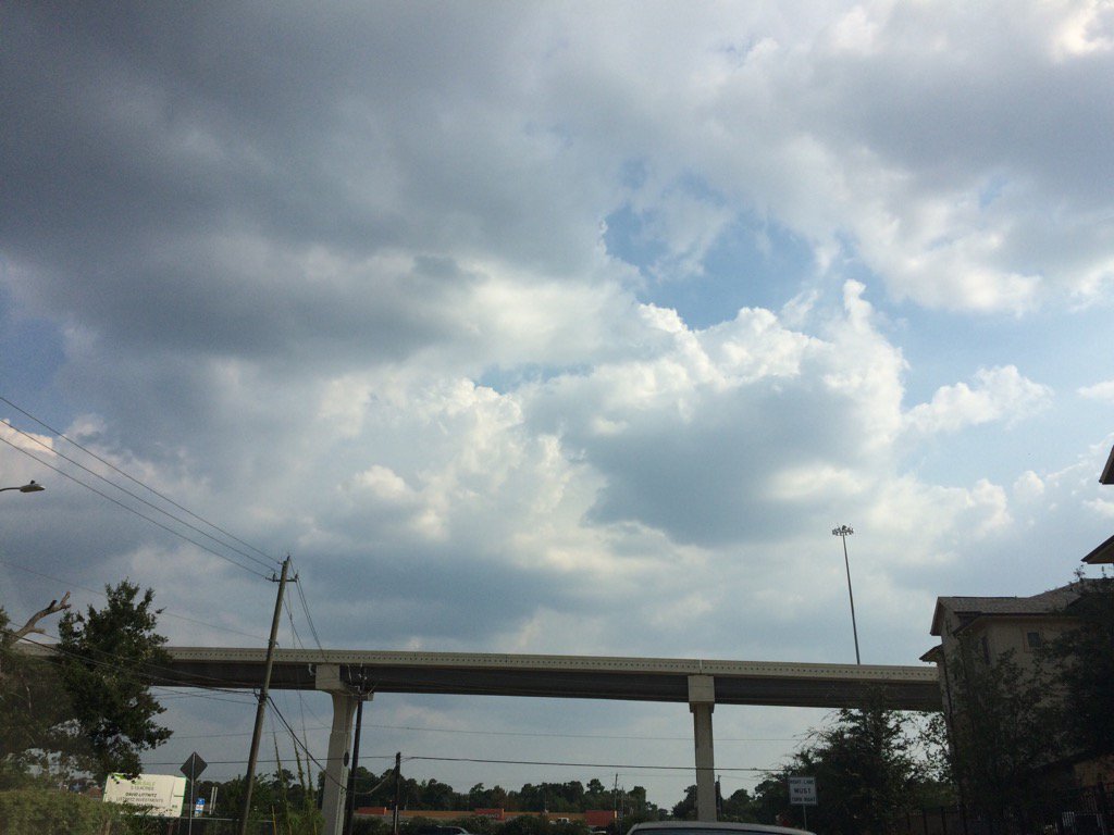
Northwest Houston, TX, during the late afternoon.

Northwest Houston, TX, during the early evening.
Summary: The day was very warm, sunny, and dry. No rain that I know of. I didn't see any rain on the Houston, TX radar. NOAA says that there were were a few isolated showers. I didn't see, feel, or hear any rain drops! Alto stratus with maybe some stratus and stratocumulus clouds looked to be widely scattered across the sky, during the early morning. Alto stratus and stratus with stratocumulus clouds looked to have started to cover most of the sky, sometime during the mid, or maybe late morning and continued on through the evening. The sky looked to be mostly clear, apart from a few stratus, or maybe alto stratus clouds. The wind speeds looked to be calm with maybe some gentle to moderate gusts. It felt warm, during the early morning and night. It started to feel very warm, sometime during the mid, or maybe late morning. It felt very warm, almost hot, during the afternoon and early evening. It felt very warm, almost hot, then eventually warm, during the late evening. There was an Air Quality Alert issued, along with still many flood warnings, for the Houston, TX area. There were no other watches, warnings, alerts, advisories, or weather statements/outlooks issued for the Houston, TX area, that I know of. The low temps looked to be in the 70's and the high temps looked to be in the 80's with maybe some 90's, or maybe 90's with maybe some 80's, for the Houston, TX area.
Houston, TX Storm Summary: There is still lots of flooding going on in the streets of Houston, TX. There were no storm damage reports, that I know of.
My Storm Summary: I didn't see, feel, or hear any rain drops. I didn't see any storm clouds, wet roads, or storm damage. There were still lots of flooded roadways that I had to avoid. I was finally forced to drive through a partially flooded, but passable under pass. When I was driving under Beltway 8, turning right on the I-10 feeder road, going towards Brittmoore. I was not a fun experience, but I am sure that my car was not affected that much by it. I hope.
Locations: Northwest and west Houston, TX.
Thoughts: Well things are starting to get back to normal. There is still lots of flooding going on in and around the Houston, TX area houses, businesses, and streets. I hope all of this flooding ends soon.
Area Forecast Discussion
Issued by NWS Houston/Galveston, TX
Issued by NWS Houston/Galveston, TX
Versions: 1 2 3 4 5 6 7 8 9 10 11 12 13 14 15 16 17 18 19 20 21 22 23 24 25 26 27 28 29 30 31 32 33 34 35 36 37 38 3940 41 42 43 44 45 46 47 48 49 50
000
FXUS64 KHGX 020220
AFDHGX

Area Forecast Discussion
National Weather Service Houston/Galveston TX
920 PM CDT Fri Sep 1 2017

.UPDATE...
Forecast for tonight looking on track. Updated temps and
dewpoints for trends.

Beat

&&

.PREV DISCUSSION... /ISSUED 628 PM CDT Fri Sep 1 2017/

AVIATION...
Sea breeze and outflow boundary are working their way inland with not
a whole lot of wind changes. SHRA activity that did develop late this
afternoon has now moved away from LBX. Look for light and variable
winds overnight with some patchy MVFR fog possible again at CXO. Expect
VFR conditions tomorrow with mainly light and variable winds.  42

PREV DISCUSSION... /ISSUED 343 PM CDT Fri Sep 1 2017/

DISCUSSION...
Current satellite is showing the typical afternoon cumulus field
developing across southeast Texas. There is a little enhanced
cumulus along the coast but the weak seabreeze is having trouble
generating enough lift for anything more than very isolated and
weak showers. This is expected again tomorrow and the dry weather
is greatly appreciated.

Models are still showing an upper level trough dropping into North
Texas tomorrow night though a significant change is a stronger
ridge over the southern Plains pinching the trough off from the
westerly flow and retrograding it back to the southwest earlier
than previous model runs. A more westerly position of this trough
means weaker lift and lower PoPs for Saturday night and Sunday.

Tropical moisture in the southern Gulf of Mexico will move north
early next week giving us our next decent chance for rainfall. At
the same time, a western U.S. ridge will amplify and northerly
upper flow will drive a cold front through the area Tuesday night
and early Wednesday. The tropical moisture already in place will
interact with this cold front producing a line of showers and
storms along the front. Fortunately the cold front will be moving
fairly quickly, especially for this time of year, pushing the rain
south by Wednesday afternoon. Behind the front, cool and dry air
will filter into the area bringing very pleasant temperatures with
highs only in the lower 80s Wed/Thu.

Hennig

MARINE...
Weak high pressure is over the area, but drifting east. As a result,
light and variable winds will gradually become more easterly to
southeasterly into the weekend. Look for winds to become more
consistently out of the southeast early next week ahead of an
advancing cold front, but with winds remaining relatively light. By
midweek, winds will begin to pick up and shift to an offshore
direction as the strong front moves across the area. SCEC conditions
are likely and a small craft advisory may be needed later Wednesday
into Thursday with gusty offshore winds in the wake of the front.

Luchs

&&

.PRELIMINARY POINT TEMPS/POPS...
College Station (CLL)      71  92  71  90  71 /   0  10  10  20  10
Houston (IAH)              72  91  72  90  72 /  10  10  10  20  10
Galveston (GLS)            77  86  76  85  76 /  10  10  10  20  20

&&

.HGX WATCHES/WARNINGS/ADVISORIES...
TX...NONE.
GM...NONE.
&&

$$

Discussion...99
Air Quality Alert
TXZ213-237-238-030000-

AIR QUALITY ALERT MESSAGE
TEXAS COMMISSION ON ENVIRONMENTAL QUALITY
RELAYED BY NATIONAL WEATHER SERVICE HOUSTON/GALVESTON TX
156 PM CDT Fri Sep 1 2017

...OZONE ACTION DAY FOR SATURDAY...

THE TEXAS COMMISSION ON ENVIRONMENTAL QUALITY (TCEQ)...HAS ISSUED AN
OZONE ACTION DAY FOR THE HOUSTON...GALVESTON...AND BRAZORIA AREAS FOR
SATURDAY... SEPTEMBER 2ND.

ATMOSPHERIC CONDITIONS ARE EXPECTED TO BE FAVORABLE FOR PRODUCING
HIGH LEVELS OF OZONE POLLUTION IN THE HOUSTON...GALVESTON AND
SURROUNDING AREAS ON SATURDAY. YOU CAN HELP PREVENT OZONE POLLUTION BY
SHARING A RIDE...WALKING...RIDING A BICYCLE...TAKING YOUR LUNCH TO
WORK...AVOIDING DRIVE THROUGH LANES...CONSERVING ENERGY AND KEEPING YOUR
VEHICLE PROPERLY TUNED.

FOR MORE INFORMATION ON OZONE:

OZONE: THE FACTS (WWW.TCEQ.TEXAS.GOV/AIRQUALITY/MONOPS/OZONEFACTS.HTML)
EPA AIR NOW:
(WWW.AIRNOW.GOV/INDEX.CFM?ACTION=AIRNOW.LOCAL_CITY&CITYID=236)
TAKE CARE OF TEXAS: (WWW.TAKECAREOFTEXAS.ORG/AIR/AIRQUALITY)

$$
No comments:
Post a Comment