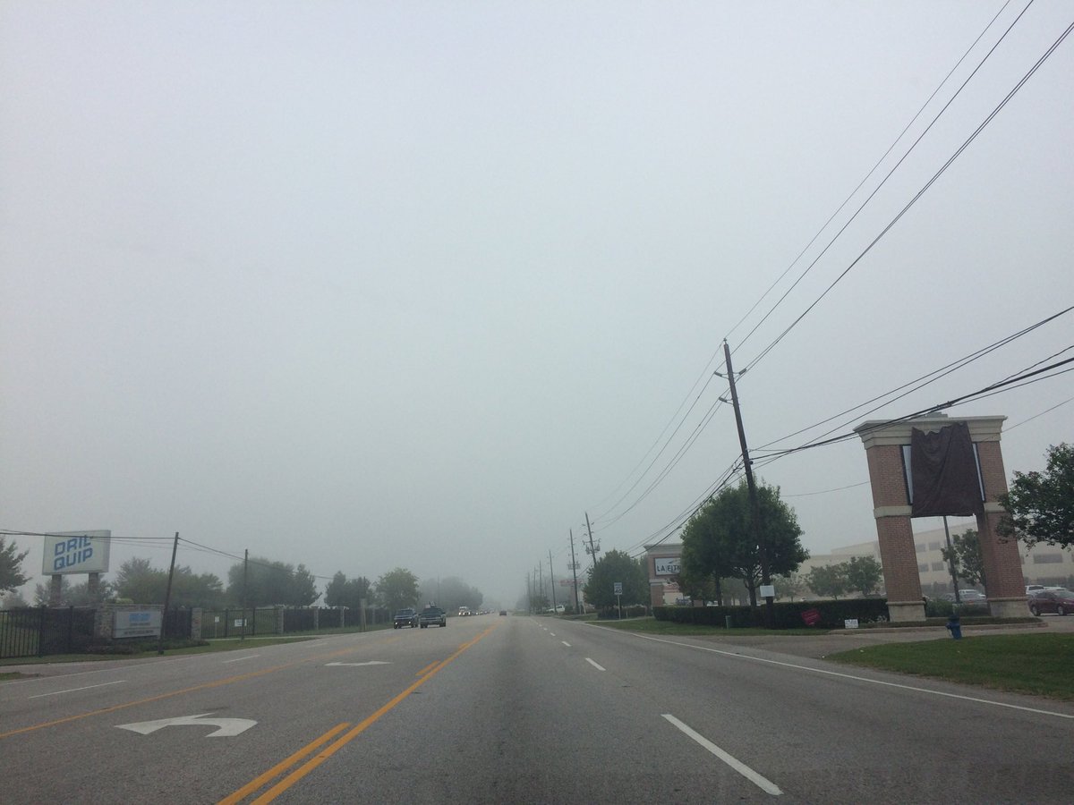
Northwest Houston, TX, during the early morning.
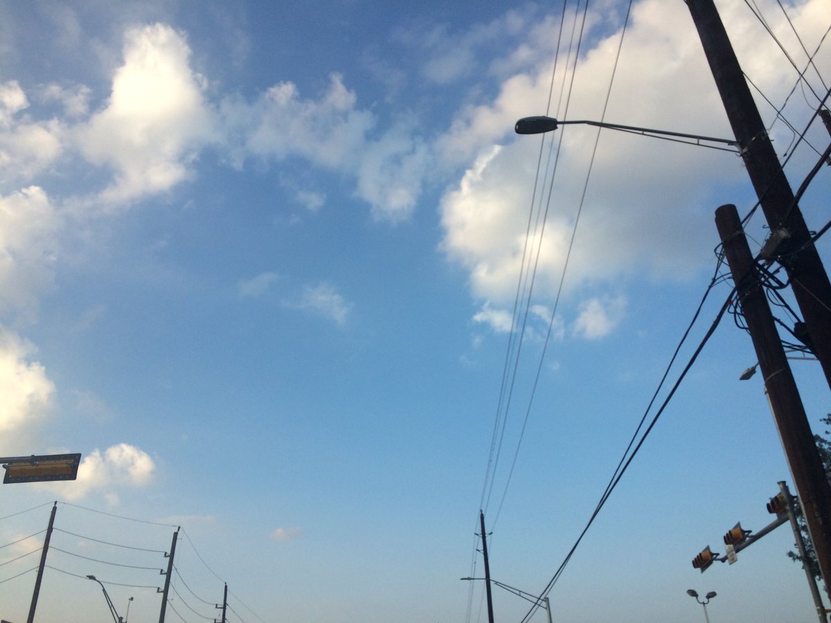
Northwest Houston, TX, during the mid-morning.
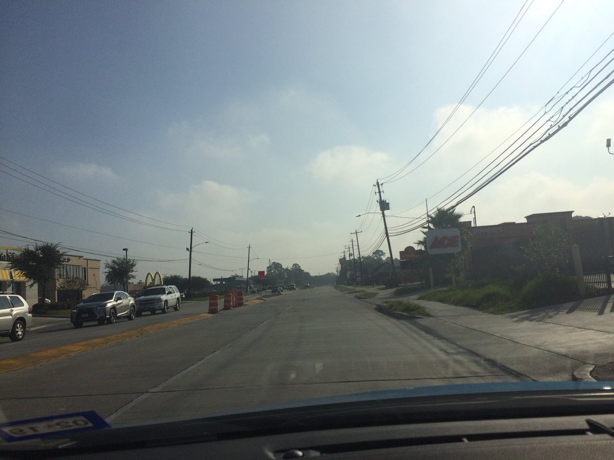
West Houston, TX, during the mid-morning.
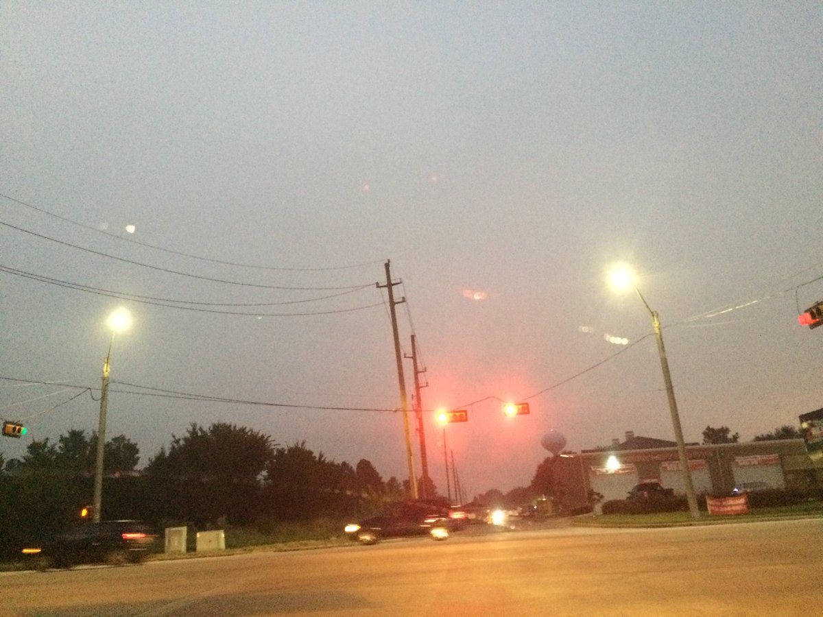
Northwest Houston, TX, during the early evening.
Summary: The day was very warm, mostly sunny, and dry. I didn't see any rain on the radar, over the Houston, TX area, during anytime of the day. I didn't see, feel, or hear any rain drops. A light to moderate dense fog looked to cover most of the sky, during the early morning and most of the mid-morning. The fog started to lift, sometime during the mid-morning, during 9 am. Alto stratus and stratus clouds looked to be scattered across the sky, some of the mid-morning, late morning, afternoon, and evening. The sky looked to be clear with maybe some alto stratus, or cirro stratus clouds, during the night. The wind speeds looked to be calm with maybe some gentle to moderate gusts and some occasional moderately strong gusts. It felt warm, during the early morning, late evening, and night. It felt very warm, during the mid-morning and early evening. It felt very warm, almost hot, during the late morning and early afternoon. It felt hot, during the mid and late afternoon. There was a Air Quality Alert issued for the Houston, TX area, by NOAA, for today. There was also a Hazardous Weather Outlook issued for the Houston, TX area, by NOAA, for today, because of the fog. There were no other watches, warnings, alerts, advisories, or weather statements/outlooks issued for the Houston, TX area, that I know of. The low temperatures looked to be in the 70's with maybe some 60's and the high temperatures looked to be in the 80's and 90's, for the Houston, TX area.
Houston, TX Storm Summary: I didn't see any rain on the radar, over the Houston, TX area, during anytime of the day. I didn't hear about any reports of flooding, or damage.
My Storm Summary: I didn't see, feel, or hear any rain drops. I didn't see any storm clouds, flooding, wet roads, wet ground, lightning, or damage. I didn't hear any rumbles of thunder.
Locations: Northwest and west Houston, TX.
Thoughts: I really enjoyed seeing the fog this morning. I like fog!
Area Forecast Discussion
Issued by NWS Houston/Galveston, TX
Issued by NWS Houston/Galveston, TX
Versions: 1 2 3 4 5 6 7 8 9 10 11 12 13 14 15 16 17 18 19 20 21 22 23 24 25 26 27 28 29 30 31 32 33 34 35 36 37 38 3940 41 42 43 44 45 46 47 48 49 50
000
FXUS64 KHGX 140301
AFDHGX

Area Forecast Discussion
National Weather Service Houston/Galveston TX
957 PM CDT Fri Oct 13 2017

.UPDATE...
Only adjustment this evening was to expand the area of more dense
fog further east from the western forecast area. Fog beginning to
develop over the southwestern CWA this evening with many western
locations T/Td depressions falling to under 5 degrees with mainly
clear skies and light breezes. Thus...no reason to think that
tomorrow morning will be any different than this morning in the
fog department so leaning towards analog in the evening update.
Morning Tmins in the lower 70s/upper 70s (coast) with afternoon
Tmaxs reaching the upper 80s to lower 90s once again under similar
humidity. 31

&&

.PREV DISCUSSION... /ISSUED 640 PM CDT Fri Oct 13 2017/

AVIATION...
Satellite and obs show that the day`s scattered clouds are
beginning to clear out, and winds are calming. This should
continue, and like last night, the development of fog can be
expected. Guidance indicates that the densest fog will be west of
most of the TAF sites, and the current forecast is a blend of
persistence and the guidance. There is some potential that
visibilities and/or ceilings may drop farther than in the current
TAF. 25

&&

PREV DISCUSSION... /ISSUED 249 PM CDT Fri Oct 13 2017/

DISCUSSION...
It`s another unseasonably warm mid-October afternoon across Southeast
Texas with 2 PM temperatures in the upper 80s to lower 90s under mainly
light south to southeast winds and not a whole lot of cloud cover.
Galveston`s high temperature so far today (89 degrees) is close to
the record high for the date (90 degrees set in 2015), and in the first
twelve days of the month this location has tied or broken six records
(four daytime high temperatures and two high minimum temperatures).
October heat across Southeast Texas will continue until a cold front
moves through the area during the day on Sunday and off the coast
Sunday evening. Over the weekend before the front`s arrival, we`ll
be dealing with late night through early morning fog development
(some possible dense requiring Dense Fog Advisories), especially along
and to the west of Interstate 45. After the fog lifts Saturday morning,
afternoon high temperatures will heat up again into the upper 80s to
lower 90s as mid/upper level ridging holds. Moisture levels will begin
to rise, and we might see some mainly afternoon shower/thunderstorm
development in/around our southwest counties and adjacent Gulf waters.
We`ll see another shot of late night through early morning fog Saturday
night through Sunday morning, and temperatures ahead of the front
(especially central and south areas) will once again get very warm.
Shower and/or thunderstorm development is possible along and ahead of
the front as it works its way through the area during the day on Sunday.
Some models are hinting at possible lingering rain Sunday night as
the lagging 850 mb front finally moves on through. It will be turning
noticeably breezy and cooler after the front moves through with the
cooler temperatures across the area through at least the first half
of the week. Gradually increasing east winds toward the middle to end
of the week will help to increase moisture across the area resulting
in a gradual warming trend and increasing rain chances. For now, have
continued to keep the rain chances on the low side, but models are
showing a general upward trend on the POPs, and we might end up seeing
our forecasted rain chances rise in our updates over the weekend and
early next week.  42

MARINE...
Light southeasterly winds are expected to become easterly on Saturday
adn Saturday evening. As a cold front approaches from the north, the
winds will swing around to the northeast on Sunday. Expect the front
off of the coast Sunday evening with an increase in north wind
speeds expected following the frontal passage. Will probably see
small craft advisory conditions developing during the mid and late
evening period across most locations. These should diminish
throughout the day on Monday and Monday night. 40

&&

PREV DISCUSSION... /ISSUED 101 PM CDT Fri Oct 13 2017/

AVIATION...
Expecting VFR conditions at the inland sites this afternoon. Hazy
conditions could lower that to MVFR at KGLS for part of the
afternoon. For tonight, another episode of MVFR or lower
conditions are possible. The SREF probabilities indicate the same
locations should lower as did earlier this morning. Confidence is
high enough to lower conditions all the way to IFR or LIFR these
conditions are possible between 11Z and 14Z for most inland sites
outside of KIAH and KHOU. As occurred today, any MVFR or lower
conditions that do occur should lift by around 15Z on Saturday
morning.

For long range planning, a cold front will move through SE Texas
on Sunday and will probably reach the coast during the early
evening. Scattered showers and thunderstorms will be possible
ahead of the front. Also, lower ceilings or visibility due to fog
will be possible Saturday night through sunrise Sunday. 40

&&

.PRELIMINARY POINT TEMPS/POPS...
College Station (CLL)      71  91  70  81  56 /   0  10  10  30  10
Houston (IAH)              73  90  71  87  62 /  10  10  10  30  20
Galveston (GLS)            79  88  78  85  69 /  10  10  10  30  20

&&

.HGX WATCHES/WARNINGS/ADVISORIES...
TX...NONE.
GM...NONE.
&&

$$

Discussion...31/25
Hazardous Weather Outlook
Hazardous Weather Outlook
National Weather Service Houston/Galveston TX
208 AM CDT Fri Oct 13 2017

TXZ163-164-176>179-195>200-210>214-226-227-235>238-140715-
Austin-Brazoria-Brazos-Burleson-Chambers-Colorado-Fort Bend-
Galveston-Grimes-Harris-Houston-Jackson-Liberty-Madison-Matagorda-
Montgomery-Polk-San Jacinto-Trinity-Walker-Waller-Washington-
Wharton-
208 AM CDT Fri Oct 13 2017

This hazardous weather outlook is for portions of Southeast Texas..

.DAY ONE...Today and Tonight

Areas of fog will result in visibilities falling below one quarter
mile at times this morning, especially in areas west and southwest
of the Houston metro. Motorists are urged to use caution on area
roadways. Fog is expected to lift by mid-morning.

.DAYS TWO THROUGH SEVEN...Saturday through Thursday

Patchy fog may result in visibilities falling below one mile at
times on Saturday morning.

.SPOTTER INFORMATION STATEMENT...

Spotter activation will not be needed.

$$
No comments:
Post a Comment