Northwest Houston, TX, during the early morning.
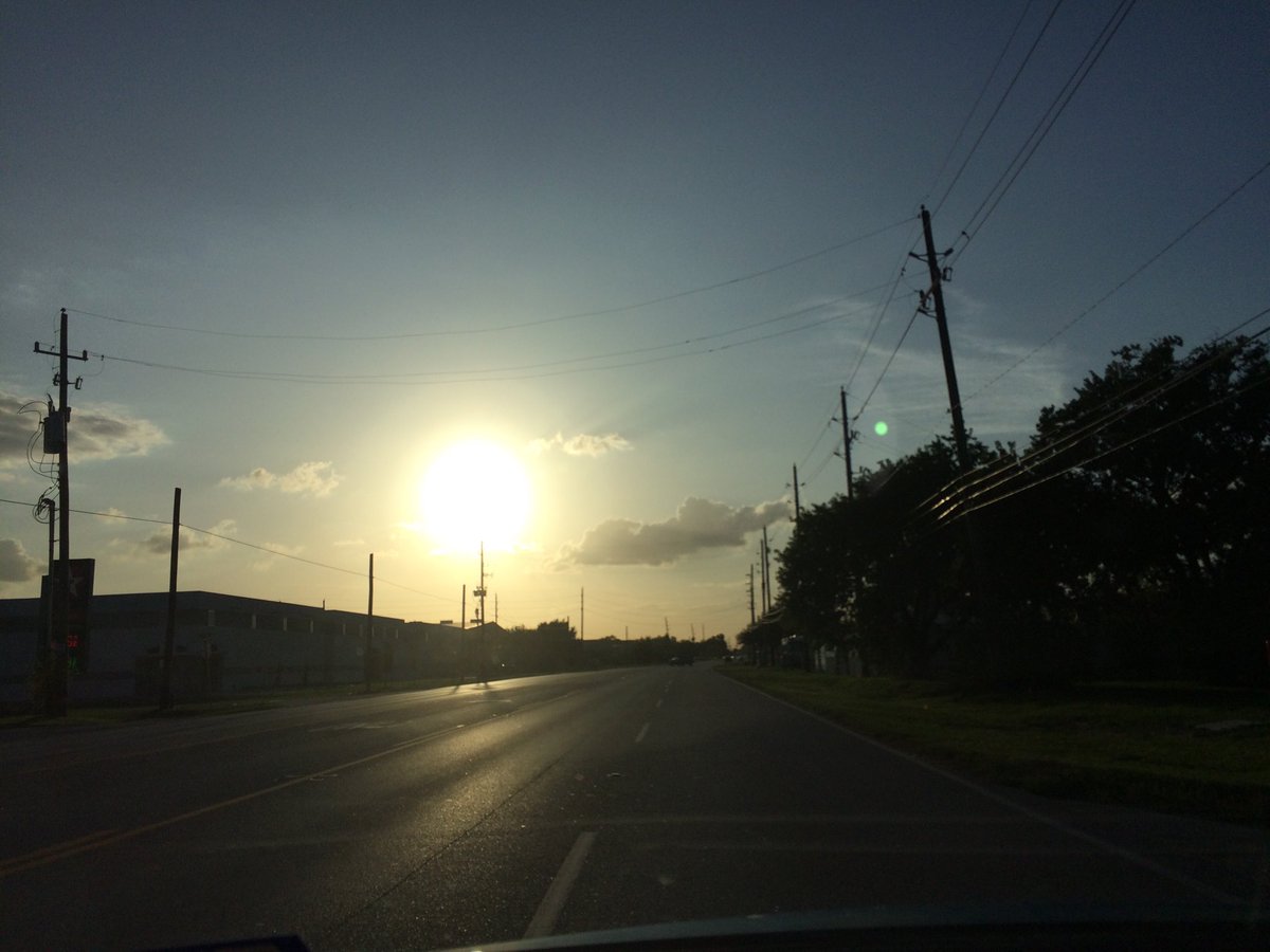
Northwest Houston, TX, during the early afternoon.
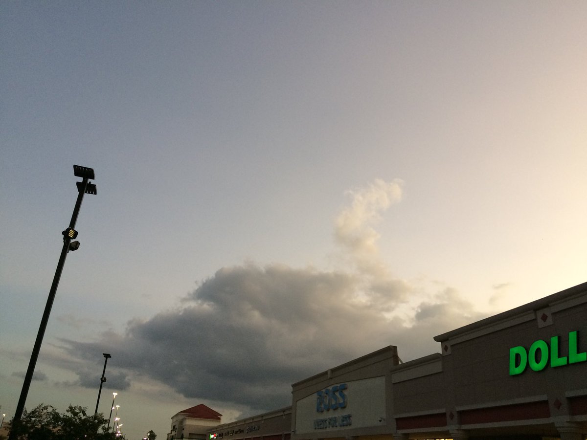
Northwest Houston, TX, during the early evening.
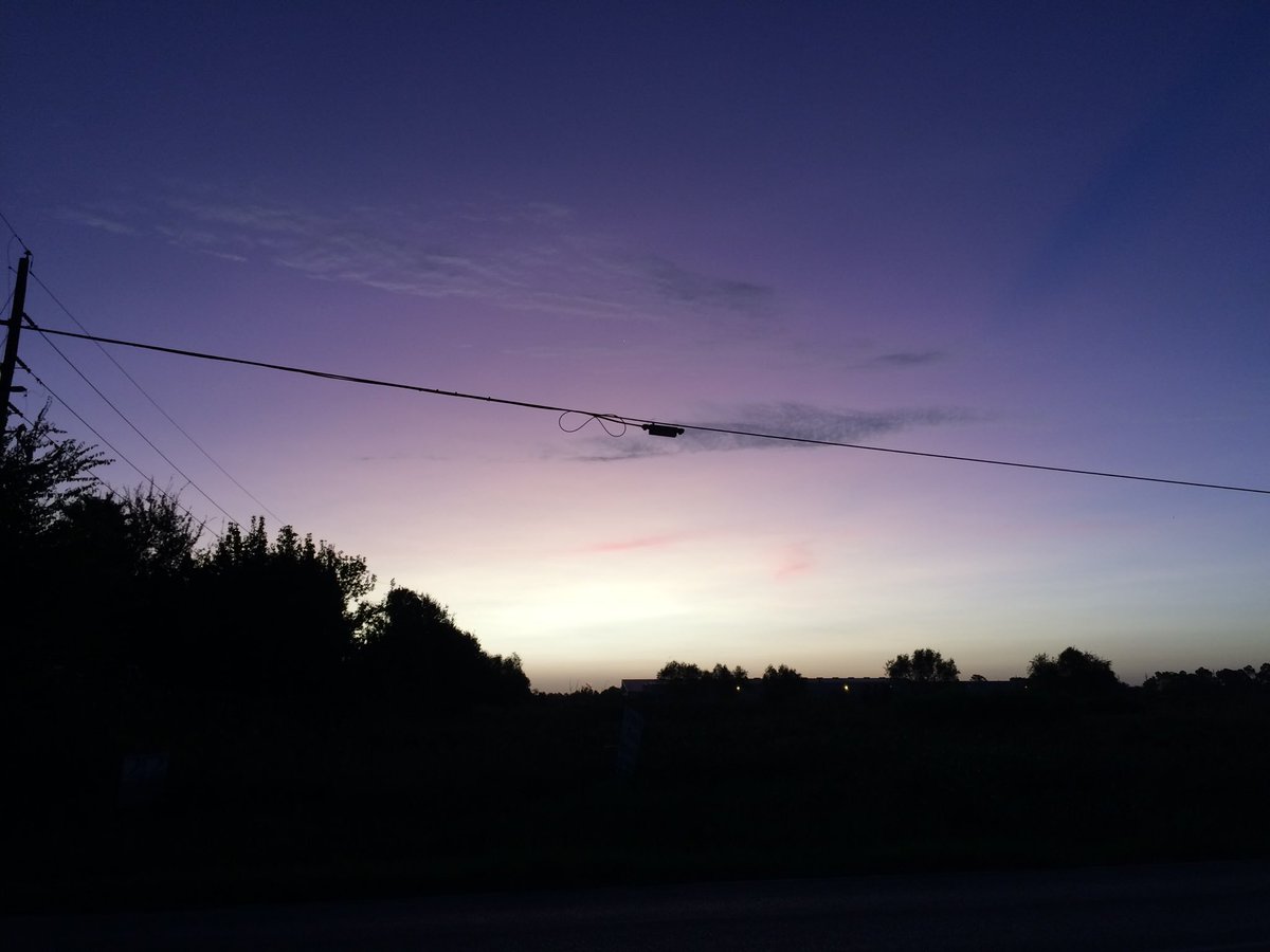
Northwest Houston, TX, during the late evening.
Summary: The day was very warm, sunny, and dry. There might have still been some lingering light to moderate showers in and around the Houston, TX area, sometime during the day; especially during the morning. I didn't see, feel, or hear any rain drops. Alto stratus and stratus clouds looked to be widely scattered across the sky, during the morning, afternoon, evening, and maybe night. The wind speeds looked to be calm with maybe some gentle to moderate gusts and some possible moderately strong gusts. It felt warm, during the early morning, late evening, and night. It felt very warm, during the mid-morning and early evening. It felt very warm, almost during the late morning and afternoon. There was a Hazardous Weather Outlook issued for the Houston, TX area, by NOAA. There were no other watches, warnings, alerts, advisories, or weather statements/outlooks issued for the Houston, TX area, that I know of. The low temps looked to be in the 70's and the high temps looked to be in the 90's, or maybe high 80's with maybe some 90's, for the Houston, TX area.
Houston, TX Area Storm Summary: There might have still been some lingering light to moderate showers in and around the Houston, TX area, sometime during the day; especially during the morning. I didn't hear about any reports of flooding, or storm damage.
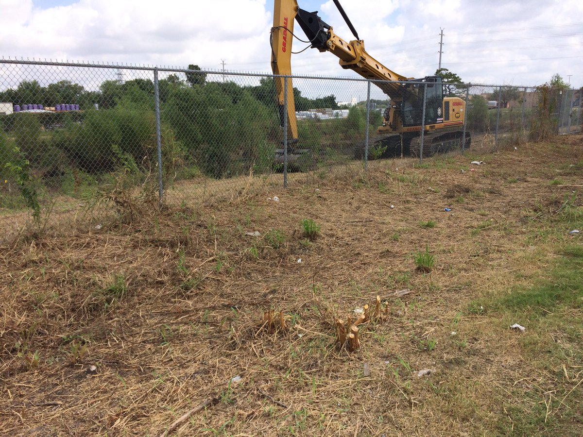
My Storm Summary: There were still some lingering puddles on the side of the road left over from the previous days rain. I didn't see, feel, or hear any rain drops. I didn't see any flooding, storm clouds, lighting, or damage caused by any storm, or weather event. I didn't hear any rumbles of thunder.
Locations: Northwest and west Houston, TX.
Thoughts: The day felt nice.
Area Forecast Discussion
Issued by NWS Houston/Galveston, TX
Issued by NWS Houston/Galveston, TX
Versions: 1 2 3 4 5 6 7 8 9 10 11 12 13 14 15 16 17 18 19 20 21 22 23 24 25 26 27 28 29 30 31 32 33 34 35 36 37 38 3940 41 42 43 44 45 46 47 48 49 50
000
FXUS64 KHGX 050228
AFDHGX

Area Forecast Discussion
National Weather Service Houston/Galveston TX
928 PM CDT Wed Oct 4 2017

.DISCUSSION...
At 01z, an area of low pressure was over NM with high pressure
over the eastern US with a light east wind. At 850 mb, a strong
area of high pressure was noted over the eastern US and 850 temps
have cooled a bit at LCH with temps down to 15 C. At 300 mb, a
sprawling ridge of high pressure was located over South Texas. A
few isolated showers linger near the coast but these will become
less numerous with time. Not a lot of change to the current
forecast with unseasonably warm temps and dry conditions through
Sunday. Made some minor tweaks to the grids to match obs but the
integrity of the previous forecast is on track. 43

&&

.PREV DISCUSSION... /ISSUED 626 PM CDT Wed Oct 4 2017/

AVIATION...
VFR conditions are expected for most areas tonight and Thursday.
Patchy areas of MVFR are possible mainly between 09Z and 13Z at
the more rural sites of KCXO and KLBX. Isolated showers could
affect KGLS through 02Z and overnight through early morning
Wednesday from 06Z to 13Z.

40

PREV DISCUSSION... /ISSUED 354 PM CDT Wed Oct 4 2017/

DISCUSSION...
Relatively quiet forecast for several days with little to no
potential for precipitation and above normal temperatures. Much of
the focus will be on this weekend and early next week as we watch
the progress of Tropical Depression 16 and a cold front for early
next week. At this time it appears that TD 16 will not track far
enough west to cause direct impacts to our area, but there is still
a fair amount of spread in the guidance, and it will be important
even in Southeast Texas to monitor the latest forecast information
from the National Hurricane Center to ensure that expected level of
impact continues. Beyond that, we`ll be anticipating the arrival of
the next cold front from the northwest, which will increase rain
potential on/ahead of the front, but bring cooler and drier air for
the mid-week behind it.

NEAR TERM [Through Tonight]...

Radar is showing a couple weak showers over Jackson County this
afternoon, but drier air has pushed in over much of the area from
the northeast, and combined with a cap around/below 700 mb in HRRR
soundings, that has kept the vertical growth of clouds in check for
most today. Can more or less expect this to continue through the
rest of the day and into tonight, though some nocturnal activity
over the Gulf waters may pop up.

SHORT TERM [Thursday Through Friday Night]...

Midlevel ridge over Texas should slowly slide and weaken southwest
while a northern stream trough digs over the Rockies. Roughly
easterly flow will continue far to the north of developing TD 16,
aided by high pressure over the Carolinas. Precipitable water is
progged essentially unanimously to continue to fall, potentially
even below 1 inch, keeping fair weather in the forecast. Though the
midlevel ridge is expected to begin weakening, it should impart
enough subsidence and fair skies for continued above normal
temperatures across the area.

LONG TERM [Saturday Through Wednesday]...

Changes are afoot for the weekend into early next week. Much of the
weekend forecast will be extremely dependent on the precise path of
TD 16, even if it does not come close enough to give us direct
impacts. Guidance on the left edge of the 16 envelope, like the GFS,
crank up PW on the outer edge of the storms`s moisture envelope, and
bring back potential for scattered showers and storms over Southeast
Texas as we look at a setup with onshore flow and higher moisture.
On the flip side, more eastern guidance like the Euro keep us more
on the subsident outer edge of the storm, with lower moisture
content and flow that is roughly shore parallel.

As best I can tell, much of the difference in track for this portion
of the forecast hinges on 16`s interaction with a wave/upper trough
that crosses the Gulf of Mexico in advance of 16. The GFS is much
stronger with this feature, even inducing a bit of a Fujiwara
effect between the two lows, which pulls the GFS towards the left
side of the envelope. Additionally, it is now nearly 24 hours
slower than the Euro with the approach of the northern trough and
cold front which also slows steering currents ahead of it, also
allowing the storm to drift more towards a Louisiana landfall.
While plausible, the Euro`s picture of a weaker leading wave and
faster frontal timing seem more realistic, so the forecast leans a
bit harder in that direction. This puts the front through the
area along with highest rain chances on Tuesday. Cooler and drier
air should come in behind the front, knocking temperatures to near
or a little below normal.

MARINE...

East winds 15 to 20 knots will prevail through the night with long
period swells of 3 to 7 feet and some wind wave on top. Will carry a
SCEC nearshore and SCA 20-60nm. The winds should relax slightly
Thursday afternoon. A few showers will prevail tonight with deeper
moisture confined to the airmass over the water thanks to the upper
ridging over TX/LA/AR.

This persistent easterly flow with the long period swell will
maintain elevated tide levels and strong rip currents for the Upper
Texas Coastal waters through Thursday morning and probably into the
evening hours...so have extended the CFW Beach Hazard Statement.

Light winds Friday night through Sunday night...followed by a potent
cold front (for this time of year) which will boost winds Monday
night or more likely Tuesday morning/afternoon into SCA with
sustained 20 knot northerlies.

Will need to keep an eye on the swell from TD 16 soon to become Nate
as this could have some impacts Sunday and Monday with swell.

45

TROPICAL...

There is not terribly much to add to the discussion that hasn`t
already been mentioned in regards to TD 16. The most important
takeaway at this time is to continue to monitor for the latest
information from the NHC, and to the latest for us, as to what
impacts this will have on our area. These impacts may not be
direct storm impacts, but rather indirect, such as issues on Gulf
facing beaches due to higher swells from the storm. The precise
track of the storm will also strongly influence potential for rain
late this weekend.

The storm also serves as a reminder that hurricane season does not
end until November 30, and it is important to replenish supplies
in your hurricane kit.

&&

.PRELIMINARY POINT TEMPS/POPS...
College Station (CLL)      87  69  89  66  89 /   0   0   0   0   0
Houston (IAH)              87  70  89  67  87 /   0   0   0   0   0
Galveston (GLS)            87  78  86  77  86 /  10  10  10   0   0

&&

.HGX WATCHES/WARNINGS/ADVISORIES...
TX...NONE.
GM...SMALL CRAFT SHOULD EXERCISE CAUTION until 2 AM CDT Thursday for
     the following zones: Coastal waters from Freeport to the
     Matagorda Ship Channel out 20 NM...Coastal waters from High
     Island to Freeport out 20 NM.

     Small Craft Advisory until 10 AM CDT Thursday for the following
     zones: Waters from Freeport to the Matagorda Ship Channel
     from 20 to 60 NM...Waters from High Island to Freeport from
     20 to 60 NM.

&&

$$

Discussion...43
Hazardous Weather Outlook
Hazardous Weather Outlook
National Weather Service Houston/Galveston TX
424 AM CDT Wed Oct 4 2017

GMZ330-335-350-355-370-375-TXZ213-214-235>238-051200-
Brazoria-Chambers-
Coastal waters from Freeport to the Matagorda Ship Channel out
20 NM-Coastal waters from High Island to Freeport out 20 NM-
Galveston-Galveston Bay-Harris-Jackson-Matagorda-Matagorda Bay-
Waters from Freeport to the Matagorda Ship Channel from 20 to
60 NM-Waters from High Island to Freeport from 20 to 60 NM-
424 AM CDT Wed Oct 4 2017

This hazardous weather outlook is for portions of Southeast Texas.

.DAY ONE...Today and Tonight

With a long fetch of moderate to strong easterly winds, elevated tides
can be expected along the coast, especially around the times of high
tide. Strong rip currents can be expected along the coast too.

.DAYS TWO THROUGH SEVEN...Thursday through Tuesday

With a long fetch of moderate to strong easterly winds, elevated tides
can be expected along the coast on Thursday, especially around the times
of high tide. Strong rip currents can be expected along the coast too.
A gradual improvement is anticipated at the end of the week and over
the weekend as winds and seas diminish.

.SPOTTER INFORMATION STATEMENT...

Spotter activation is not anticipated.

$$
No comments:
Post a Comment