Northwest Houston, TX, during the early afternoon.
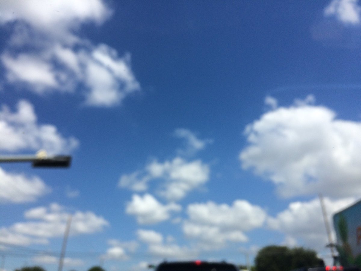
Summary: The day was very warm, sunny, and dry. I didn't see any rain anywhere on the radar in the Houston, TX area, during anytime of the day. I didn't see, feel, or hear any rain drops. Alto stratus and stratus clouds looked to have started to be widely scattered across the sky, sometime during the late morning and stayed through the early afternoon. The sky looked to have become clear, sometime during the mid, or maybe late afternoon and stayed that way through the evening and night, think. I think the sky looked to be clear, during the early and mid-morning. The wind speeds looked to be calm with gentle to moderate gusts with some moderately strong gusts. It felt warm, during the early morning, late evening, and night. It felt very warm, during the mid-morning and early evening. It felt very warm, almost hot, during the late morning. It felt hot, during the afternoon. There were no watches, warnings, alerts, advisories, or weather statements/outlooks issued for the Houston, TX area, that I know of. The low temps looked to be in the 60's with maybe some 70's and the high temps looked to be in the 80's with maybe some 90's, for the Houston, TX area.
Houston, TX Storm Summary: I didn't see any rain anywhere on the radar in the Houston, TX area, during anytime of the day. I didn't hear about, or see any reports of flooding, or storm damage to anywhere in the Houston, TX area.
My Storm Summary: I didn't see, feel, or hear any rain drops. I didn't see any storm clouds, flooding, wet ground, lightning, or storm damage. I didn't hear any rumbles of thunder.
Locations: Northwest Houston, TX.
Thoughts: It felt hot today during the afternoon, even though the highest temp that I saw in my neighborhood (where I was all day) was only in the high 80's. Lots of differences with the Houston, TX forecast this weekend and next week.
Area Forecast Discussion
Issued by NWS Houston/Galveston, TX
Issued by NWS Houston/Galveston, TX
Versions: 1 2 3 4 5 6 7 8 9 10 11 12 13 14 15 16 17 18 19 20 21 22 23 24 25 26 27 28 29 30 31 32 33 34 35 36 37 38 3940 41 42 43 44 45 46 47 48 49
000
FXUS64 KHGX 062334
AFDHGX

Area Forecast Discussion
National Weather Service Houston/Galveston TX
634 PM CDT Fri Oct 6 2017

.AVIATION.../00Z TAF/
Weak high pressure over the area has allowed for light east winds
today. Winds should decouple tonight with VFR conditions.
Tropical Storm Nate will be moving into the Gulf of Mexico tonight
and into the northern Gulf tomorrow. Winds should become
northerly tomorrow with an increase of moisture in response to
Nate. Intermittent shower activity will be possible through the
day tomorrow for KIAH southward to the coast. TAFs include VCSH
for these terminals and keeping KCLL, KUTS and KCXO with no
mention of precipitation.

Overpeck

&&

.PREV DISCUSSION... /ISSUED 332 PM CDT Fri Oct 6 2017/

DISCUSSION...
The two major factors on the area`s forecast will be Tropical
Storm Nate, churning northward across the Central Gulf of Mexico,
and for the long-awaited front early next week. While there
continues to be strong agreement that the front will enter the
region Tuesday, there`s less consensus as to how strongly and how
far across the area it will push. This introduces a little more
uncertainty into both rain chances near the front and how dry and
cool we`ll get on the backside of the front into the middle and
late week. Regardless, the spread in outcomes is relatively low
stakes, with little to no potential for dangerous weather in our
area.

NEAR TERM [Through Tonight]...

A nice, clear radar scope presents across the area today, with the
exception of an interference spike to the northwest of the radar.
Whether using the high-tech GOES-16, or the more hipster window
technology, there is some cumulus present. However, the cu field
is fairly flat, and does not show much - or any - ice content.
That should continue for the rest of the afternoon, with clouds
clearing out as the updrafts lose steam as we lose daytime
heating. However, towards daybreak, the Gulf waters and perhaps
some coastal spots will see clouds increasing thanks to a band of
convection that may be tangentially related to Nate. It`s unclear
how much rain will actually remain in this band, and may simply
increase cloud cover around daybreak, but I do bring in some
slight chance PoPs for the Gulf before dawn.

SHORT TERM [Saturday Through Sunday Night]...

As Nate barrels up towards the northern Gulf coast, we should look
for at least some fair rain chances over much of the Gulf waters
and for the upper coast from the storm`s outermost rainbands. The
best chance for rain would be near and coastward of US-59/I-69,
while the rest of the area should stay drier with northeasterly
to northerly winds under the subsident edge of the storm. Rain
should generally be light - about a third of an inch over a
widespread area, but localized spots would see more. However,
storm motion should be fast enough to keep too much rain from
piling up in any one spot to cause any more issues than on a
typical day in Southeast Texas featuring scattered showers and
storms.

There may be some potential for a bit of a repeat on Sunday, but
by this time Nate should be quickly exiting the area, and located
over Mississippi or western Alabama, and may simply be unable to
generate rainbands in our area by this time.

Also acting against rain potential too deep into our area will be
the development of northerly flow at low levels because of the
circulation of Nate. This flow won`t dry us out dramatically, but
precipitable water values should be fairly similar to today with
airflow from the continent rather than the Gulf.

LONG TERM [Monday Through Friday]...

By Monday, look for return flow off the Gulf to quickly return in
the wake of Nate, and we`ll start to pump moisture back into the
area ahead of Tuesday`s front. Guidance seems fairly gung ho on
precip, but chose to back it down some as there is fairly limited
time for moisture return until the front moves into the area
Tuesday. Also, have tended to flatten the PoP distribution in time
given some uncertainty in just how quickly the front pushes across
the area.

There is pretty good confidence the front will be moving into
Southeast Texas in the morning, but there`s more uncertainty in
how it behaves from there. On the strong end is the Euro, which
digs a deep upper trough in the lee of the Rockies to help push
the front quickly to the Gulf early Tuesday afternoon. On the
other end, the GFS favors a more compact northern stream upper
trough - where it would dig into the Southern Plains, the GFS
actually begins to cut off on the upstream side of the trough.
However, it stays connected to the jet on the downstream side,
which results in the nascent closed low getting sucked back up in
the smaller, stronger trough. Now, thousands of feet beneath this,
the front is starved of its upper support and limps slowly to the
coast, barely making it over the waters. This would keep clouds in
place, as well as rain chances at the coast and over the Gulf
waters thanks to enhanced surface convergence on the dying front.
I tend to favor the Euro solution, as it tends to match the
general character of the guidance over the past days. This also
gives it a bit more continuity with the previous forecast. That
said, the GFS does not look terribly different from the GEFS mean,
with only a couple members showing a marked post-frontal drop in
temps and humidity. I do keep hints of the GFS` solution in the
forecast, with some PoPs lingering through Wednesday and tempered
falls in dewpoint and temps in the wake of the front.

Both the GFS and Euro see winds working back towards onshore
Thursday, which means we`ll see the rebound in heat and humidity
begin for the late week

AVIATION [18Z TAF Issuance]...

VFR. Few CU over the area with dry air draped over the area.
Light easterly winds should veer slightly by 10-30 degrees but
still light. Moist axis associated with the surface trough south
of Louisiana will shift westward and bring an increase in clouds
mainly MVFR CIGS near 12z Saturday to the GLS/IAH area along with
the threat of showers. By 15z Saturday expect SHRA and a few TSRA
along and east of the surface trough axis which should be near an
LBX/HOU/IAH line. Intermittent MVFR CIGS/VISBY 15z Saturday and
beyond with the axis going nearly stationary. 45

MARINE...

Easterly winds continue and seas gradually coming down and this
should continue this evening. As trough over the Central Gulf moves
west and over the UTCW will lead to increase in seas and rain
chances. As Nate moves quickly northward Saturday across the Central
Gulf will see some peripheral swell move into the region though the
greater swell will be aimed into the Central Gulf Coast. Tide levels
will continue to run a little above normal through the weekend.

A cold front moves off the coast Tuesday morning and will usher in
offshore flow for a couple of days. Winds and seas in the wake of
the front will likely warrant SCEC and maybe SCA for 6-12 hours
mainly for seas of 7-9 feet. 45

&&

.PRELIMINARY POINT TEMPS/POPS...
College Station (CLL)      67  89  70  91  71 /   0   0  10  10   0
Houston (IAH)              71  87  73  90  72 /   0  30  10  20  10
Galveston (GLS)            78  85  79  87  79 /  20  50  20  20  20

&&

.HGX WATCHES/WARNINGS/ADVISORIES...
TX...NONE.
GM...NONE.
&&

$$

Aviation/Marine...39
No comments:
Post a Comment