
Radar of the line of thunderstorms descending down on the Houston, TX area, during the early morning.
Northwest Houston, TX, during the mid-morning.
Northwest Houston, TX, during the late morning.
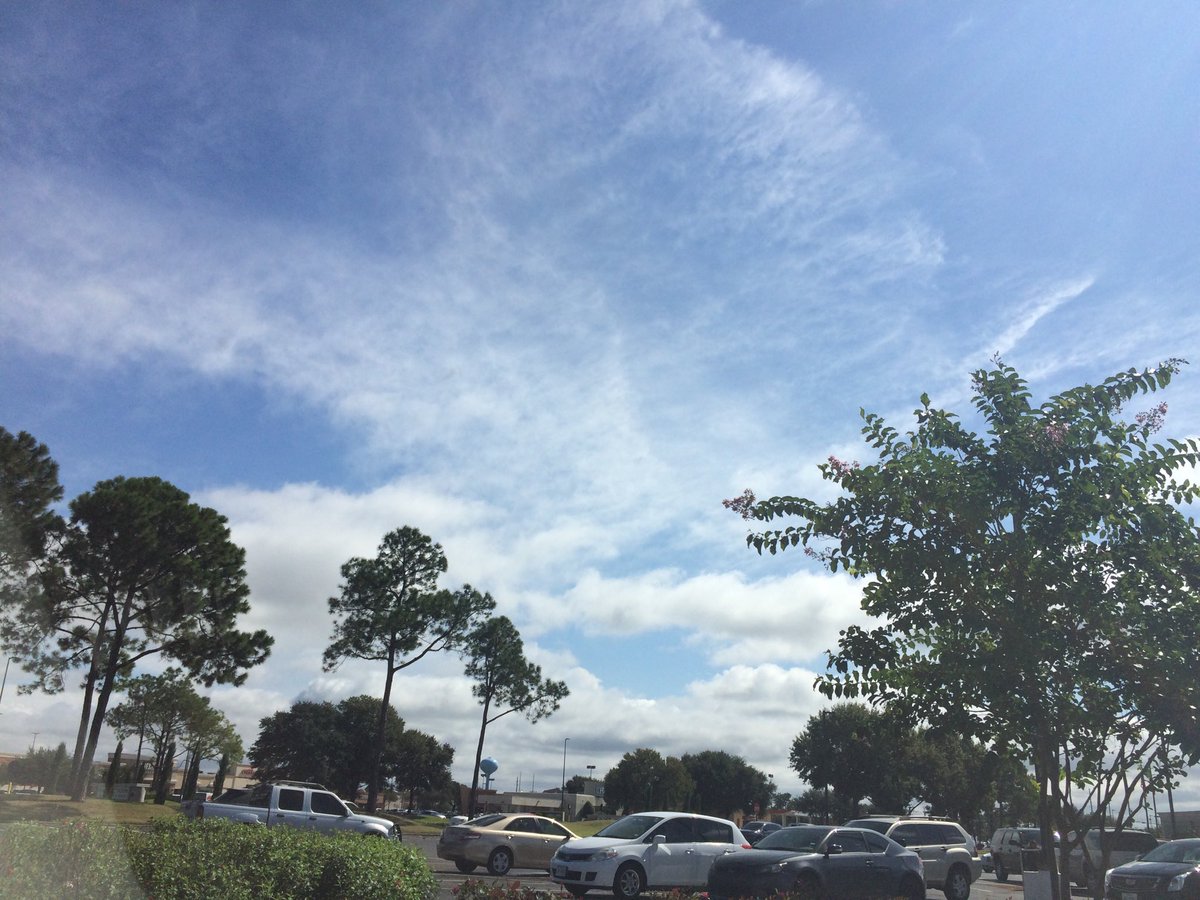
Northwest Houston, TX, during the early afternoon.
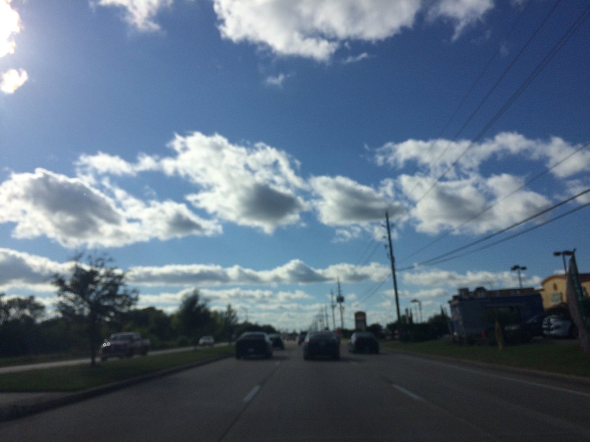
Northwest Houston, TX, during the late afternoon.
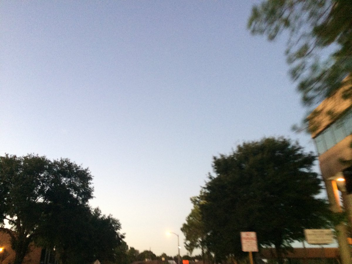
Northwest Houston, TX, during the late evening.
Summary: The day was partly wet, mostly sunny, and cool. A cold front pushing a line of Moderately heavy to heavy thunderstorms pushed southward through the Houston, TX area, during the morning and maybe parts of the early afternoon. Moderately to heavy rain fall at my house, during the mid-morning and maybe parts of the early morning. Another round of moderate rain fell at my house, during the late morning. Stratus clouds looked to cover the whole sky, during the morning. Alto stratus and stratus clouds looked to cover most of the sky, during the afternoon and early evening. The sky looked to have become clear, during the late evening and stayed clear, during the night. The wind speeds were calm with gentle to moderate gusts and some moderately strong gusts. It felt warm, during the early morning. It started to feel very cool, almost cold, sometime, during the late, or maybe mid-morning. It felt cool, during the early afternoon and late night. It felt a little cool, almost warm, during the mid and late afternoon, and evening. It felt a little cool, during the early night. There was a Hazardous Weather Outlook issued for the Houston, TX area, by NOAA. Along with some Special Weather Statements and Advisories, issued for the Houston, TX area. The low temperatures looked to be in the low 60's, maybe 50's and the high temperatures looked to be in the low 70's with maybe some 60's, for the Houston, TX area.
Houston, TX Storm Summary: A cold front pushing a line of Moderately heavy to heavy thunderstorms pushed southward through the Houston, TX area, during the morning and maybe parts of the early afternoon. I didn't hear about, or see any reports of any flooding. I didn't hear about, or see any reports of any damages, but I saw some damages at my house.
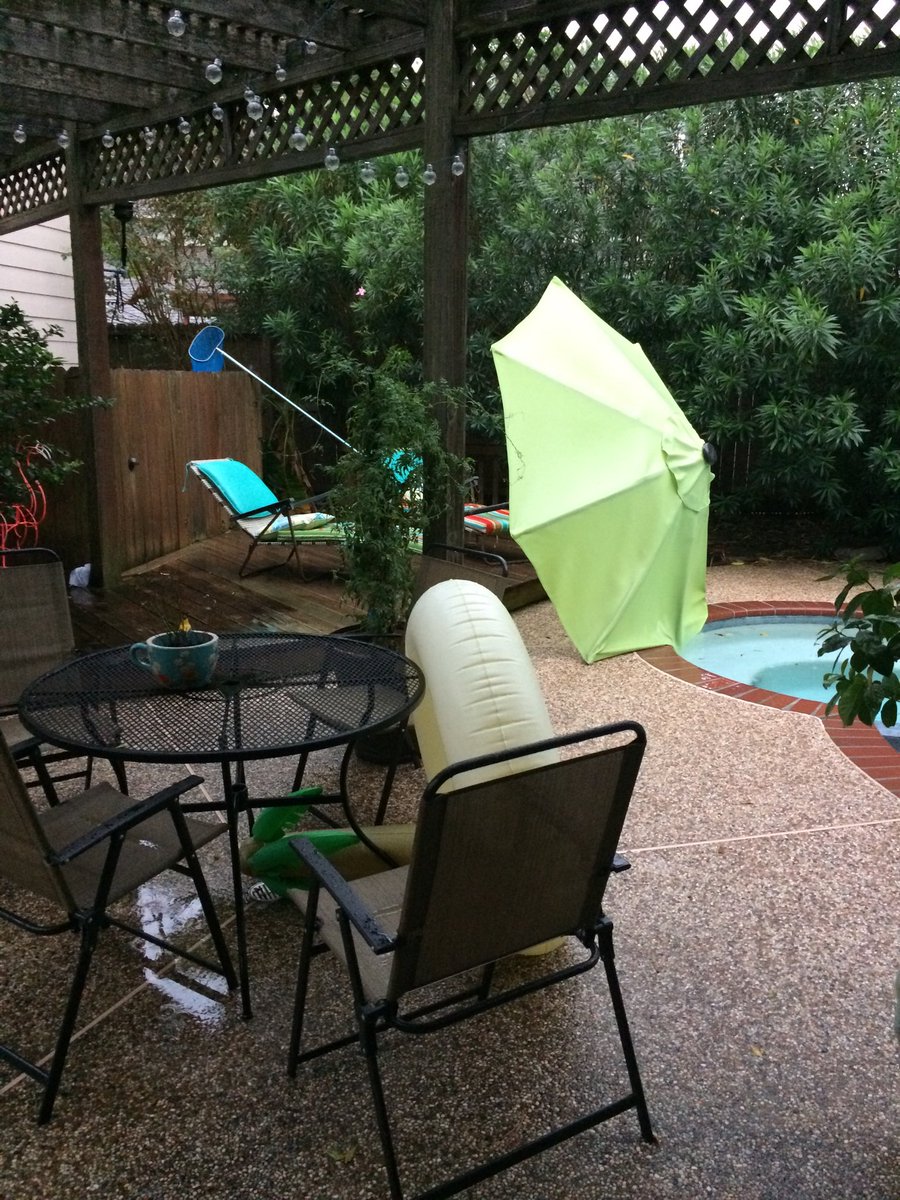
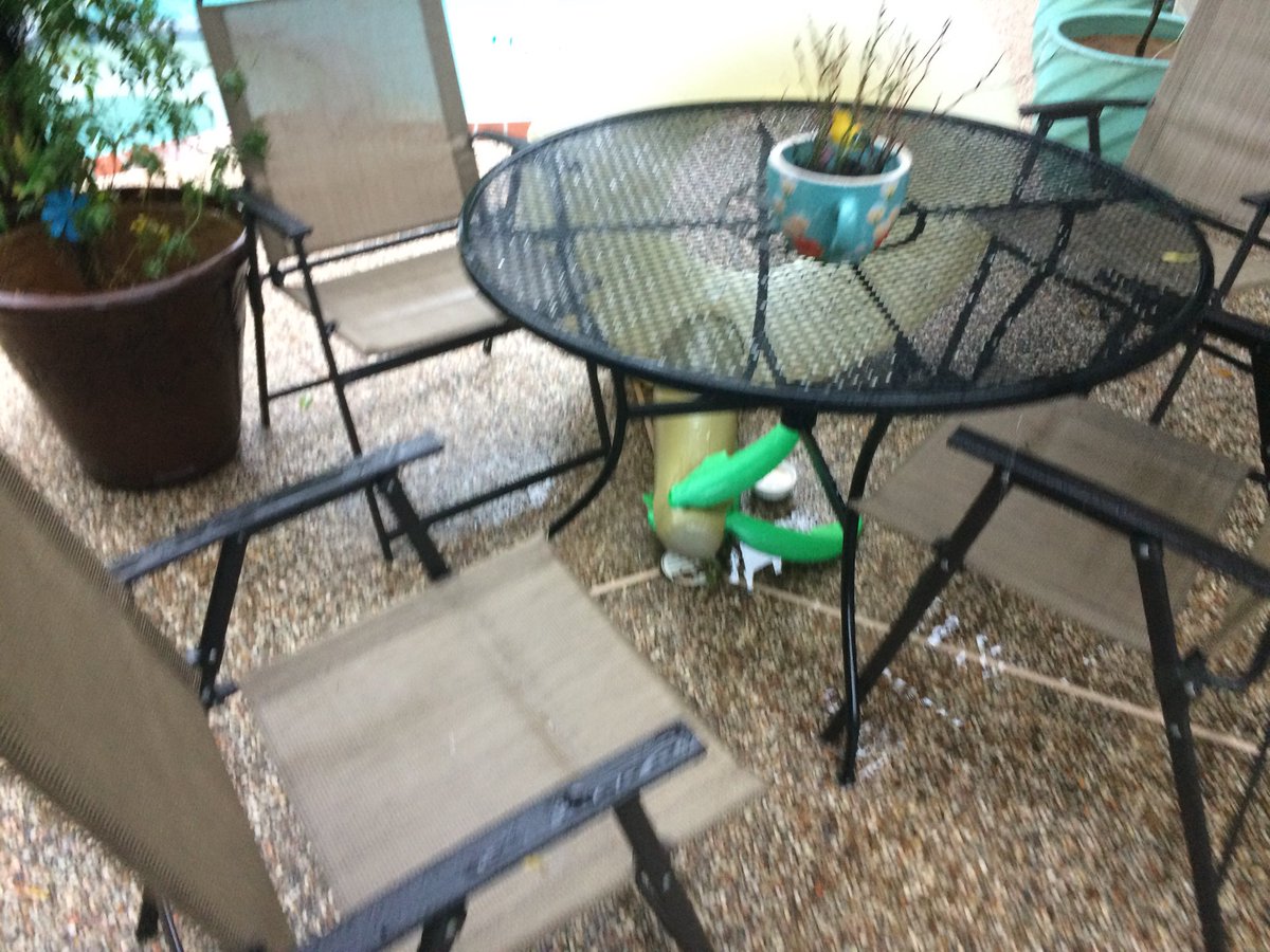
My Storm Summary: Moderately to heavy rain fall at my house, during the mid-morning and maybe parts of the early morning. Another round of moderate rain fell at my house, during the late morning. I didn't see any flooding. I saw some flashes of lightning and heard some loud rumbles of thunder. No flooding roads, just a wet soggy ground and some small to medium sized puddles. A huge gusts of 40 to 50, and maybe even 60 mph, caused the umbrella stand outside of my house to fall, as well as some other things. There were no power outages during the storm, but the lights did flicker, during the late and maybe early night. I am not sure if it was storm related, or not. I just though maybe the thunderstorms might have damage the power lines a little during the morning. Maybe I don't know. The thunderstorms could have nothing to do with it.
Locations: Northwest Houston, TX, Cypress, TX, and Katy, TX.
Thoughts: That was a cool thunderstorm! I really like those cold front lined thunderstorms. I think they are really fun to watch.
Area Forecast Discussion
Issued by NWS Houston/Galveston, TX
Issued by NWS Houston/Galveston, TX
Versions: 1 2 3 4 5 6 7 8 9 10 11 12 13 14 15 16 17 18 19 20 21 22 23 24 25 26 27 28 29 30 31 32 33 34 35 36 37 38 3940 41 42 43 44 45 46 47 48 49 50
000
FXUS64 KHGX 230029
AFDHGX

Area Forecast Discussion
National Weather Service Houston/Galveston TX
729 PM CDT Sun Oct 22 2017

.AVIATION...
VFR conditions for the next 24-30 hours.  47

&&

.PREV DISCUSSION... /ISSUED 349 PM CDT Sun Oct 22 2017/
After a stormy, gusty morning, the cold front has pushed through
the area with skies clearing out across Southeast Texas. Cooler,
drier air is pushing into the area, and will be more pronounced
when a reinforcing cold front moves into the area on Tuesday,
finally knocking temperatures below seasonal averages. The week
ahead also looks rather dry, with no rain chances in sight until
onshore flow finally returns enough moisture at the end of the
week just in time for another cold front.

NEAR TERM [Through Tonight]...

Outside of a few lingering showers over the Gulf waters, the radar
is now clear this afternoon over Southeast Texas. Even any high
clouds have moved off to the east, as the new Day Cloud Phase
Distinction RGB for GOES-16 shows only low clouds around the
Houston metro and along the Gulf coast. Temperatures have been
slower to rebound as clouds lingered later into the day than
originally anticipated last night, so highs did have to be nudged
downward. However, with the sun we`ve seen this afternoon, most -
if not all - of the area should climb into the 70s late this
afternoon before cooling off this evening.

Otherwise, a quiet night is on tap. Colder and drier air moving in
behind the front will cause dewpoints to fall into the 40s for
all but the immediate coast by daybreak, and allow for low
temperatures in the 50s for most. Coastal spots may stick around
60, and chilly spots up north may manage to fall into the upper
40s. Winds should become light over land, though continued
gustiness over the waters is discussed in the marine section
below.

SHORT TERM [Monday Through Tuesday Night]...

Very little of interest to see here for most interests. The front
that has just passed will knock things down to typical seasonal
temperature values for Monday. The drier air will push RH values
to 30 percent or lower, and will begin to make fire weather a
factor worth discussing - and so it is below. A reinforcing front
is set to arrive Tuesday, which will result in another windier
day. As currently forecast, we would not need a wind advisory, but
it`s pretty close at the coast. Any upward movement in the
forecast before then would likely require one to be issued. After
that, the gradient should weaken Tuesday night as high pressure
slides into the region. The cooler air should push lows by early
Wednesday morning into the 40s and 50s, a good 5 to 10 degrees
below seasonal norms.

LONG TERM [Wednesday Through Sunday]...

Sunny skies should continue through Wednesday, though the chilly
start will keep things from warming beyond the seasonal average,
and likely a little bit cooler. On Wednesday night, look for the
surface high to drift past the area over the northern Gulf, which
means we should see winds begin to back towards onshore overnight.
It`s probably not going to accomplish a whole lot immediately,
perhaps keep most from seeing lows Wednesday night into Thursday
from dropping below 50 degrees. However, southwesterly to
southerly winds should help boost Thursday`s temps to around 80
degrees.

Though there`s fairly good agreement in the models for most of the
week, things start to break down this weekend in handling the next
cold front. The GFS continues to be considerably faster with its
front than the Euro, and weaker with its upper trough. Despite
this, it also follows with a surge of northerlies and colder air
at 850 mb. The Euro continues to be slower, though it`s finally
moved its frontal passage into Saturday, similar to an earlier
cycle of the GFS. Conversely, it brings in a deeper upper trough,
but no real reinforcing shot of cold air for the weekend. For lack
of a sign that either scenario is more plausible than the other,
have mostly gone ahead with a blend (slightly leaning towards the
GFS) that will allow for an easier nudge to what emerges as the
most likely scenario. For what it`s worth, neither model is
terribly enamored of the rain potential on this front, likely
because return flow doesn`t really begin in earnest until Thursday
afternoon - and with rain on Friday or early Saturday, there just
isn`t a ton of time to build a reserve of moist, unstable air.
Precipitable water values in the GFS don`t even exceed an inch
until Friday morning, and don`t even reach 1.5 inches before the
front sweeps through. Still, there does appear to be a brief
window with some deeper moisture and somewhat favorable upper wind
fields that we should manage something on Friday and/or Saturday,
but much will depend on frontal timing.

AVIATION [18Z TAF Issuance]...

A narrow east to west band of cloud around 2500-3500ft still holding
on near UTS to HOU but these should erode quickly in the coming hour
or two. VFR conditions on tap after 23z with northerly winds.
45

MARINE...

This mornings storms and strong winds have departed. Abundant
reports of 30 to 50 knot winds with the storms.

Winds of 15 to 25 knots will prevail tonight and have hoisted the
SCA. Seas of 4 to 8 feet will be common and could edge up closer to
9 before weakening in the morning and afternoon Monday. High
pressure builds in and traverses SETX relaxing winds Monday night
before another cold front arrives Tuesday. Deep layer northerly
winds of 20-30 knots will prevail Tuesday afternoon through
Wednesday. Winds begin to turn back around to the south Thursday
with only a short period of onshore flow and moisture return with
another front arriving Friday night or early Saturday. All of these
post frontal environments will support SCA conditions.

Elevated tide levels will fall tonight on the outgoing tide and
should not return to above normal until Thursday.
45

FIRE WEATHER...

Dry air is here to stay for the next 4 days. Moderately strong north
winds will usher in lower dewpoints this afternoon and help to start
the drying out from today`s rainfall. Most areas got 0.25-0.75" of
precip and plenty of gusty winds with the storms. RH values in the
coming afternoons will be low typically falling into the 20-35
percent range with northerly winds 5 to 10 mph...a little stronger
near the coast. A cold front Tuesday is going to further boost the
winds and 10-15 with gusts near 20 will be more common with a deep
layer of 20+ knots through the mixed layer. Winds relaxing somewhat
Wednesday afternoon into the evening hours. and expect Elevated Fire
Weather Conditions Tuesday and possibly Wednesday. Some moistening
Friday with onshore flow returning Thursday could yield a night or
two of good recovery. Friday night/early Saturday another cold front
arrives and could bring a chance of rainfall (if enough moisture
gets back) and strong gusty northerly winds behind a deeper Central
U.S. upper trough.

45

&&

.PRELIMINARY POINT TEMPS/POPS...
College Station (CLL)      74  49  80  53  75 /  70   0   0   0   0
Houston (IAH)              74  55  79  55  76 /  90   0   0   0   0
Galveston (GLS)            81  63  76  63  77 / 100   0   0   0   0

&&

.HGX WATCHES/WARNINGS/ADVISORIES...
TX...NONE.
GM...SMALL CRAFT SHOULD EXERCISE CAUTION until 5 AM CDT Monday for
     the following zones: Galveston Bay...Matagorda Bay.

     Small Craft Advisory until 11 AM CDT Monday for the following
     zones: Coastal waters from Freeport to the Matagorda Ship
     Channel out 20 NM...Coastal waters from High Island to
     Freeport out 20 NM...Waters from Freeport to the Matagorda
     Ship Channel from 20 to 60 NM...Waters from High Island to
     Freeport from 20 to 60 NM.

&&

$$
Hazardous Weather Outlook
Hazardous Weather Outlook
National Weather Service Houston/Galveston TX
525 AM CDT Sun Oct 22 2017

TXZ163-164-176>179-195>200-210>214-226-227-235>238-231030-
Austin-Brazoria-Brazos-Burleson-Chambers-Colorado-Fort Bend-
Galveston-Grimes-Harris-Houston-Jackson-Liberty-Madison-Matagorda-
Montgomery-Polk-San Jacinto-Trinity-Walker-Waller-Washington-
Wharton-
525 AM CDT Sun Oct 22 2017

This hazardous weather outlook is for portions of Southeast Texas..

.DAY ONE...Today and Tonight

A cold front will cross the region early this morning. A band of
showers and thunderstorms should accompany the cold front with
most of the storms moving through between 7 AM and noon.
Widespread rainfall of one half inch with isolated amounts of 1
to 2 inches possible. Some storms will bring gusty winds of 20 to
40 mph with the front.

.DAYS TWO THROUGH SEVEN...Monday through Saturday

No hazardous weather is expected at this time.

.SPOTTER INFORMATION STATEMENT...

Emergency managers and storm spotters should prepare for possible
activation this morning.

$$
No comments:
Post a Comment